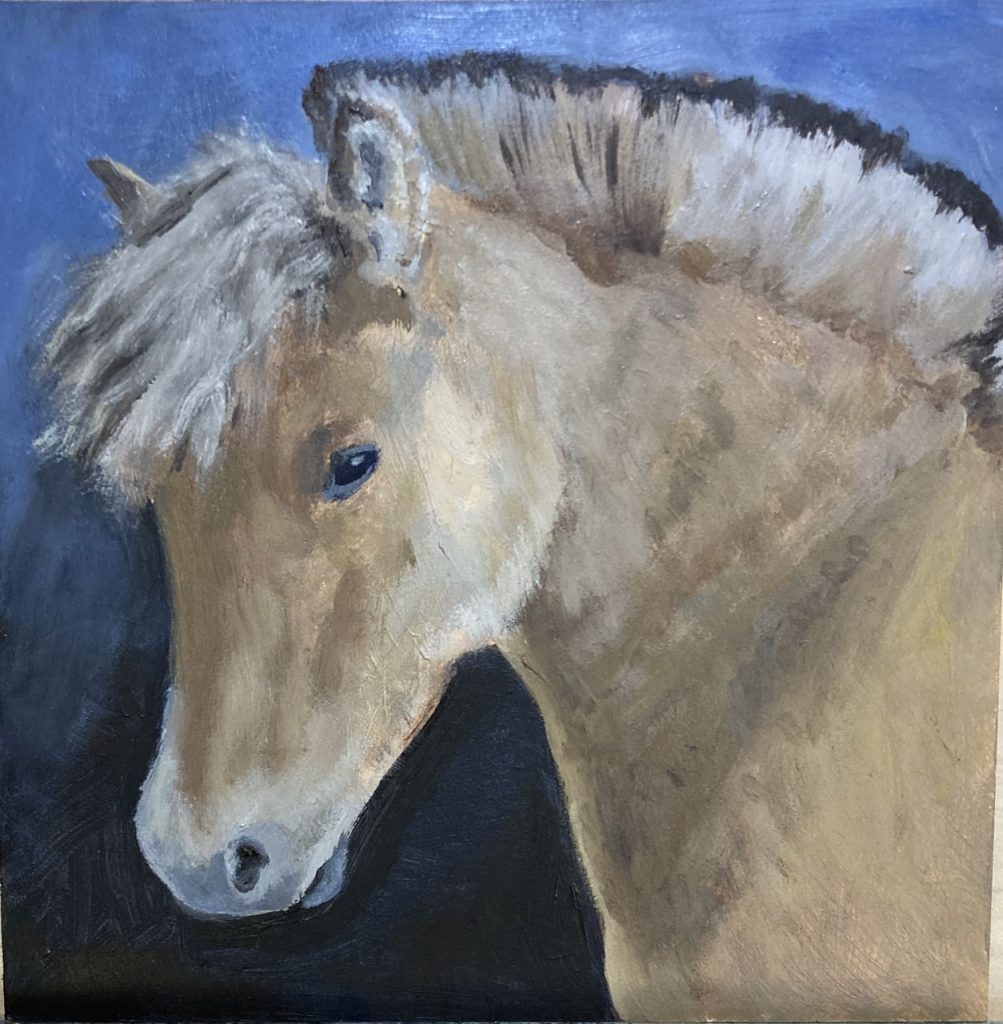
I’ve been sketching out some more horses, I have several photos that I’m inspired by, but I haven’t got a good composition yet. I’m also in the process of rounding up skulls and props to set up my own still lifes but for now i’m using some free online images.
Last year I bought a sundew plant to help with fungus gnats and fruit flies – and it worked great. I felt inspired by some of their photos (my house is already filling up with plants, but I still want more.) In any case, Predatory Perennials gave me permission to use some of their photos as reference.
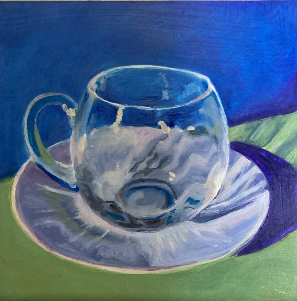
This is a 6×8 oil on panel. Hopefully there will be more soon.
I’ve been spending a lot of time doing quick sketches and practicing monsters. Monday I’m going to swoop through the thrift store to look for oil paintings that look like they need to have monsters added to them, failing that I’ll look for inexpensive frames to use for other paintings. These are all very small. they still take me longer than just one day, but I’m working on it.
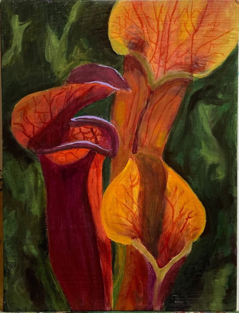
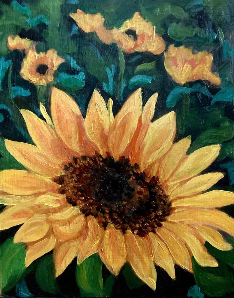
More attempts at ‘daily painting’ although this took me more than 1 day. I tried it because I think of flowers as being very difficult and I guess I wasn’t wrong, this gave me some trouble.
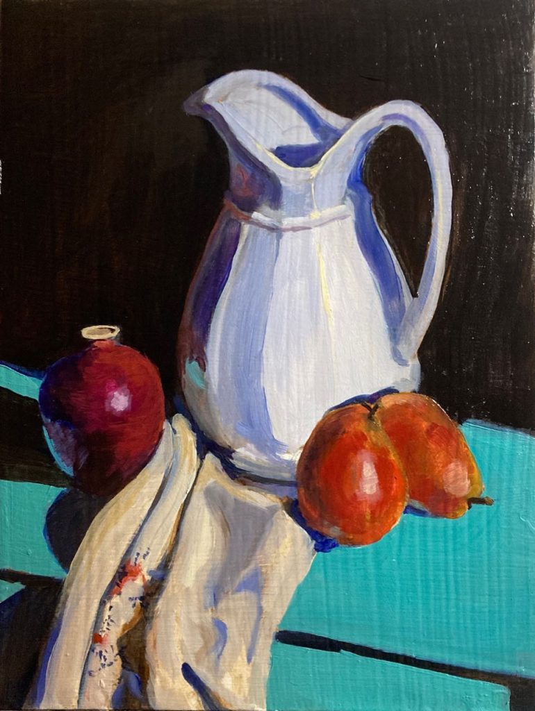
8×10 oil on panel
I got my brother in law to spend a couple hours cutting down new panels into tiny sizes and I hope this will encourage me to paint more often without worrying so much about ‘what if I botch it?’. Wish me luck.
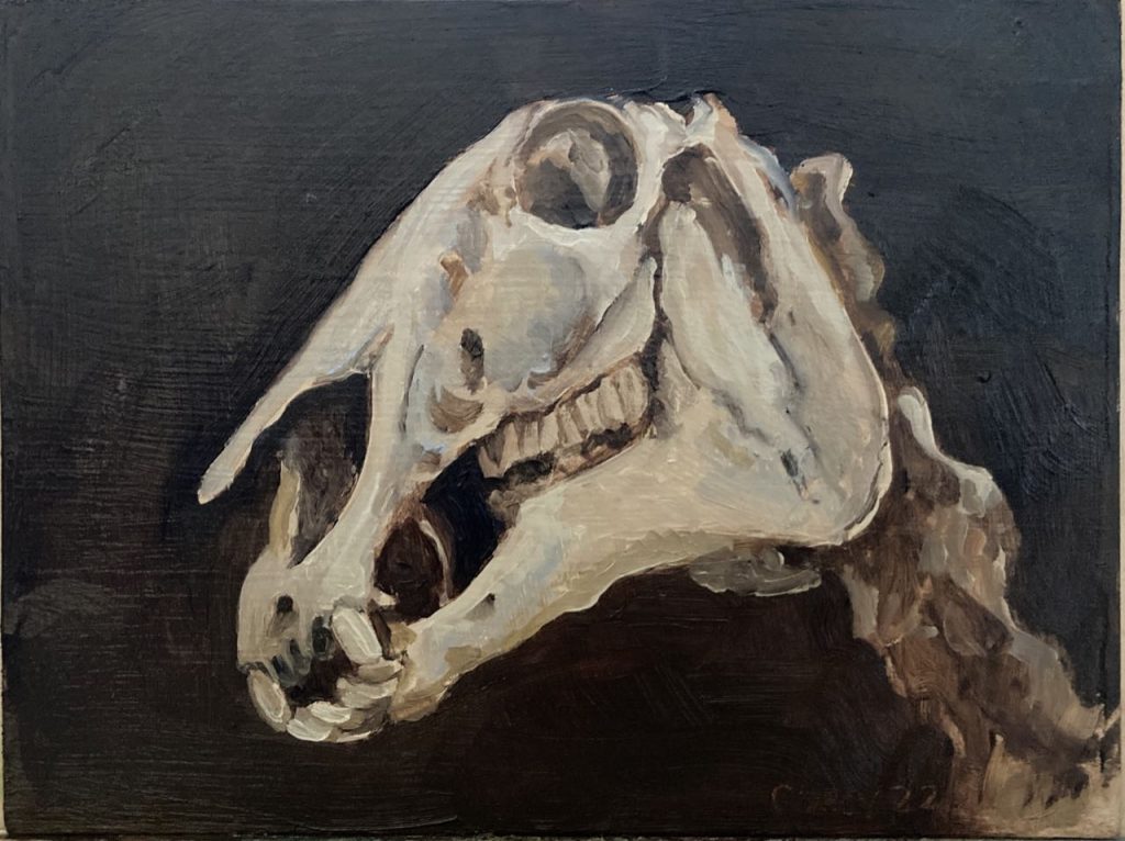
This horse skull wants to rap battle you for beer.
I haven’t got the knack for getting enough paint to stick ‘wet into wet’ or ‘alla prima’ so I’m having to let it dry a bit before I go in to refine. I’ll keep working on it.
As with most things, the way to get better at painting is to practice. I know this, but I’ve still been avoiding oil painting for a while. Why? Because the last thing I painted I thought was pretty good and then as soon as I start anything and I don’t feel like it’s going to turn out as well as that I abandon it.
Obviously I’m not going to improve this way. I’ve been watching videos for inspiration and hit upon Carol Marine who has a book called Daily Painting: Paint Small and Often To Become a More Creative, Productive, and Successful Artist. This isn’t quite a resolution, but I am going to try to paint small, but regularly. I’m going to try to not worry too much about making them perfect, but get them down and then move on to the next.
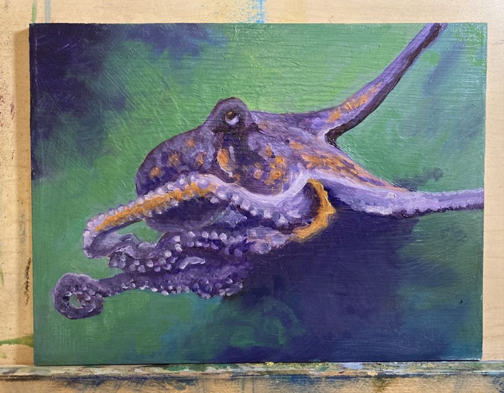
I had a watercolor of this octopus sketch already in my notebook. Here it is as a 6×8 oil on panel. Sorry about the glare, photographing the paintings is not my strong suit. And I haven’t figured out a good way to sign them yet.
Something that Ian Roberts (artist) wrote in one of his books was that you should expect to produce bad art. If you go to museums you can see some of the really bad to mediocre art of very famous painters because when you’re that famous people dig up everything you’ve ever done and ship it off to a museum, even if it’s something you would have left hidden in your garage forever. Having a success rate of 50%, or even 10% is still good!
Because I’m relatively new to this, and because I don’t expect anyone to ever read this blog, I’m sharing a lot of my ‘clearly learning how this works’ and ‘didn’t work’ art. Enjoy! I’m hoping I can look back at this in 3 years and see a clear improvement.
Meanwhile! I’ve been trying to sketch a little bit whenever I can and have been sharing the results as part of “Inktober”. There might be some sort of official rules about that but I’m doing what suits me. Usually this means an ink sketch with a bit of watercolor over it or more of my grayscale sketches. None of these took more than an hour or so.
To be fair: none of these are my total failures. I’m not sharing the times I made big mistakes or I got halfway through and realize that I couldn’t tell what I’d drawn and it looked like some abstract design when it wasn’t. If you look back at images I posted of entire sketchbook pages you can see some.
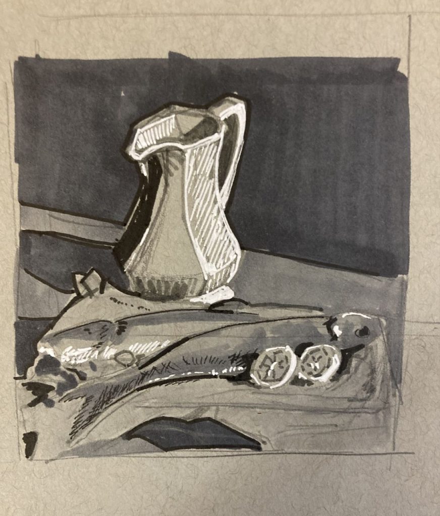
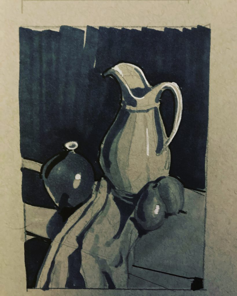
Jug + Vase value study (unsplash)
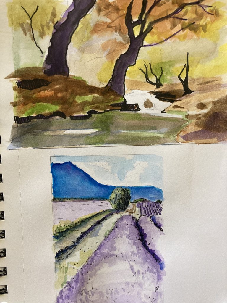
Landscapes from unsplash images
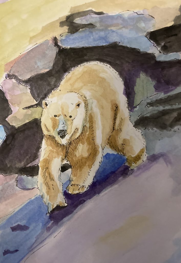
Polar bear (pixabay image)
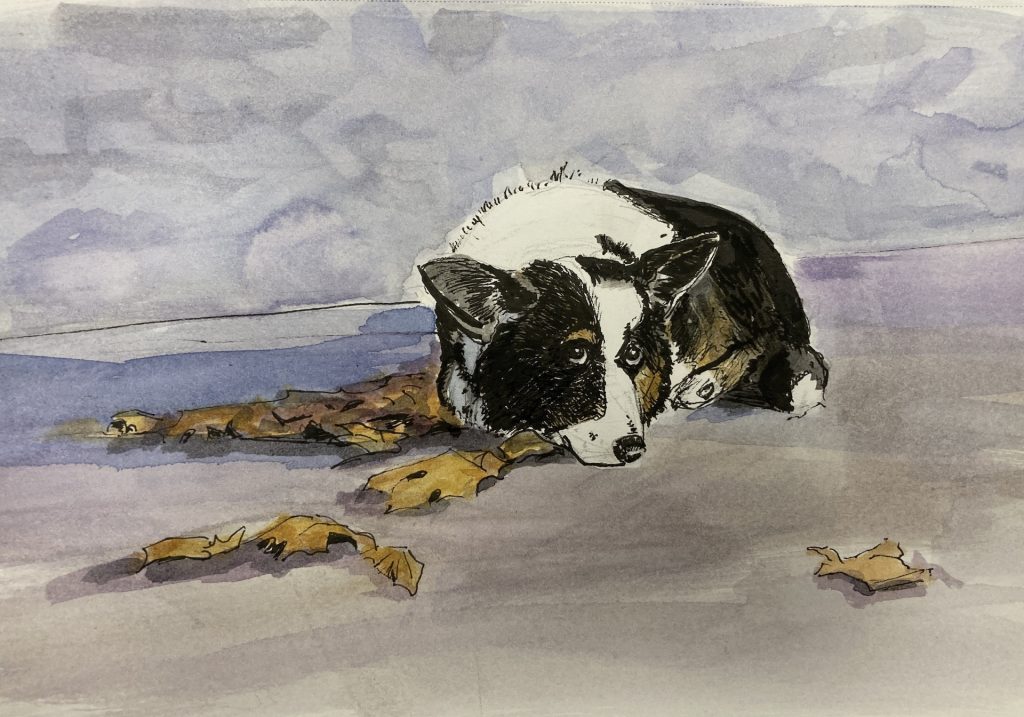
My dog being adorable
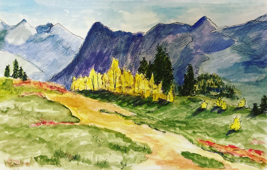
Larches at Maple Pass
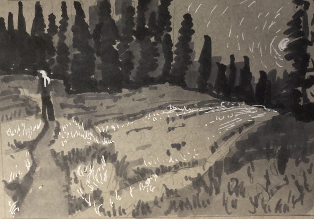
Wonderland value study
Wonderland value study
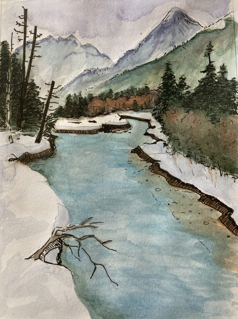
A snowshoeing trip
Watercolors are all on a 5.5×8.5 Canson mixed media pad with a micron pen sketch. Grayscale are Micron pen, blick marker, and Sakura white gel pens on Strathmore toned gray sketch paper. Nothing is bigger than 5 or 6 inches in any dimension.
I took a few notes along the way and these are the things I want to remember for later.
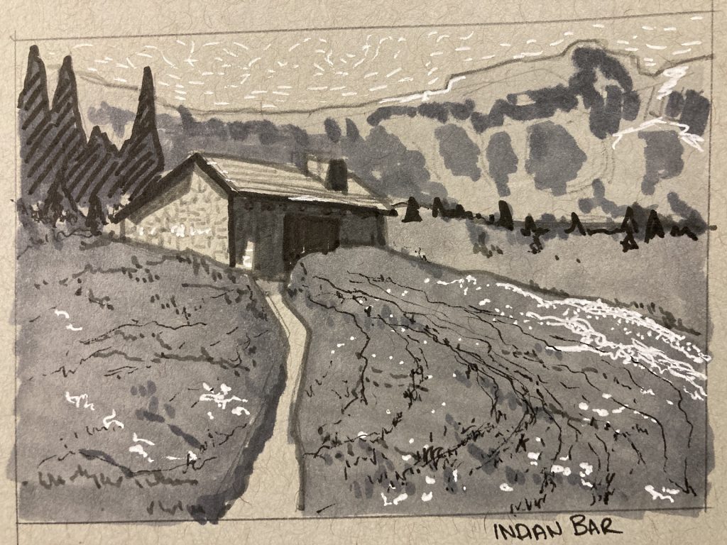
Highlights: Yellowstone Cliff & Windy Gap, Emerald Ridge, swimming at Golden Lake and St Andrews Lake, the ‘fairy hall’ like quality of lower Ipsut Pass in the fog, the Silver Forest south of Golden Lakes, the entire stretch from just north of Nickel Creek through Indian Bar to Summerland.
Should have brought: A dedicated bottle for the bidet – one that I don’t like very much. A sit pad (got left behind by accident), waterproof pants/lighter rain gear, more socks for S, neosporin, a safety pin in my med kit, more alleve, warmer PJs for S, ramen flavor packets to add to our food, miso soup, spices in general, more TP (N saved us), soap! (which somehow got left behind), a faster water purifier, and the pesto & parmesan noodles I’ve brought kayaking before but left out this time.
This was a great idea: bandana, pickles, snickers bars, dehydrated risotto, dehydrated panang curry, mashed potatoes, clothes that quick dry
Leave behind: extra fuel cannisters, my heavier raincoat (replace with something lighter). We never used the playing cards – so maybe?
We had word (from a bit of cell service back on day 8) that N, K’s sister was going to try to hike up to Summerland camp before sunrise on our last day to bring us breakfast and also to get some early morning photography. Thus we all got up super early to watch the show. My iphone wasn’t really up to the task, so trust me that it was far more spectacular than what you see. For starters there were, as you might imagine, so many stars. We sat in the darkness looking up at the mountain and I saw more stars! It took me a moment to realize that I was seeing the headlamps of climbers on their way to the summit. We were able to make out more the longer we looked, at least a dozen, and we could see that they were making progress and see a rough outline of the route all of them were taking. I also turned and saw another night hiker’s light up at Panhandle gap, where we’d been the day before.
The rising sun turned the mountain pink
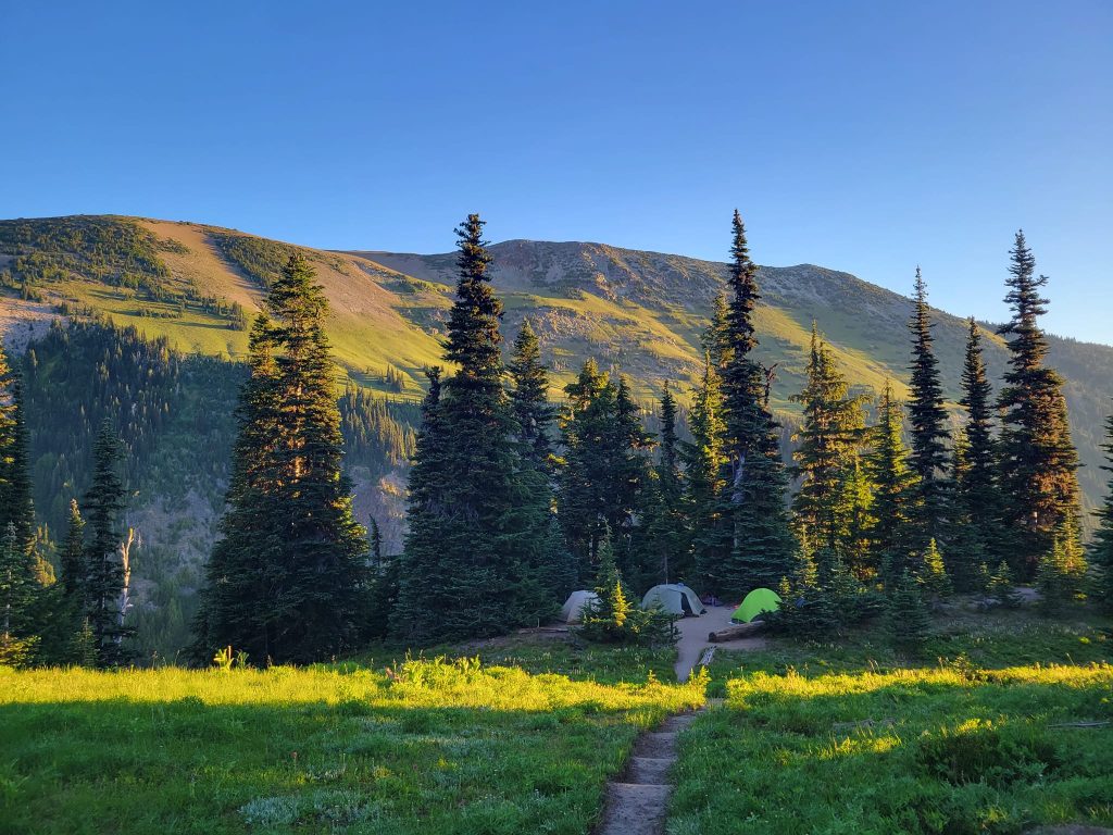
Our campsite at Summerland
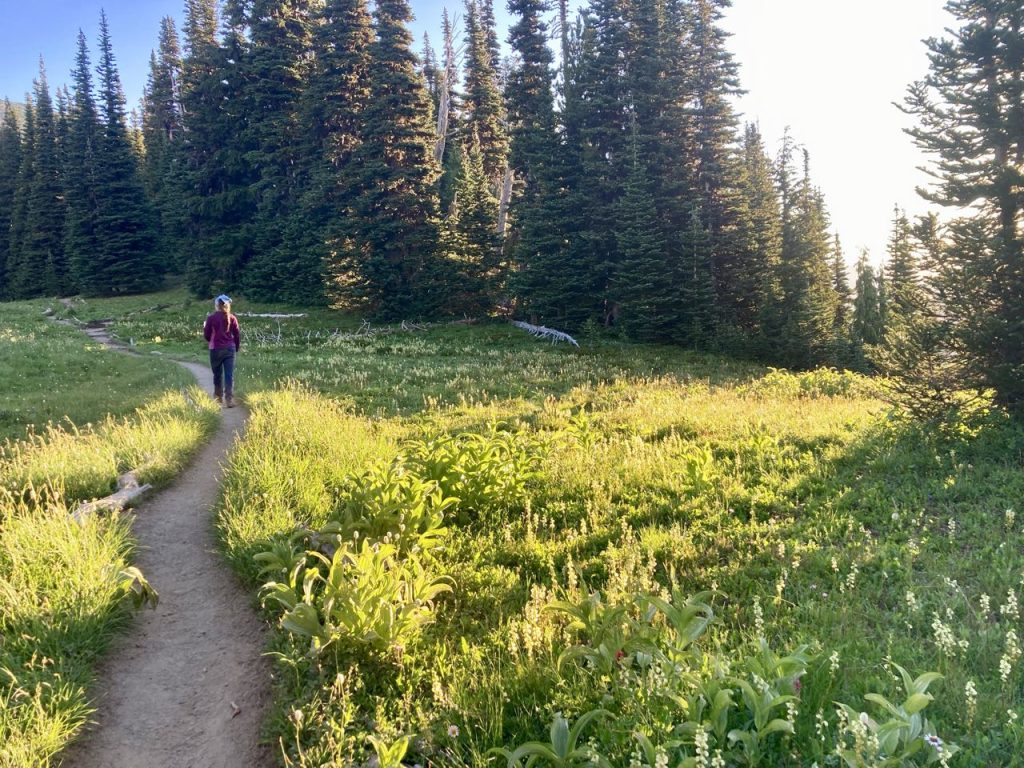
Searching for the best view
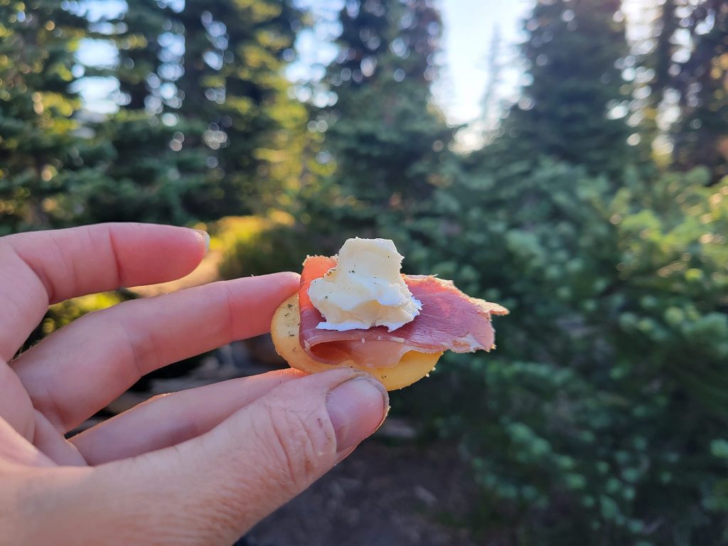
A bit after sunrise N turned up with, I kid you not, a charcuterie board. Not exactly a board – but crackers, brie, prosciutto – the works. You know how any regular food tastes like the best food you’ve ever had right after you’ve been eating, for example, rehydrated rice and beans for 10 days? This was amazing. Also that light I’d seen at Panhandle Gap? That was N. She’d gone past us all the way up to the gap to catch the sunrise, then hiked back DOWN to bring us food.
Best breakfast ever
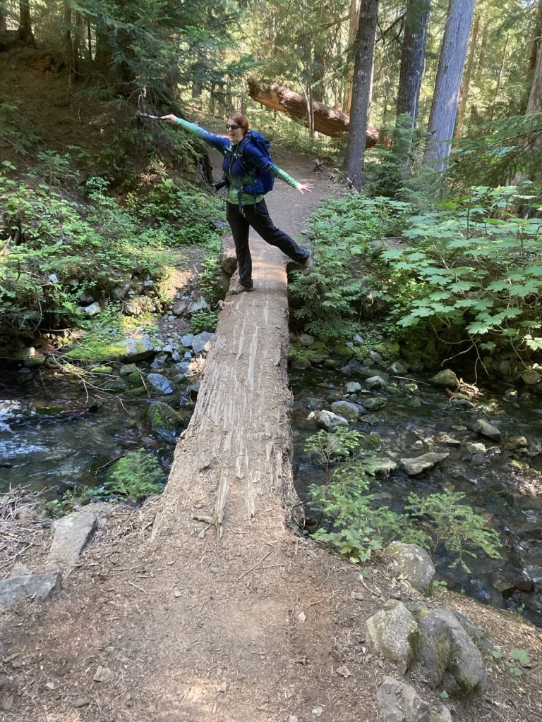
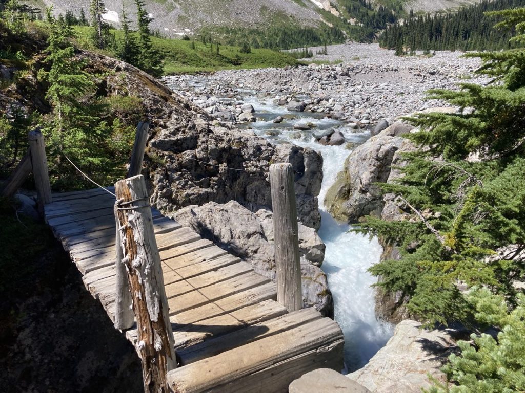
N showing me how crossing bridges is done
Half of this hike was familiar to me. I’d been as far as Panhandle gap with K in the past, so it wasn’t until we passed the trailhead and kept going toward White River that I was in new territory. But I can see why K chose it – it’s one of the prettiest places in the park. The hike to White River was mostly deep forest, with only one ominous warning sign that the White River bridge was out and impassable. We deduced that this sign was old, since we’d seen the bridge when we started the first day and there hadn’t been any significant weather since then. Also, we spoke to almost everyone going the other way and you’d think someone would have mentioned it.
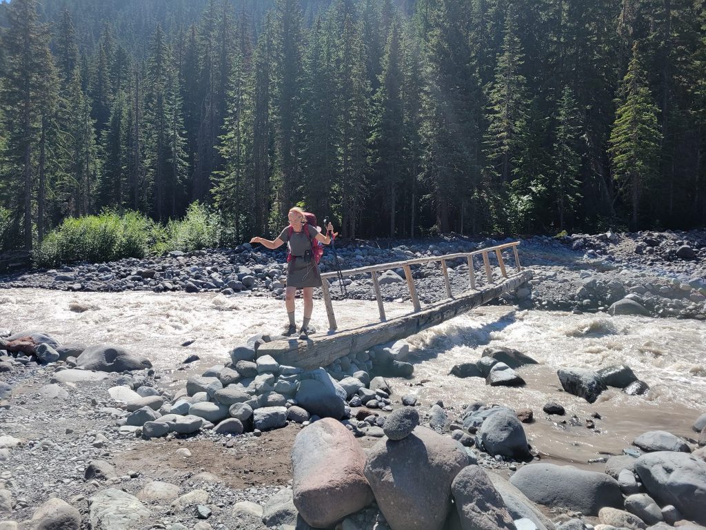
A bit of celebration at the last scary bridge (3 banana peels)
And we were done. Time to return to everyday life. On the one hand, I really wanted a proper shower, but on the other hand, I wasn’t looking forward to returning to the world and its problems.
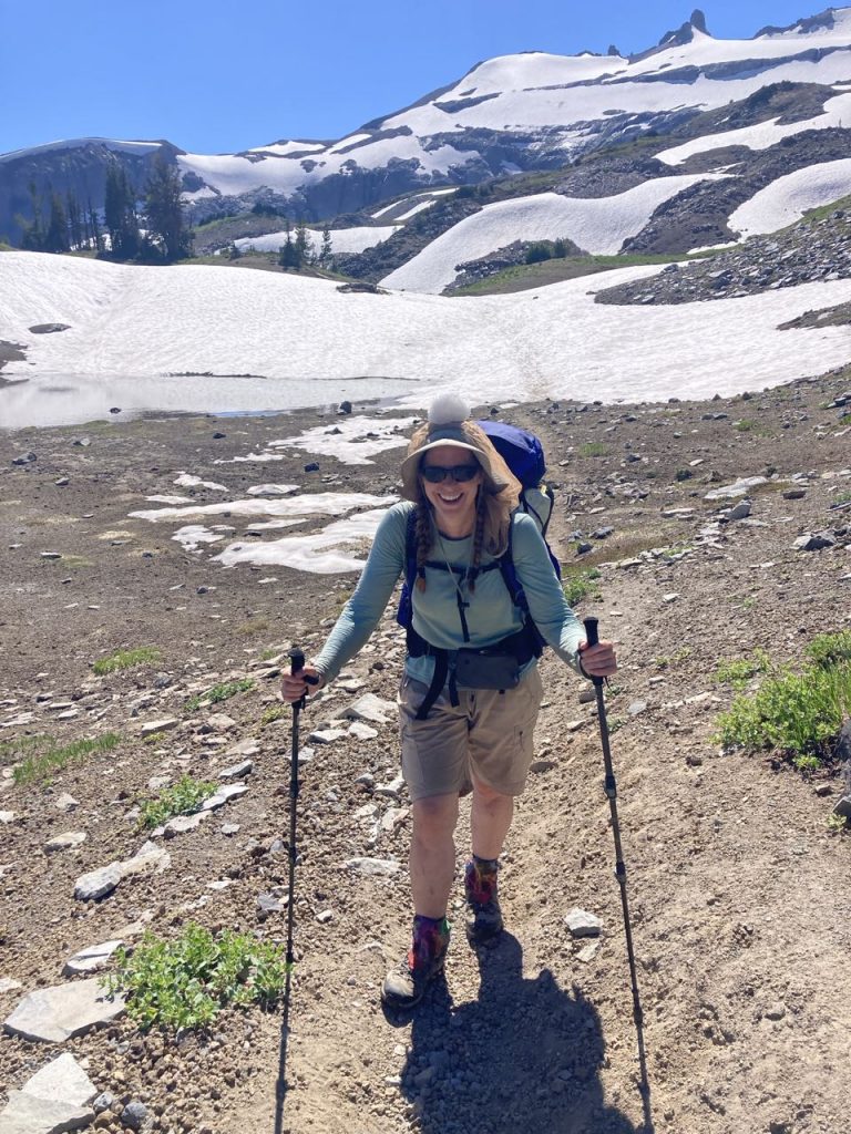
This was going to be a big day and one that I’d had some concerns about. We needed to travel over 11 miles and had at least 4000 feet of elevation gain, which put it at the top of the range of any day hike I’d ever done before. It would also take us to the highest elevation on the entire trip, about 7000 feet. On the other hand, some of my concerns were because I’d been initially misreading the map and thought we had more than 5000 feet of gain and I’d been steeling myself for that. When I realized the error and that it was ‘only’ 4000 feet I felt much more optimistic about it.
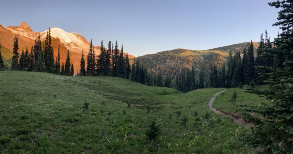
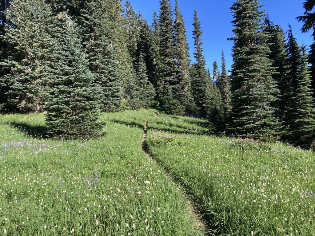
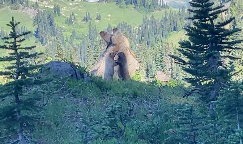
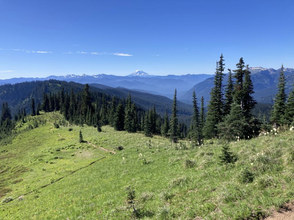
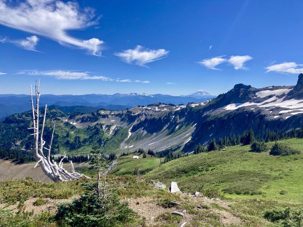
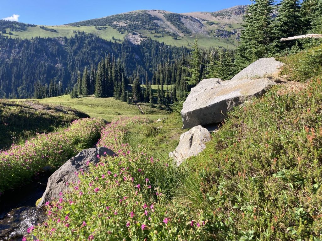
Uphill, out of Nickel Creek and it wasn’t long before the trees started to thin out and we reached a ridge where we had some views of the area. We also passed a family of marmots who were almost completely unconcerned about our passing by. Mom and dad sat on a rock while two kids played. There was still a lot of beargrass in bloom, amazing views everywhere, and we began our descent to Indian Bar.
Up out of the forestMarmot FamilyMount Hood in the distanceDescending to Indian Bar
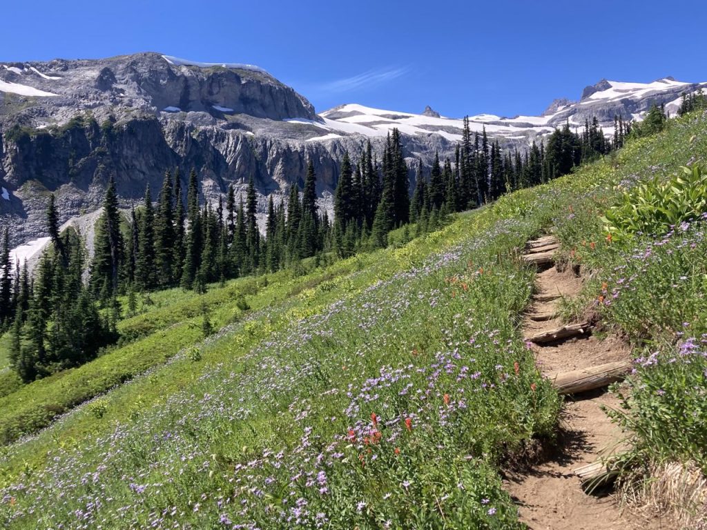
Above Indian Bar
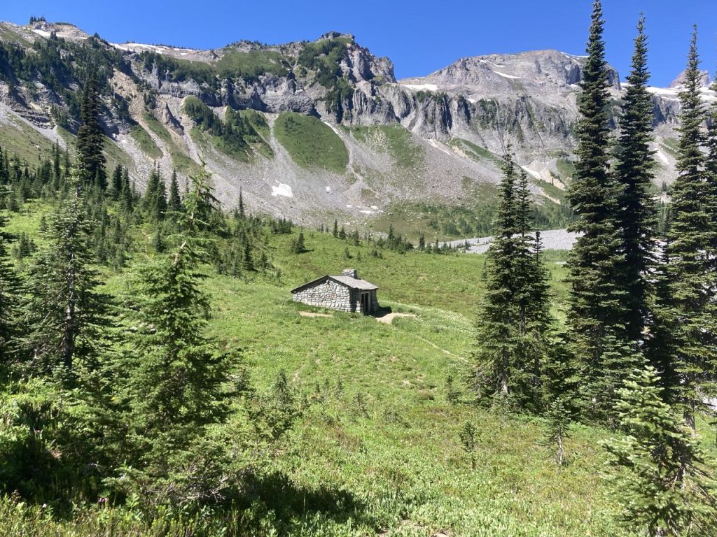
Indian Bar and Summerland are the two most popular campsites on the entire trail, and they fell last on our hike because placing them that far out was the only way we could complete the circuit when I went to get the permit. I can see why they are so popular. The downhill to the camp was a nice respite.
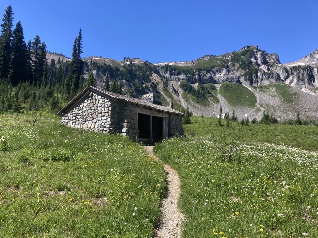
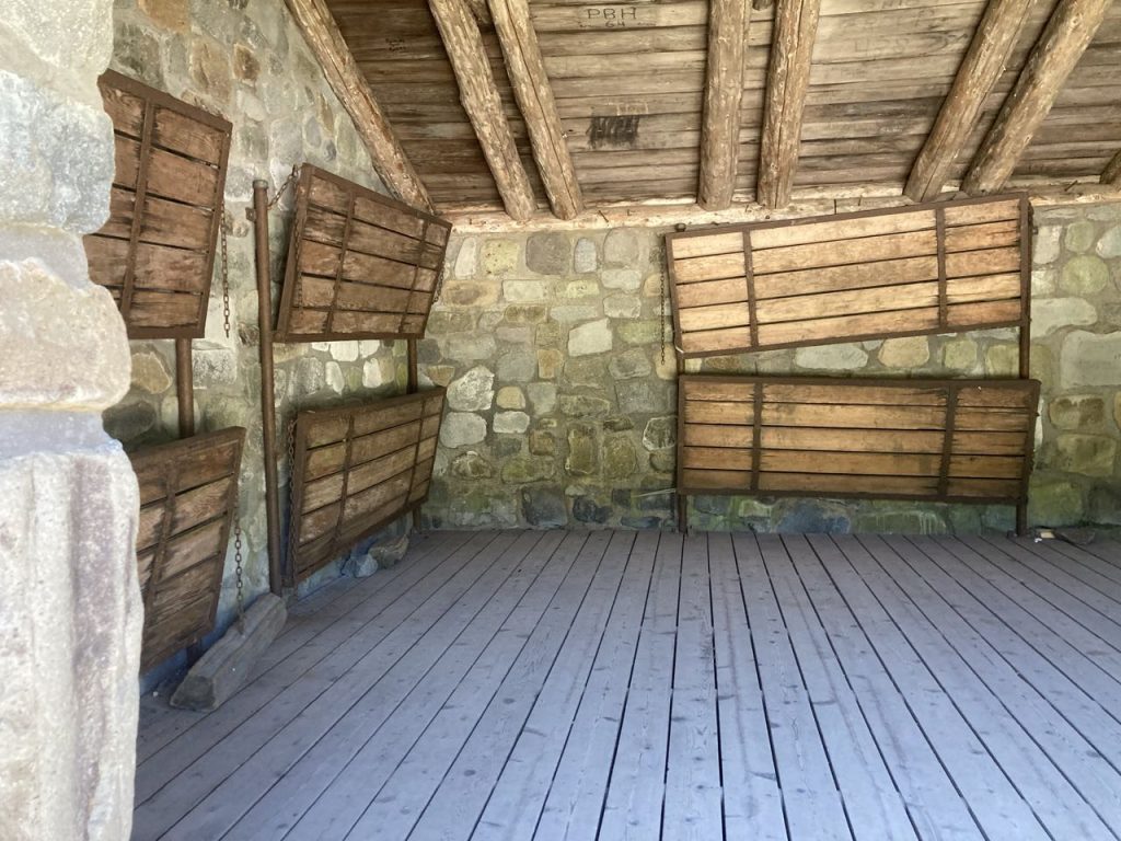
2 banana peels. Solid, wide, just very high.Indian Bar shelterBunks inside the shelterIndian Bar
We had lunch at the little creek below the cabin. The downside of having that bit of downhill was that now we had to go back UP, and the climb out of Indian Bar was long, steep, and exposed. K & I suggested to the two younger members of the group (younger than me by 15 and 30 years) that maybe they should go ahead at their own pace to get to Summerland before us and try to grab one of the better campsites. I handed over the permit and they started out.
Climbing up out of Indian BarLooking back the way we had come
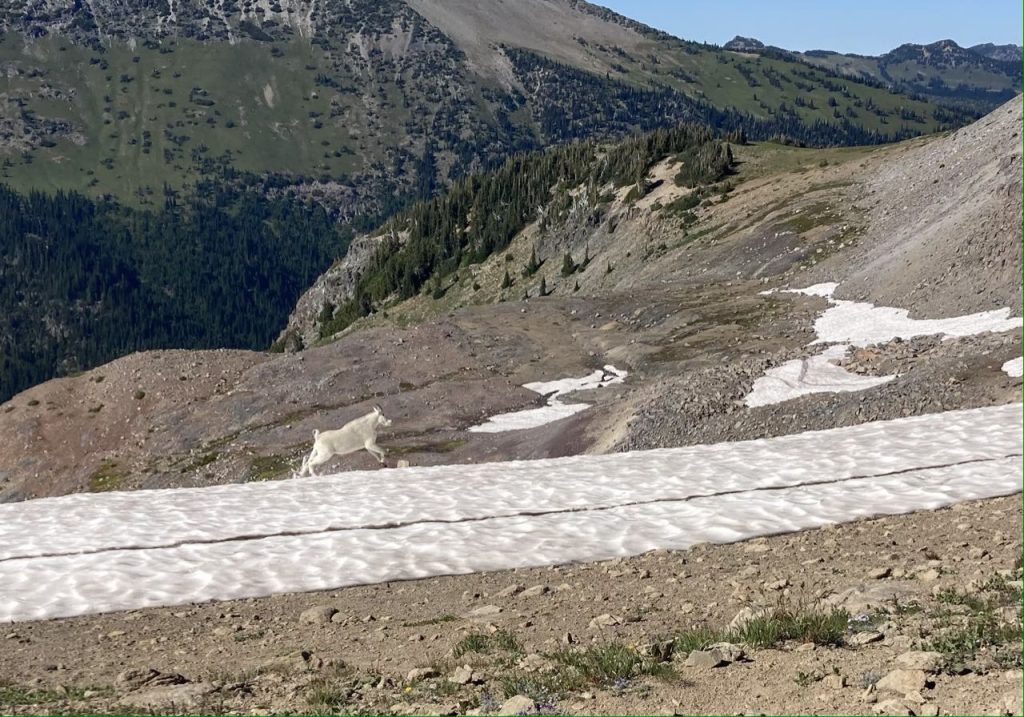
The climb was hot and we decided to go as slowly as we wanted and to take many breaks. We eventually got up into some snowfields to cross which gave us the opportunity to cool off. Kim made a snowball and started to carry it with her so I dubbed it the ‘snow baby’. Looking out at all the open grass below us, I started to talk about how we hadn’t seen any mountain goats on the trip and I was somewhat disappointed. I’d seen some at a distance on a day hike to Burroughs and thought we would encounter more. While talking, and scanning the fields far below I finally saw a little white speck of ‘snow’ that I realized was moving. We watched for a while and confirmed that there was, indeed, a single goat visible far, far away. But there was no point in trying to take a photo. It didn’t look like anything. I promised to work on my goat-summoning magical powers, and we hiked on.
Now and then we’d catch a glimpse of hikers ahead of us which we presumed were S & R, but we weren’t able to confirm that until we reached Summerland and could talk to them. But my goat summoning paid off! Just before we reached Panhandle Gap, the highest point, I looked to my left and there was a goat RIGHT THERE walking almost parallel to us. We were in a very open area so he had to have been following alongside for quite a while before we noticed him. Once spotted, and once it became apparent that our paths were slowly converging, he ran to get ahead of us.
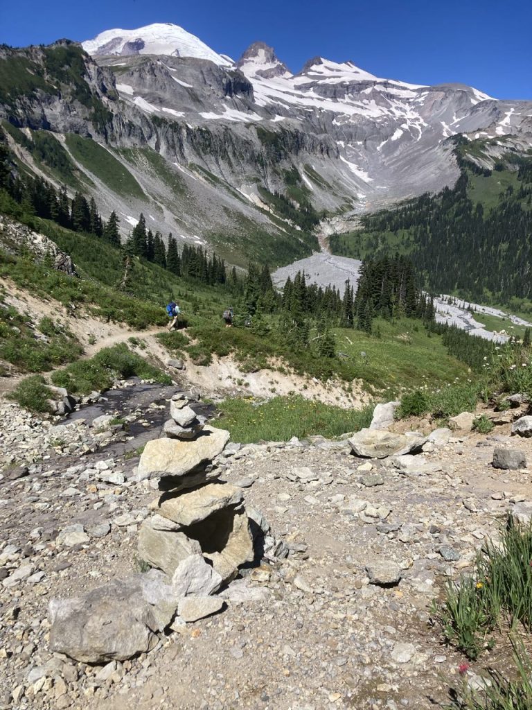
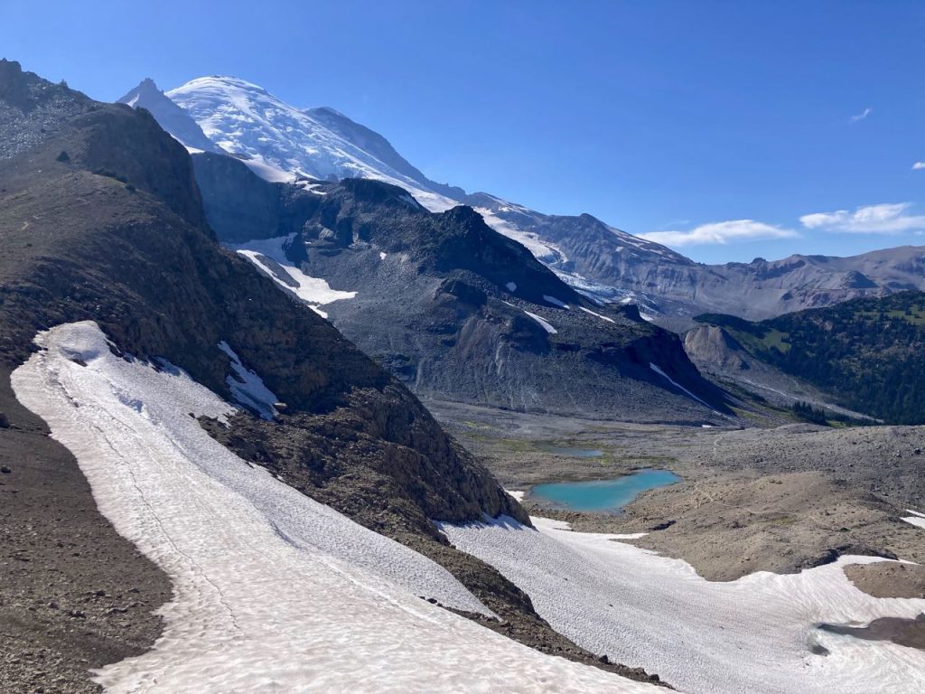
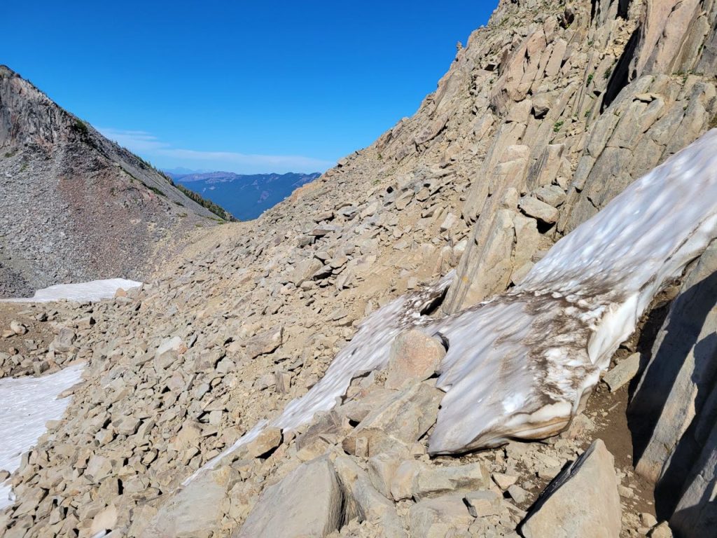
He decided to run to get ahead of us just as we reached the gap. We stopped here for a break and to survey our options. We knew there was a hazardous ‘snow bridge’ here and one look at it told us we weren’t going to take that path (photo below). This is the main path, but the snow that lingered on it had melted out below so to stay on the path you had to walk on a bridge of snow of unknown thickness while everything underneath it had melted out. It looked very easy to either slip off of it or punch through unexpectedly.
K with the snow babySurprise GoatPanhandle GapThis IS the trail, but we said “Nope”
Instead of risking that we opted to scramble down the talus slope to the left. This was slow going, and I heard later, S’s least favorite part of the trail. I thought she’d love it because it reminded me of jumping around on the boulders at the Carbon River, but apparently, during her descent, she rested her weight on a very large boulder and it MOVED. And that made her very untrusting of everything around her.
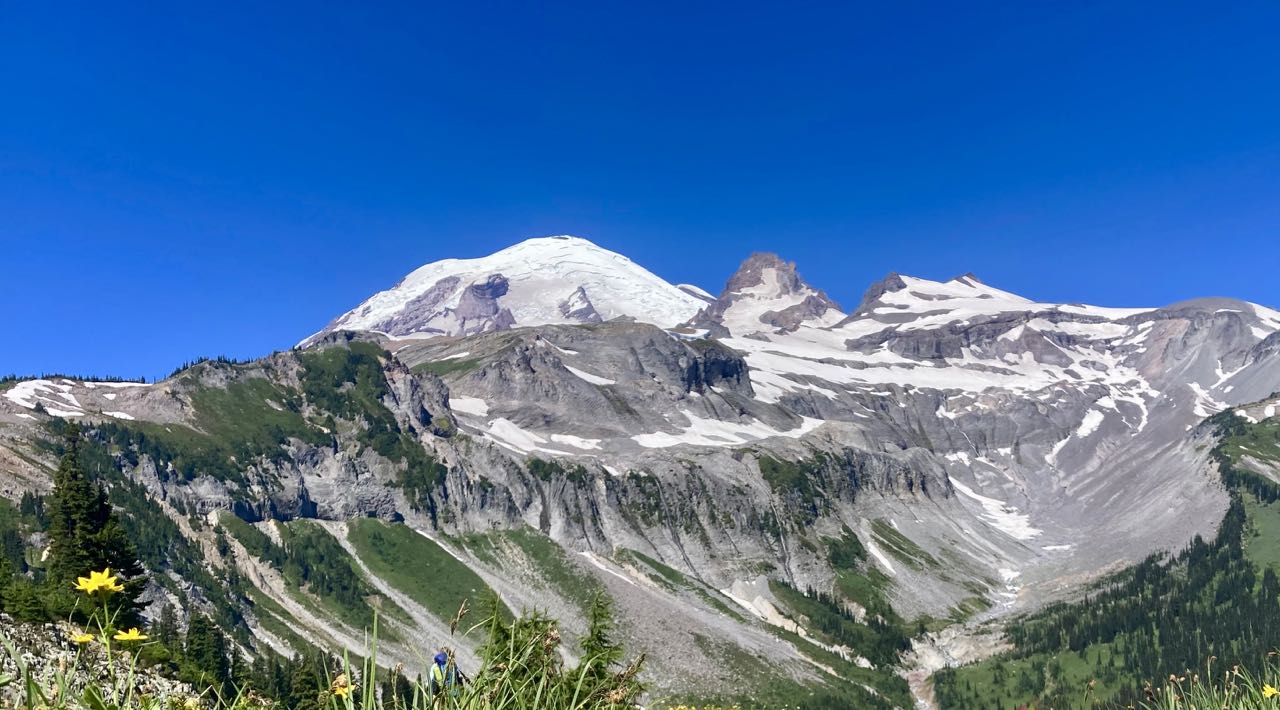
This part of the landscape looked like the surface of the moon to me, and made me a little sad because I imagine it used to mostly be glacier, but now we could see Summerland below us. We had one more dubious crossing – it was only a creek, but there was no bridge and the rock-hopping prospects were not great. K finally decided to go for it and jumped onto some big rocks. I considered it, then chickened out and instead put on my sandals and waded across at a spot where I could see the bottom.
Summerland
S & R had a great spot for us. It was a little far from the toilet, but also far from other campsites for privacy and close to a nice view. We had our supper near a marmot friend and they told us about the slight incident. Apparently when they got there and started setting up camp, another hiker kept aggressively asking, multiple times, if they were going to stay *there* and if they had a permit. (They were and they did). From the tone of it, I think this hiker might have thought that both S & R were teenagers off on a lark. In reality: S is a Jr in college and R is a PROFESSOR.
This was our last full day so I did my best to eat as much food as possible so I wouldn’t have to carry it. We planned to get up early the next morning to watch the sunrise and we were expecting K’s sister to hike in to meet us.
")


