Posted on 3 Comments

Anacortes to Friday Harbor

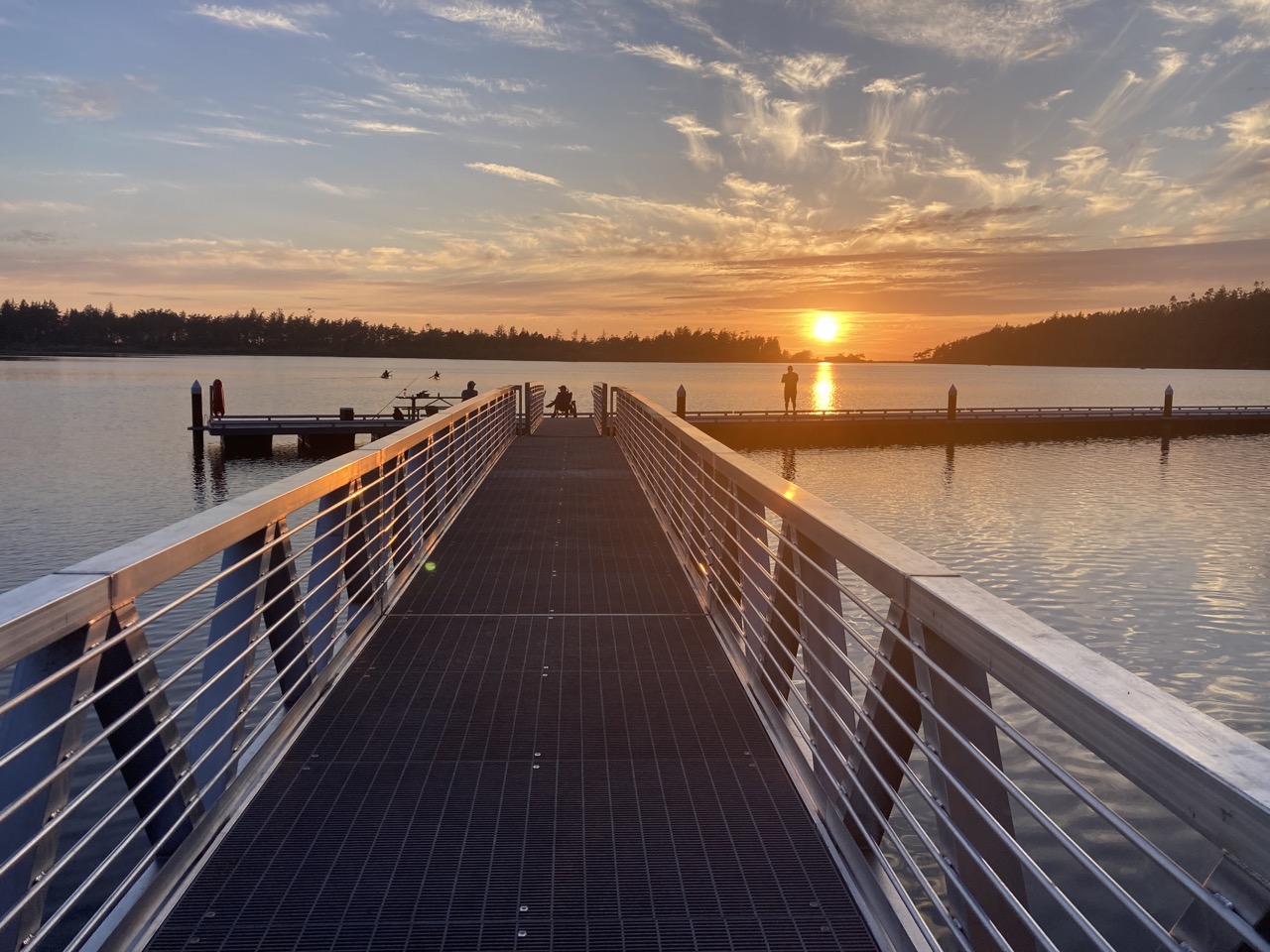
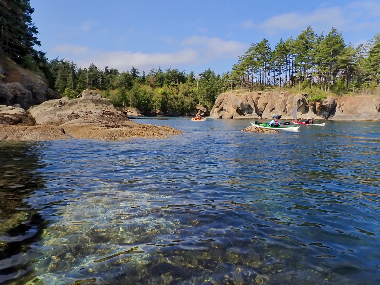
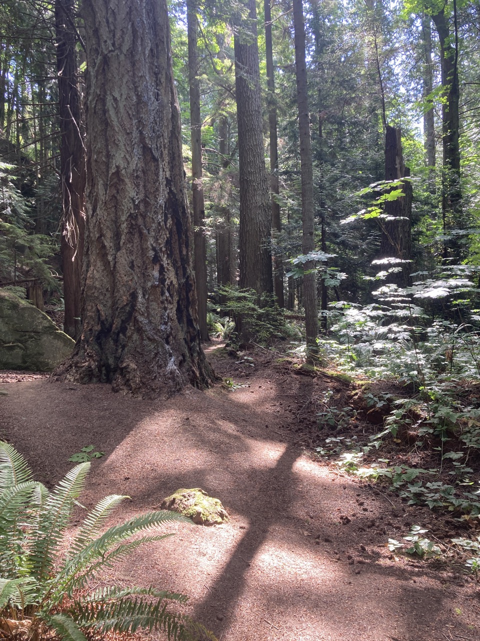
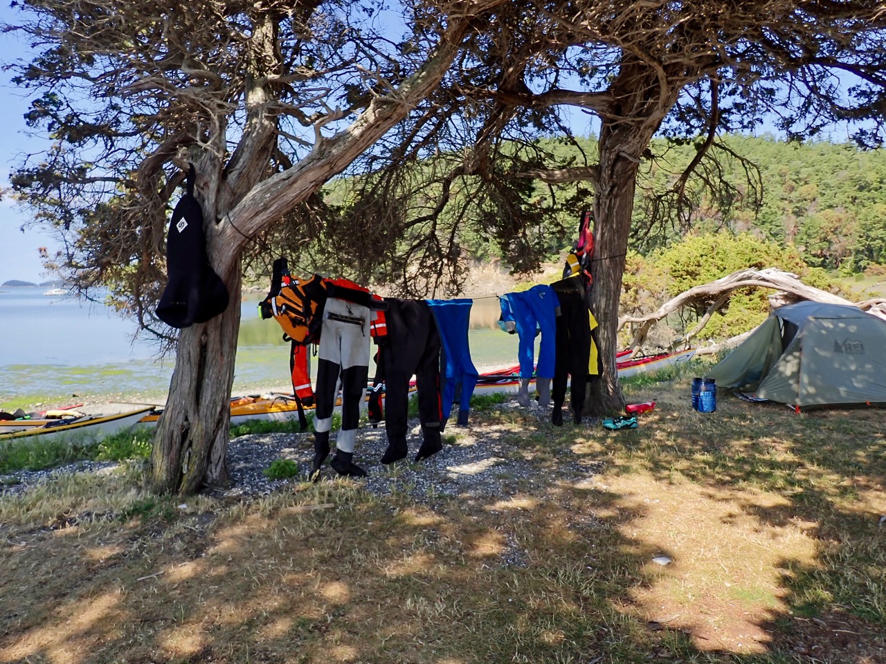
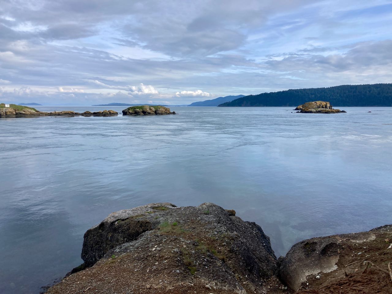
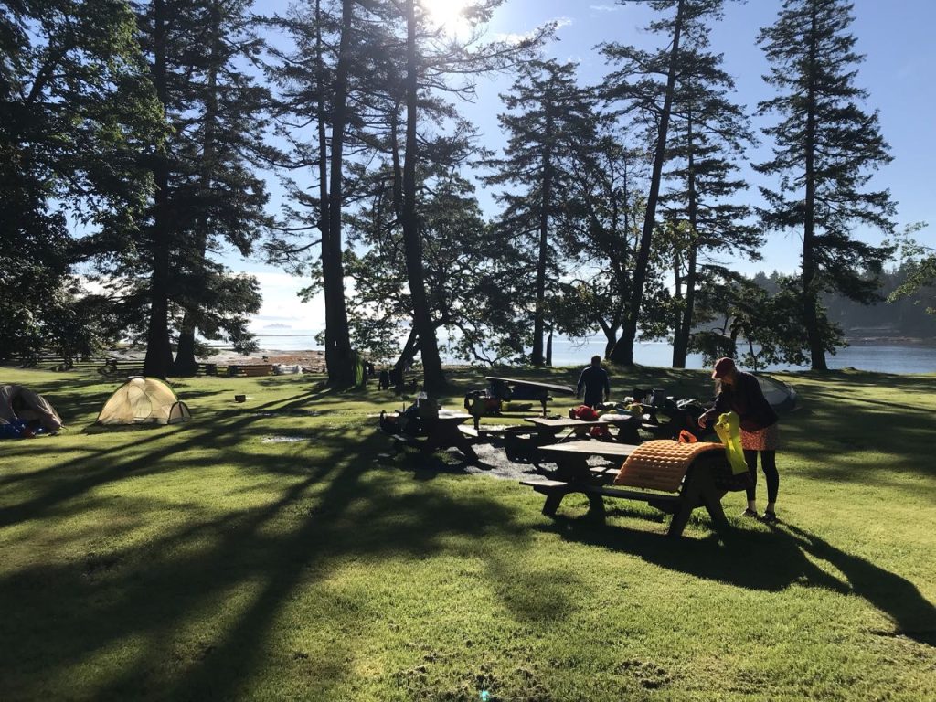
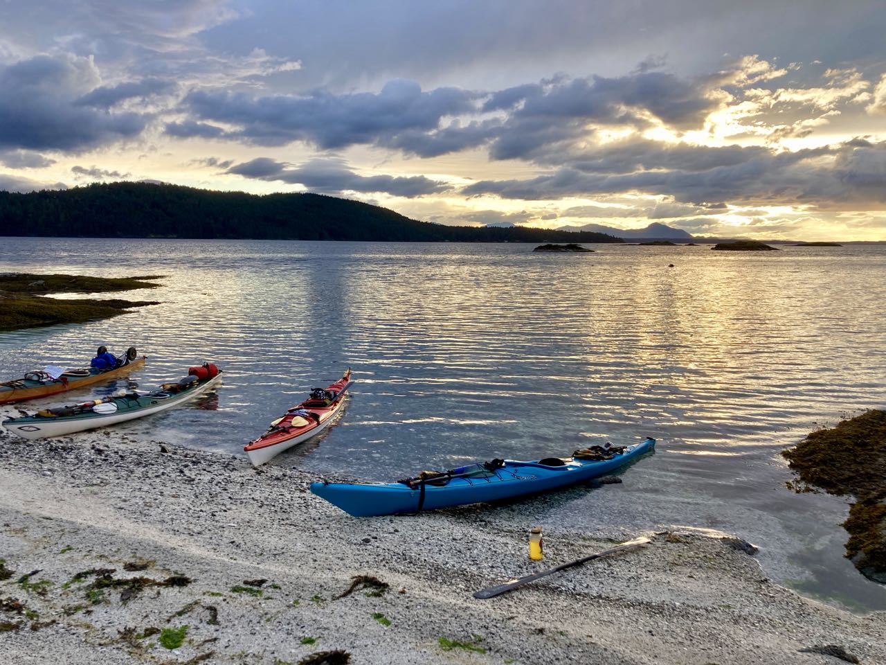
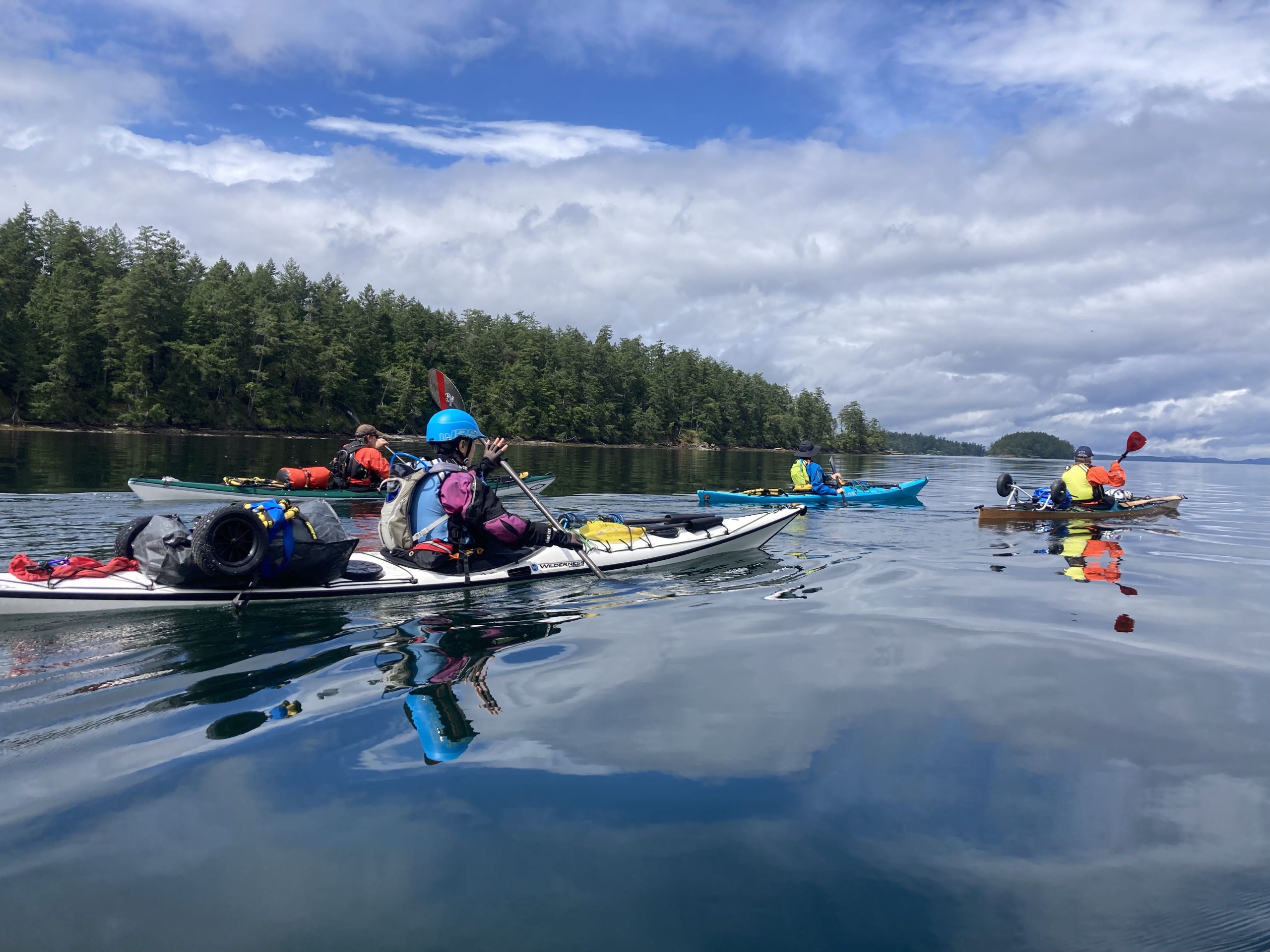
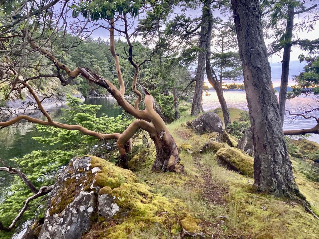
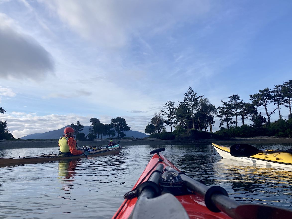
More kayaking! Over the weekend I went to a 3-day kayaking ‘jamboree’ at Deception Pass where we had instruction and spent the rest of the time learning about camping, knots, and going on multiple paddles (one of which I led)

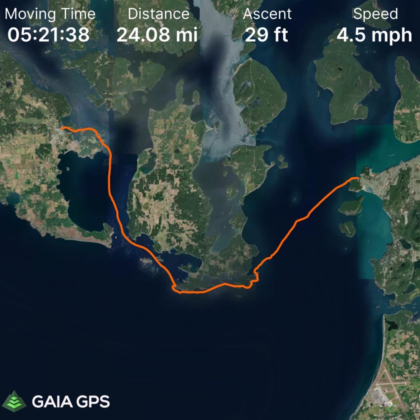
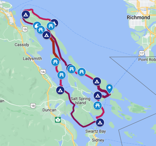
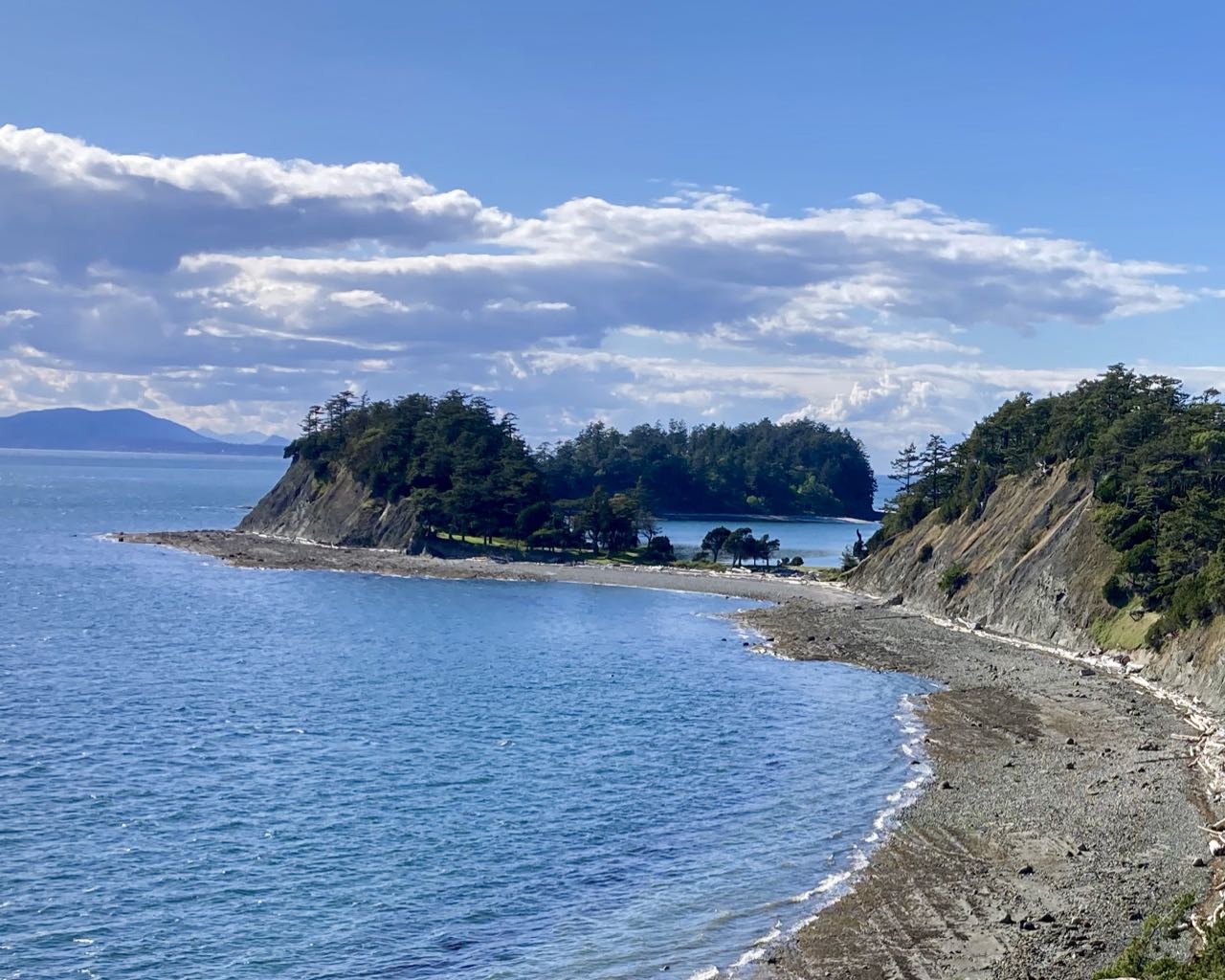
But now it’s time for the real adventure. I’ve been wanting to do this paddle since last year but I’m not ready to do it alone and it’s only scheduled so often. So here it is: Washington Park in Anacortes to Friday Harbor on San Juan Island going south around the tip of Lopez Island. It’s 24 miles and goes through Cattle Pass which can get ‘spicy’.

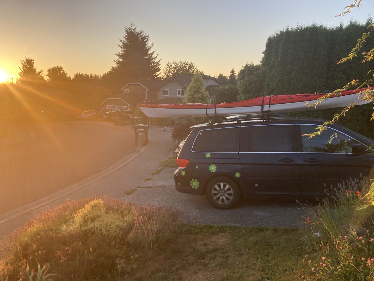
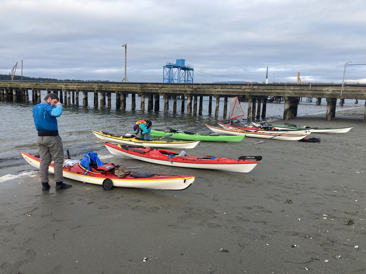
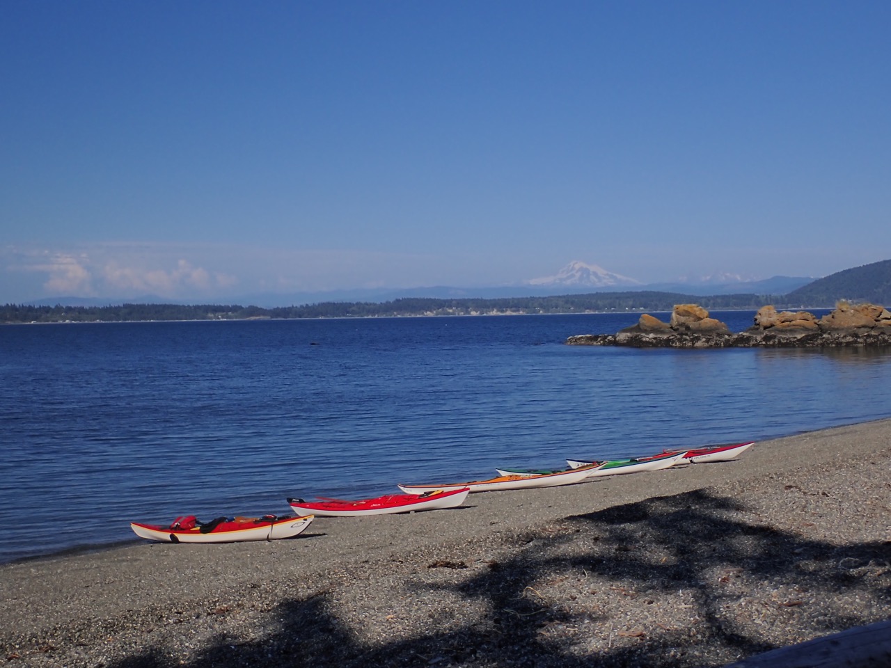
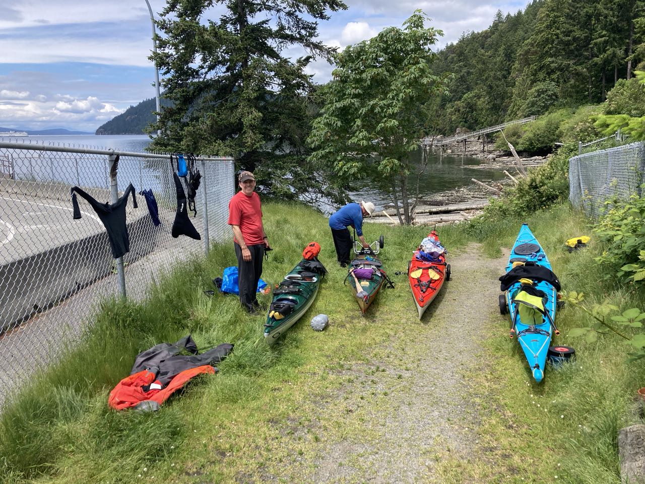
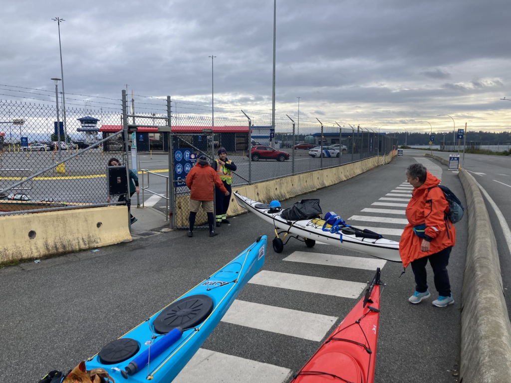
Of course an early start is necessary. Here’s my adventure-van.

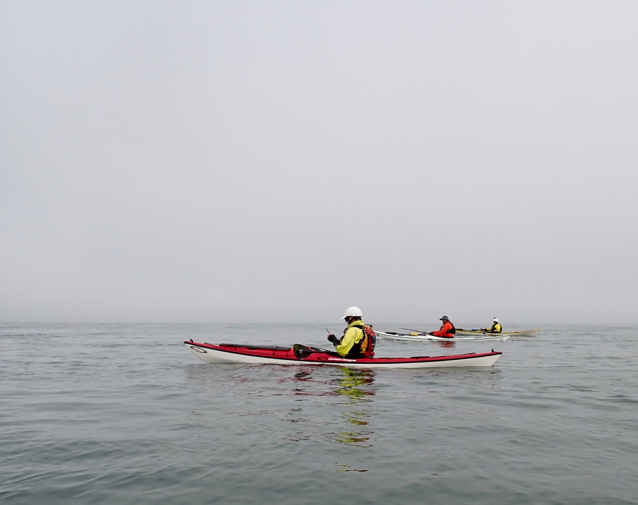
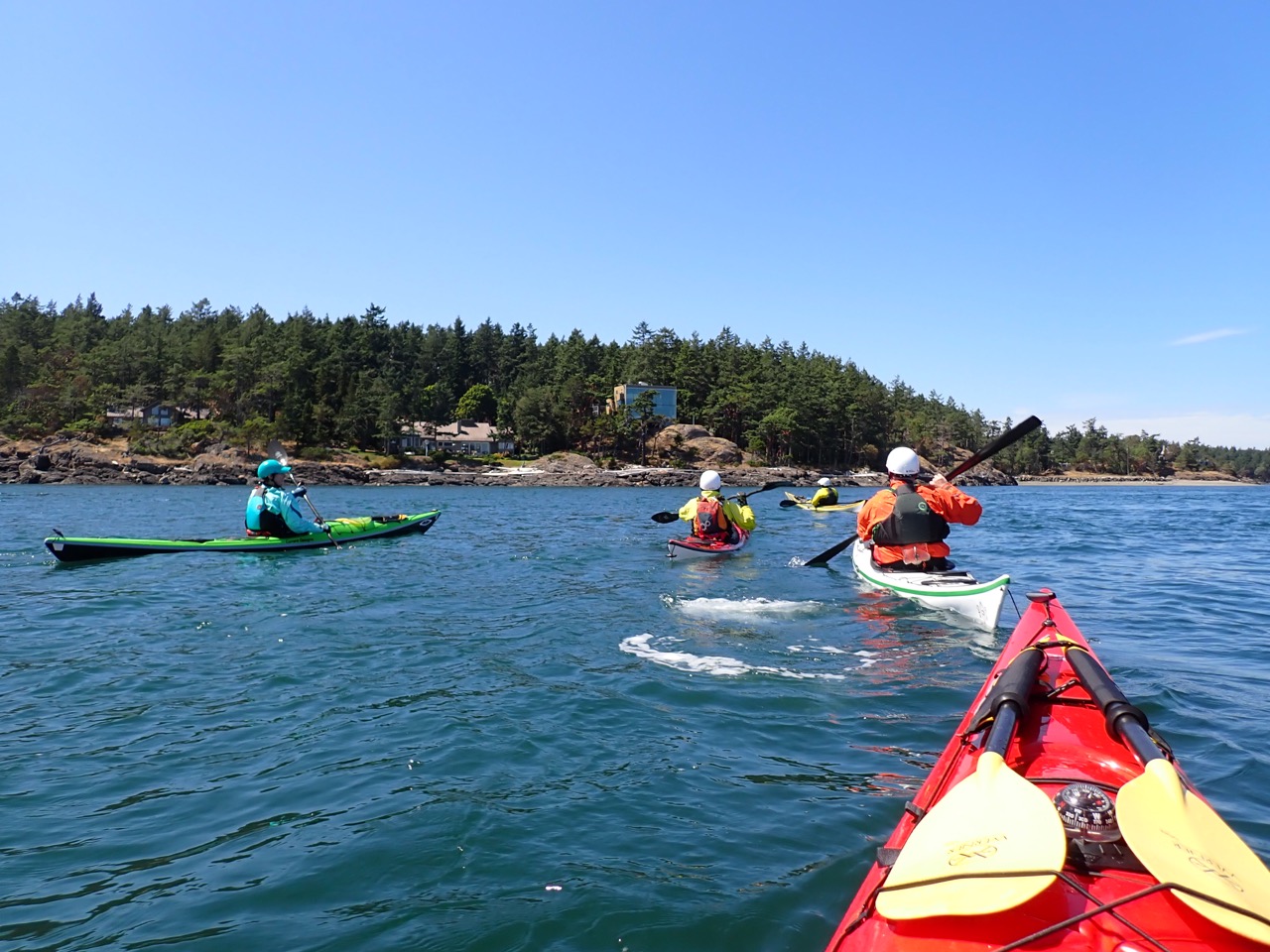
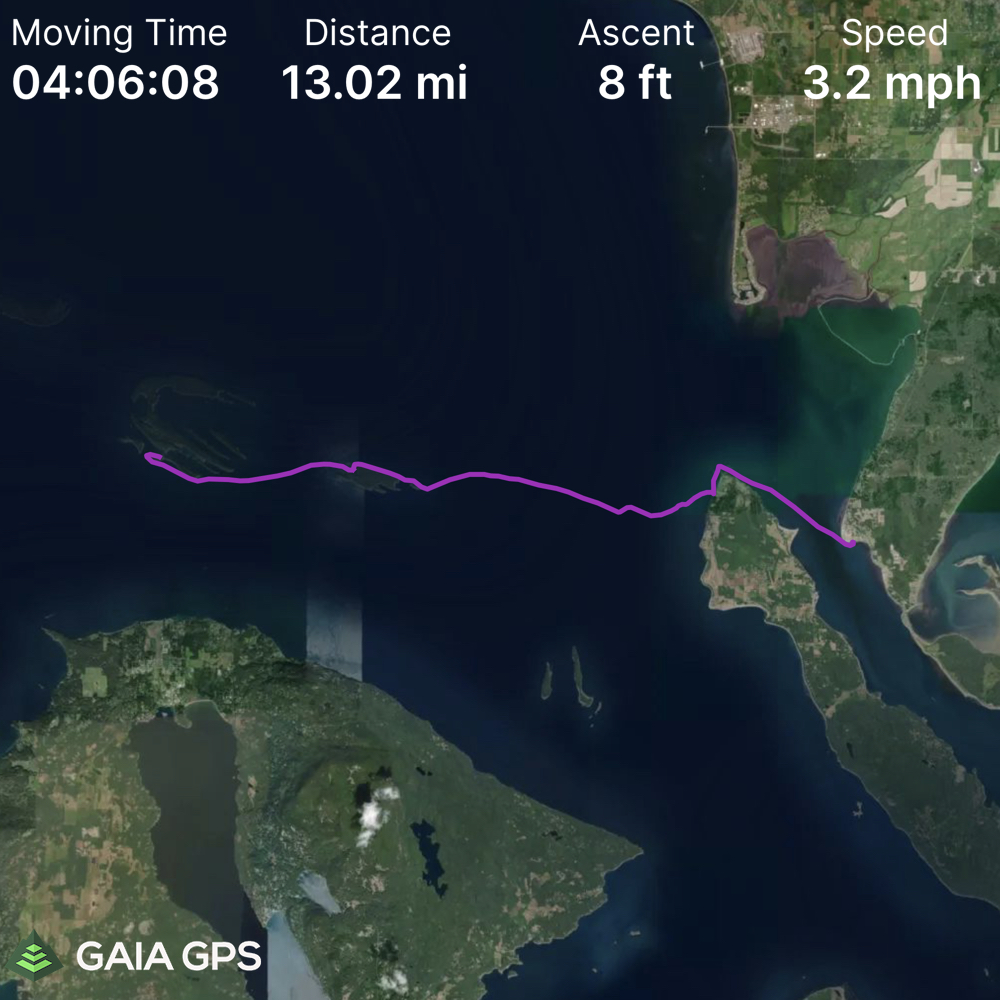
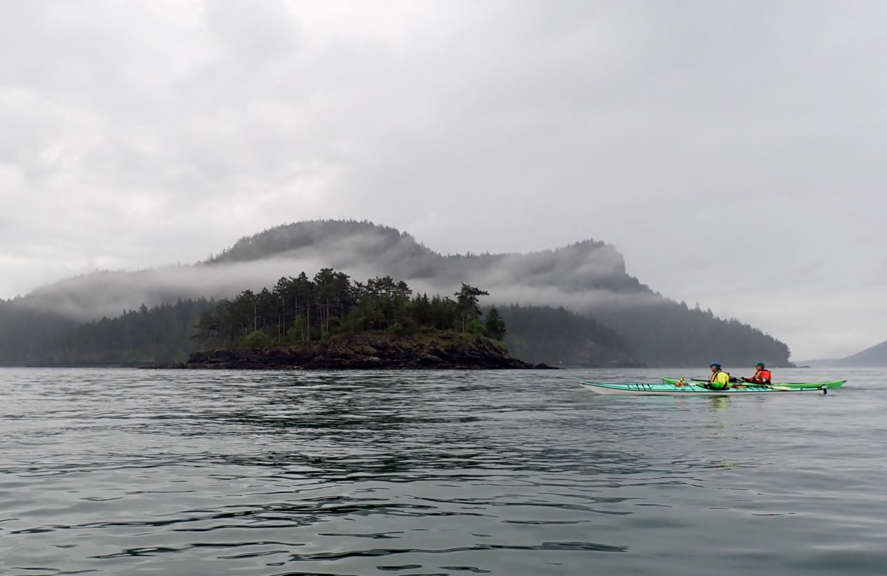
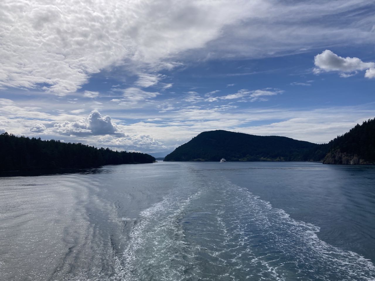
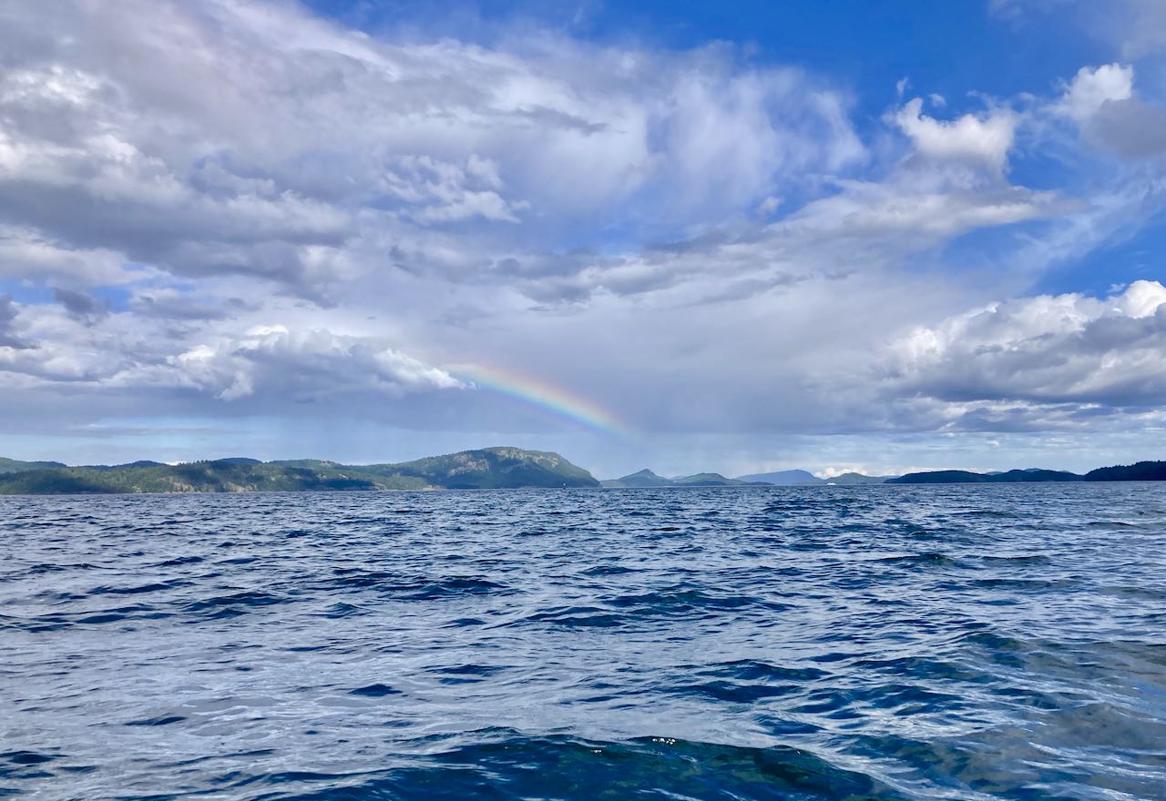
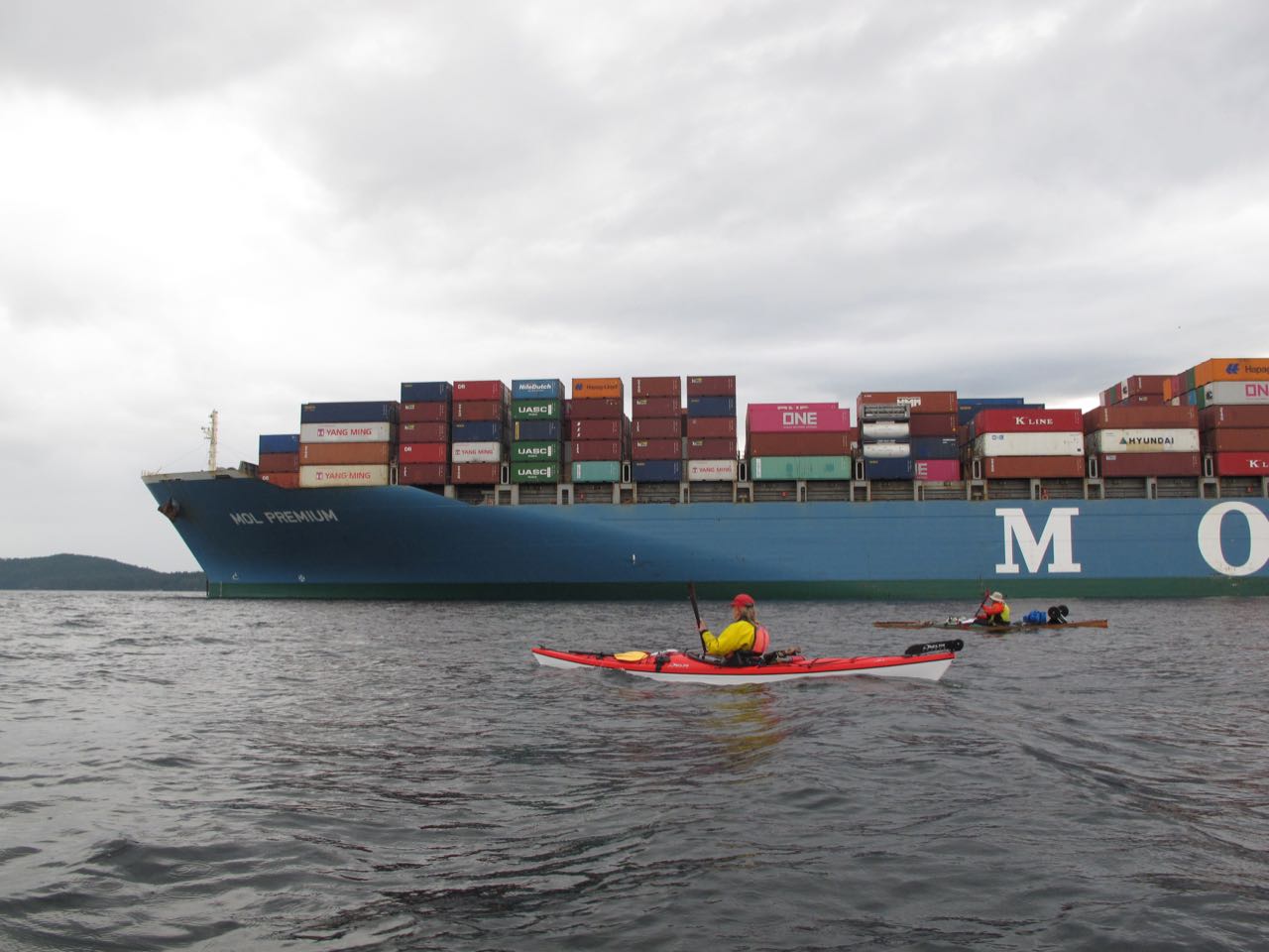
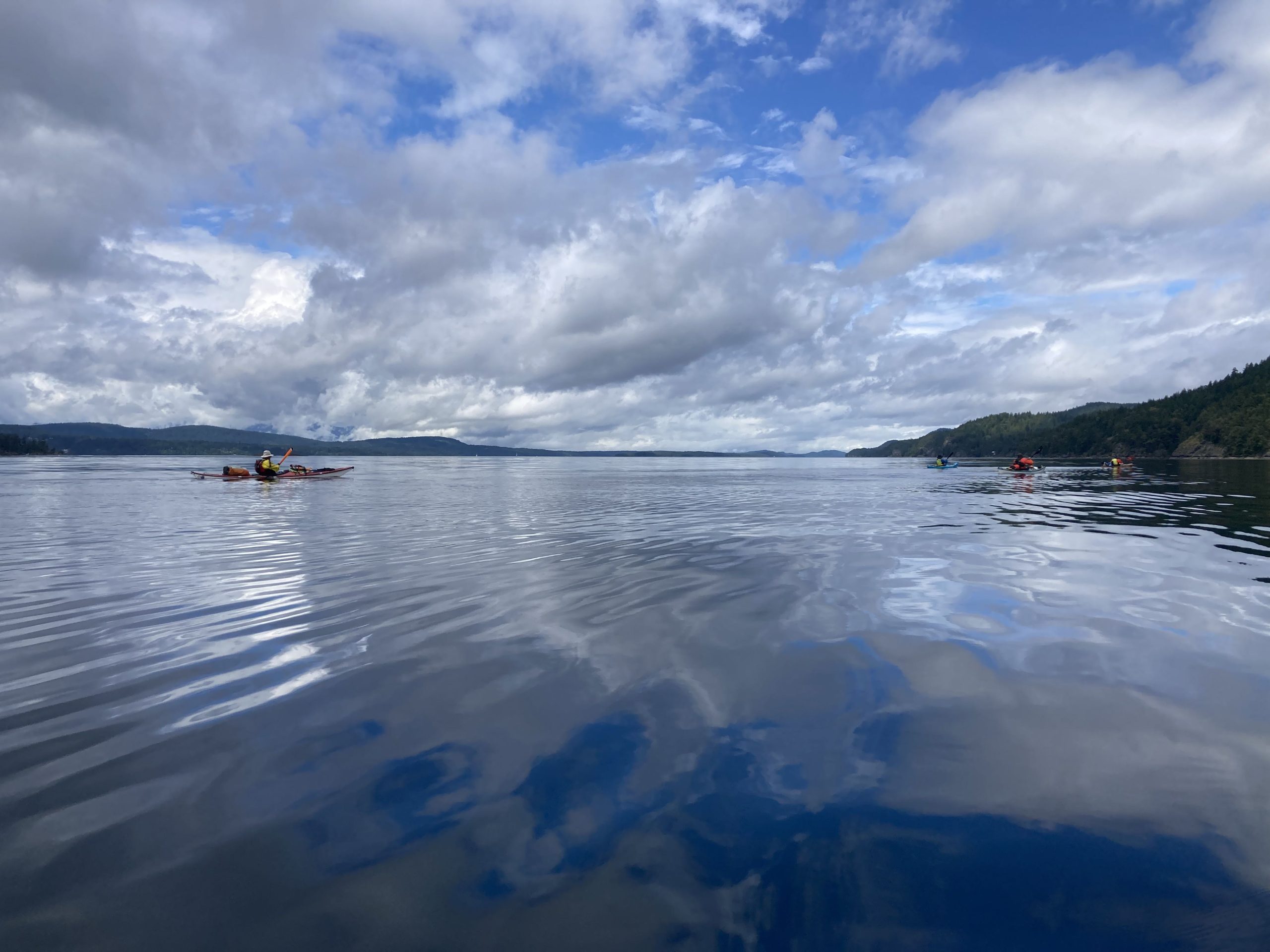
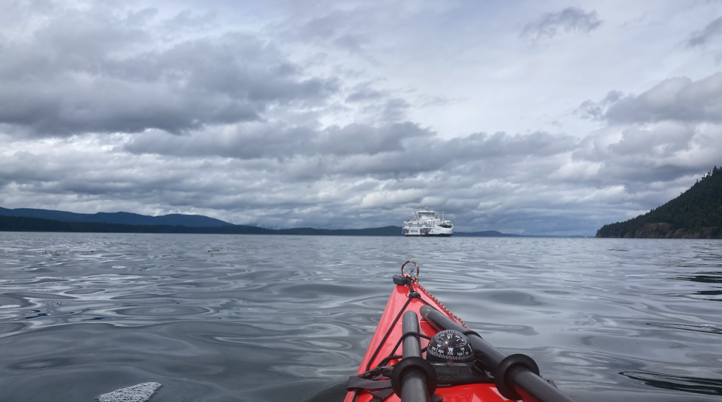
This was unexpected (to me) given how clear it was on the drive over, but on the water there was heavy fog. We thought the sun might burn it off quickly but no – we made the whole crossing in heavy fog. With a strong south current pulling us if we’d been navigating entirely without GPS there was a chance we might have missed Lopez island entire. Here our trip leader is calling Seattle Marine Traffic on the radio to confirm there are no large ships before we cross the shipping lane.

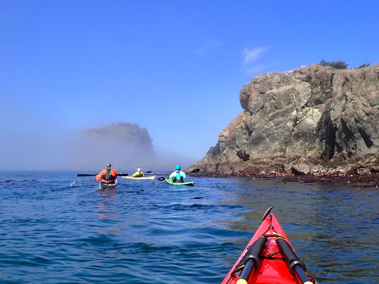
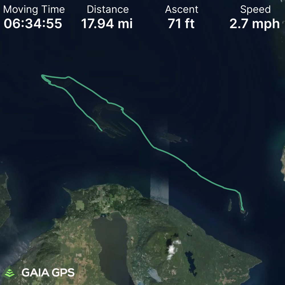
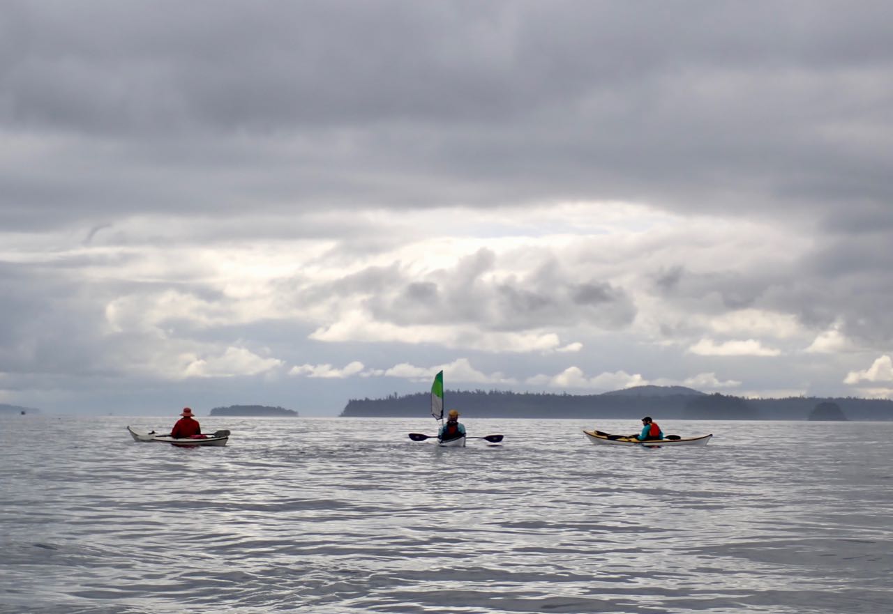
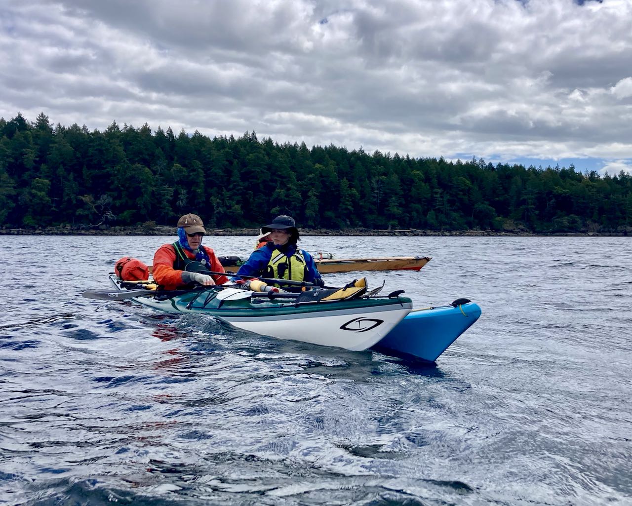
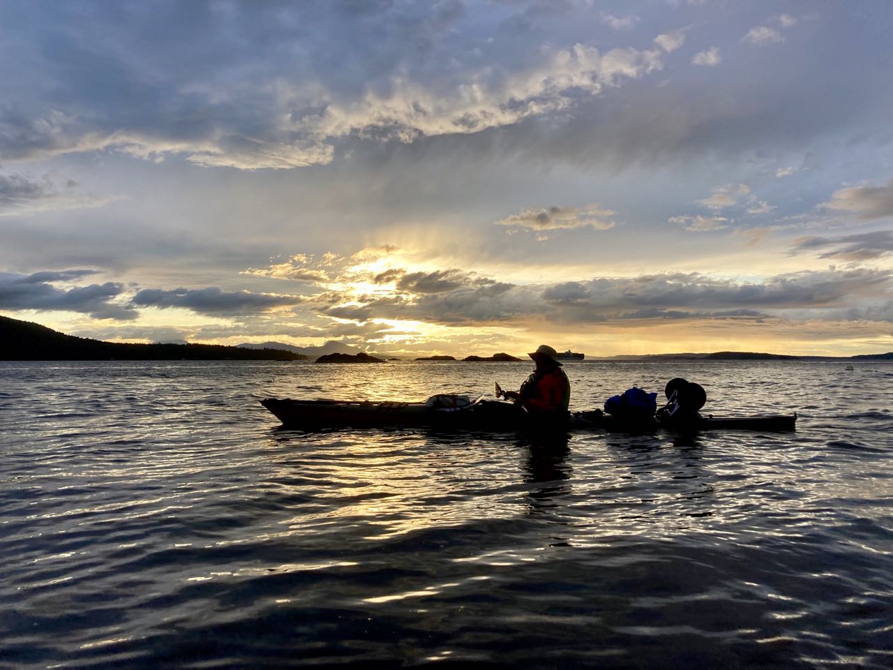
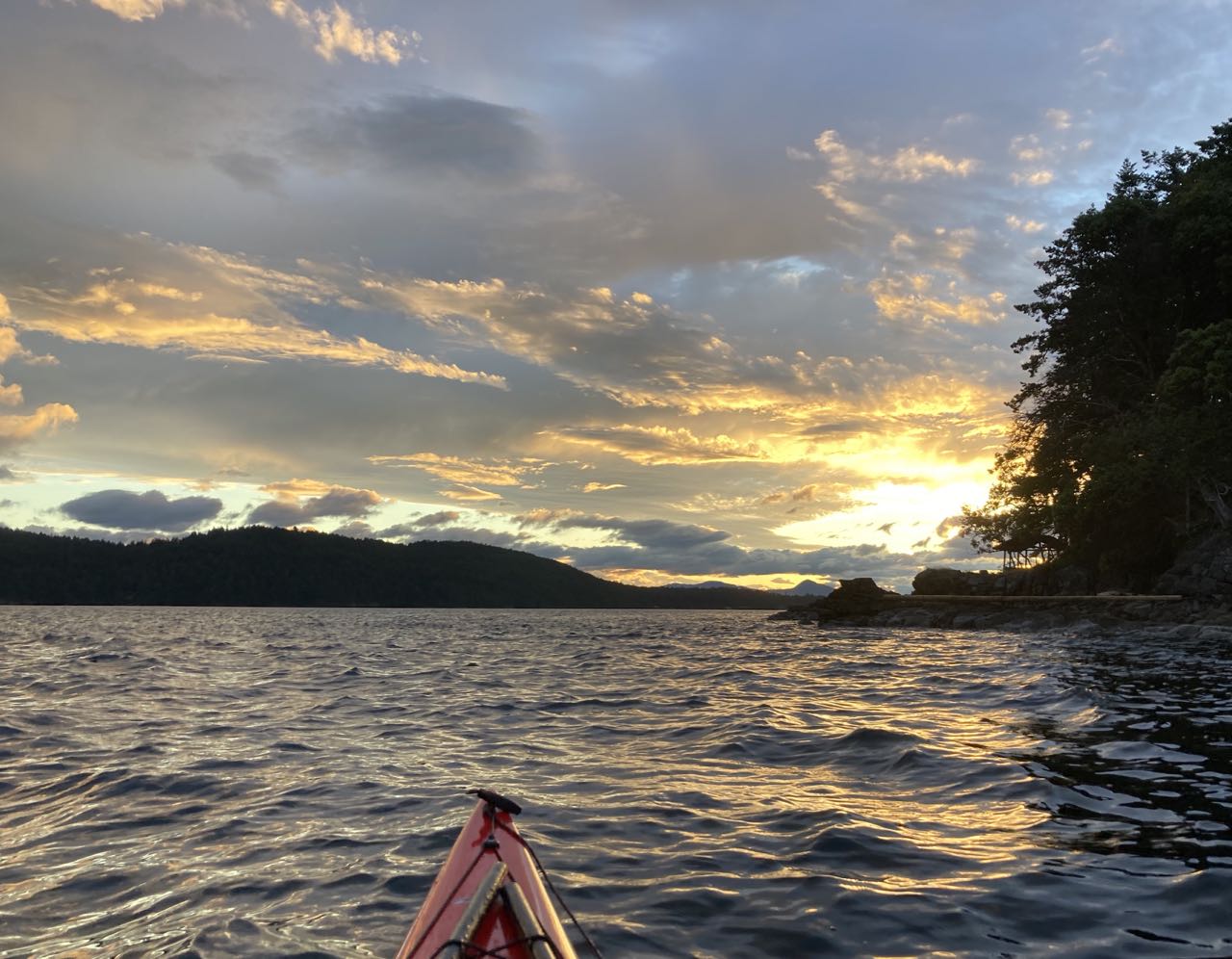
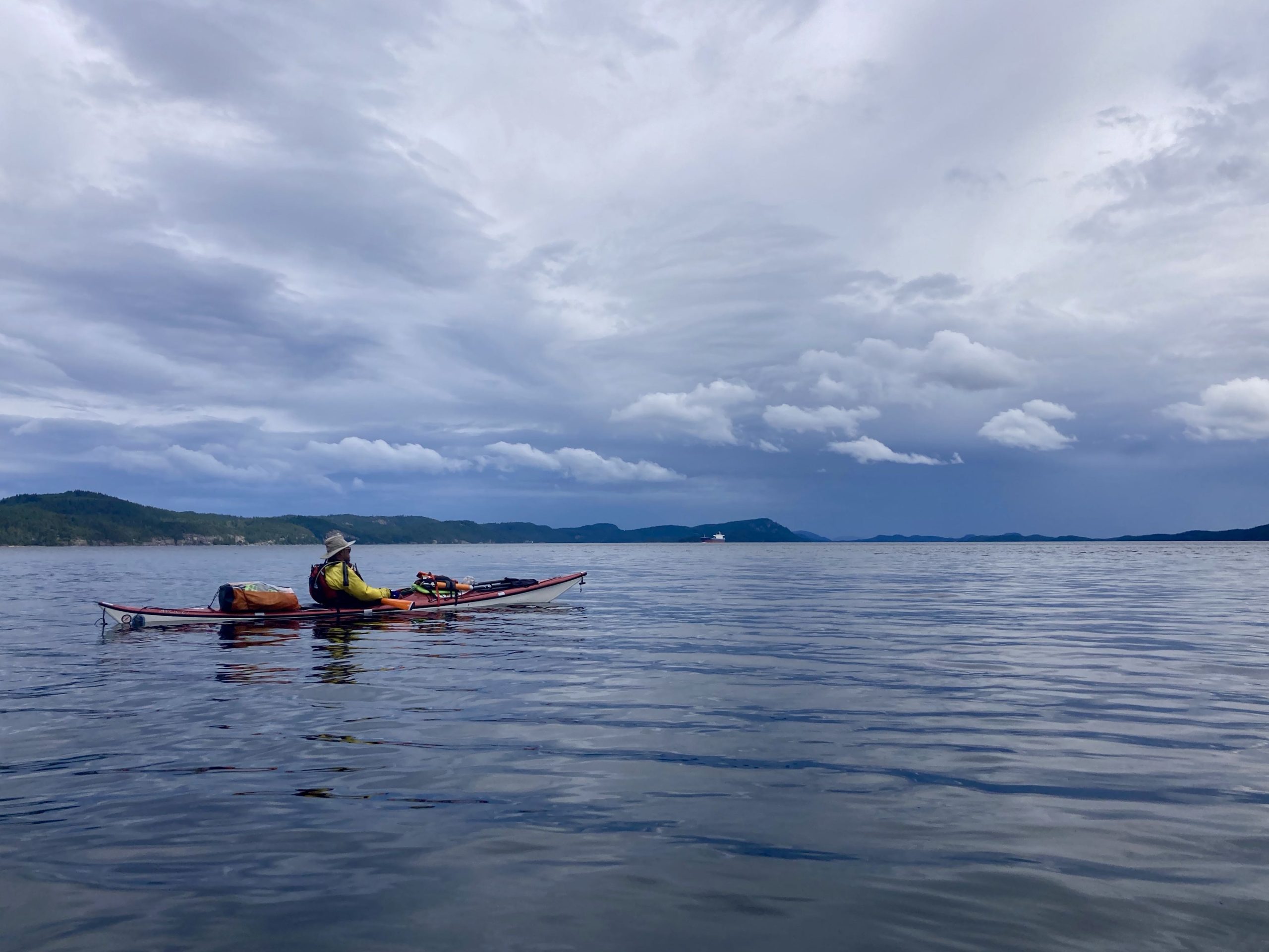
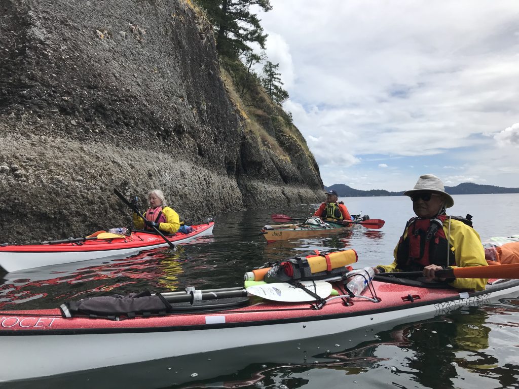
The fog broke just before lunch at Iceberg point on the south end of Lopez and then we quickly got into Cattle Pass before it reached max flood (which was about 6 knots). Even though we went through early we still reached a max speed of 10.5mph at one point. It felt like it took no time at all to reach Turn Island.

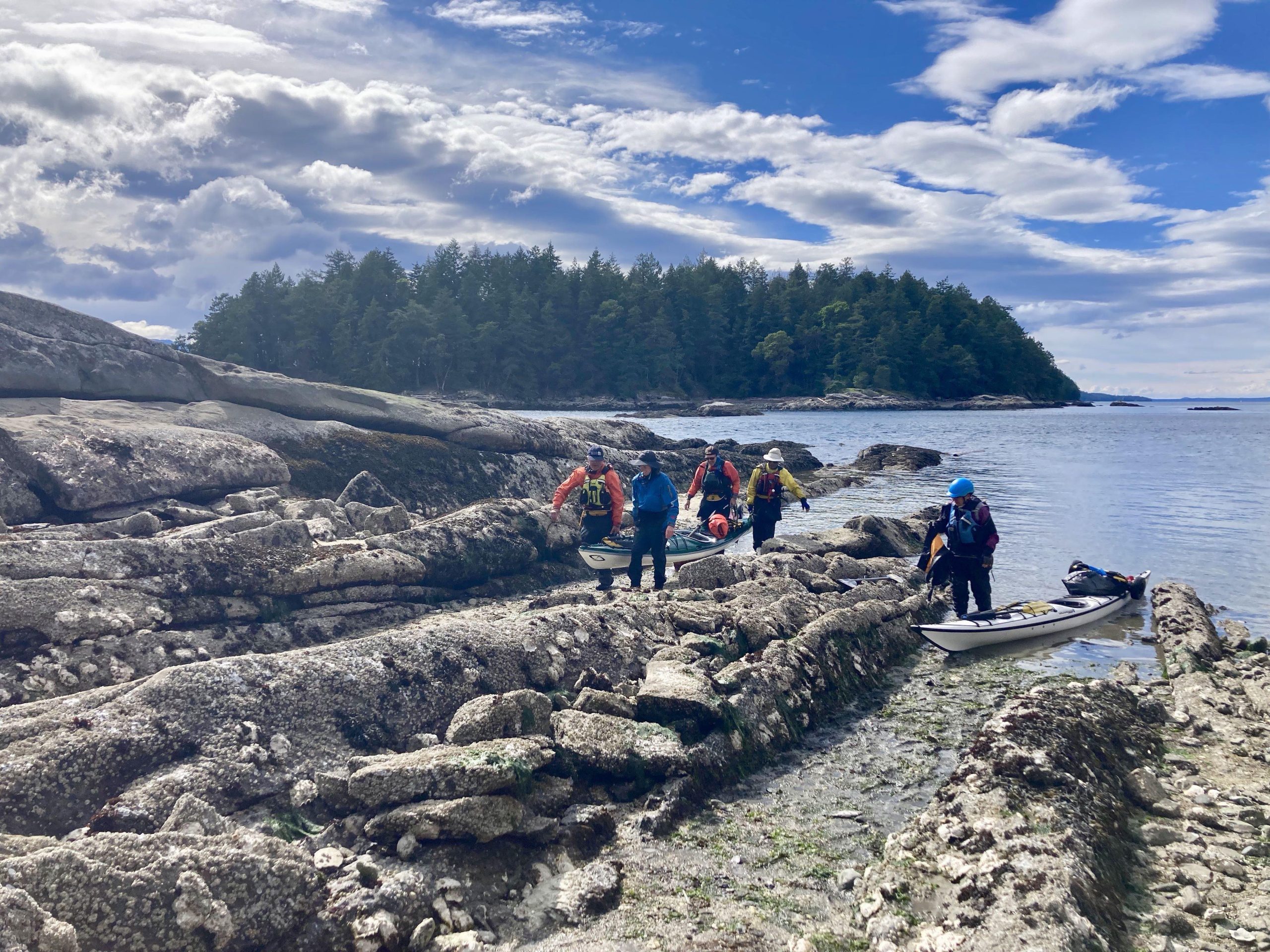
No photos of the excitement of Cattle Pass (a relatively calm day, I’m told) because I was busy not falling out of my boat.

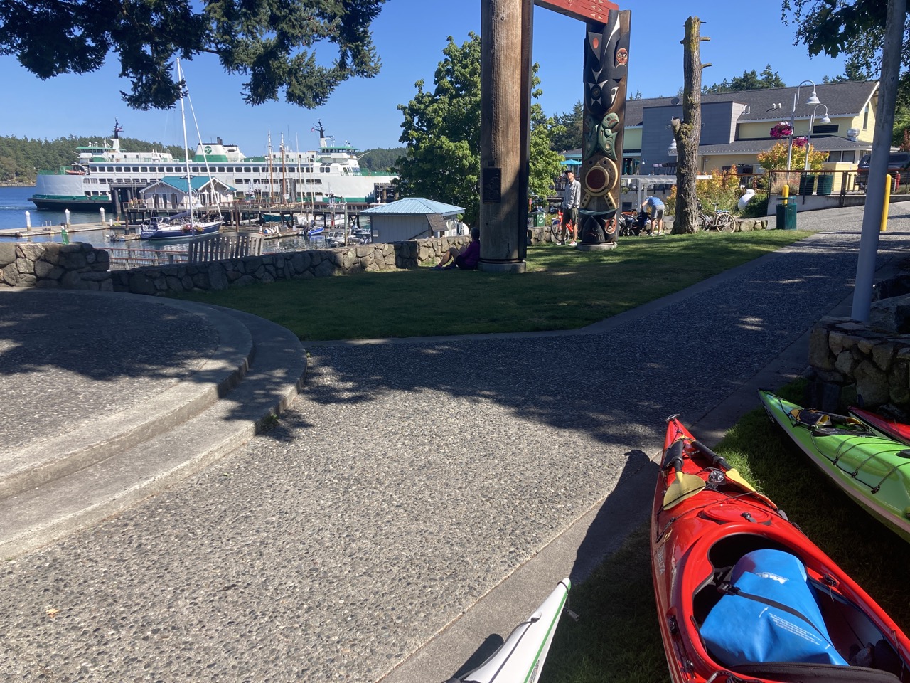
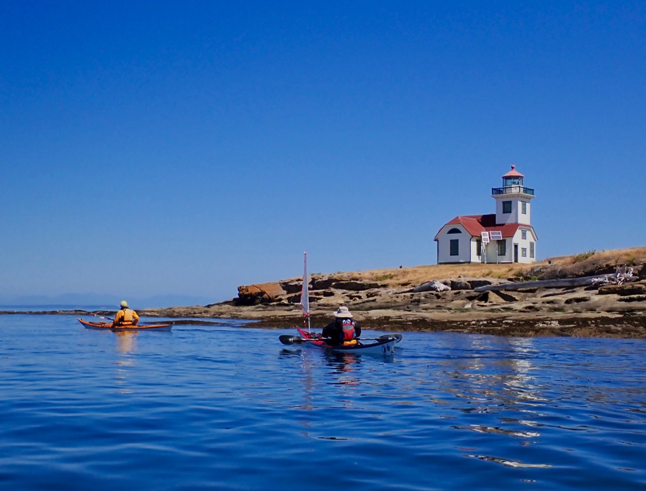
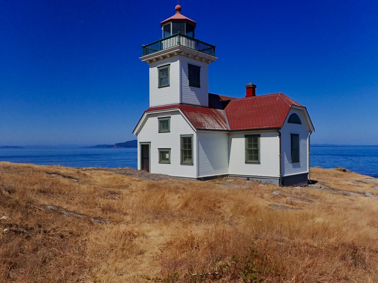
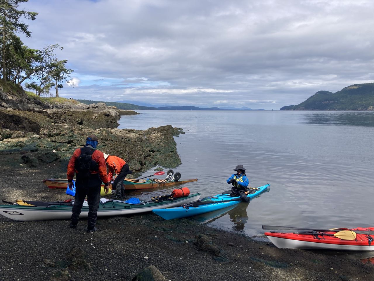
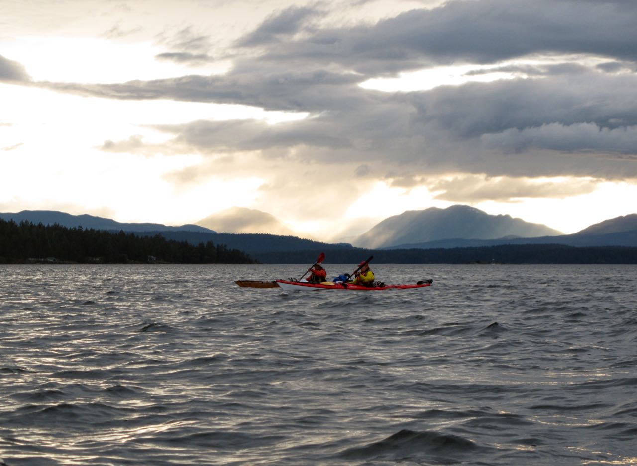
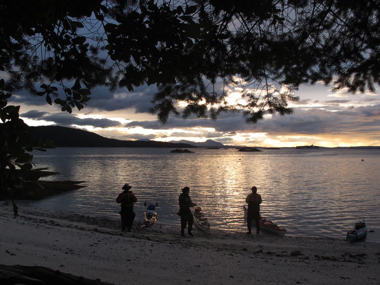
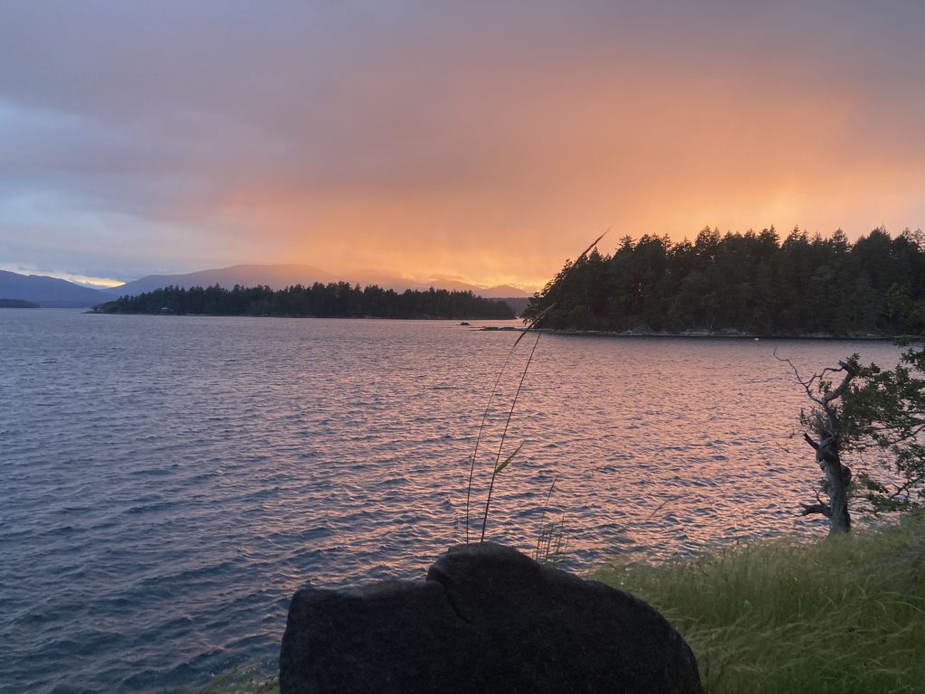
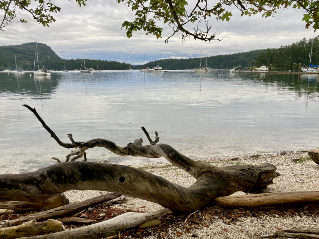
Friday Harbor! I always feel very fancy when I get to arrive at dock, climb out and go get food. Which is what we did! We left our kayaks in front of the ferry terminal and went across the street for an early dinner. We landed at 3pm but wound up having to wait for the 6:30pm ferry, which was then late. But Friday Harbor is always enjoyable so we walked around and spoke to the caretaker at their community garden.

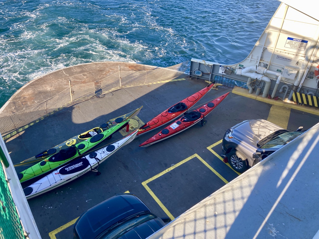
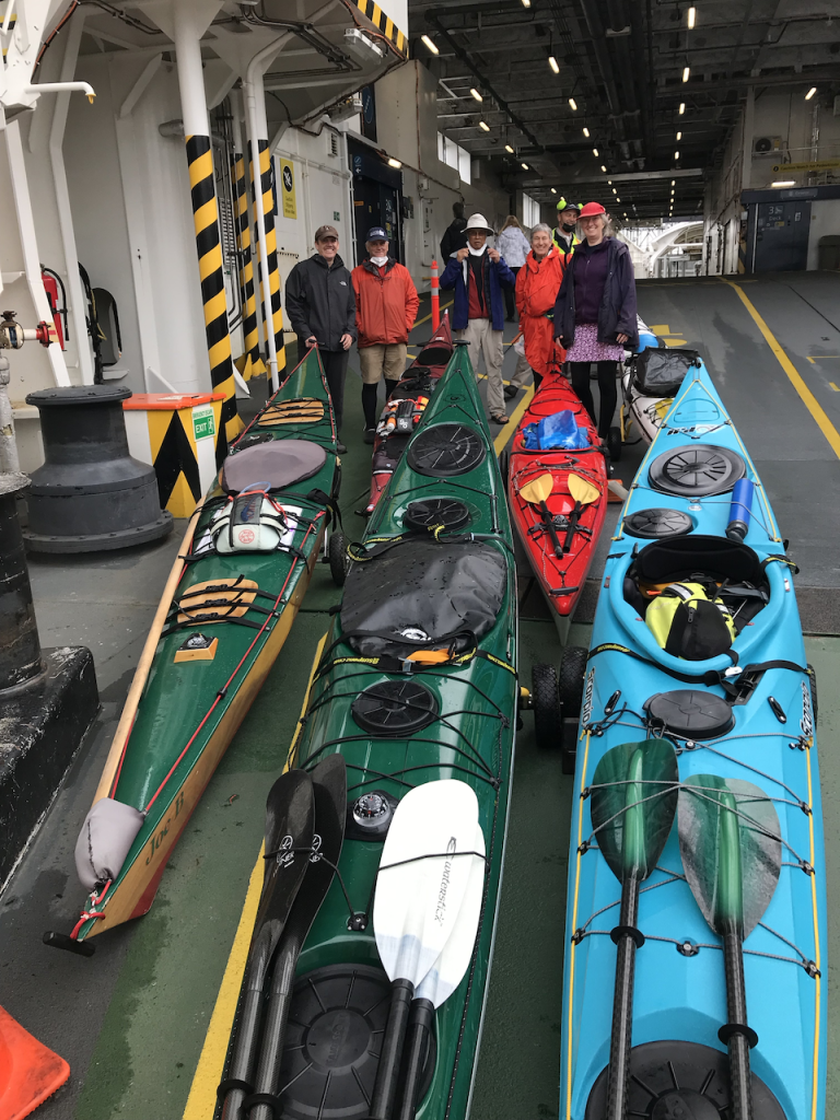
Finally on the ferry heading home with all our boats loaded in the front. We brought wheels to roll on and returned to our cars back in Anacortes.

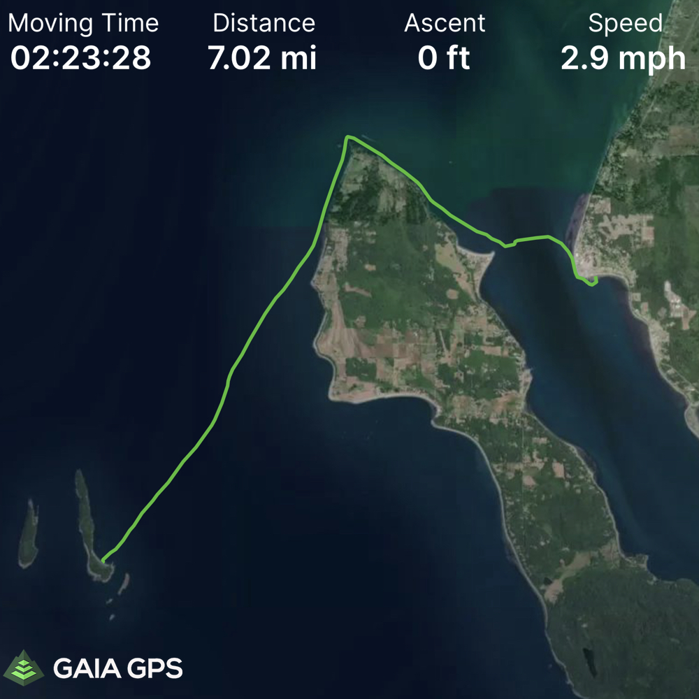
Here’s the summary: 24 miles, just over 5 hours moving time and an average of 4.5 mph. I’d do it again, and I’m feeling less intimidated by Cattle Pass (even though I know we got it on an easy day and nobody was sucked into a whirlpool).

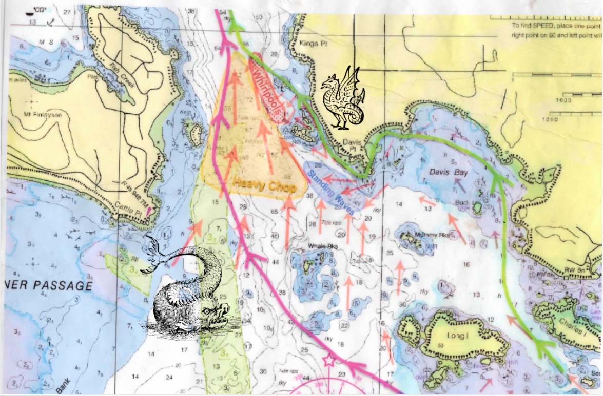
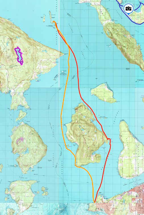
A quick edit – I thought I should include this planning map we made to outline the potential hazards in Cattle Pass. See if you can spot my special additions!

Posted on Leave a comment

Sucia-Clark

I had to cancel a trip I was leading earlier in the month but was invited along on this little 3 day as a make-up paddle. The trip was planned to Sucia which I was excited about because my only previous trip to Sucia had to be cut short due to weather.

We launched from the small beach area next to the Lummi island ferry. Total of 8 paddlers and we knew we might need to change plans due to some predicted high winds. The original plan was Day 1 Sucia, Day 2 Patos, Day 3 return. Instead we did Day 1 Sucia, Day 2 Clark, and Day 3 return. Moving to Clark placed us much farther south so the wind would blow us in the correct direction on day 3.

On our way we stopped at Matia Island and despite a lot of discussion on the topic I’m still not sure how to pronounce it. It had a beautiful forest loop, a large boat dock, and limited forested camping.

The loop trail on Matia

Sucia was lovely again. Soon after landing we made camp, hung our gear to dry and set out exploring. First we explored the shell fossils along the beach but I mentioned to Steve that there was a really nice fish fossil on the other side of the island and we decided to go see it. It’s a small island, how far could it be? It had seemed pretty close when I paddled over there before.

It was 3 miles each way. So we got a good hike in. Still worth it.

The next day we checked the weather forecast and our trip leader decided the best option was to wind up on Clark Island to the south so that the following day the winds would be blowing us toward our destination and not into Canada. That meant Day 2 was a much longer day than originally planned.

First we headed over to Patos Island where we met some other paddlers we knew, scoped out the campsites, and met the docent at the lighthouse who opened it up a few minutes early so we could have a tour. See those two solar panels? They replaced an entire room full of machinery that the lighthouse used to need to function. The light is now LED and only about 5 inches high.

Patos Lighthouse

Steve’s favorite madrone tree on Patos

We then turned back east, paddling along the north side of Sucia and stopping for lunch so everyone could check out the fish fossil (without a 6 mile hike). We passed by Matia toward Clark, making a 6 or 7 mile crossing. Here’s where I found out I was getting too much sun or not enough water or something: I got a migraine that did not go away with medication. A few miles in and I was struggling – everyone could tell and offered to help out with a tow. We set the lines up and while I never quite stopped paddling, several people traded out giving me an assist so we got where we were going. So when you see our slower time for that day – this is why.

As soon as I was able to sit down in some shade for a decent amount of time I felt better.

Clark Island

This time we were able to snag some of the beach sites out of the wind. They were not as private and the toilet was farther away, but building a fire on the beach was pretty cool. We had a firelog along, this time courtesy of Susan. And we had an excellent view of Baker.

The next morning was windy but not as exciting as we had feared. The whitecaps settled down while we made our crossing toward Lummi and we made it back to our launch site a little early.

Posted on Leave a comment

Clark Island Overnight

This summer I really want to explore the San Juan Islands by kayak – as much as possible! And if I’m able to do it without getting onto a ferry, even better. Yesterday I left for a 1-night (Sat-Sun) trip from Anacortes to Clark Island. Clark is located just off Orcas Island and isn’t far from Sucia (where I need to get back to).

Our route as mapped on Gaia. Anacortes to Clark (orange), 15.2 miles in 2 hrs 57 min. Average moving speed was 5.4mph with a max speed of 7.9 mph. As you might guess we had a substantial current pushing us along.

Return trip (red) 15.36 miles in 3 hours 43 minutes. Average moving speed 4.4mph and max speed 6.8 mph. We still had the current with us but had a substantial headwind until we were close to Cypress Island. We also stopped for lunch at Cypress Head.

Setting sun catching the madrone trees on Clark Island.

We launched at 2pm to take advantage of the current assist. There was no rain or wind but it was overcast the whole way. We passed by a spectacular view of Eagle’s Cliff at the north end of Cypress and I hope to go back to hike it soon. North, near Lawrence point the currents were confused – first pushing left, then right, then left again, but it was slow enough that it was hard to see which direction they were going before they caught you. I’m told that it can be MUCH more exciting than what we experienced. We arrived a little after 5pm and found, to our surprise, that the entire beach area was filled up!

There were many empty sites, though, up the little hill in the forest and I picked one that had a view of the rocks to the east and south to Orcas.

View from in front of our campsite

It rained overnight which meant it was kind of gross to pack up, but it didn’t rain ON us, at least. THere was a pretty brisk wind from the SSE (but less than 10 kts).

Dave and Jeff, north of Cypress
Fred, Susan, and Terri

I was a little cold when we started, but, as usual, working hard warmed me up. By the time we reached Cypress the wind had died down and we could see some sun start to break through. We stopped for lunch at Cypress Head, paddled through some confused currents to the east of it, and then rode the last of the ebb back to Anacortes. We only had to dodge one ferry (and it was quite far away). By the time we returned to the launch it was warm and sunny.

This felt like a pretty ambitious trip to me, and we got quite far into the San Juans. It makes me confident that I can do a lot of exploring without always having to take a ferry. I guess the trick is the weather and timing the currents.

No photos of these, but we saw porpoises, lots of seals, and two sea lions who came very close to the boats.

Posted on Leave a comment

Gulf Islands Adventure – Final Day – We Made It!

After all the wind, this day was flawless. We packed up early enough that we had time to kill on our leisurely way back to the Mayne Island ferry.

We reached the ferry dock in plenty of time as well and used the spell of good weather to change and hang some of our stuff out to dry on the fence. I went looking for snacks at the little shop behind the ferry parking and discovered, that, while it did have a little fridge with some drinks and a small selection of snacks, it was mostly an art supply store. So I guess if you came to the island and had a sudden need to make an acrylic painting, you’d be set!

We rolled back onto the ferry and had an uneventful return. We hope to return next year and we have an invitation to stop by and visit Ian if we are in the vicinity!

Posted on Leave a comment

Gulf Islands Adventure – Day 8 – the second long haul

We left Ian with some reluctance and turned back into the wind – which was of course still blowing. If anything it blew harder today, up to 15 knots, straight into us and we kept trying different sides of the little islands to see if one of them was more in the lee than the other. Nothing really seemed to help. At one point we pulled off for 30 minutes because the wind was just so strong that we were barely making any progress.

Our goal fo the day was to make it all the way across the northeast of Salt Spring Island to Prevost. If we reached Prevost today, we would be back on our original itinerary with only a short hop the next day to catch the ferry. This whole day was something of a slog but it wasn’t really *hard* if that makes sense. I never had the feeling that my strength would give out or that I was exceeding my ability, it was just taking a really long time.

Late in the afternoon, around 2pm, we got a break in the clouds and a rainbow. This was our signal that the wind was about to end, and shortly after we had sun and calm for our final crossing to the very muddy campsites at Prevost. We just paddled 40 miles in 2 days.

Posted on Leave a comment

Gulf Islands Adventure – Day 7 – behind schedule

Having spent two days up at Nanaimo we now have to change our plan. Either we go on the route as written and return two days late, or we shorten the trip to try to maintain our schedule. We opted for the latter, knowing that we’d have to put in some long days to get back in time. First we packed up our wet gear and headed out toward False Narrows.

Breaking camp after the storm. Photo by Tom F

Our first landing was at Pirates Cove Marine Provincial Park, and while we’d gotten a late start to time the narrows, we were all still feeling pretty good and we knew how much farther we had to go to make our ferry. After consulting each other and some maps, we made the decision to press on, hopefully to return to Wallace Island if we had enough fuel. By which I mean we “crouched over our open hatches shoveling food into our faces like animals” (That’s how A phrased it)

Me – eating most of a summer sausage like a starved coyote. (Photo by Tom F)

Leaving De Courcey Island, the wind was still against us. It had been blowing in our faces for most of the trip and we kept trying to find some shelter by switching from one side of the little islands and then the other, but nothing was going to change the fact that we were mostly going straight into a 10 knot wind. We’d been looking at the forecast and nothing was going to change for a while, so this was just how it would be. We skirted Pylades and now had a long open crossing ahead. We decided there was nothing for it and just started straight into the wind toward Reid.

No plan survives, they say, and here’s where we ran into trouble. The crossing took FOREVER. And by the time we finally made it to Reid Island, our first landing spot for a rest, it was already getting dark. We hadn’t planned to stay at Reid, it didn’t have a good camping spot, but we pulled out onto a tiny private beach, checked the maps, and found there was a teeny islet of public land at the south end. We resolved that we would pitch tents on it no matter how bad it was rather than trying to continue after dark. We headed back out. And now as we rounded a point it was clear that both the wind AND the current were against us, that’s why we were making such poor progress. We battled around the corner when this happened:
P: “Uh oh.”
everyone: “what?”
P: “I left my phone on that tiny beach”
T: “A & I are still feeling good. Stay here and we will go back for it.”
They head back around the point. Five minutes later:
P: “Uh oh.”
Me: “What?”
P: “I found my phone.”
We tried to call T & A to let them know, but there was no answer so there was nothing for it – and we both turned back to tell T & A not to spend all their time looking for a phone that wasn’t there.
And that’s when our miracle happened!
When P & I got there, we found A talking to someone new. It was the landowner, Ian, who had a house on the point and had been watching us struggle around in the wind. He’d come down to offer us space in his bunkhouse for the night!

This was such an incredible relief! It was so lucky that he saw us, that we had to turn back and were able to meet him. A kept asking “did we die? Are we dead?” Ian offered showers, beds, and beer/wine while we traded stories that evening.
A thing I learned: If I spend 8 hours bouncing around in a kayak when I get back onto land it still feels like the ground is swaying. If I drink just one glass of wine on top of that I become legless.

Total mileage for the day: 22 miles!

Posted on 1 Comment

Gulf Islands Adventure – Day 2 – Montague to Wallace

June 5th we packed up at Montague and prepared for a 10 mile paddle along Galiano Island and across to Wallace Island. This is where we got our first look at some of the impressive sandstone sculpture that we would follow for most of the trip, and also, I think, where we first met some of the seals that would keep an eye on us for the rest of the trip.

My camera / phone has no zoom capabilities, so it was hard to capture animals and birds, and I don’t now recall where we first saw them, but we saw many seals, otters, some feral mink and a variety of birds, including eagles, vultures and guillemots. The weather remained good for our paddle, cloudy at times but no rain during the day. The Sandstone had an interesting variety of textures including something that looked a lot like honeycomb. I’m curious as to how that may have formed.

We passed this house that I think might be Rivendell. I didn’t get a photo of the shed next to it, but it had a very hobbit-hole look to it.

Seems like this house should be in the Lord of the Rings
Carrying the boats up at Wallace

We arrived at Wallace Island around 4pm and I had to think about my scheduled Covid test. We had a few bars of service, it was better up on the cliff, so I set up my tent, prepped my test kit in it, and went up to wait for my call in time. The video worked and we weren’t cut off. I was able to take the test and finally talk to a human who agreed I might have a hard time turning in the test, but couldn’t do more than make a note in my file. I didn’t get the kind of reassurance I was looking for that Canada wasn’t going to mad at me and the best she could offer was the number for Public Health Canada, and the lab’s help line (the one I spent 40 minutes on hold for already). This may surprise you, but it’s challenging to keep your phone charged out there. My last call to their help line burned through 20% of my phone battery and I didn’t have enough to try again now. Time to go for a walk and watch the sunset.

Small cove on Wallace Island
Sunset from Wallace Island
Posted on 1 Comment

Gulf Islands Adventure – Day 1 – Tsawassan to Montague

On June 4th I set out with 5 friends from my sea kayaking club on a 9-day trip to the Gulf Islands in BC. This is considered a relatively sheltered area, but it’s still just off the Straight of Georgia and has some big crossings and some areas where we had to time it just right to avoid strong currents. Our plan was to launch from Mayne Island, head north almost to Nanaimo, then return south through False Narrows, around Salt Spring Island, and finally returning to Mayne Island to take the ferry back to Tsawassan, BC. All told, 120 miles. The longest day would be around 18 miles.

The Plan

We met at 4AM to make sure we could cross the border at 6, and arrive in plenty of time to figure out how to unload, get the kayaks on wheels, figure out where long term parking was, and get ourselves onto the 9:20 ferry. This all went relatively smoothly except for the part where I was randomly selected to take a Covid test at the Canadian border. That seems simple enough, right? I’ll just do the swab in the car, box it up and drop it in the post before I get on the ferry. Ah… how optimistic of me! While reading the instructions I was able to gather that they wanted me to register online (okay, did that), then I have to install some video software because they want to WATCH me do the swab. Then I’m supposed to book an appointment online. I decide I can’t think about this right now because we have to unload.

Threading the needle: getting our 17 foot kayaks through a sharp angle.
Loaded and ready! (photo by Alice V)

On board the ferry I discover that I can’t take care of the whole Covid thing before I leave the ferry. I can’t book an appointment until the next day, Sunday, because they want you to be able to get the swab sample to Fedex within 24 hours of taking it. This is going to be a problem because by Sunday I’m going to be paddling from Island to Island, frequently to places with no roads, much less a fedex office. I try to call their help line to explain the issue and I’m pretty confident she hung up on me on purpose (after I waited on hold for 40 minutes).

One of my fellow travelers has been to Canada multiple times and felt I could probably throw the whole thing in the trash for all it was worth, but it had threatening language about “$5000 fine” and I’m nervous about these things, so this is going to remain an issue.

We arrive at Mayne Island, roll off the ferry and through a gate where we have to lift our very heavy kayaks down to the beach. Luckily we have some straps to make this a 4-person carry and we get everyone down and ready to go.

Our first leg takes us across from Mayne Island to Galiano past the opening to the aptly-named “Active Pass”. We had to keep an eye (and an ear) out for the ferries, and crossed a pair of sizable current lines before we got close to the calmer area near Galiano.

Letting the ferry go by outside of Active Pass
Along the cliffs of Galiano Island (photo by Alice V)

It’s cloudy but fair weather, and we make our short hop across the channel and along the coast to Montague Harbor Marine Provincial Park. It’s sheltered behind another, small island, and seemed popular spot for boaters. All is well for camp the first night.

At our first campsite
Posted on Leave a comment

Sucia Island

I haven’t posted in over a year but I’ve been doing things! Mostly I’ve been out hiking and kayaking, and in September I started riding horses again. I may or may not fill in the past year, but for now, here’s the 3 day trip from this week. I’ve been hearing about kayaking trips to Sucia Island (north of Orcas) for years now and I finally got to go with NSSKA.

The entire island is a state park and can only be reached by boat. There is no ferry service to the island. Most people arrive by motor boat, and we saw a few professional tour groups while we were there, but we made the 2 mile crossing after first visiting a Cascade Marine Trails campsite at Point Doughty.

Our original plan was to stay two nights and explore Matia and Patos islands, but forecasted high winds convinced us to return after only one night. We spent our second night at Moran State Park, paddled two of the lakes there, and went for a hike.

Arriving at Fox Bay Camp
Looking back at our campsite from a hiking trail
Some of the views around Sucia
Hike around the island
Fossil fish on Sucia
Sucia, Patos and Matia islands from Orcas
Posted on Leave a comment

France – Narbonne

France Trip – Summer 2018:  I need to learn to take photos of all my adventures, not just things that are pretty.  We arrived in Narbonne and had one day there before we were to head off up the Canal du Midi to Carcassonne. This was our best chance to be close to the Mediterranian, which I had never seen, so we drove out to visit the beach.

No photos from me because when we got there, there was a pretty brisk offshore wind that was blowing sand everywhere and I didn’t want to risk getting sand inside my lens/camera.  The beach was a long, shallow sand beach and the water was a perfect temperature.

The excitement happened on the way back – in a crowded intersection in Narbonne (when we’d made a wrong turn and we’re trying to get back on course using the GPS) we were hit in the right side passenger door by another car.  Yay! Rental Car! Our car had some dents in both doors but the other car.. the whole bumper fell off.

The other driver asked us to follow him, to his home, as it turned out, where we were invited inside and had the fun of filling out accident report forms, in French, with the help of his family none of whom spoke much English and we did not speak French.

We had some questions about WHY he had a stack of accident reports in his home and HOW his entire front bumper fell off (and he had a bunch of twine handy to tie it back on – had it already fallen off??) But he was so very friendly. It’s a bit of a mystery, but the insurance is sorting it out.

Once we finally made it back to the canal it was time to move onto our boat for a week of travel up river to Carcassonne.