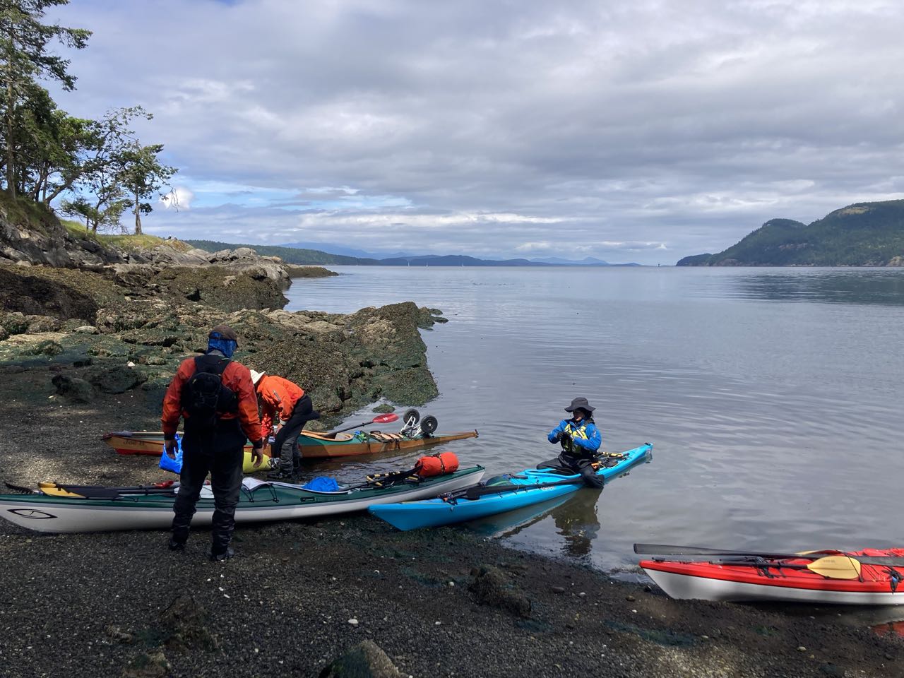
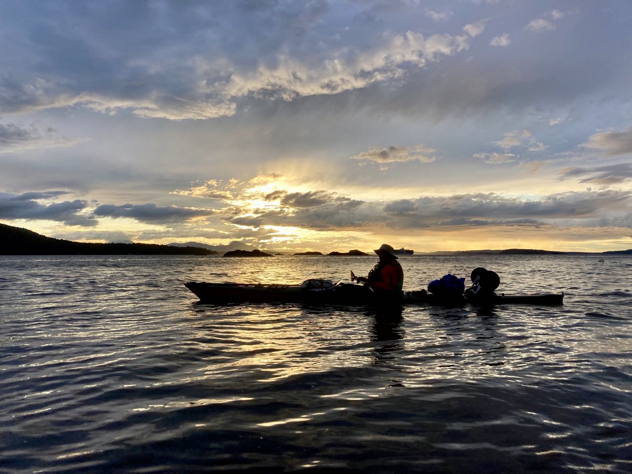
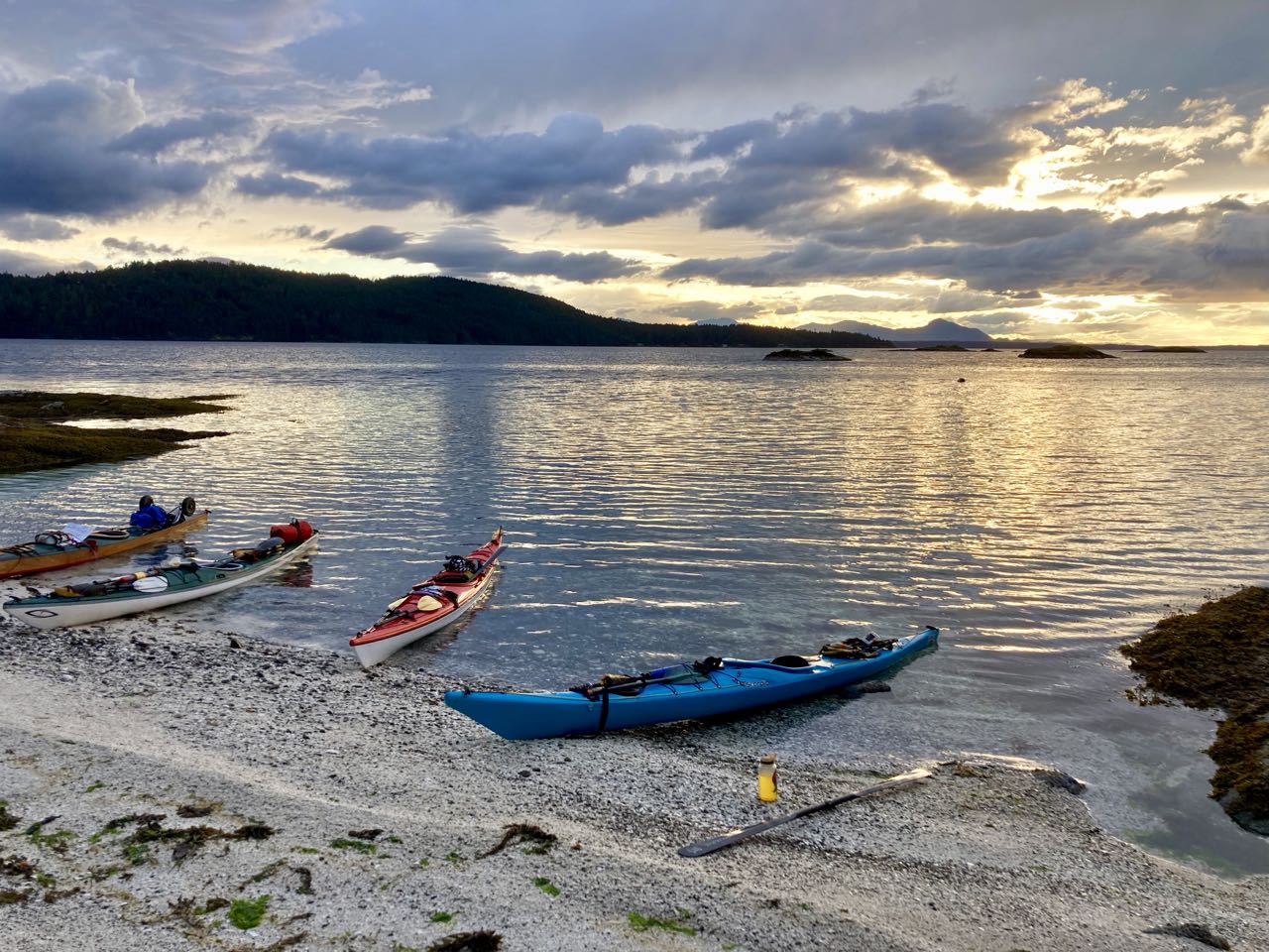
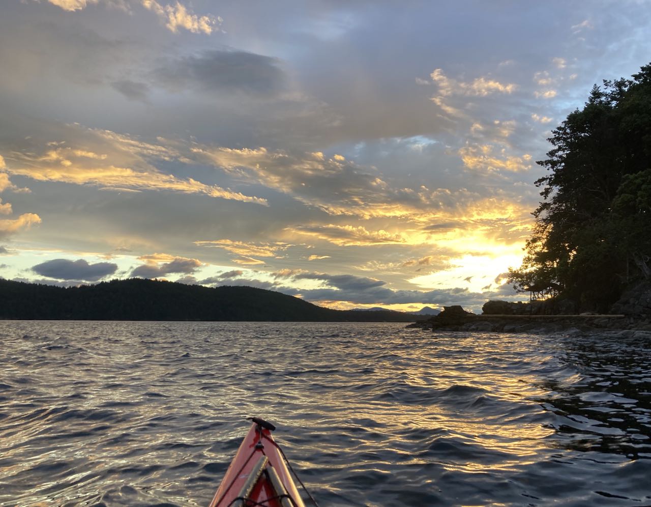
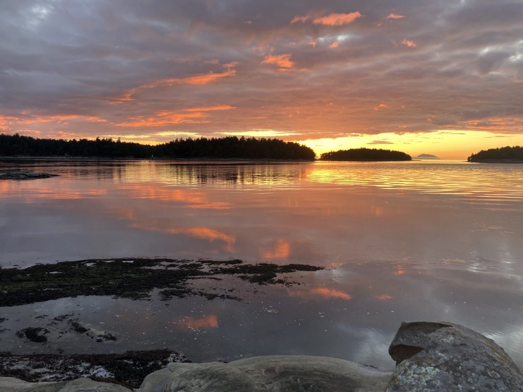
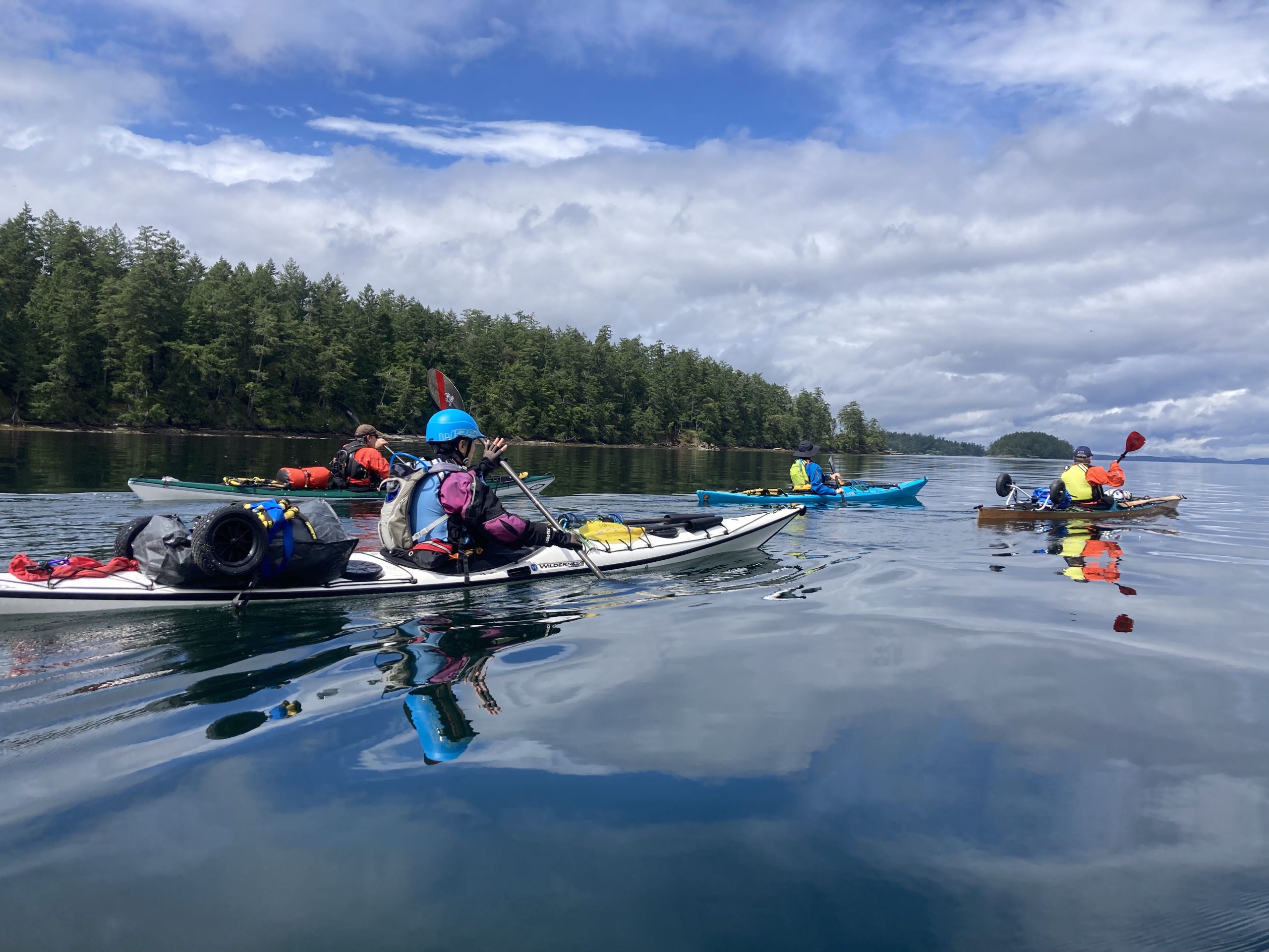
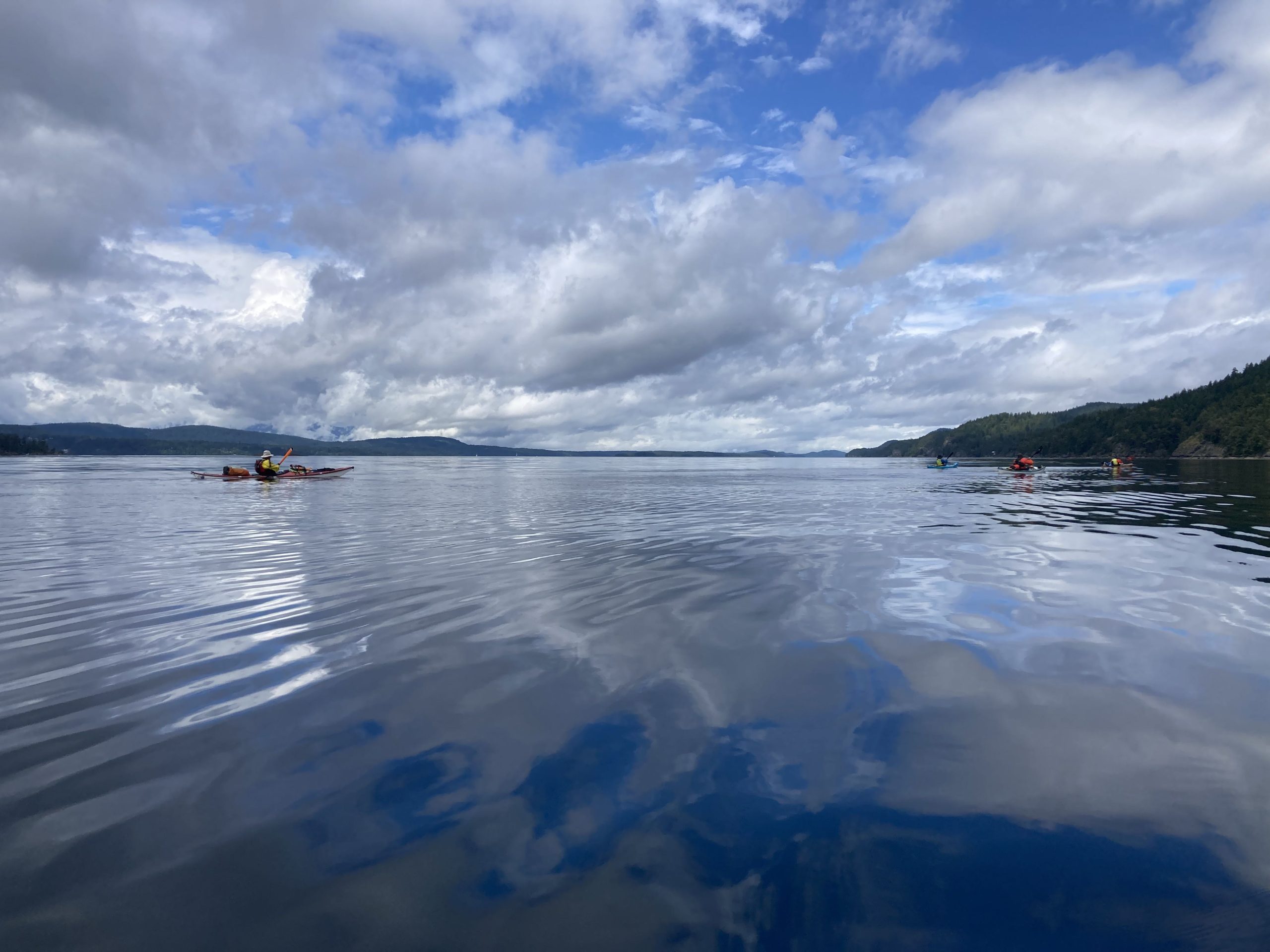
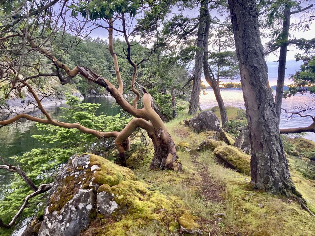
After all the wind, this day was flawless. We packed up early enough that we had time to kill on our leisurely way back to the Mayne Island ferry.
Glassy calmA little rest spot
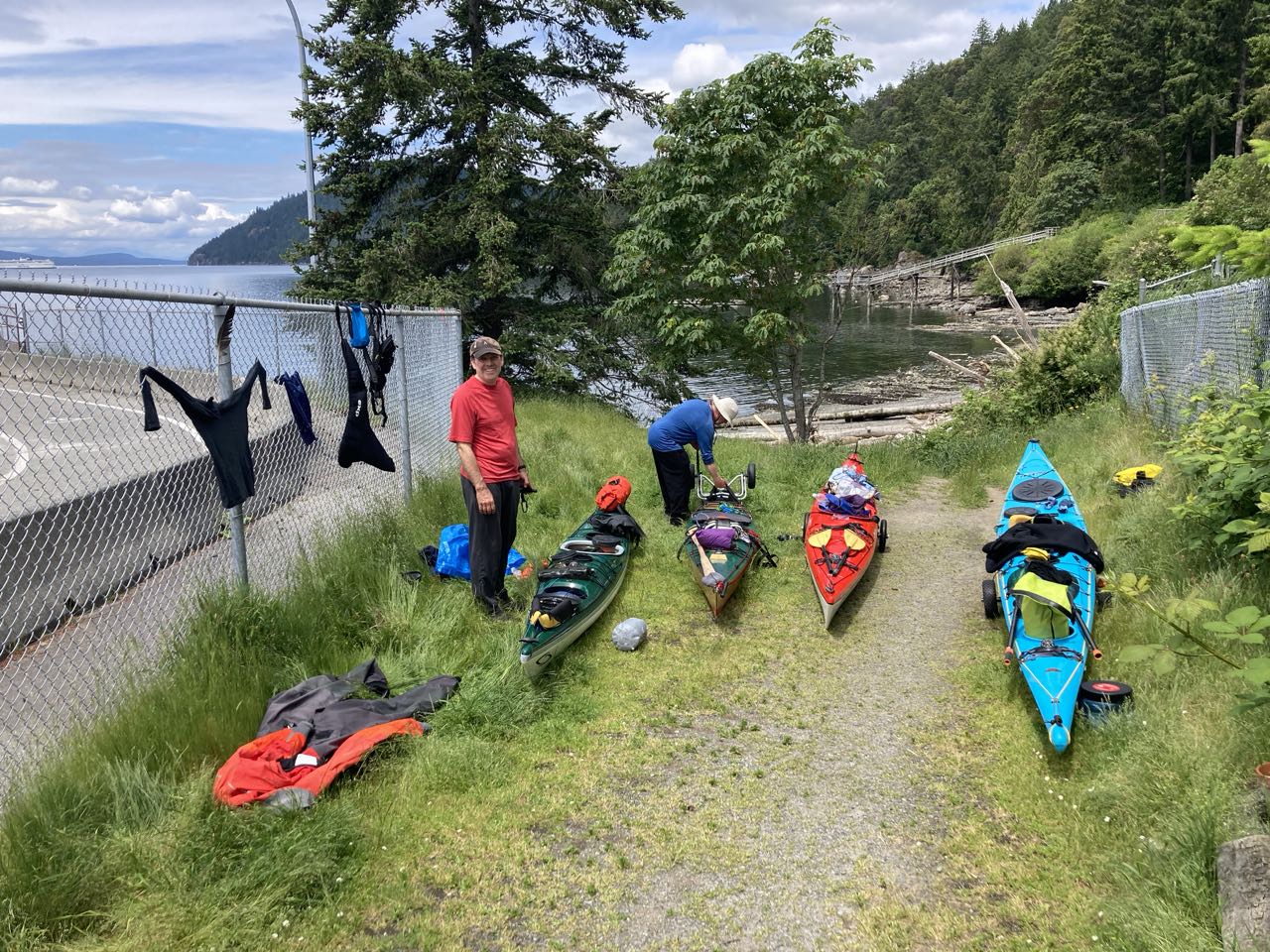
We reached the ferry dock in plenty of time as well and used the spell of good weather to change and hang some of our stuff out to dry on the fence. I went looking for snacks at the little shop behind the ferry parking and discovered, that, while it did have a little fridge with some drinks and a small selection of snacks, it was mostly an art supply store. So I guess if you came to the island and had a sudden need to make an acrylic painting, you’d be set!
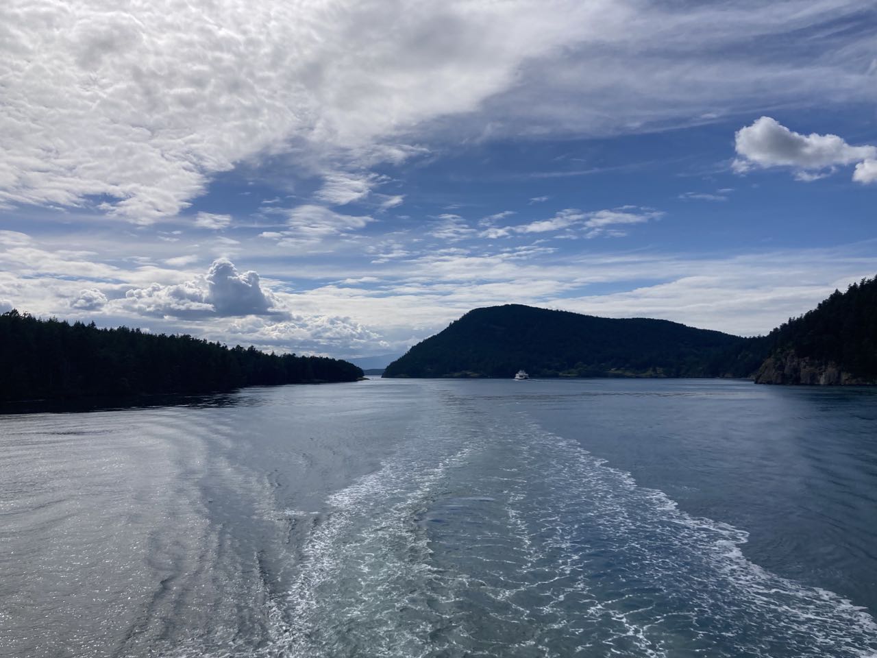
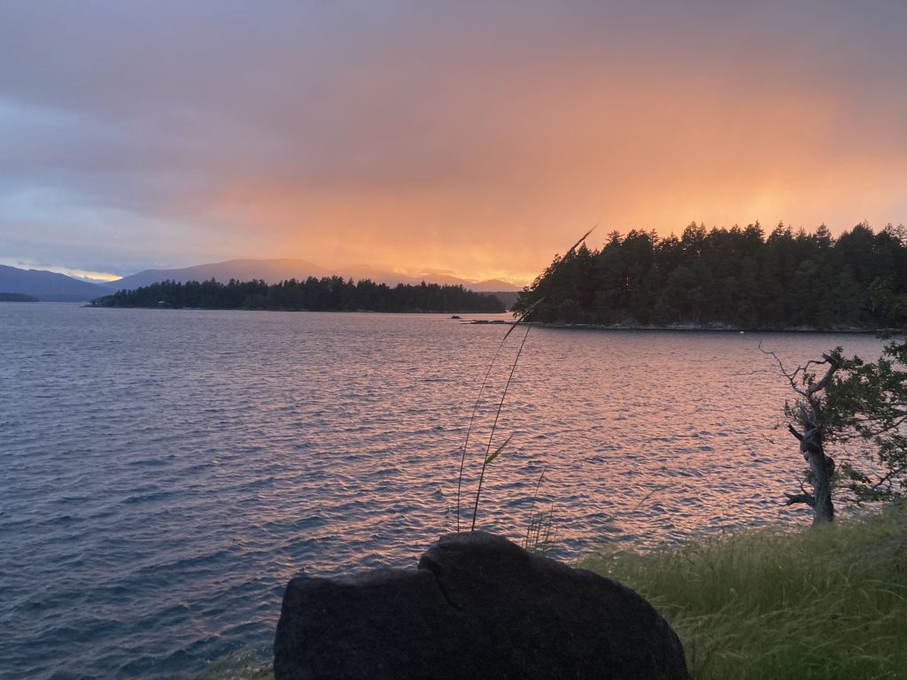
We rolled back onto the ferry and had an uneventful return. We hope to return next year and we have an invitation to stop by and visit Ian if we are in the vicinity!
Drying our stuffBack on the ferryGoodbye Gulf Islands
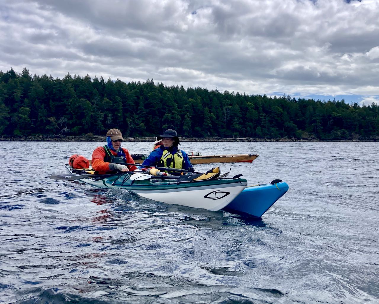
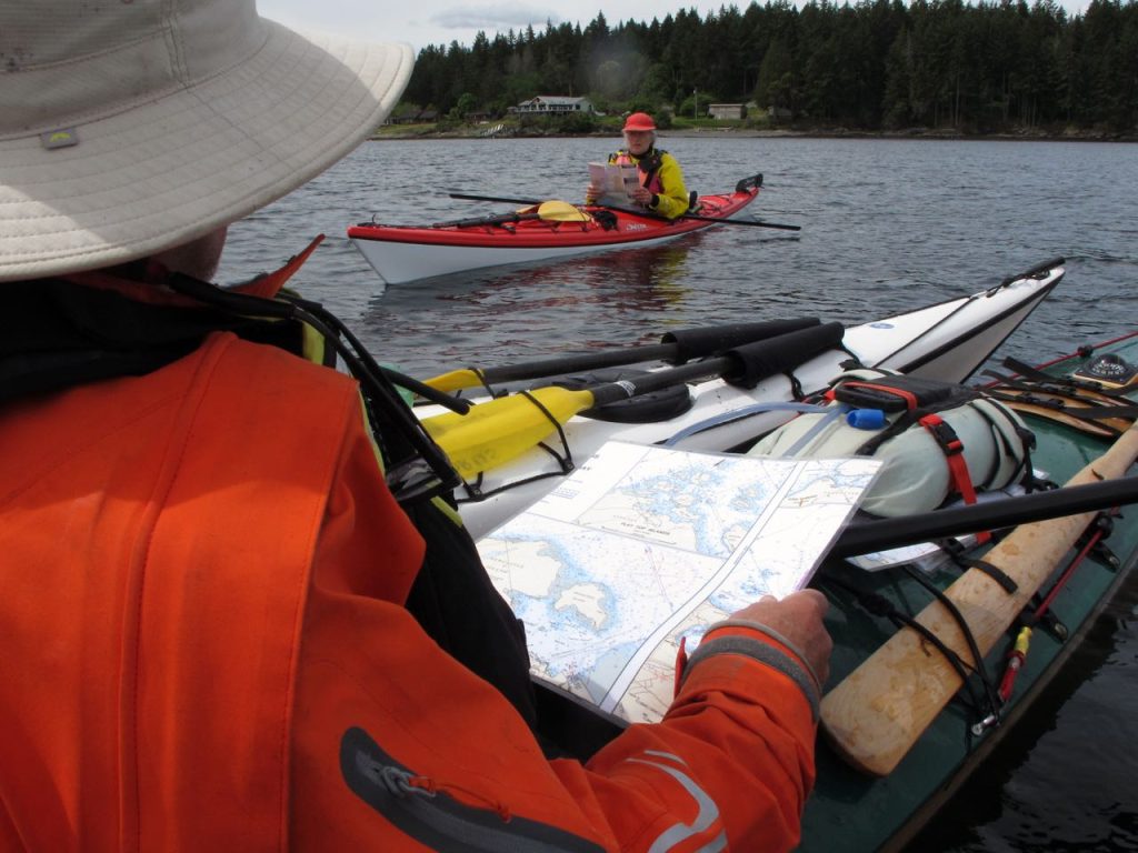
We left Ian with some reluctance and turned back into the wind – which was of course still blowing. If anything it blew harder today, up to 15 knots, straight into us and we kept trying different sides of the little islands to see if one of them was more in the lee than the other. Nothing really seemed to help. At one point we pulled off for 30 minutes because the wind was just so strong that we were barely making any progress.
Our goal fo the day was to make it all the way across the northeast of Salt Spring Island to Prevost. If we reached Prevost today, we would be back on our original itinerary with only a short hop the next day to catch the ferry. This whole day was something of a slog but it wasn’t really *hard* if that makes sense. I never had the feeling that my strength would give out or that I was exceeding my ability, it was just taking a really long time.
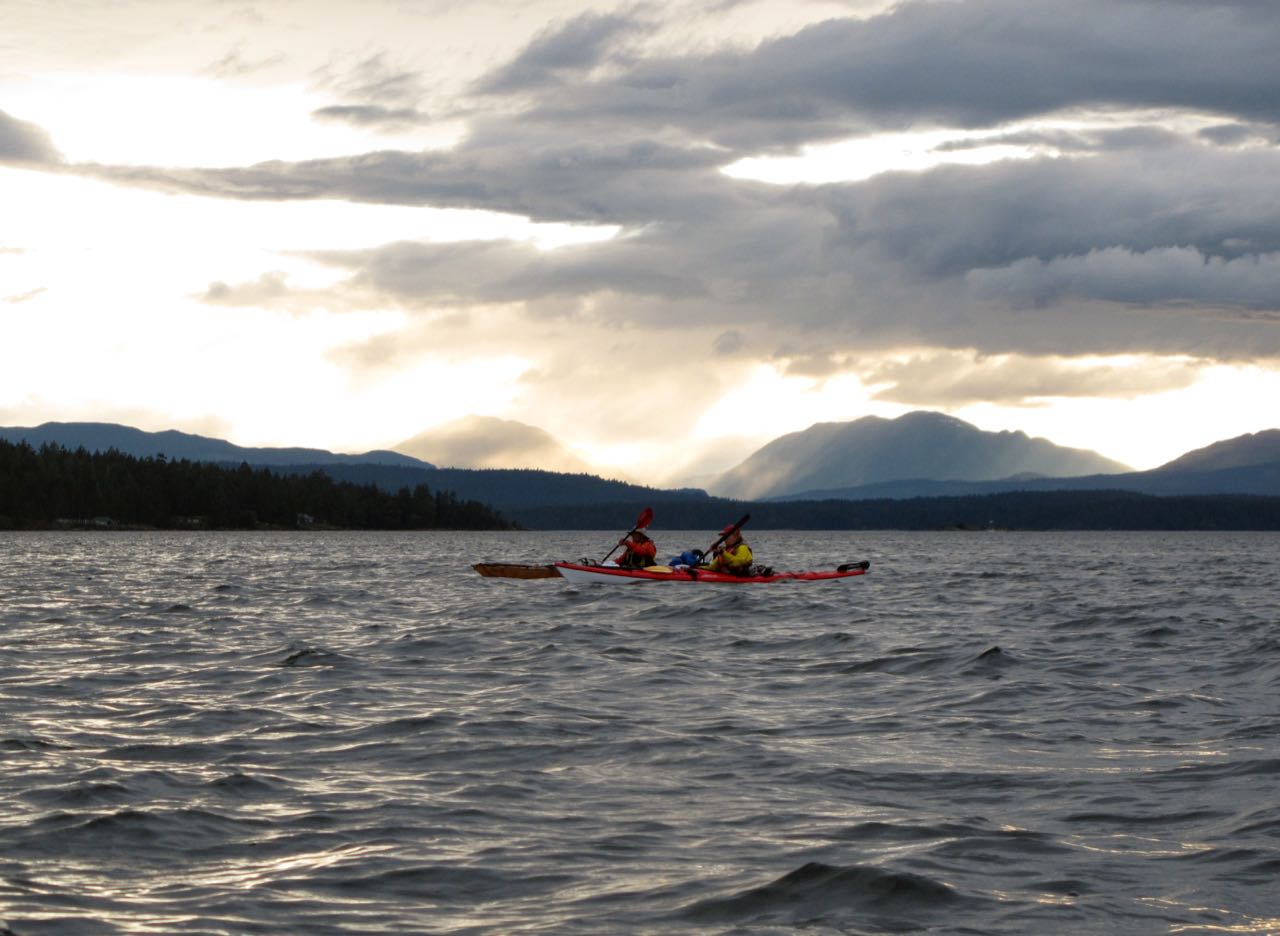
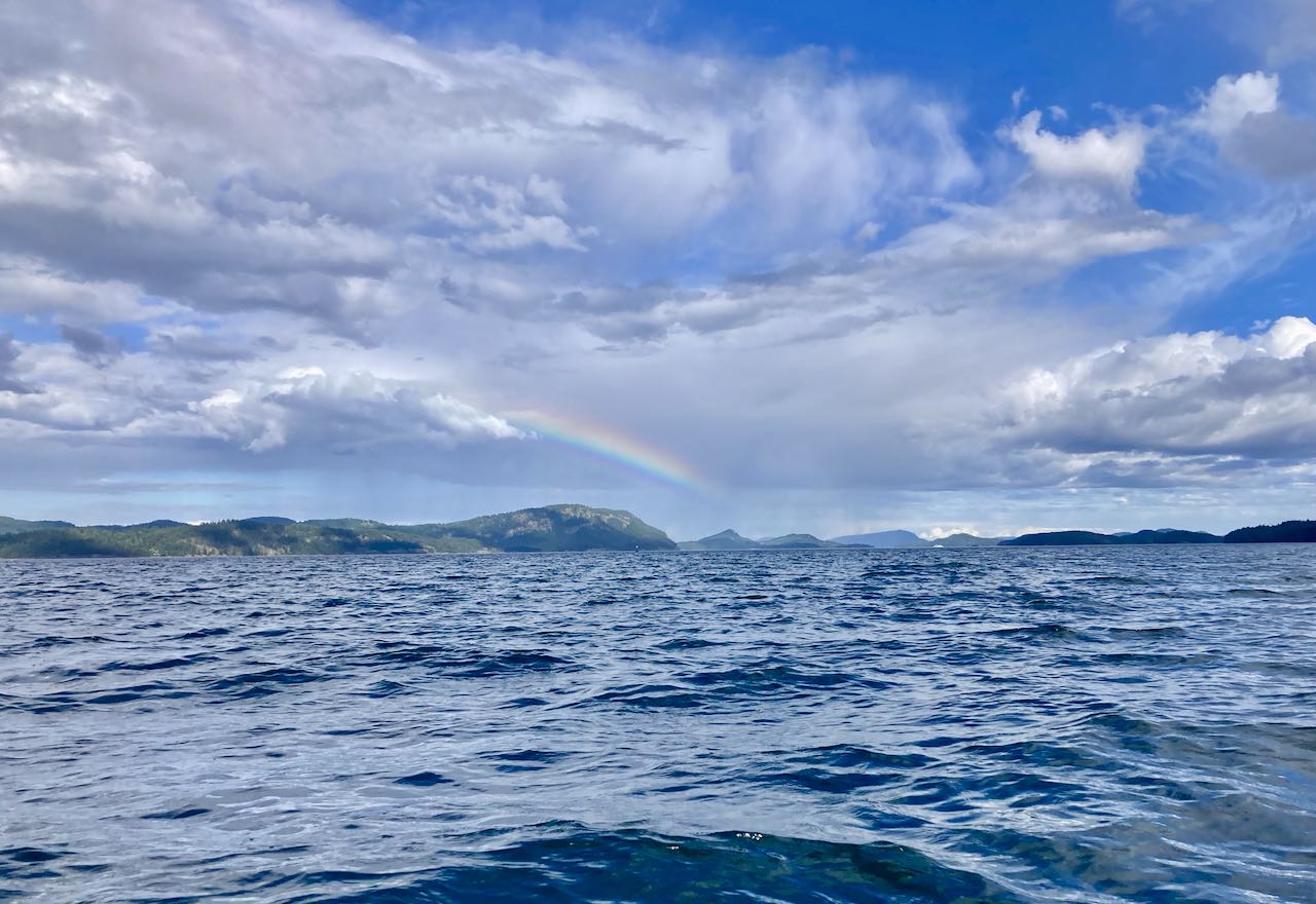
Checking maps in the windMore wind (photo by Tom F)Our sign that the wind would end
Late in the afternoon, around 2pm, we got a break in the clouds and a rainbow. This was our signal that the wind was about to end, and shortly after we had sun and calm for our final crossing to the very muddy campsites at Prevost. We just paddled 40 miles in 2 days.
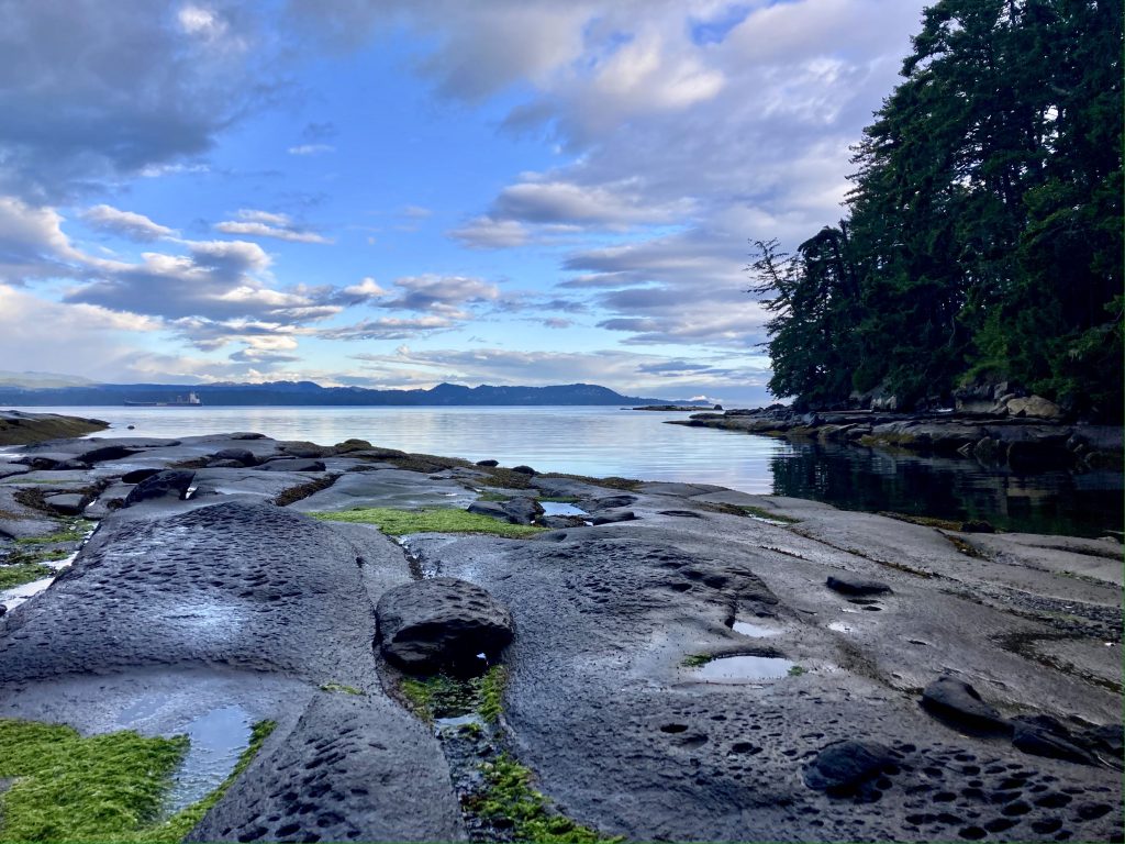
Calm seas by the time we landedThe beach at PrevostOur final campsite
Having spent two days up at Nanaimo we now have to change our plan. Either we go on the route as written and return two days late, or we shorten the trip to try to maintain our schedule. We opted for the latter, knowing that we’d have to put in some long days to get back in time. First we packed up our wet gear and headed out toward False Narrows.
Breaking camp after the storm. Photo by Tom F
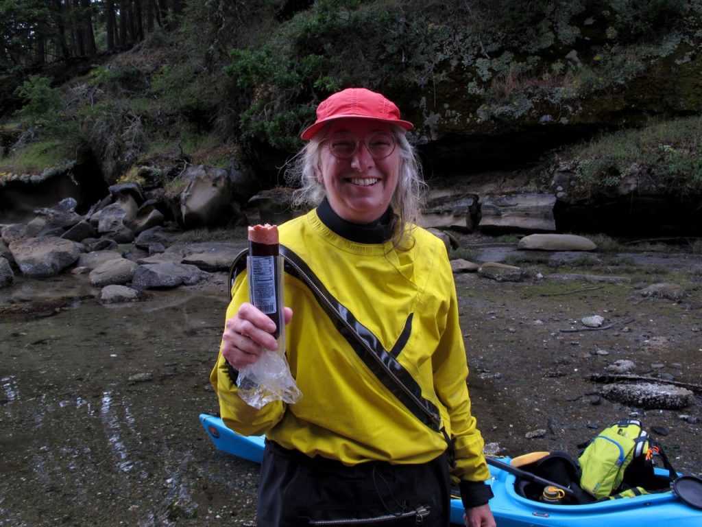
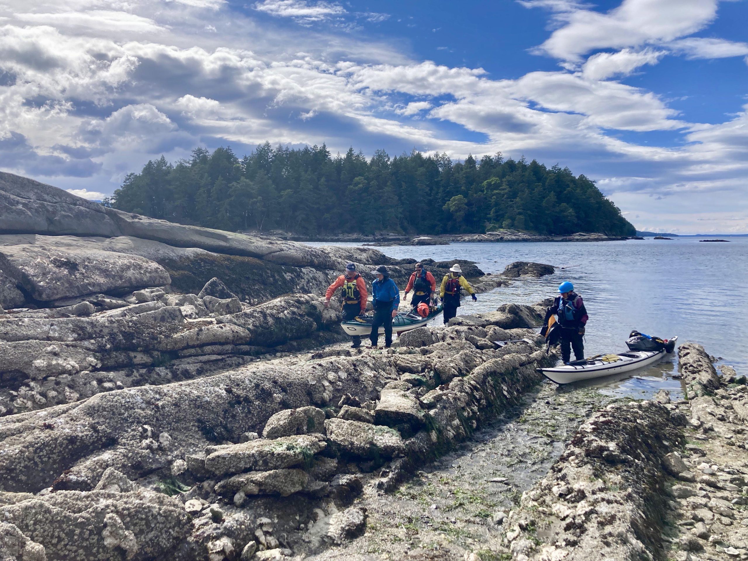
Our first landing was at Pirates Cove Marine Provincial Park, and while we’d gotten a late start to time the narrows, we were all still feeling pretty good and we knew how much farther we had to go to make our ferry. After consulting each other and some maps, we made the decision to press on, hopefully to return to Wallace Island if we had enough fuel. By which I mean we “crouched over our open hatches shoveling food into our faces like animals” (That’s how A phrased it)
Me – eating most of a summer sausage like a starved coyote. (Photo by Tom F)
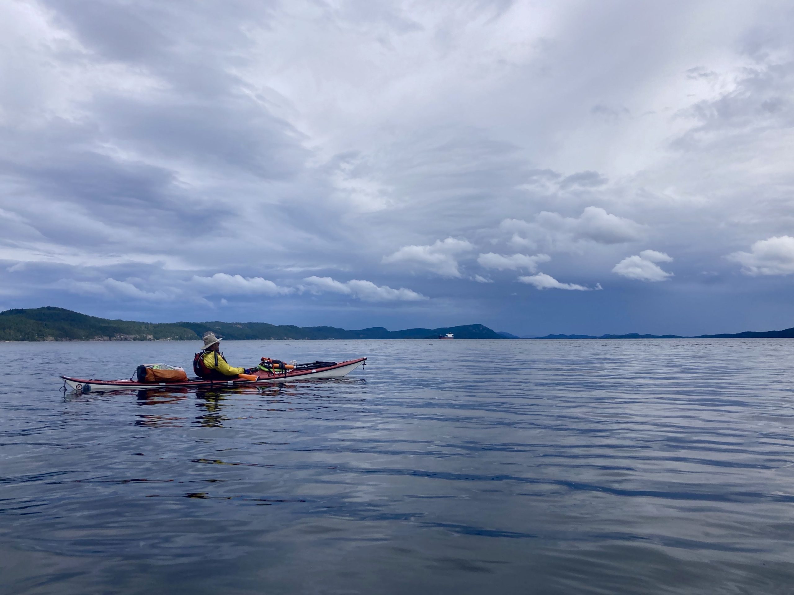
Leaving De Courcey Island, the wind was still against us. It had been blowing in our faces for most of the trip and we kept trying to find some shelter by switching from one side of the little islands and then the other, but nothing was going to change the fact that we were mostly going straight into a 10 knot wind. We’d been looking at the forecast and nothing was going to change for a while, so this was just how it would be. We skirted Pylades and now had a long open crossing ahead. We decided there was nothing for it and just started straight into the wind toward Reid.
Some big tankers anchored in the area (Photo by Tom F)Big crossing
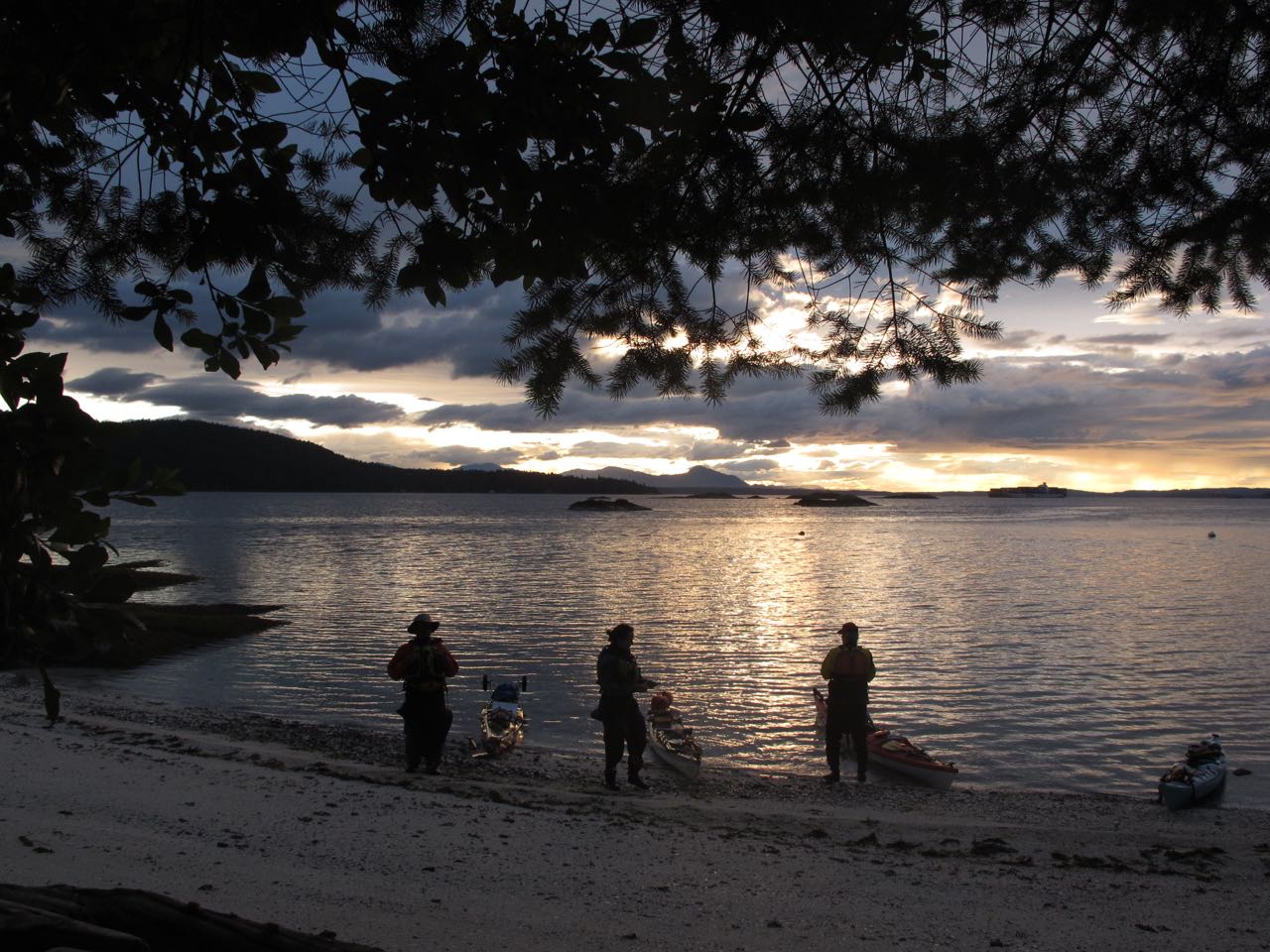
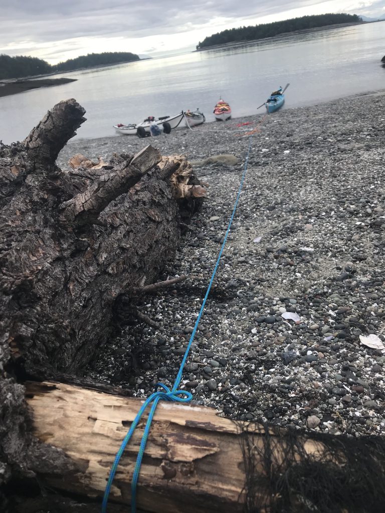
No plan survives, they say, and here’s where we ran into trouble. The crossing took FOREVER. And by the time we finally made it to Reid Island, our first landing spot for a rest, it was already getting dark. We hadn’t planned to stay at Reid, it didn’t have a good camping spot, but we pulled out onto a tiny private beach, checked the maps, and found there was a teeny islet of public land at the south end. We resolved that we would pitch tents on it no matter how bad it was rather than trying to continue after dark. We headed back out. And now as we rounded a point it was clear that both the wind AND the current were against us, that’s why we were making such poor progress. We battled around the corner when this happened: P: “Uh oh.” everyone: “what?” P: “I left my phone on that tiny beach” T: “A & I are still feeling good. Stay here and we will go back for it.” They head back around the point. Five minutes later: P: “Uh oh.” Me: “What?” P: “I found my phone.” We tried to call T & A to let them know, but there was no answer so there was nothing for it – and we both turned back to tell T & A not to spend all their time looking for a phone that wasn’t there. And that’s when our miracle happened! When P & I got there, we found A talking to someone new. It was the landowner, Ian, who had a house on the point and had been watching us struggle around in the wind. He’d come down to offer us space in his bunkhouse for the night!
Ian’s beach where we didn’t leave a cellphoneRounding the point in the windIan’s houseIan himself, with P & A.
This was such an incredible relief! It was so lucky that he saw us, that we had to turn back and were able to meet him. A kept asking “did we die? Are we dead?” Ian offered showers, beds, and beer/wine while we traded stories that evening. A thing I learned: If I spend 8 hours bouncing around in a kayak when I get back onto land it still feels like the ground is swaying. If I drink just one glass of wine on top of that I become legless.
We had a late start the next morning because we had to wait for a slack tide at a narrow passage up ahead, but after a leisurely start, things went wrong. We had some wind, but more, we had some trepidation about an upcoming day – twenty miles long with some precise timing and no good bailout points. As we passed the ferry terminal that went from Gabriola Island to Nanaimo, D had the idea that this might be a good place to end the trip. We rafted up to discuss the options and wound up turning northwest, across the bay to Nanaimo. The wind was against us and we had two foot waves on the approximately 3 mile crossing. This was a little rough and it seems that during that crossing, Vincent also started having second thoughts (also his boat was still sinking). Once we’d made it to Nanaimo both opted to board the ferry back to Vancouver. A and P went to help them with logistics while T and I headed over to Newcastle Island to see about camping spots there – we’d already missed our window to head south that day.
Changing the plan. Photo by Tom F
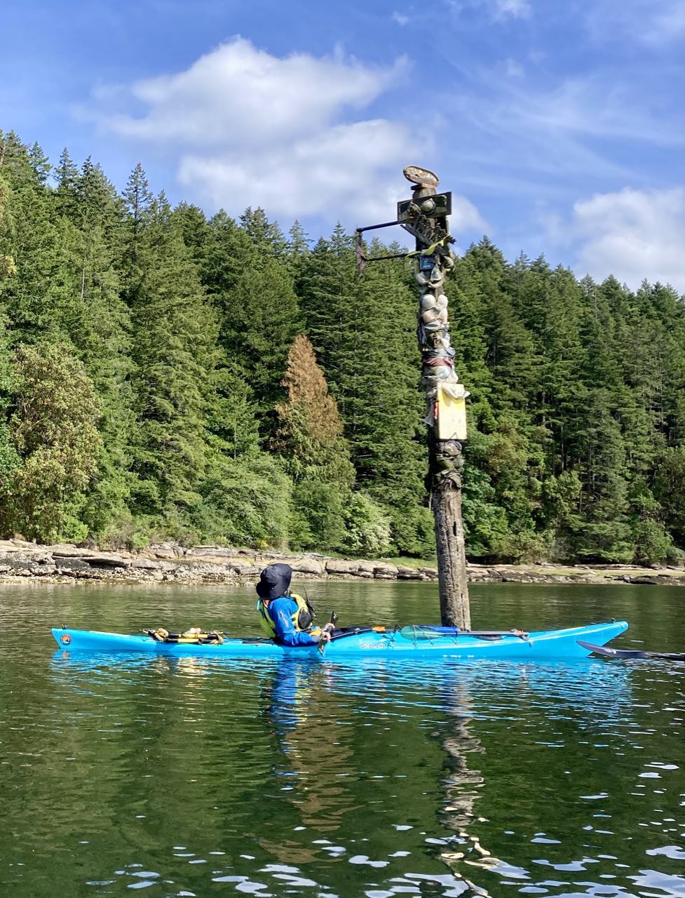
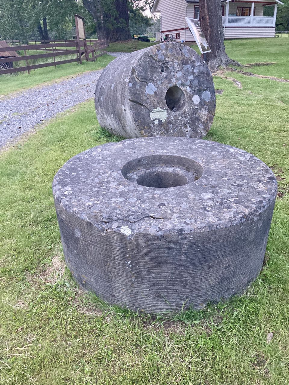
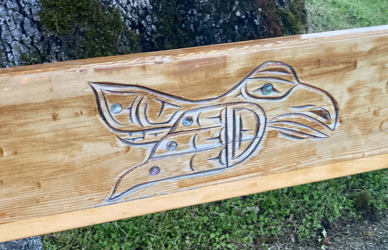
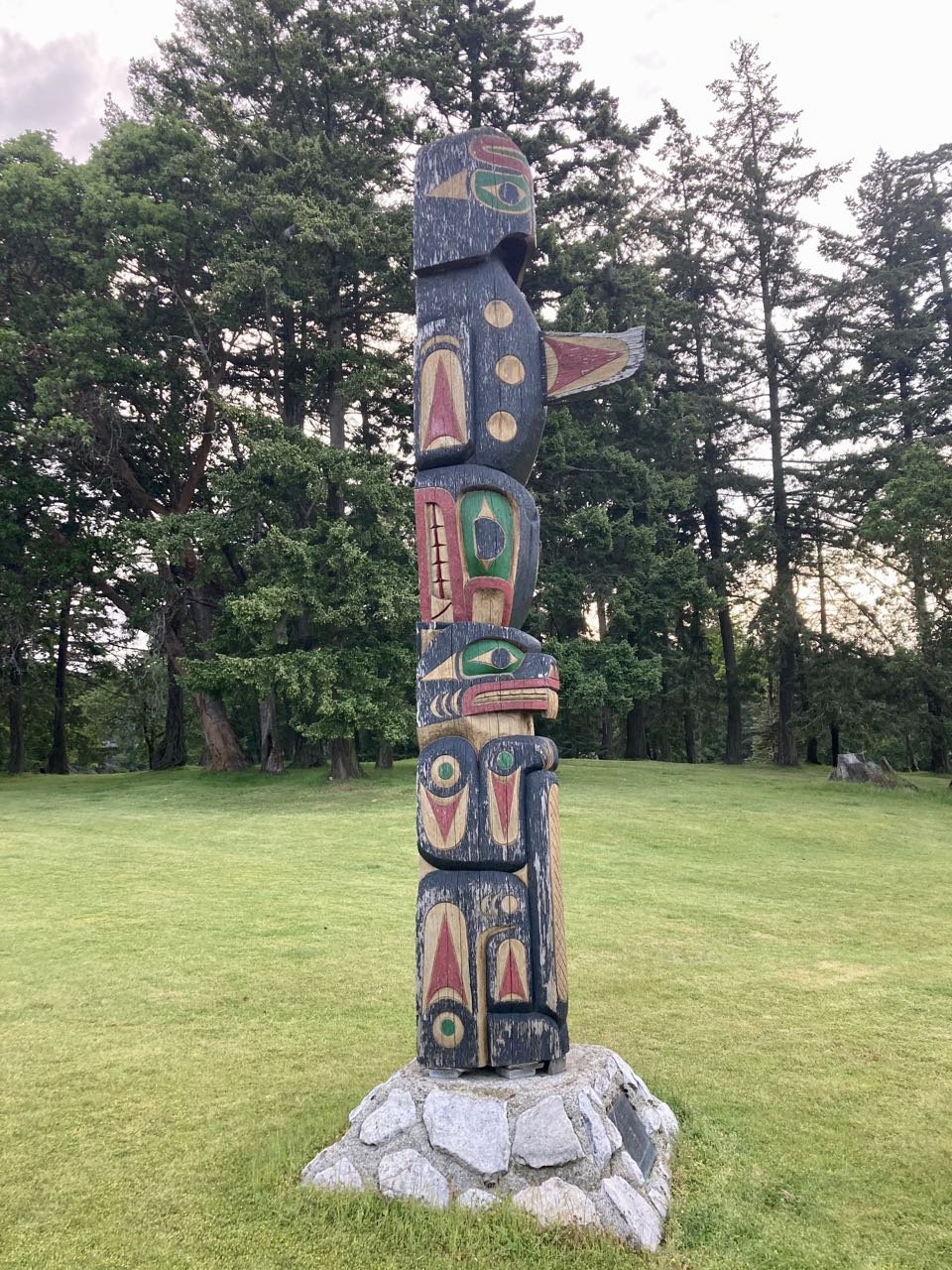
We found camping at the resort but it hadn’t yet fully opened for the season. What this meant in practice was that we pretty much had the run of the place. We set up camp in a big meadow, were told about the white raccoons, and left to explore the hiking paths, millstones and native art. Oh – did I neglect to mention the mysterious post covered with bras in the channel between the island and the mainland? We have no idea what that meant.
The Bra PoleMillstonespark benchStanding watch
That night was still and perfect. We went for a night paddle over to Nanaimo and came back through all the boats anchored in the bay. The next day, however, was a storm. We’d about it the day before, saw that there were potentially 30 knot winds predicted and opted to shelter in place rather than risk it.
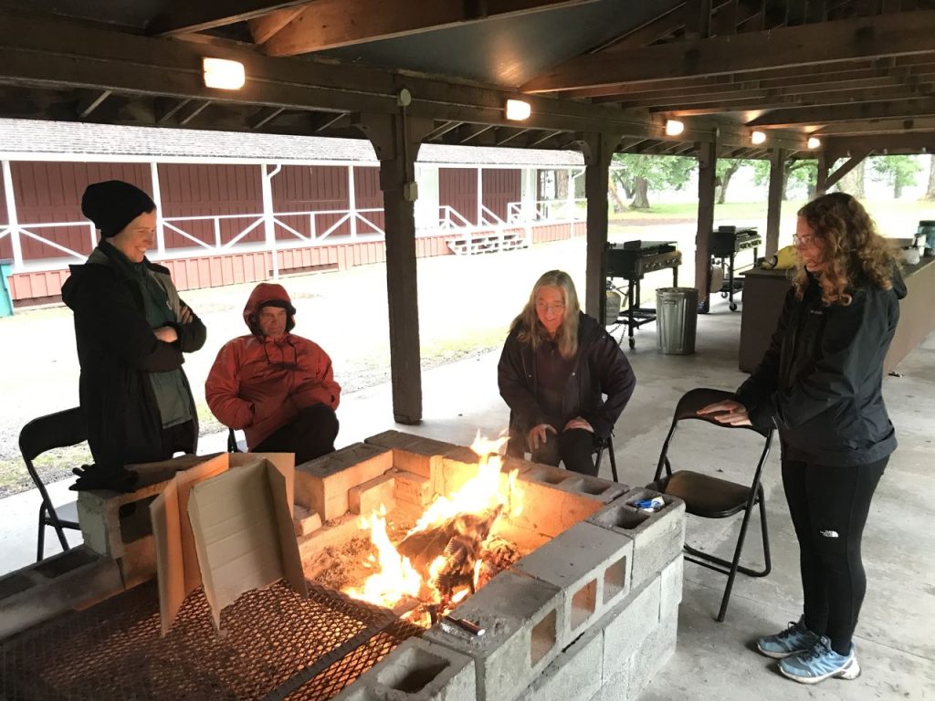
I have no photos from that next day because it was WET. We took the tiny passenger ferry to Nanaimo, ate at a fancy restaurant and did some sightseeing. More importantly – I found a place to drop of the COVID TEST! Finally getting rid of that albatross meant high-fives all around. We stayed in town as long as possible before returning to our very wet campsite. The camp had wood for sale, but we didn’t think we could get it to light, until I thought to ask if we could use the covered shelter right next to their gift shop. They said they used that space for salmon bakes, but since no one was around to go right ahead. They sold us some damp wood and by using that plus their giant pile of discarded cardboard we made ourselves a pretty decent fire.
We spent the rather cold, wet evening, watching raccoons fight over a box of bagged chips that had been left on the porch, smelling like a trash fire, trying to smoke a little recreational herb that our neighbors at Descanso had given to T, and made a new friend, a young woman from Germany who also appreciated the warmth of the fire.
We said goodbye to the Crown Islets and worked our way through the other Flat Top Islands, heading northwest around Gabriola. This part of the trip hinged on good weather because we were out on the relatively-exposed Straight of Georgia. The weather held and it was bright and sunny for most of the day. There were more seals and sea lions that we saw near a lighthouse. I also tried to call Canadian Public Health and some company called “Purloator” about picking up my Covid test, but didn’t really learn much. I turned my phone to airplane mode for most of the day.
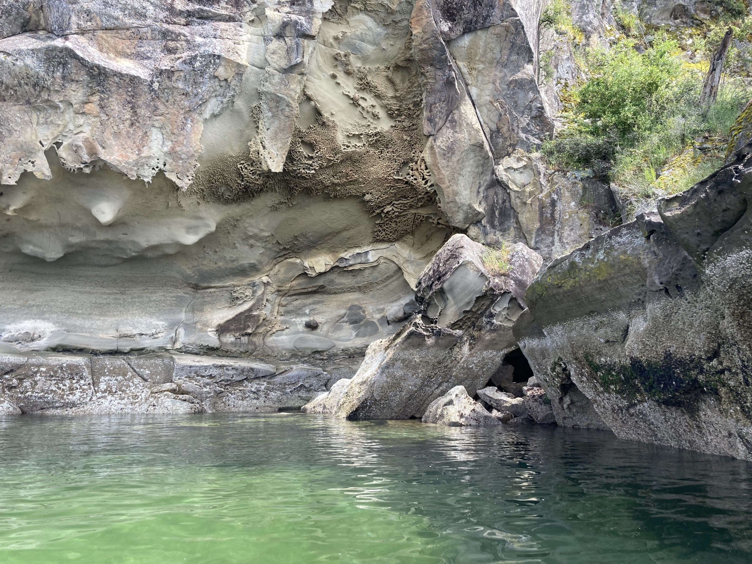
The cliffs here had dark staining that sometimes looked like faces to me.
The main paddling challenge today was that Vincent’s boat seemed to be sinking. It had started earlier, but after he’d paddle for a little while, his boat would get lower and lower, and when we would stop we’d have to pump out the rear hatch.
Vincent H Paddling along Gabriola Island
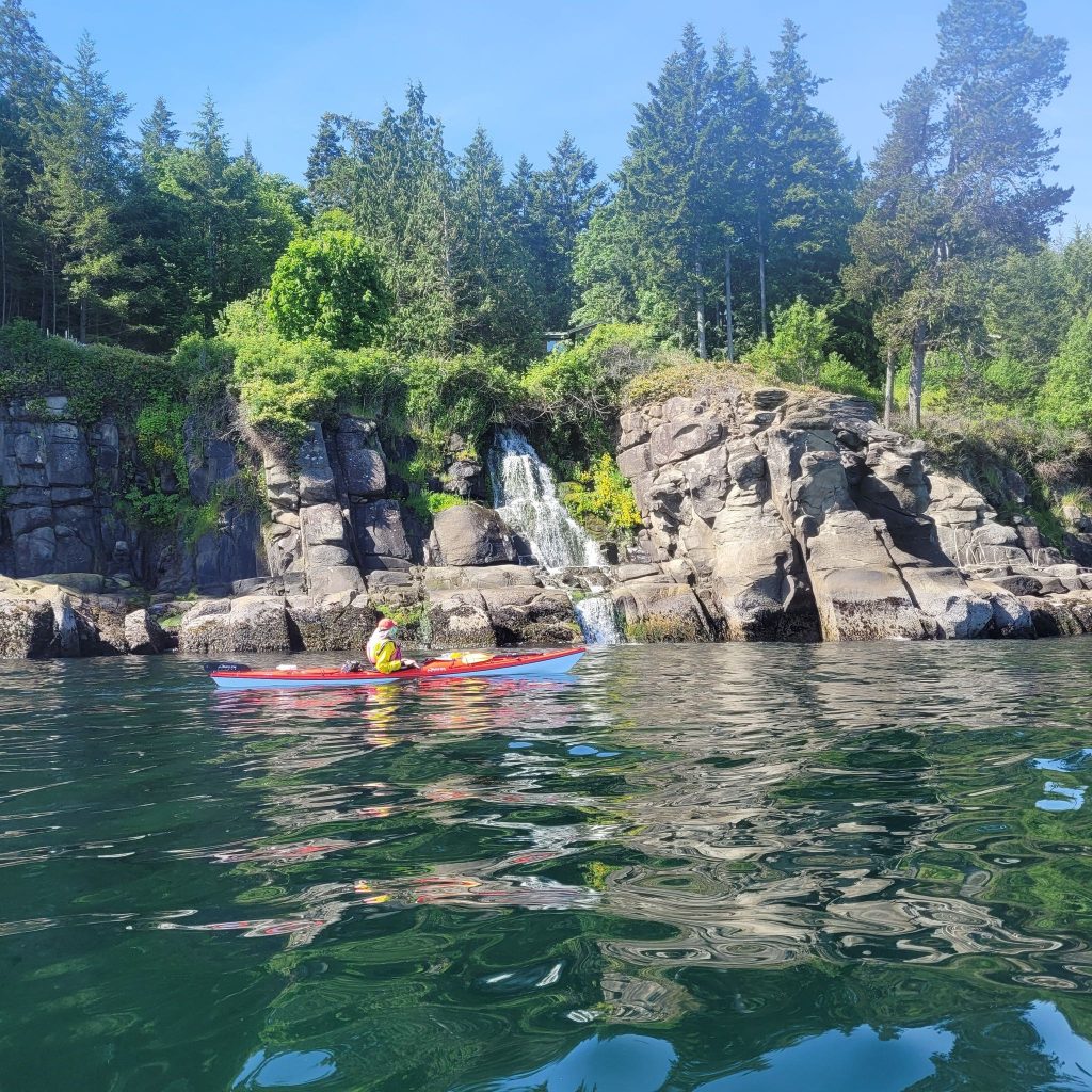
passing waterfalls (photo by Paul M)
I backed into this slot around a corner so I could hide and surprise Alice and Diana when they came around, but some boat wake interrupted my cunning plan.
so sneaky
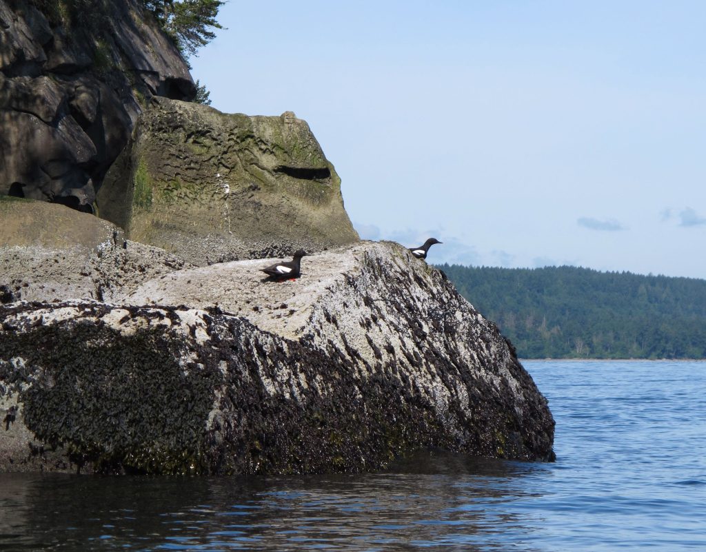
Guillemots (photo by Tom F)
Descanso Bay
We reached our campground in Descanso Bay, across from Nanaimo, and, according to our original plan, this would be as far north as we would go. Am I hinting enough that things won’t go to plan? There were two potential beaches to land at. One with a nice beach but a bit of a carry to get to the campsites, and one right next to our campsites, that was full of sinking mud and broken, sharp, oyster shells. I noped out of the oyster-beach and was later joined by everyone else when the tide started to go out and threatened to leave everyone’s boat trapped in the mud. We saw otters here and a pileated woodpecker.
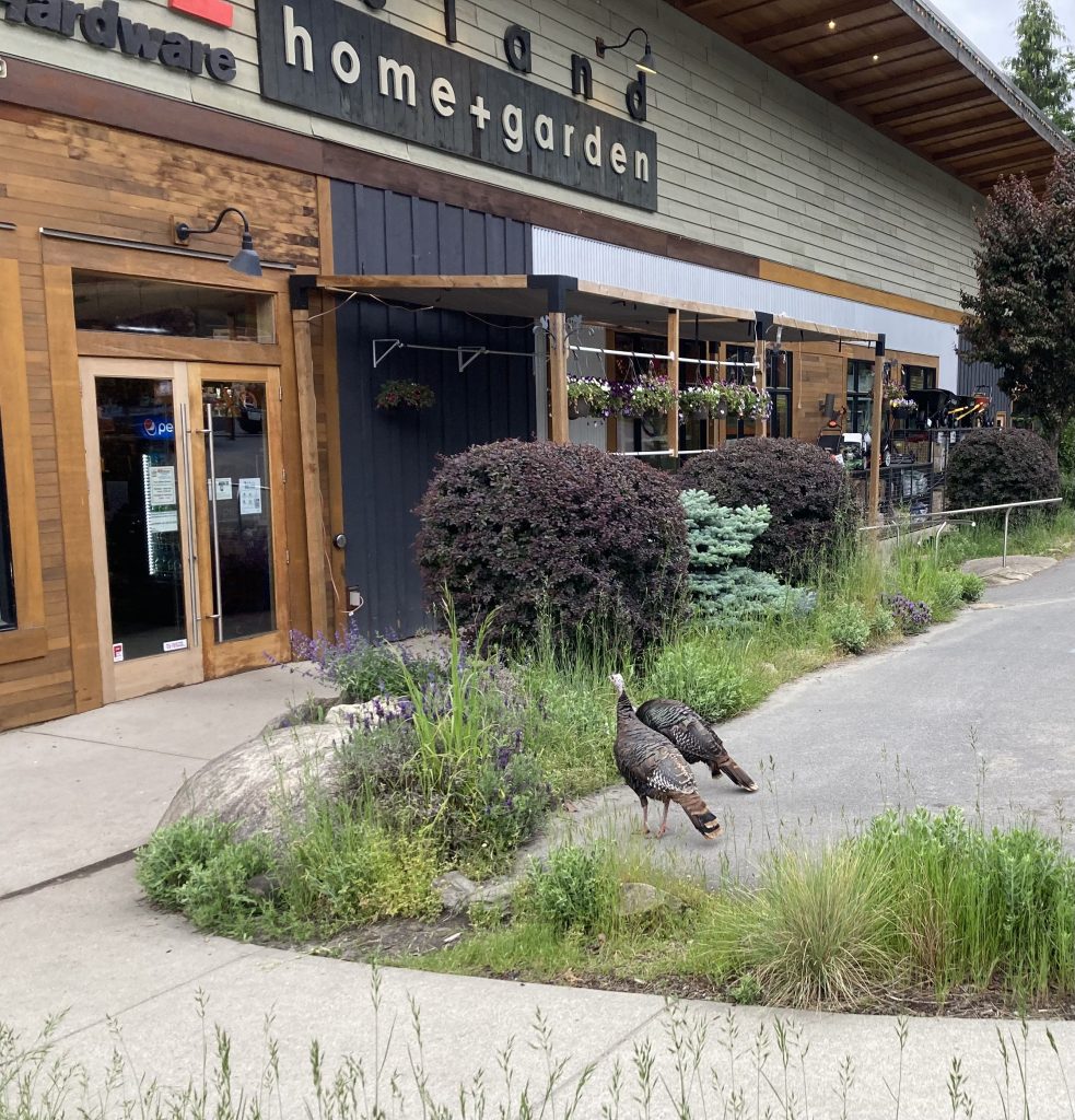
That evening we walked about a mile to town and went to a very fancy pizza restaurant & I bought a mojito because I’m fancy. These wild turkeys were standing in the parking lot when we got out.
June 6th – we had some rain overnight but it was dry when we had to pack up. Today our timing mattered because we needed to go through Gabriola Pass near the slack. We were told, and I’ve since seen some video, that currents in the pass can get up to 8 knots and we didn’t want to deal with that in our fully-loaded boats, many of which had gear or wheels strapped to the deck.
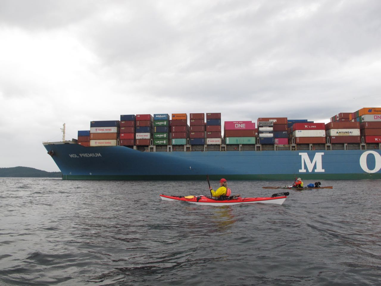
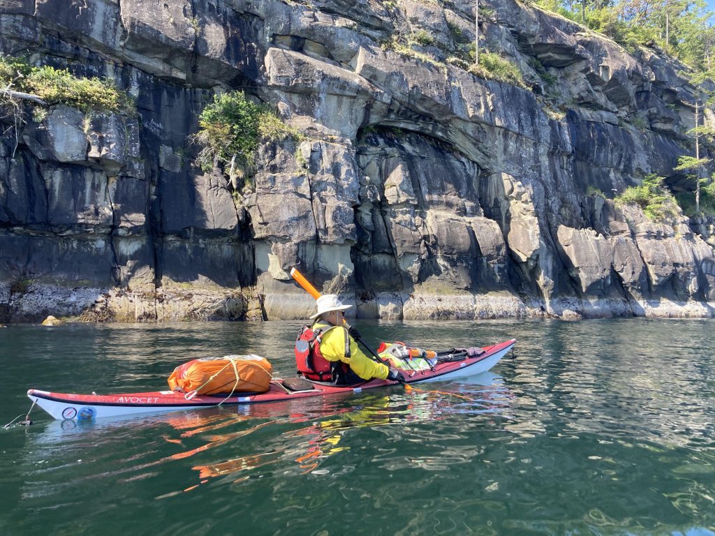
After packing and oatmeal for breakfast (I’ve decided that oatmeal is always a good breakfast – it’s quick, it’s warm, and I can put as much dried fruit in it as I want) we were on our way. We set out northwest past the Secretary Islands and along the west side of Reid before making a big crossing, diagonally, to Valdes. This area is full of tankers and container ships waiting for a slot to open at the port in Vancouver. They made me a little nervous as we are very small and they are huge, but they luckily never moved while we were there.
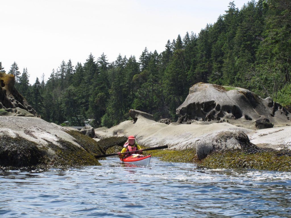
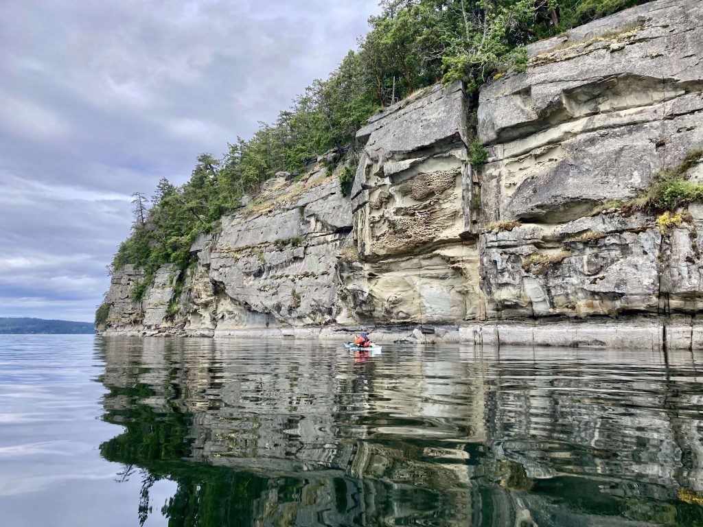
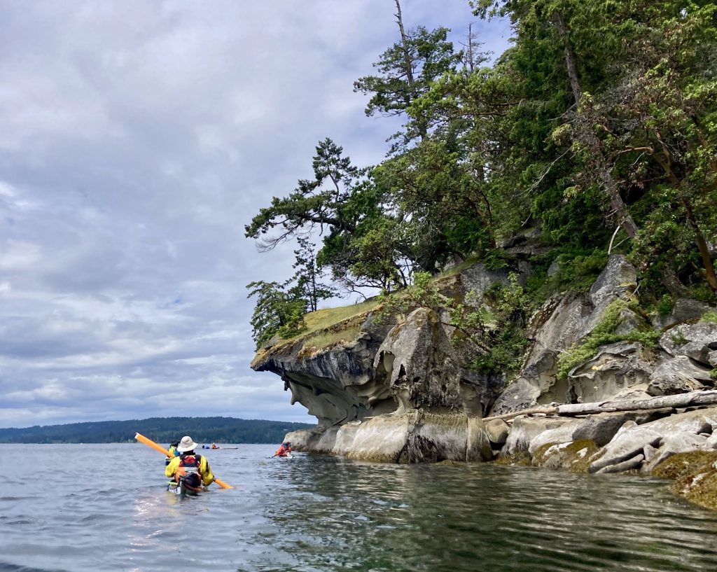
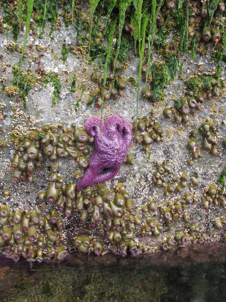
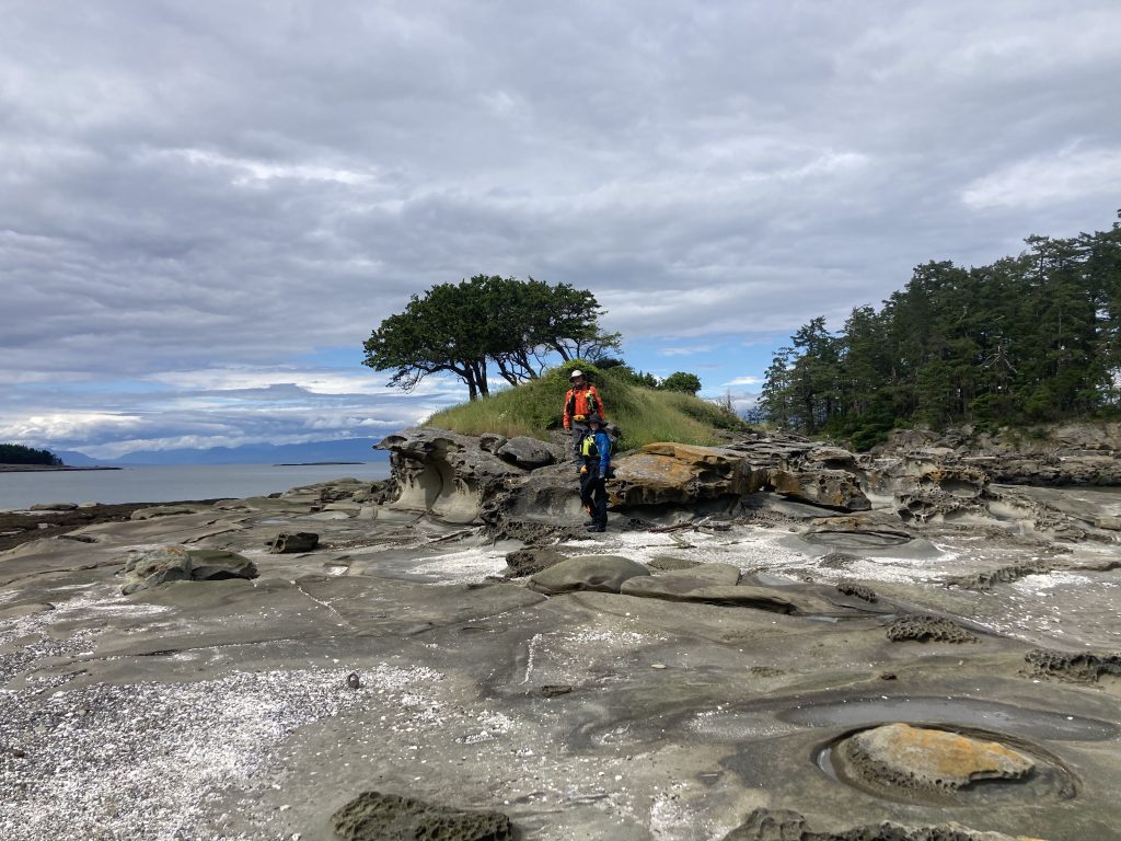
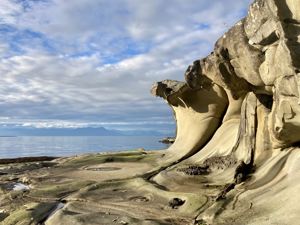
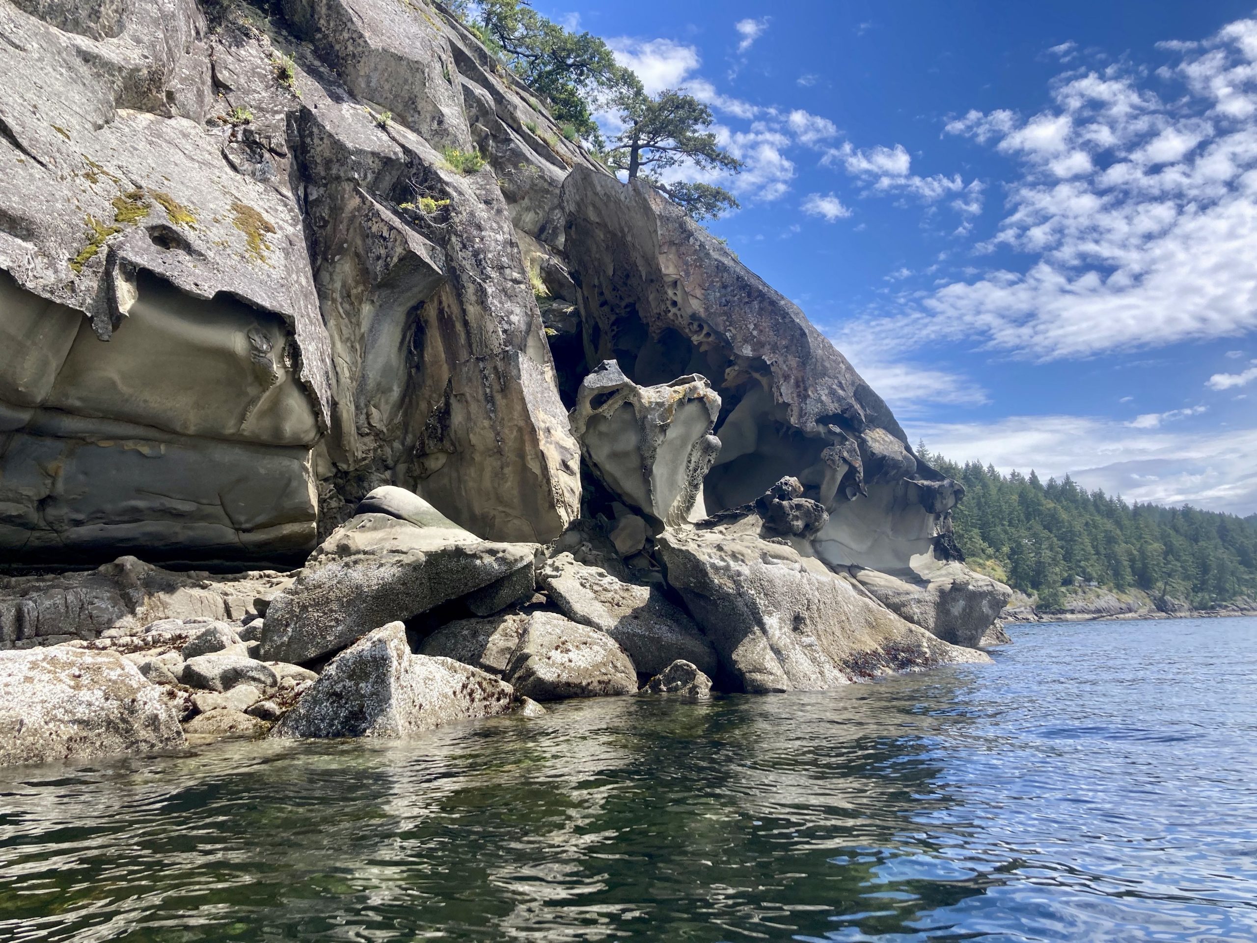
Our lunch spot was a bit north of Blackberry Point and we waited for a while, looking at a Gary Oak to make sure we were hitting the slack, and then we entered the pass. The sandstone cliffs along Valdes were impressive, and we saw many sea stars – which I found encouraging because they had suffered a big die off a few years back.
Sandstone cliffs making us look small
Sandstone formations on Valdes
Purple Sea Star (photo by Tom F)
The pass turned out to be … nothing impressive. We even wondered if it really got as bad as they say, but we took a few minutes to explore the marina and then paddled through, looking for our mysterious islet in the Flat Tops.
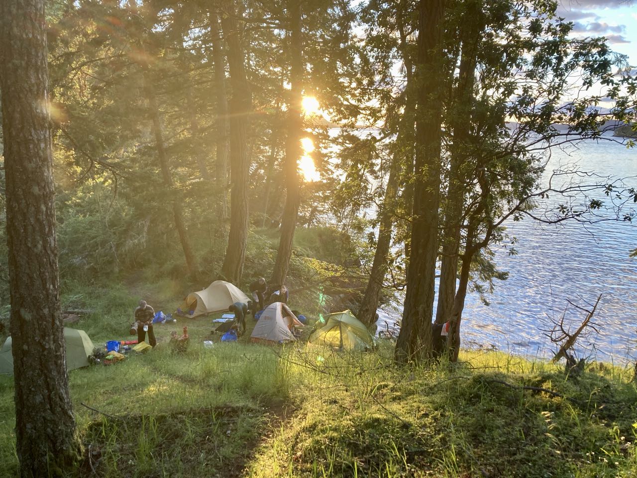
Most of the Flat Top Islands are privately owned and off limits, but there are two tiny islets that are open to camping, with NO services. When I first saw them I was highly skeptical that we could even fit 6 tents on them – one was basically a grassy rock with one tree on it. The other didn’t even have a tree. But we did, and once we were settled in I was so glad we had stayed there. It was magical.
We saw many seals and one sea lion as we pulled in.
are we really going to put 6 tents on THAT?
Alice’s method of letting the tide lift the boats to us (photo by Alice V)
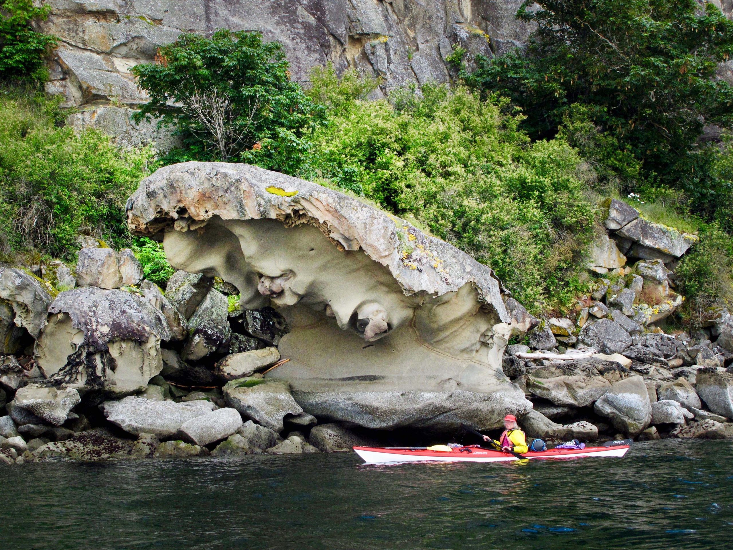
June 5th we packed up at Montague and prepared for a 10 mile paddle along Galiano Island and across to Wallace Island. This is where we got our first look at some of the impressive sandstone sculpture that we would follow for most of the trip, and also, I think, where we first met some of the seals that would keep an eye on us for the rest of the trip.
My camera / phone has no zoom capabilities, so it was hard to capture animals and birds, and I don’t now recall where we first saw them, but we saw many seals, otters, some feral mink and a variety of birds, including eagles, vultures and guillemots. The weather remained good for our paddle, cloudy at times but no rain during the day. The Sandstone had an interesting variety of textures including something that looked a lot like honeycomb. I’m curious as to how that may have formed.
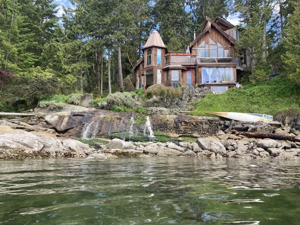
We passed this house that I think might be Rivendell. I didn’t get a photo of the shed next to it, but it had a very hobbit-hole look to it.
Seems like this house should be in the Lord of the Rings
UnderwayGlassy seasVincent
Carrying the boats up at Wallace
We arrived at Wallace Island around 4pm and I had to think about my scheduled Covid test. We had a few bars of service, it was better up on the cliff, so I set up my tent, prepped my test kit in it, and went up to wait for my call in time. The video worked and we weren’t cut off. I was able to take the test and finally talk to a human who agreed I might have a hard time turning in the test, but couldn’t do more than make a note in my file. I didn’t get the kind of reassurance I was looking for that Canada wasn’t going to mad at me and the best she could offer was the number for Public Health Canada, and the lab’s help line (the one I spent 40 minutes on hold for already). This may surprise you, but it’s challenging to keep your phone charged out there. My last call to their help line burned through 20% of my phone battery and I didn’t have enough to try again now. Time to go for a walk and watch the sunset.
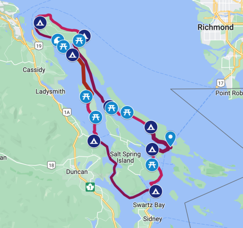
On June 4th I set out with 5 friends from my sea kayaking club on a 9-day trip to the Gulf Islands in BC. This is considered a relatively sheltered area, but it’s still just off the Straight of Georgia and has some big crossings and some areas where we had to time it just right to avoid strong currents. Our plan was to launch from Mayne Island, head north almost to Nanaimo, then return south through False Narrows, around Salt Spring Island, and finally returning to Mayne Island to take the ferry back to Tsawassan, BC. All told, 120 miles. The longest day would be around 18 miles.
The Plan
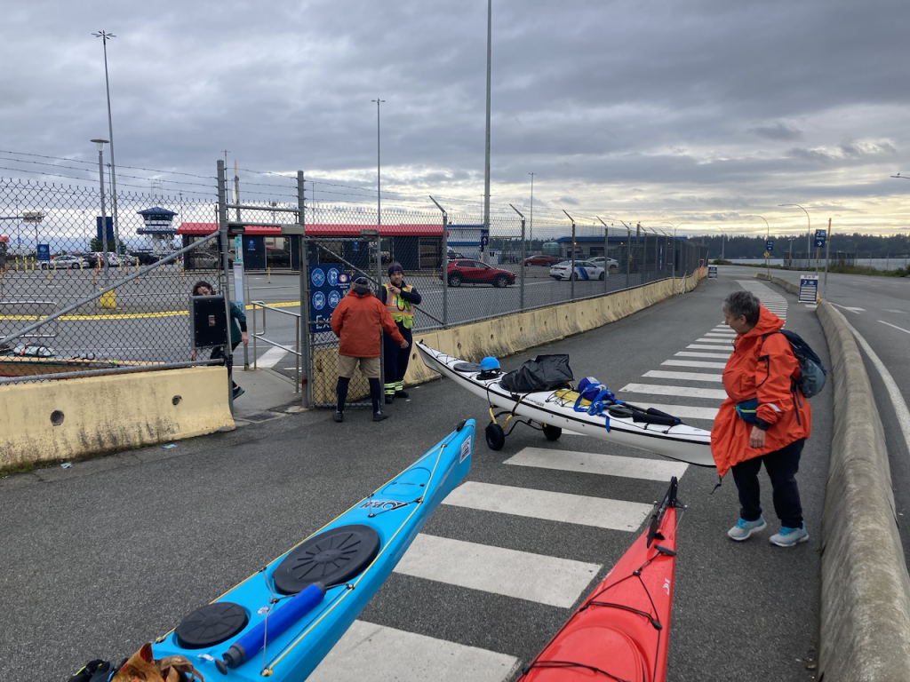
We met at 4AM to make sure we could cross the border at 6, and arrive in plenty of time to figure out how to unload, get the kayaks on wheels, figure out where long term parking was, and get ourselves onto the 9:20 ferry. This all went relatively smoothly except for the part where I was randomly selected to take a Covid test at the Canadian border. That seems simple enough, right? I’ll just do the swab in the car, box it up and drop it in the post before I get on the ferry. Ah… how optimistic of me! While reading the instructions I was able to gather that they wanted me to register online (okay, did that), then I have to install some video software because they want to WATCH me do the swab. Then I’m supposed to book an appointment online. I decide I can’t think about this right now because we have to unload.
Threading the needle: getting our 17 foot kayaks through a sharp angle.
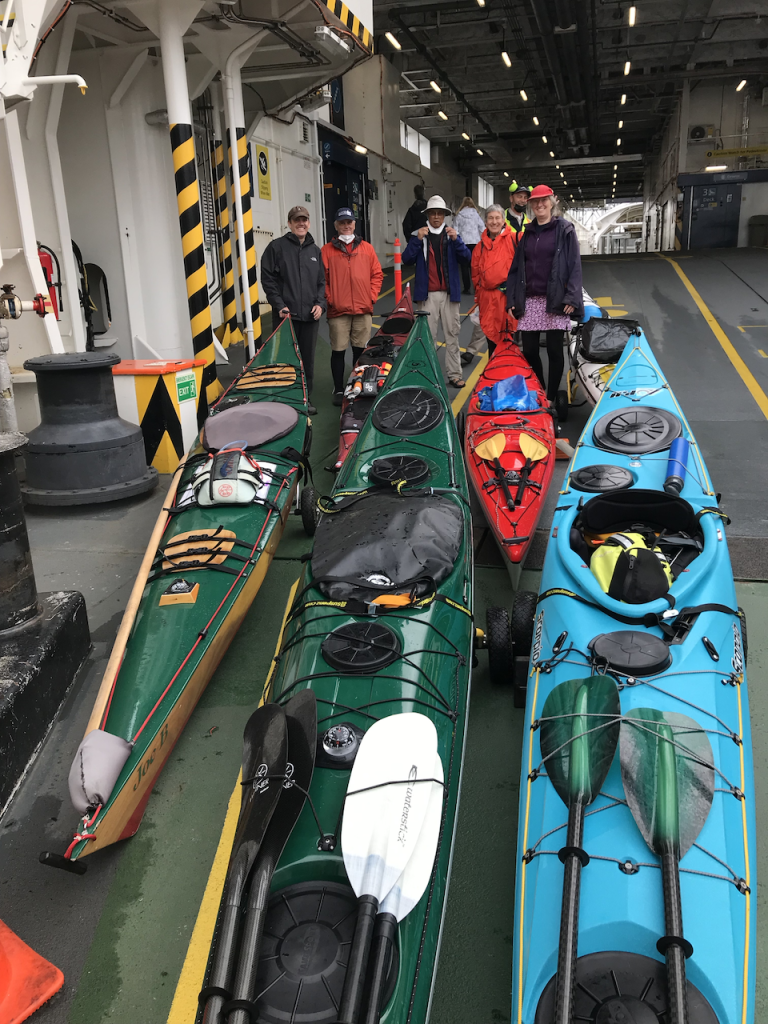
Loaded and ready! (photo by Alice V)
On board the ferry I discover that I can’t take care of the whole Covid thing before I leave the ferry. I can’t book an appointment until the next day, Sunday, because they want you to be able to get the swab sample to Fedex within 24 hours of taking it. This is going to be a problem because by Sunday I’m going to be paddling from Island to Island, frequently to places with no roads, much less a fedex office. I try to call their help line to explain the issue and I’m pretty confident she hung up on me on purpose (after I waited on hold for 40 minutes).
One of my fellow travelers has been to Canada multiple times and felt I could probably throw the whole thing in the trash for all it was worth, but it had threatening language about “$5000 fine” and I’m nervous about these things, so this is going to remain an issue.
We arrive at Mayne Island, roll off the ferry and through a gate where we have to lift our very heavy kayaks down to the beach. Luckily we have some straps to make this a 4-person carry and we get everyone down and ready to go.
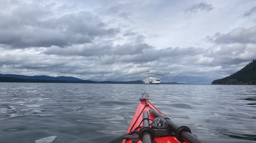
Our first leg takes us across from Mayne Island to Galiano past the opening to the aptly-named “Active Pass”. We had to keep an eye (and an ear) out for the ferries, and crossed a pair of sizable current lines before we got close to the calmer area near Galiano.
Letting the ferry go by outside of Active Pass
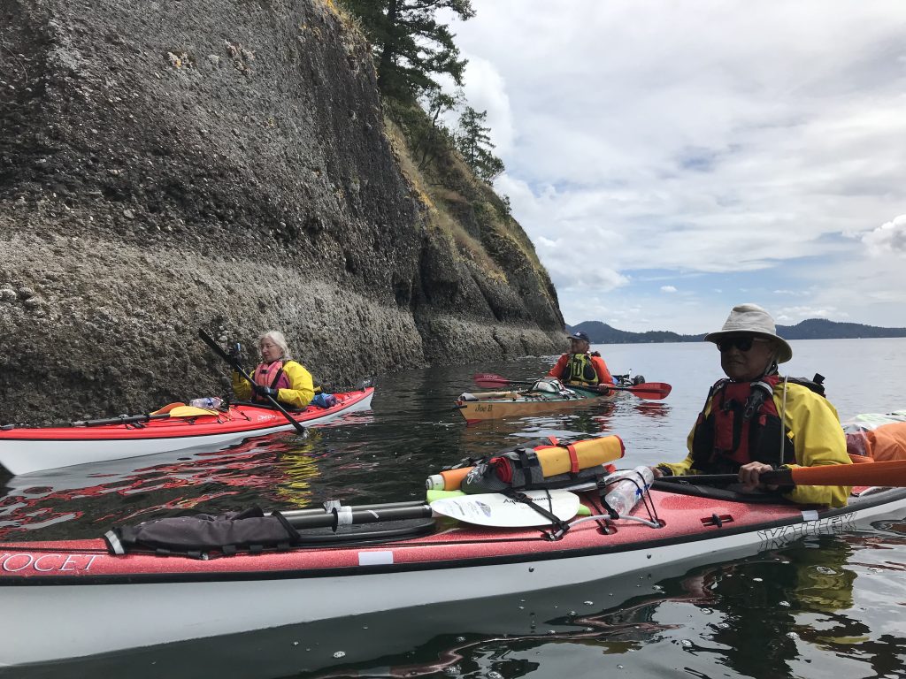
Along the cliffs of Galiano Island (photo by Alice V)
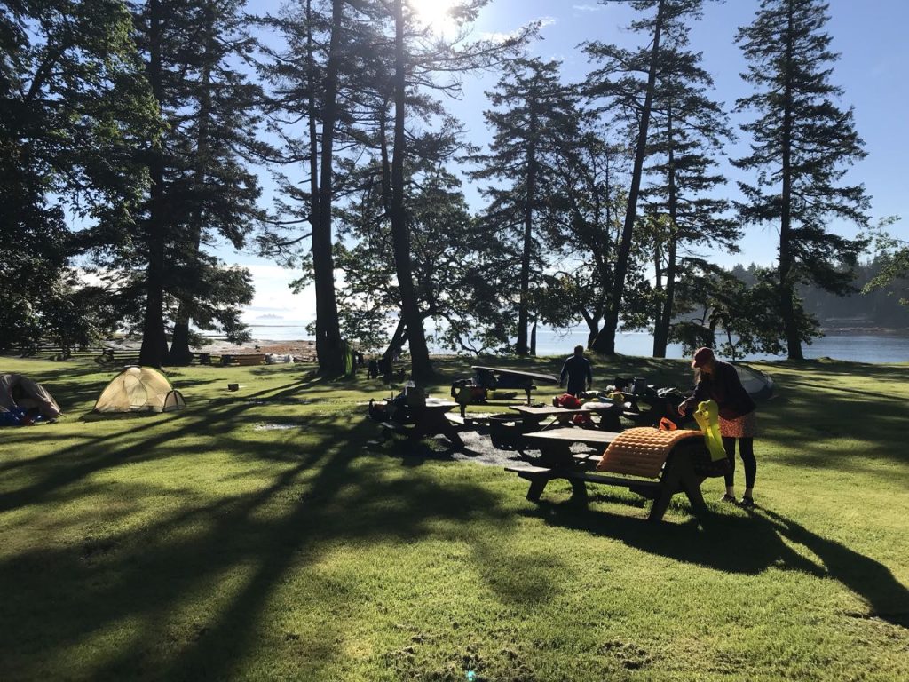
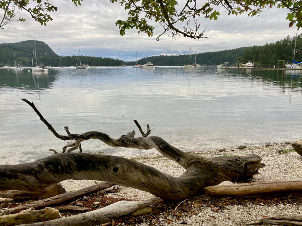
It’s cloudy but fair weather, and we make our short hop across the channel and along the coast to Montague Harbor Marine Provincial Park. It’s sheltered behind another, small island, and seemed popular spot for boaters. All is well for camp the first night.


")


