Yellowstone Cliffs to Mowich Lake, Aug 10
Today we planned to split the party. K & R really wanted to hike the “Spray Park” section of the trail, which sounds beautiful, but my daughter said she wasn’t used to the pace yet and was unsure about committing to an additional thousand feet of elevation gain and 3 miles. Two days later she’ll be charging ahead of everyone while holding a coffee mug casually, but she wasn’t ready yet.
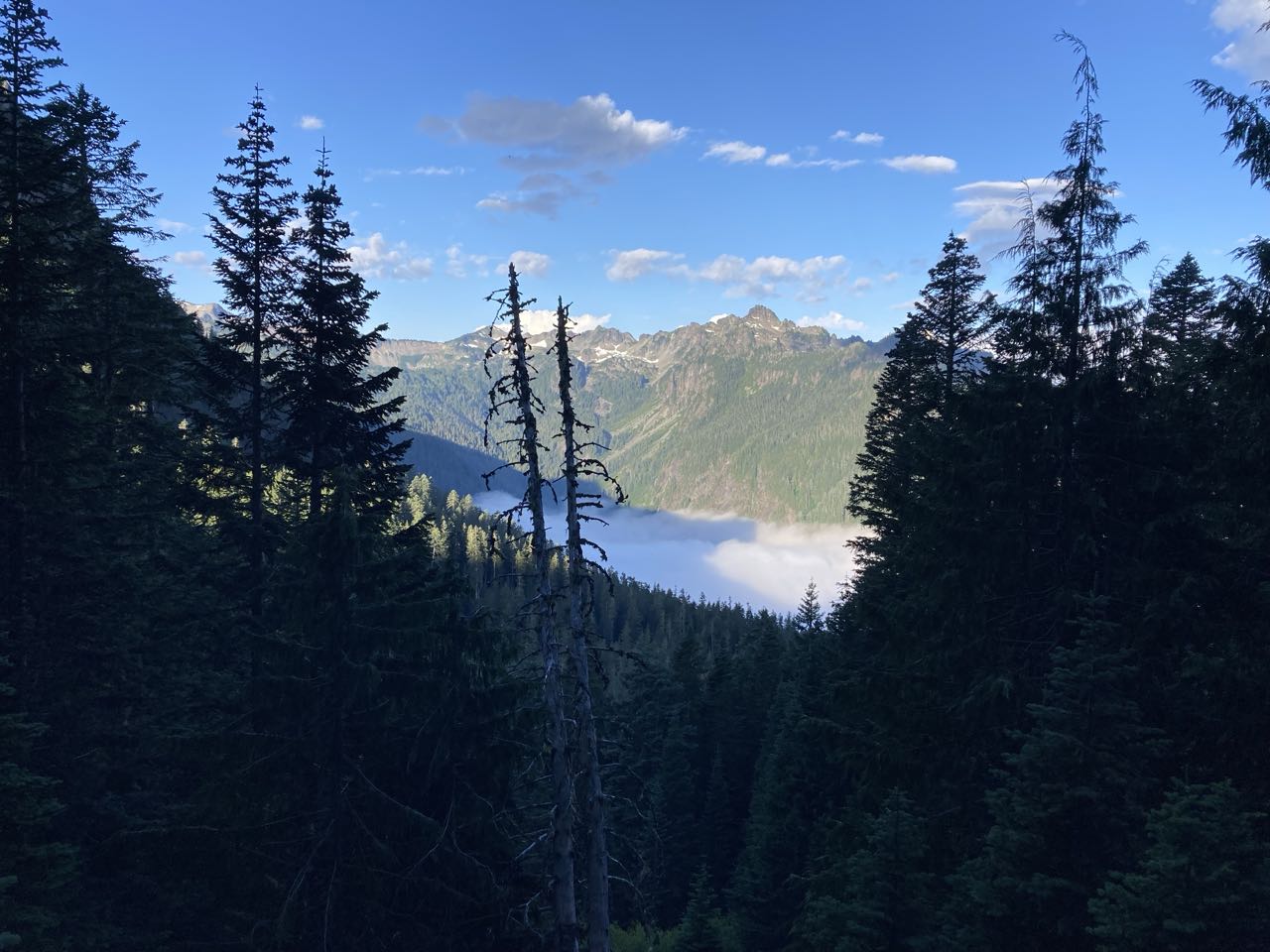
The day started sunny but we saw the fog in the Carbon River valley below us, and we followed the trail down into the fog. We hiked together down to the Carbon River turnoff and split up. At that point my daughter and I promptly got lost.
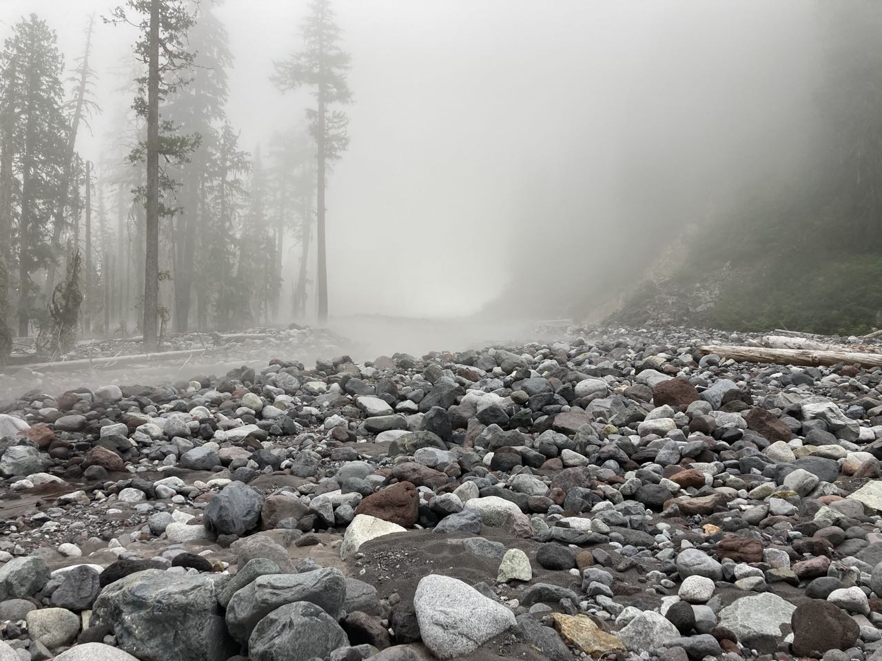
The Carbon River Bridge is one that had washed out multiple times and been replaced so when we came out of the forest in the fog, it wasn’t immediately clear where the bridge WAS. Scanning around we spotted flagging that led us over river cobbles to the north until we finally spied the bridge in the distance. I did NOT like this bridge. I have this quick panning shot of it that doesn’t really show why it was scary. The river was fast and dangerous, you could hear the rumble of rocks being turned over in it, the bridge was high above the water, and at a few points the railing pulled so far away from the main log that I couldn’t reach it. Or if it DID try to reach it I’d have to be resting all my weight on it, which seemed like a really bad idea. I hated this bridge.
We’d gone quite a ways north to find the bridge and so I assumed we’d have to backtrack to a spot parallel with where we left the trees to get back on the trail on the other side. I was wrong about that. But that’s what we did, walking right past some flagging in the fog, and following the river bed upstream to the south. Eventually we found ourselves scrambling over boulders and hopping on rocks, which was when I had the idea to check the mapping app to see what the problem was. We’d walked right past the trail and were now running parallel past an old section that had been abandoned due to washouts.
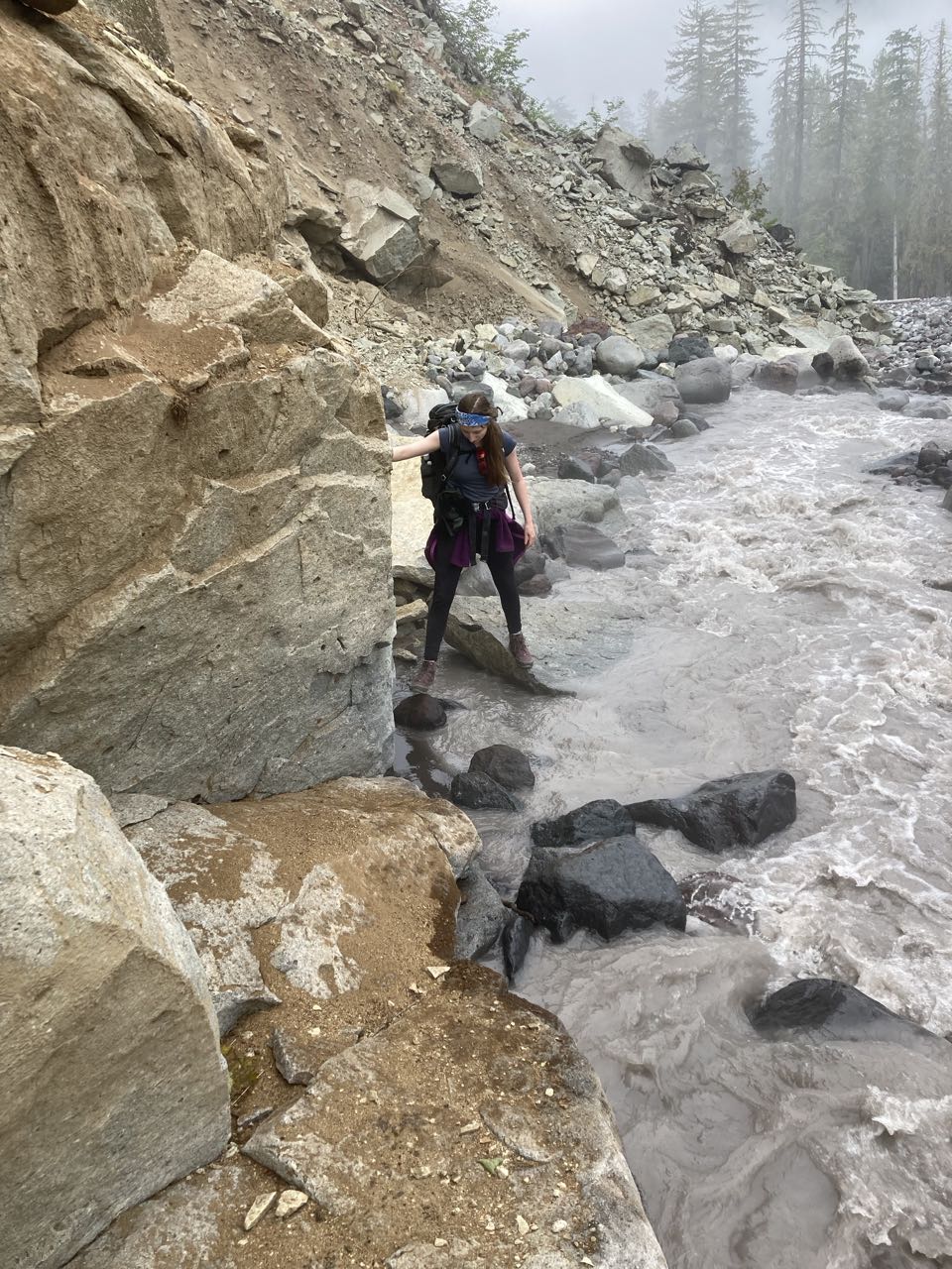
All told it took us an hour to get from the trail on the east bank to the trail on the west bank after all the boulder hopping, getting lost, and then stopping for a snack. S said this was her favorite part of the trail (where we got lost) because it was more technically challenging.
But we were back on course now! This next section, as we headed toward Ipsut Creek had a lot more hikers on it (since we were somewhat near a big trail access point) and also featured perhaps 5 or 6 more bridges over parts of the Carbon River that had fallen in.
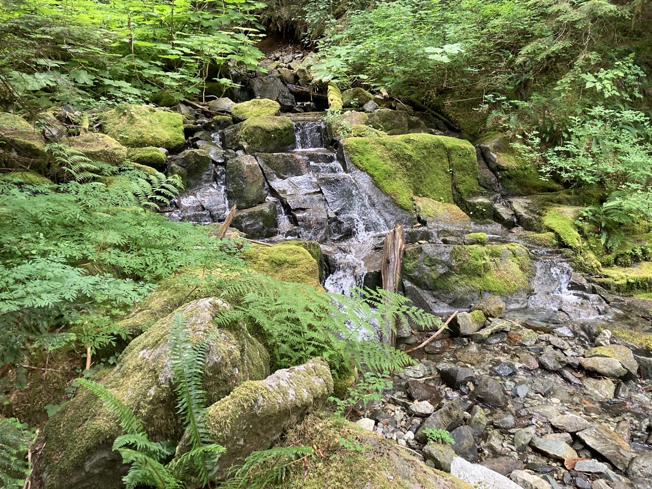
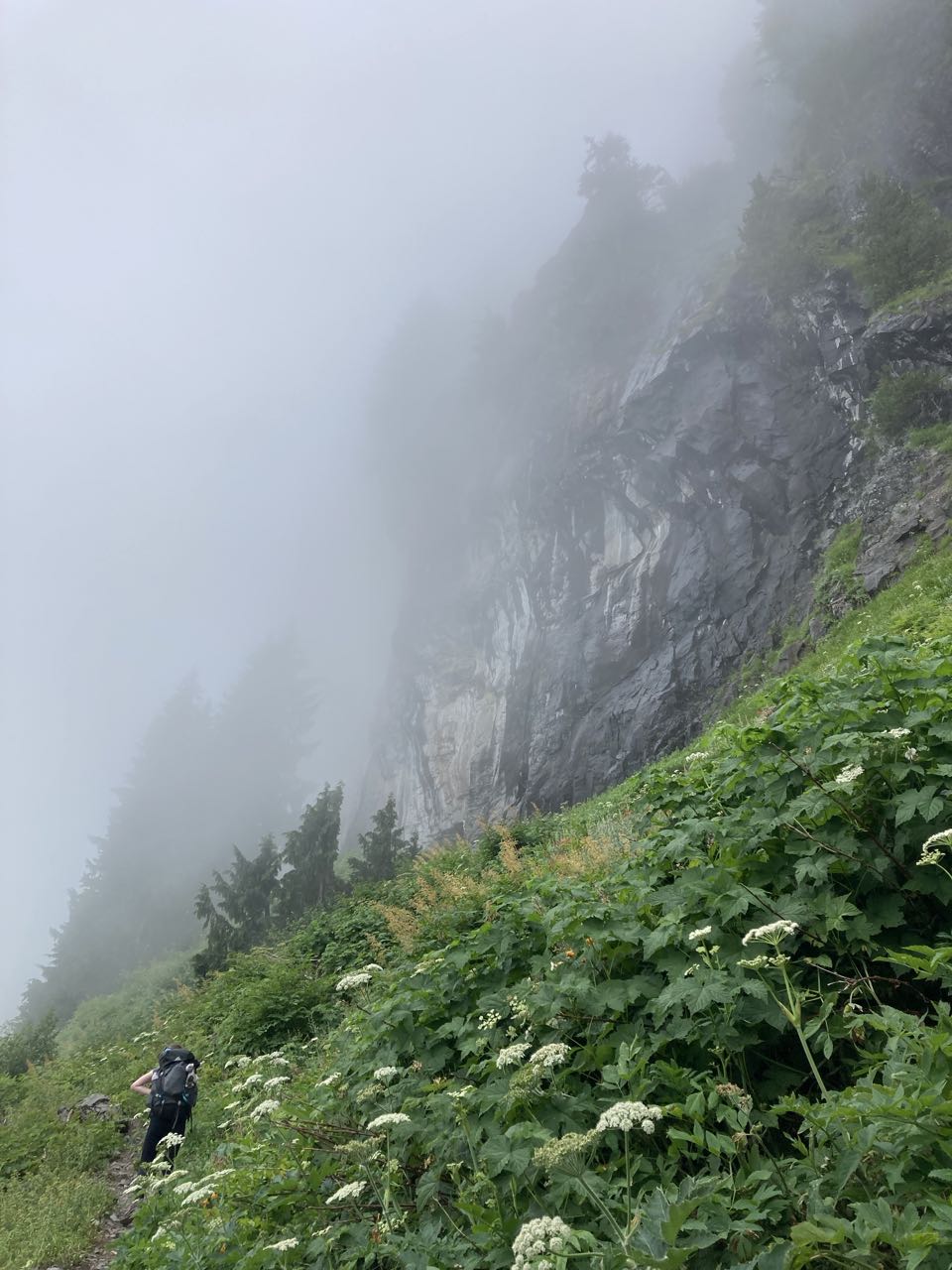
The fog never lifted as we went along the Carbon River, or when we turned up Ipsut Creek toward Ipsut pass. I think I’d like to come back here in the sun as I feel I probably missed out on some good views as we gained more and more elevation, but even in the fog the trail was full of tiny waterfalls and narrow, magical little grottos.
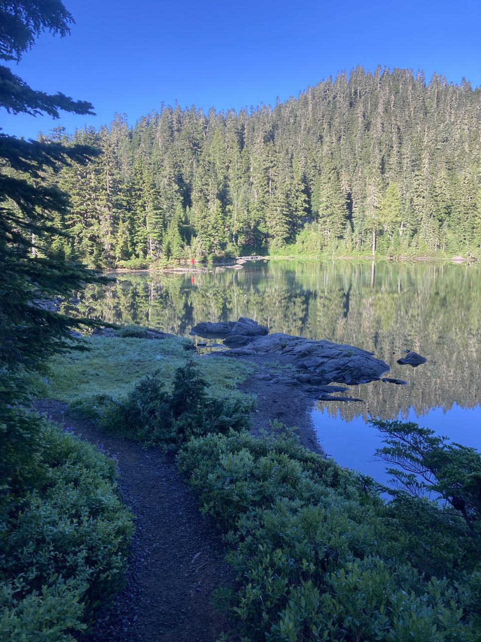
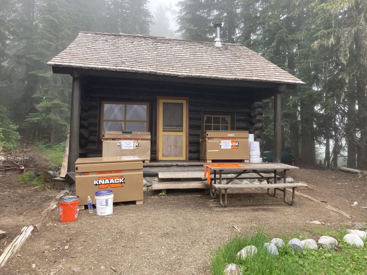
We took a break between the two cliffs at the top of the pass before taking our time heading gently down to Mowich Lake. This is a bigger campground, accessible by car and the location of our first food cache. So while it spoiled the atmosphere of being deep in the wilderness, we also had access to lots of snacks. Snacks were important! Sometime on day 1 we’d started talking about Lord of the Rings, assigned ourselves hobbit names, and stressing the importance of hobbit meals. This turned out to be useful for everyone as a pattern of taking multiple small meals throughout the day was what wound up working best to keep everyone safe and happy. Breakfast, Second Breakfast, Elevensies, Lunch, Tea, Dinner, and Supper. On most days we’d reached our campsite by Tea time.
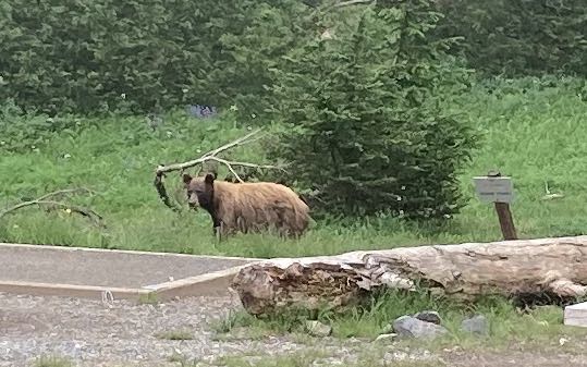
We had a harder time than you might expect finding the campsite at Mowich Lake because there were little trails everywhere but no signs. Eventually we found it, pitched our tent, found the cache and waited for K & R to meet us. It rained some that evening but not before we had a chance to see another visitor. This time a mama bear and her TWO cubs. I saw both of the cubs but, again, didn’t get a photo of them. Although she is cinnamon-brown in color, she is a black bear. You can see how close she was to the tent sites.
To recap: on day 1 we saw one bear. On day 2 we saw two bears. On day 3 we saw three bears. We felt that this might get really exciting by day 10, but alas, we would see no more bears for the rest of the trip.
(edit) My notes from the trail
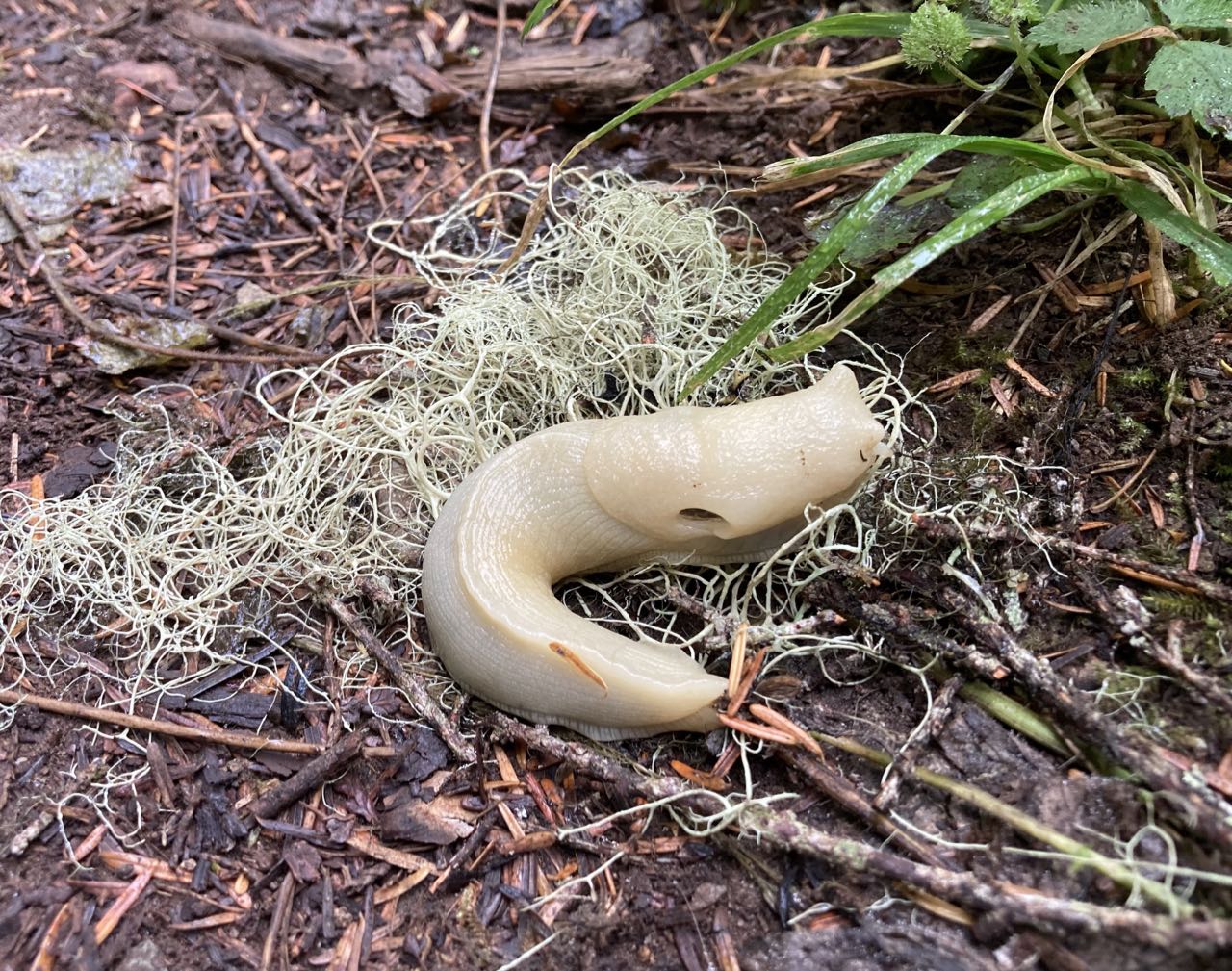
Deer, snakes, banana slug. Hiked down (long way down!) to the river where we split – sending Frodo and Sam down the river while Merry and Pippin entered Fangorn.
It took us an hour to cross the river because 1) the bridge was hard to reach (boulders) and then we got lost – walking past the trailhead and scrambling up the riverbed until we realized our mistake. Along the river were many scary bridges but it was flat until past Ipsut. We began the slow incline past many waterfalls & mossy rocks.
Last mile was very steep and overgrown. We emerged between 2 towering cliffs pursued by fog. Easy descent to Mowich where we got lost again. Heavy mist -> rain. Cider was amazing! K & R arrived about 1 hour after us (5pm). Cinnamon bear and 2 cubs in campground.
")


“This is not the trail” you really do have the best captions…