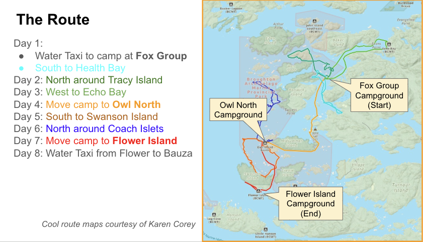
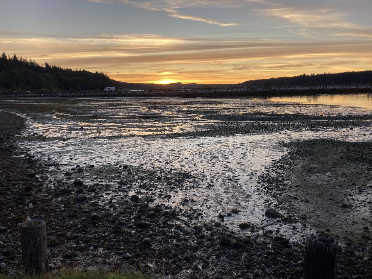
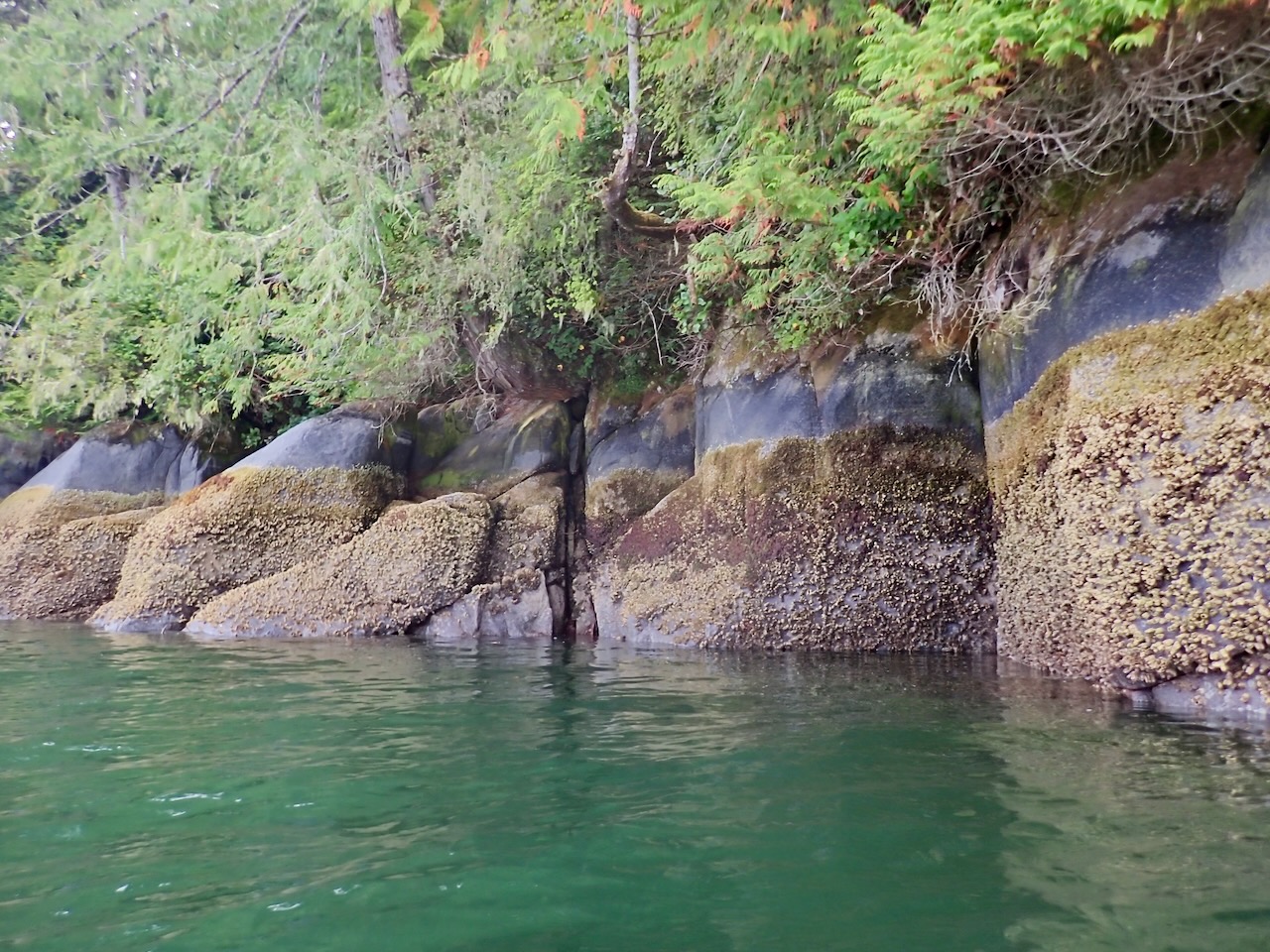
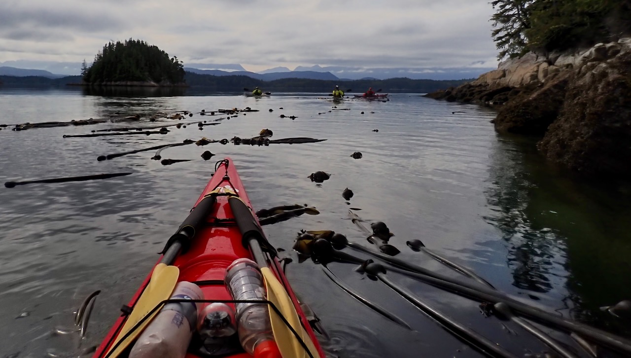
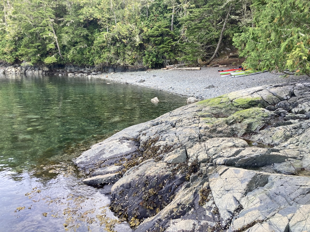
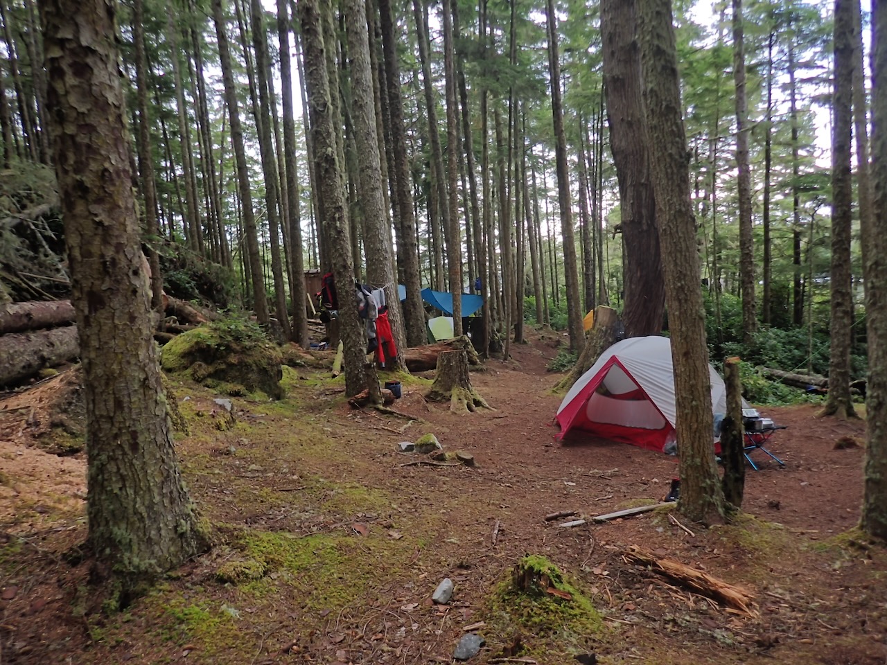
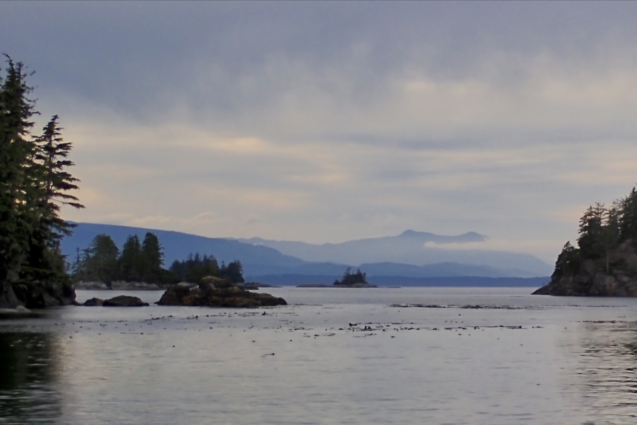
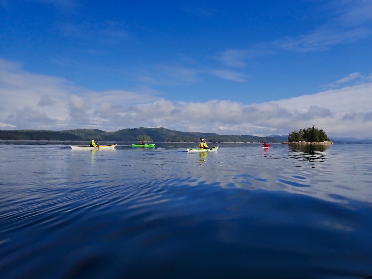
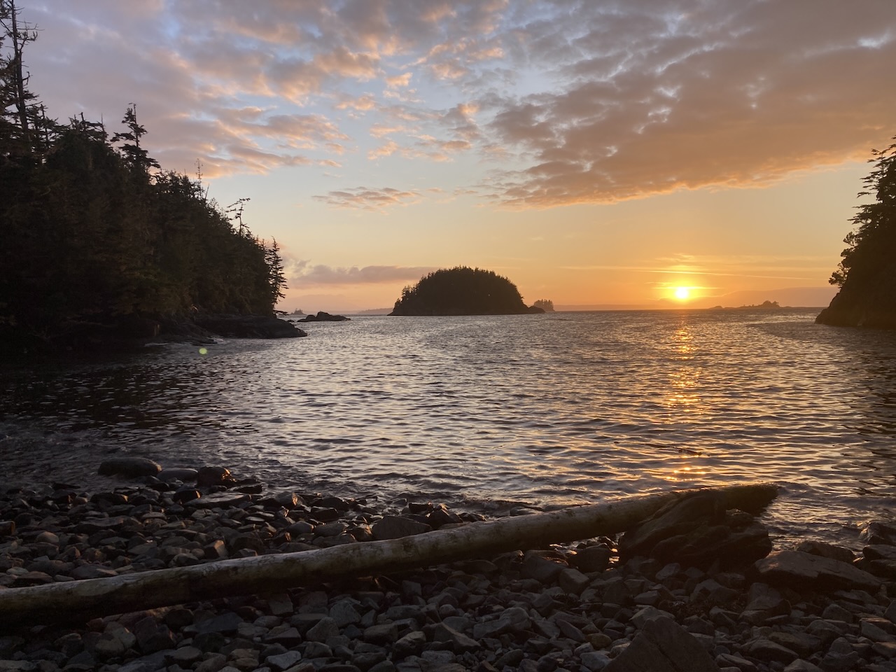
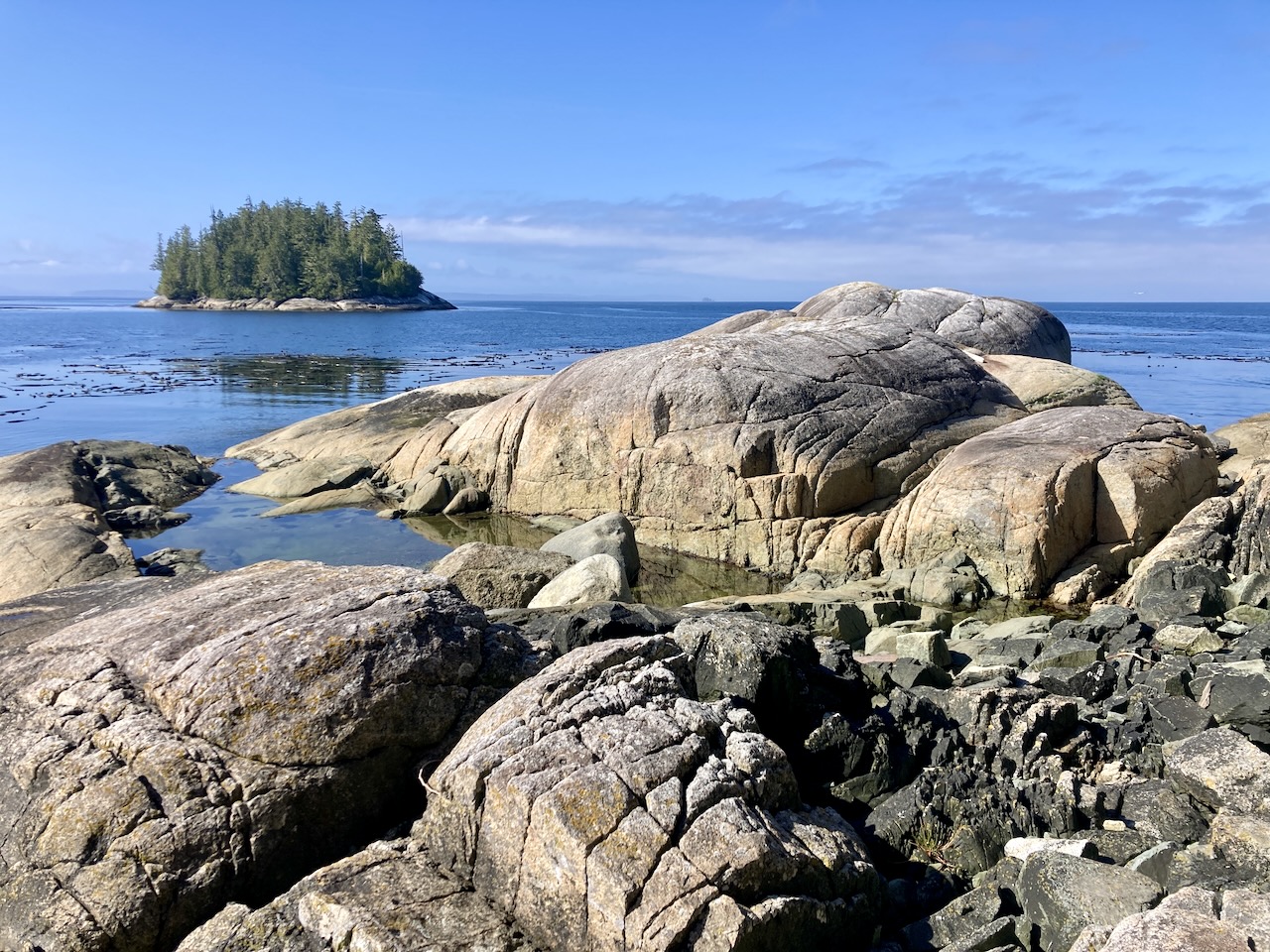
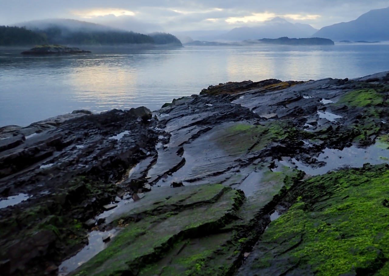
I’m not done with 2024-year of awesome kayaking. This was a week long trip up to the Broughton Archipelago on the north side of Vancouver Island, BC. Originally we planned to move nearly every night but we got such a good campsite on Fox that we decided to stay there 3 days, making day trips out, before moving on.
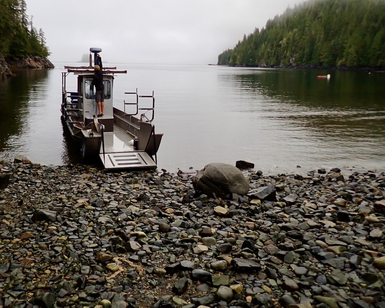
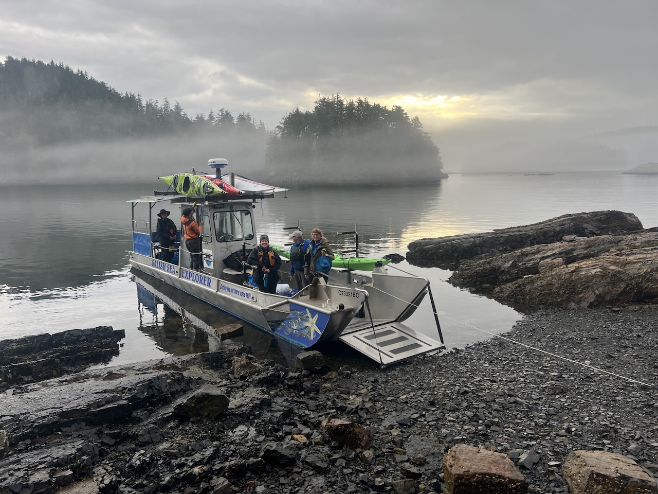
We drove up to the northern tip of Vancouver Island, spent the night and then took a ‘water taxi’ from the main island out into the Broughton’s proper, to Fox Island.
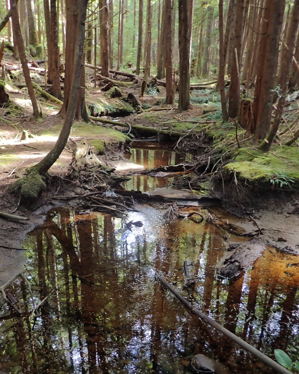
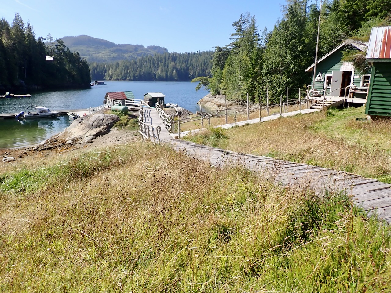
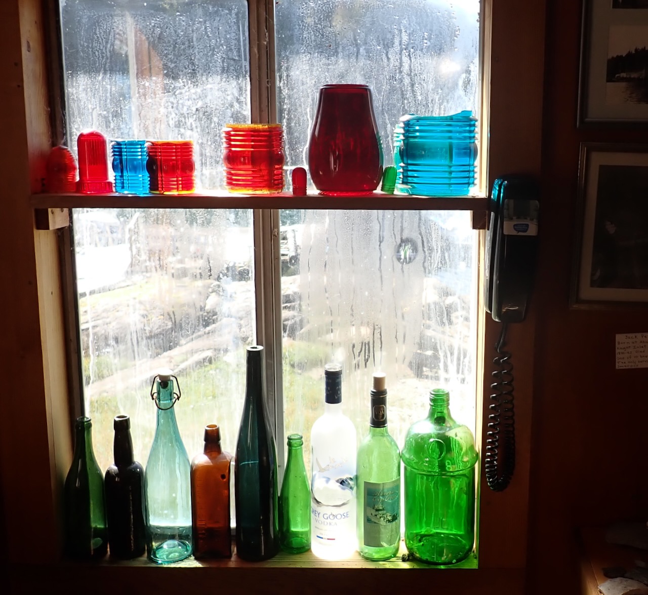
We took several day trips, including up to Echo Bay which is a small settlement with a summer resort (closed while we were there) and a museum run by “Billy Porter” who has lived in the area his whole life collecting, in his words, ‘sea junk’.
We encountered many humpback whales but this is our best video. We came out from behind a small island and they were right there, slowly moving back and forth, feeding.
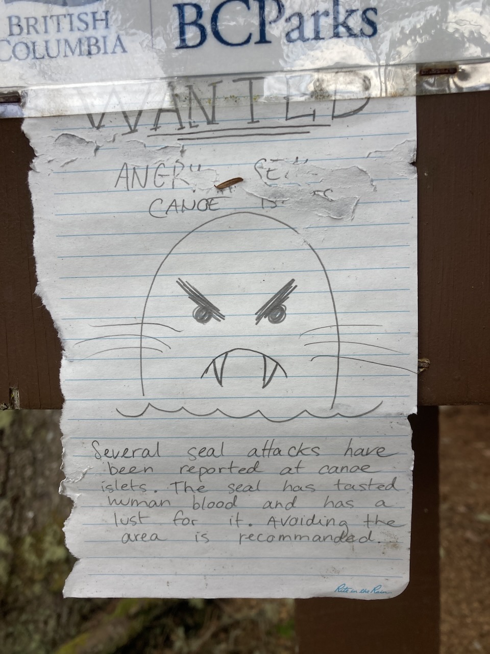
We found this beautiful sign, warning us about an aggressive seal. We were a little skeptical at first but spoke to some of the tour guides later and it’s accurate – this angry seal will attack you. Keep your distance. We did as instructed and never encountered him.
This may be the best place I’ve ever done a multi-day kayak. There are hundreds of tiny islands that are fun to paddle around, whales, seals, and, at least as late in the season as we went, quiet. A+ Would go again.
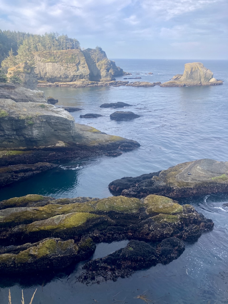
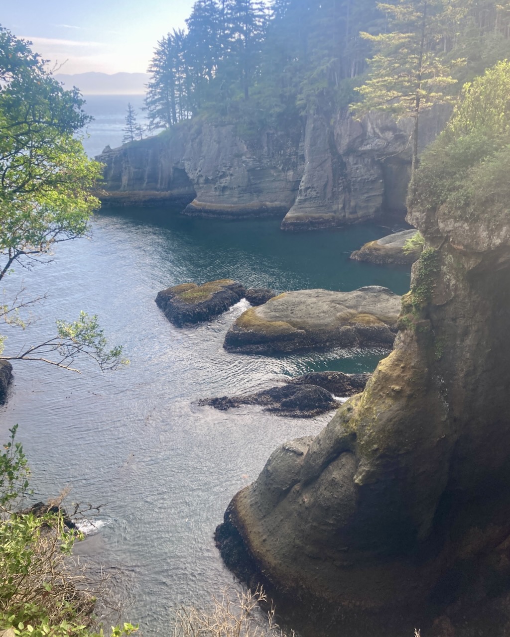
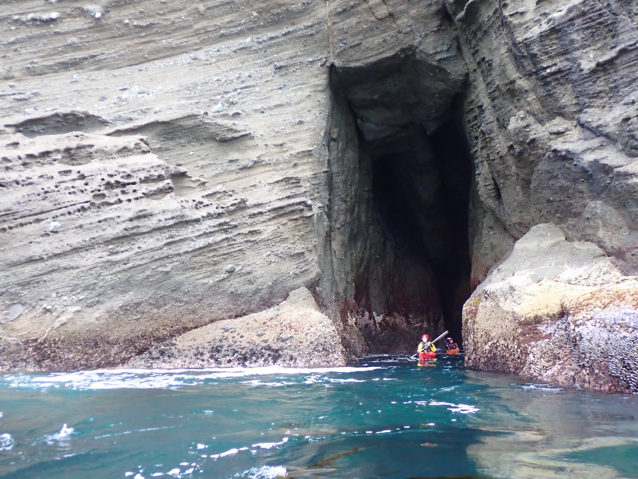
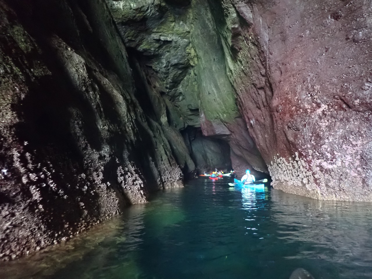
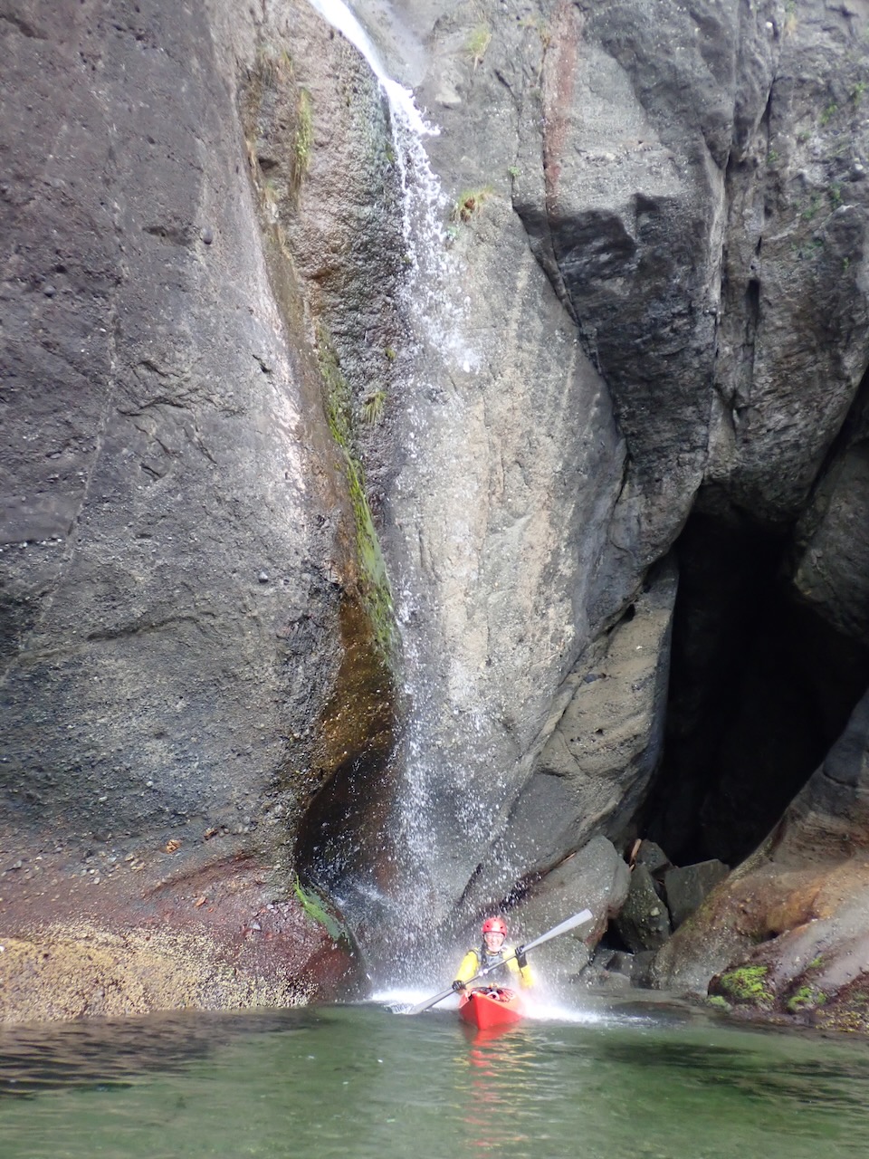
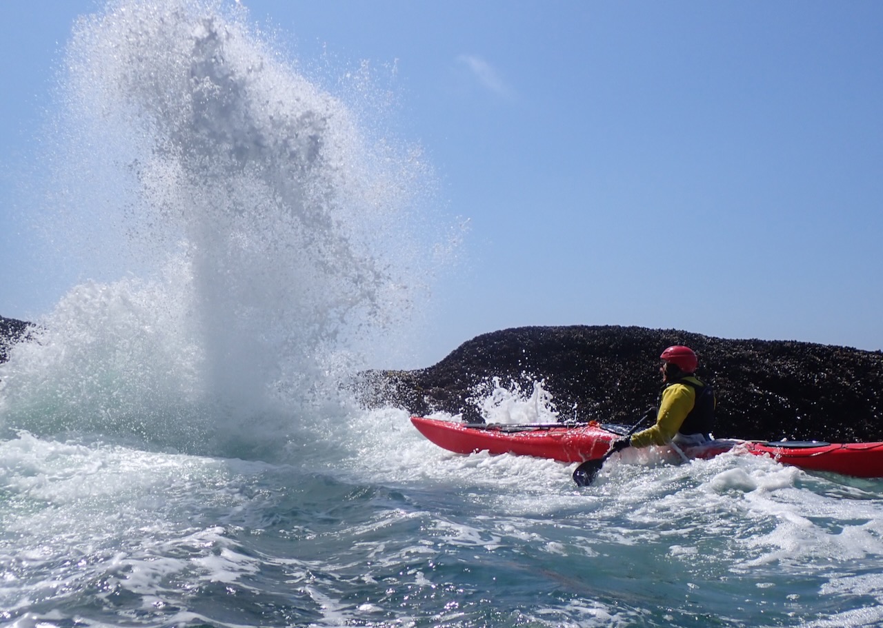
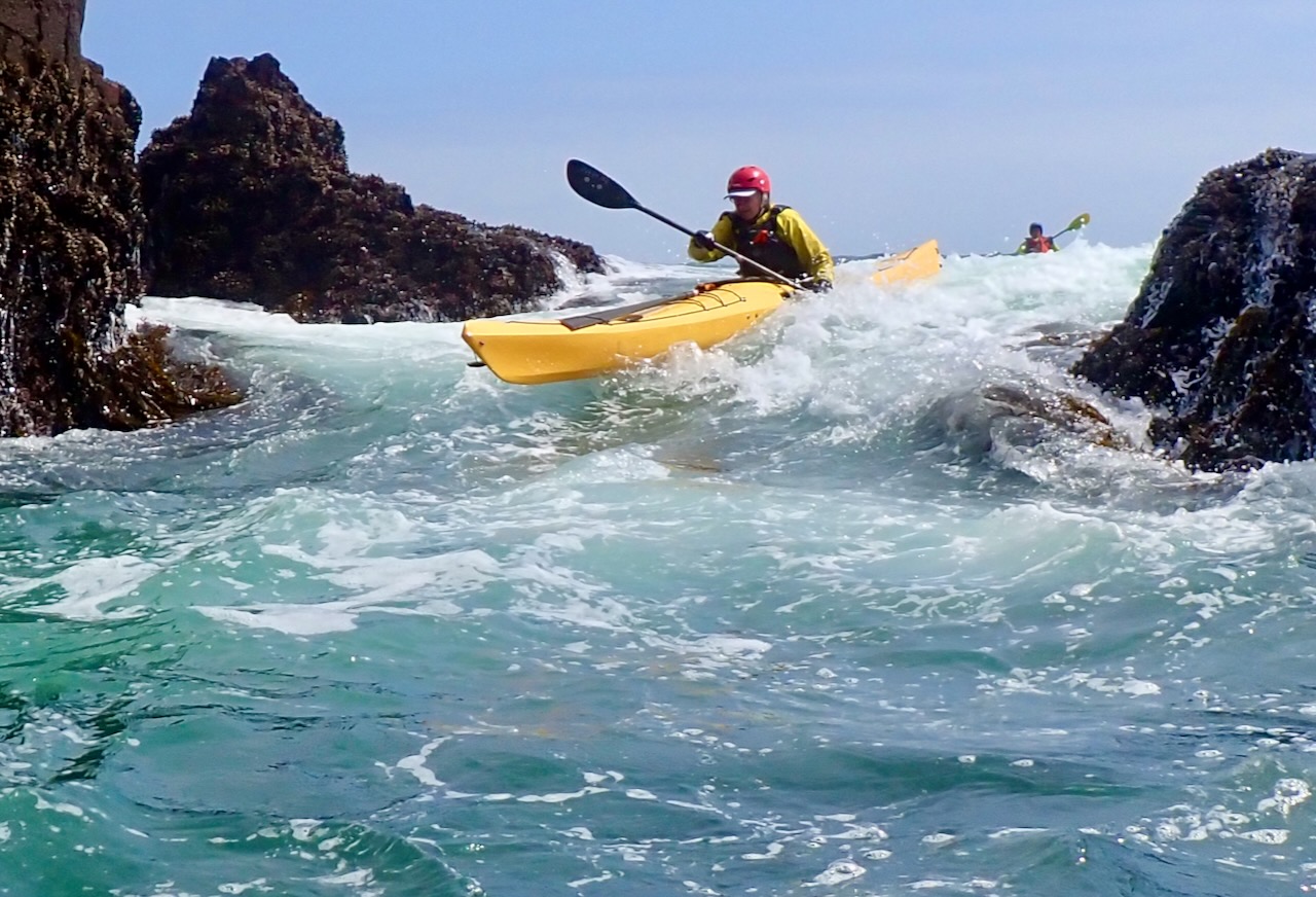
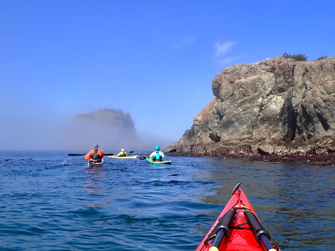
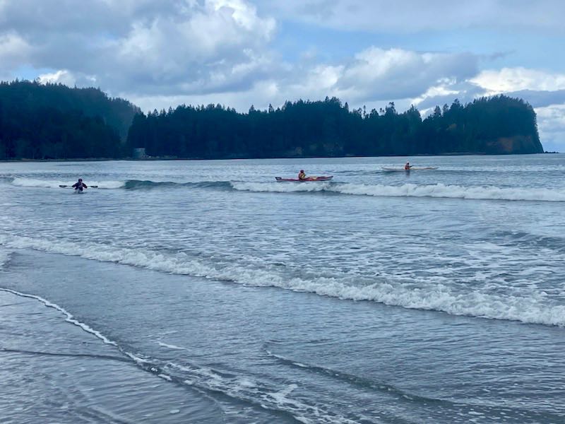
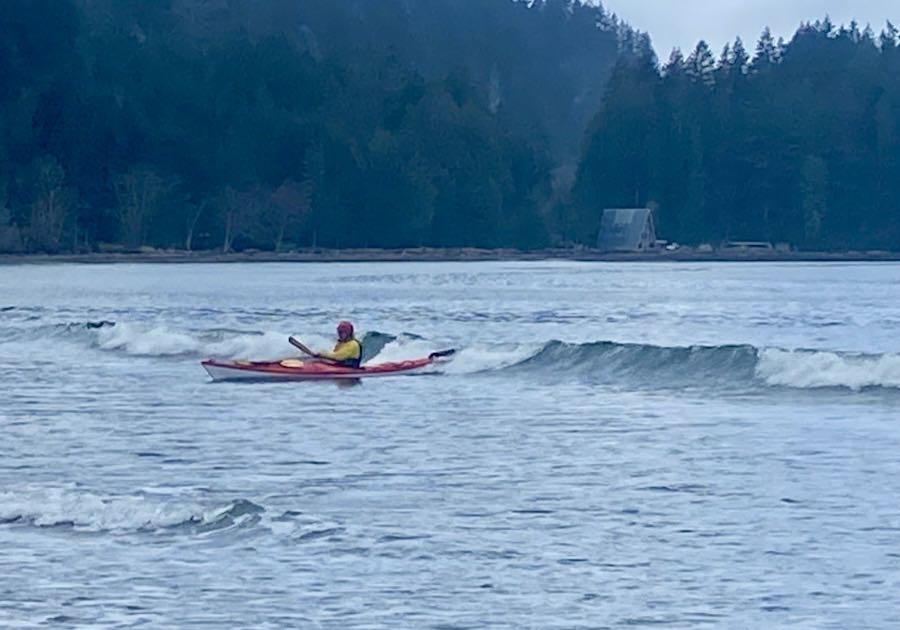
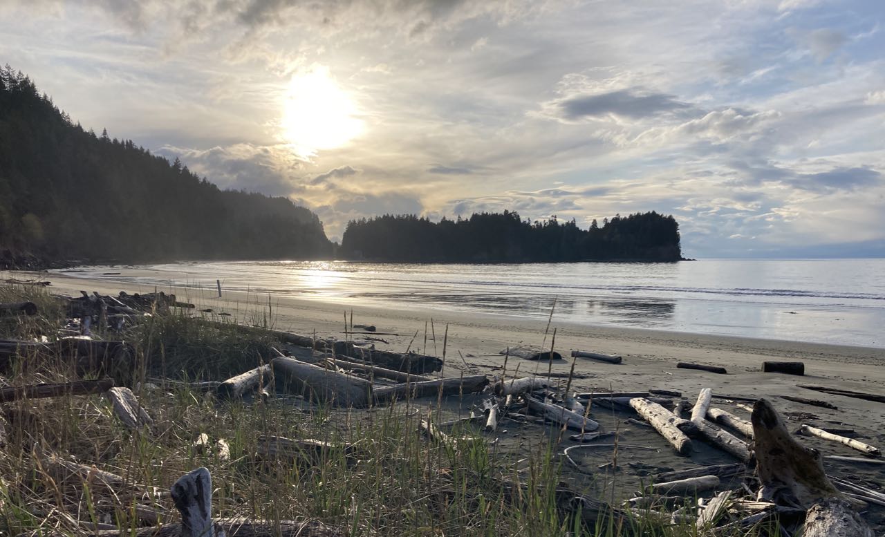
This was a week long coastal class through Body Boat Blade and was a blast – highly recommended. Our last day we had glass calm conditions which is bad for rock gardening, but was fantastic for exploring the caves at Cape Flattery.
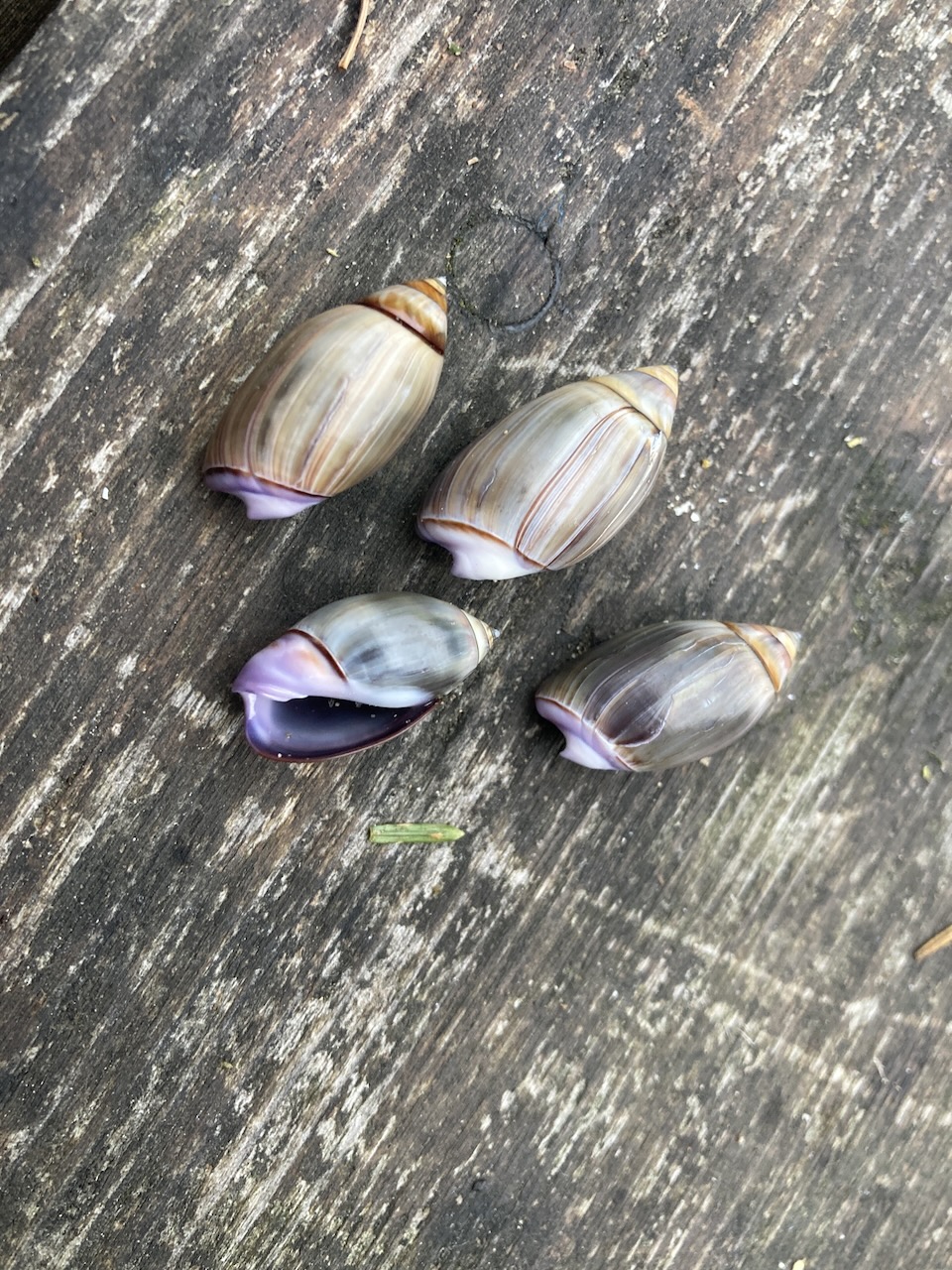
Some shots from Hobuck Beach Resort, Cape Flattery (from the land side), and the shells that the Makah use (we did not remove any from the location)
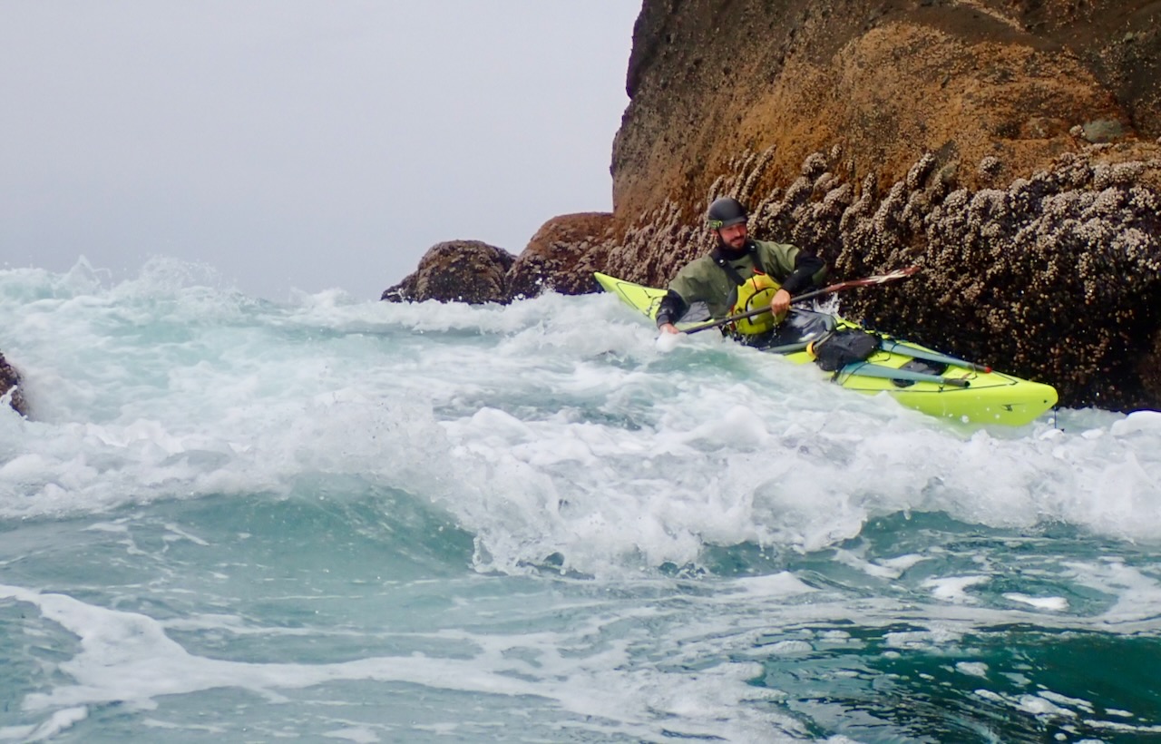
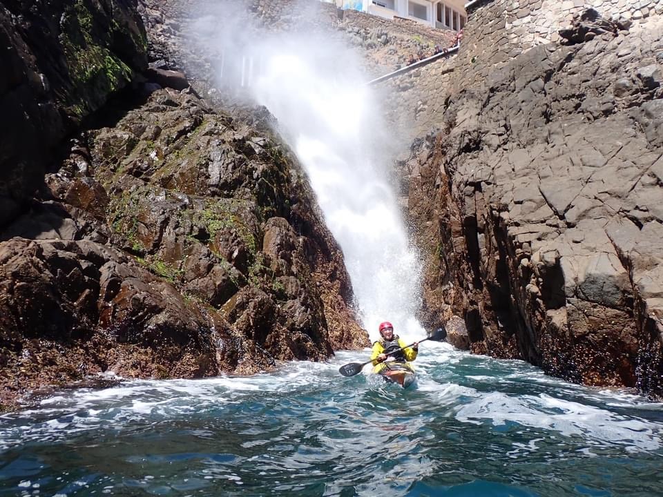
Alex La Londe showing how it’s done. The caves at Cape Flattery, and Bill Vonnegut once again making me look like a badass through photography.
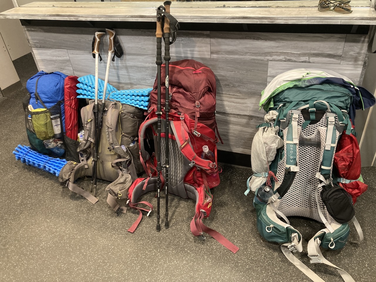
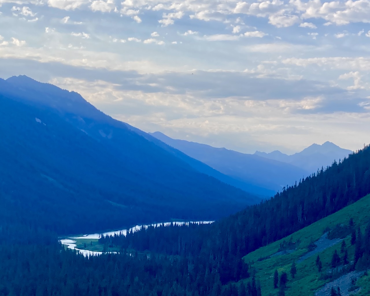
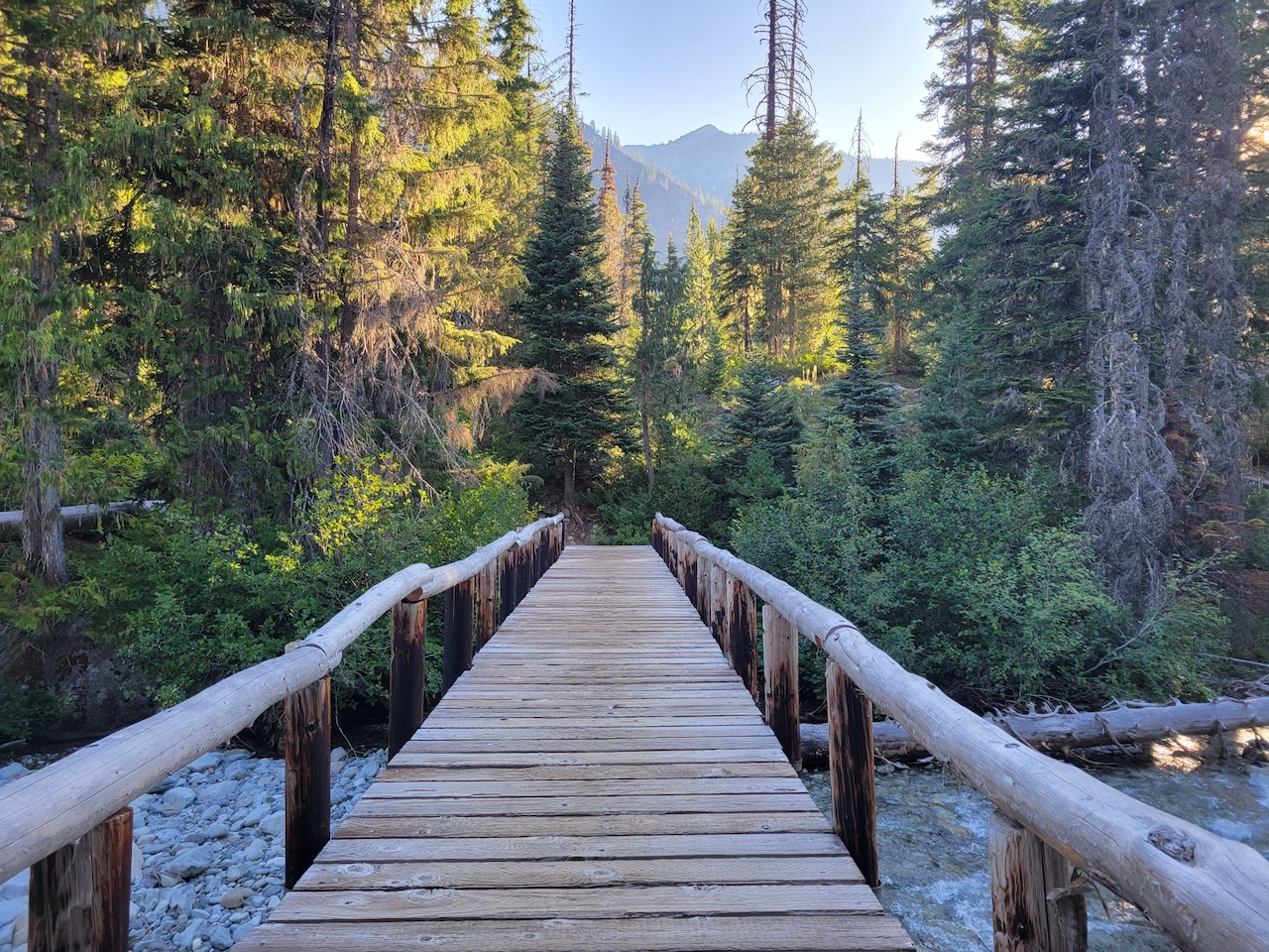
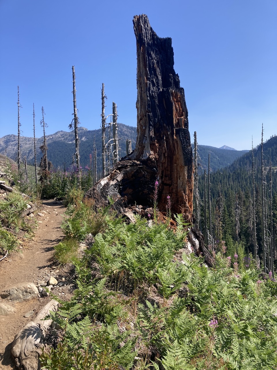
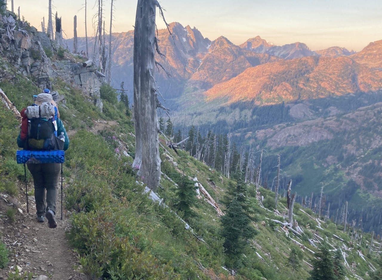
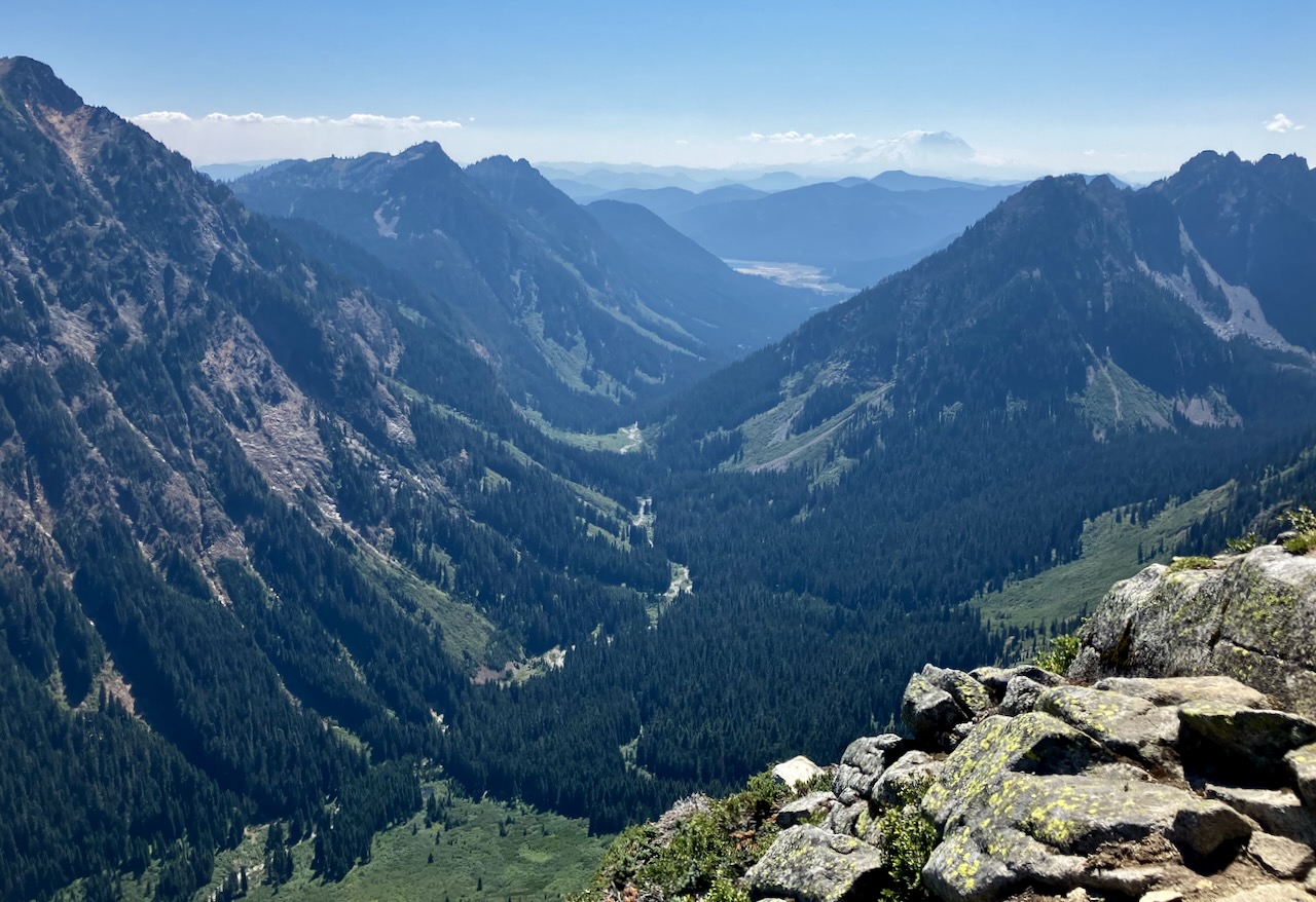
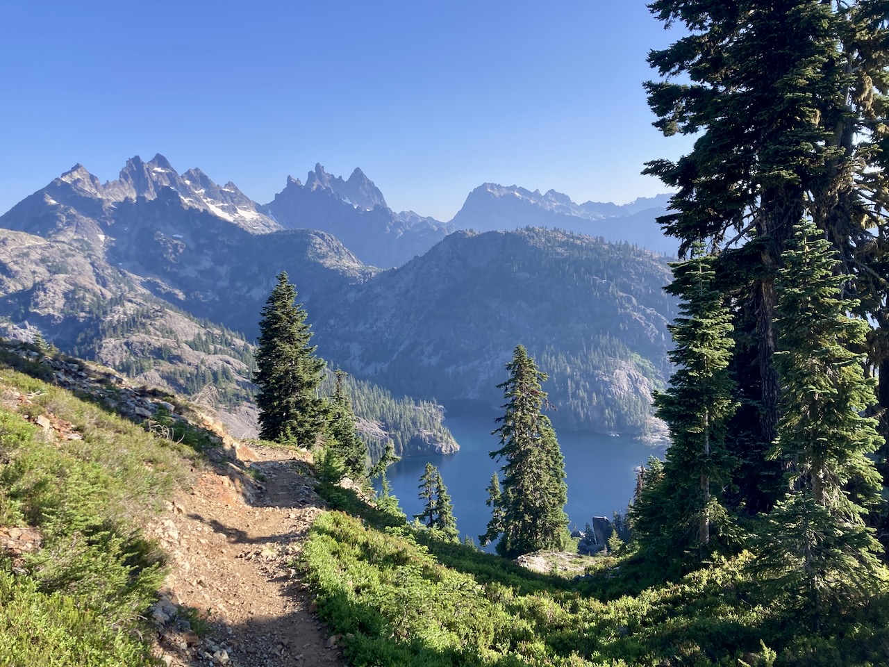
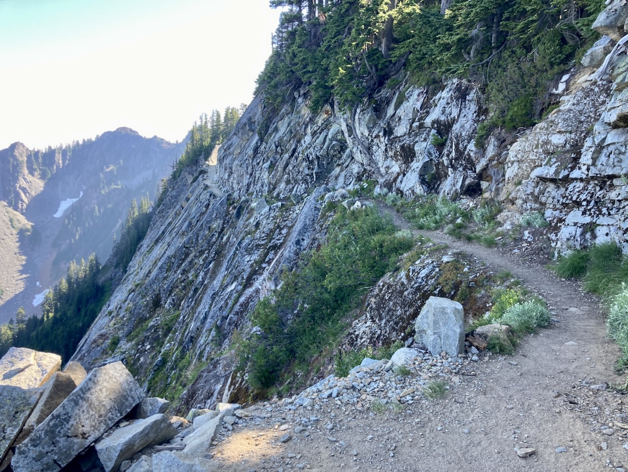
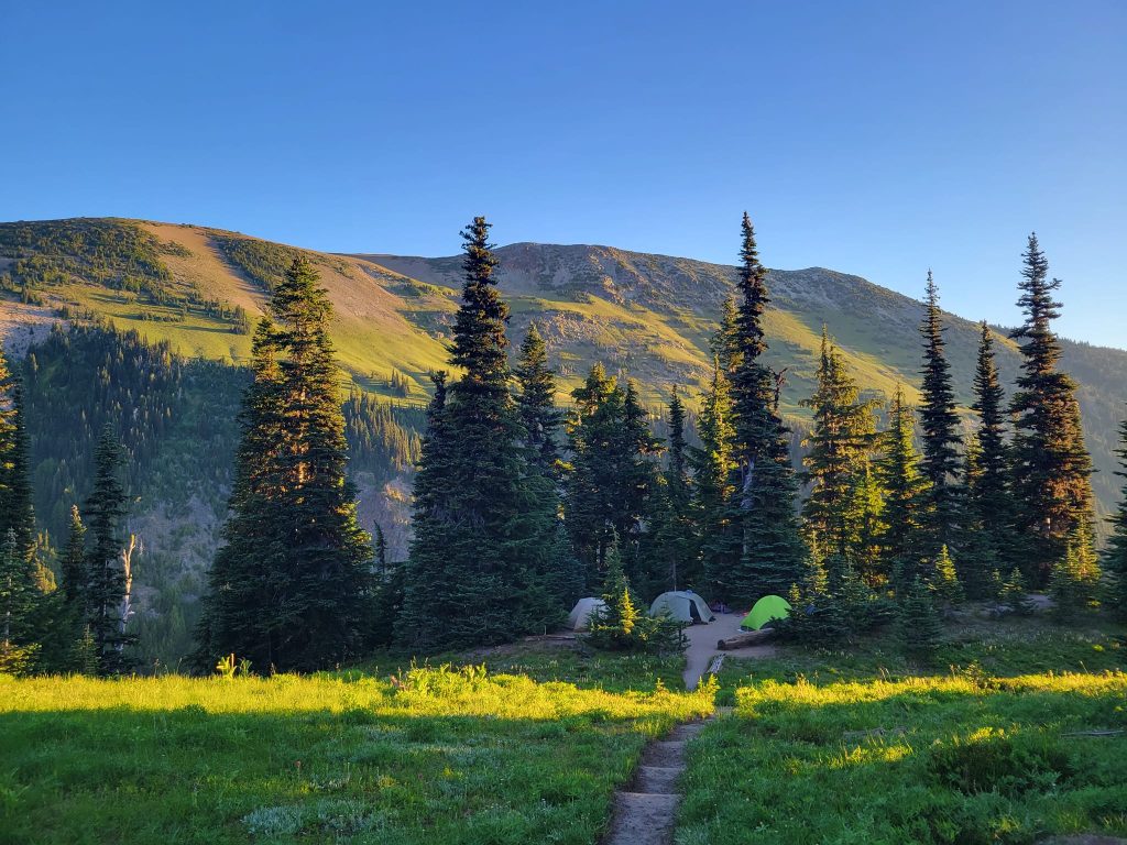
We did this 72 mile section the first week in August, picking a pretty easy pace except for the last day when we decided to push through, exit a day early and did 18 miles: a personal record for me. We headed southbound, starting at Stevens Pass and ending at Snoqualmie.
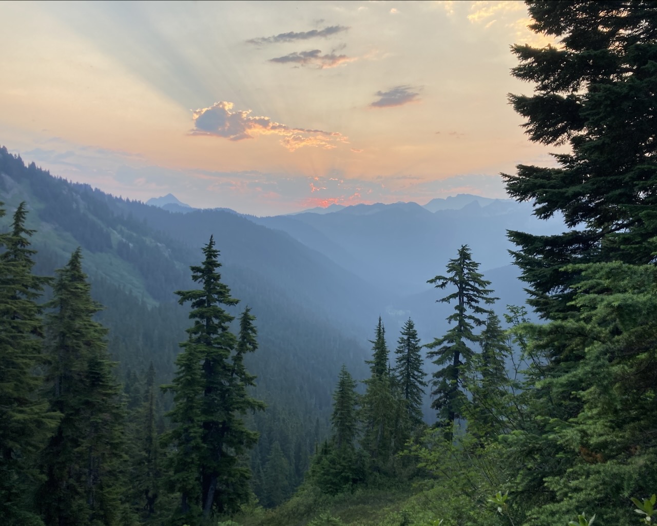
When we started out there was some concern about fires – we could see heavy smoke and had heard some reports so we made sure we had a few exit options if the smoke became more than I could handle. But as soon as we crossed over the first pass at Stevens it began to clear.
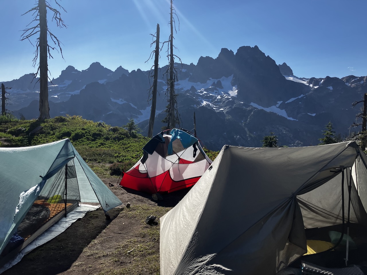
This was my second longest hiking trip (after my 10 day hike of the Wonderland Trail) and the most days worth of food I’ve ever carried – on the Wonderland we arranged for a resupply every 3-4 day. For this one we started with 7+ days of food, no resupply, and my starting weight was 34lbs.
I bought myself a new tent just for this – a durston. Which is single wall tent that uses your trekking poles in place of its own poles – it weighs only 17oz compared to my 2-man REI quarter dome, which comes in at about 3lbs.
PCT J Section Day 1J section PCT South Day 2PCT J South Day 3PCT J South Day 3Cell service!
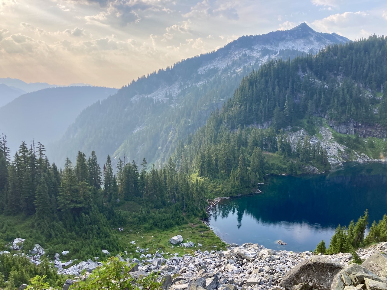
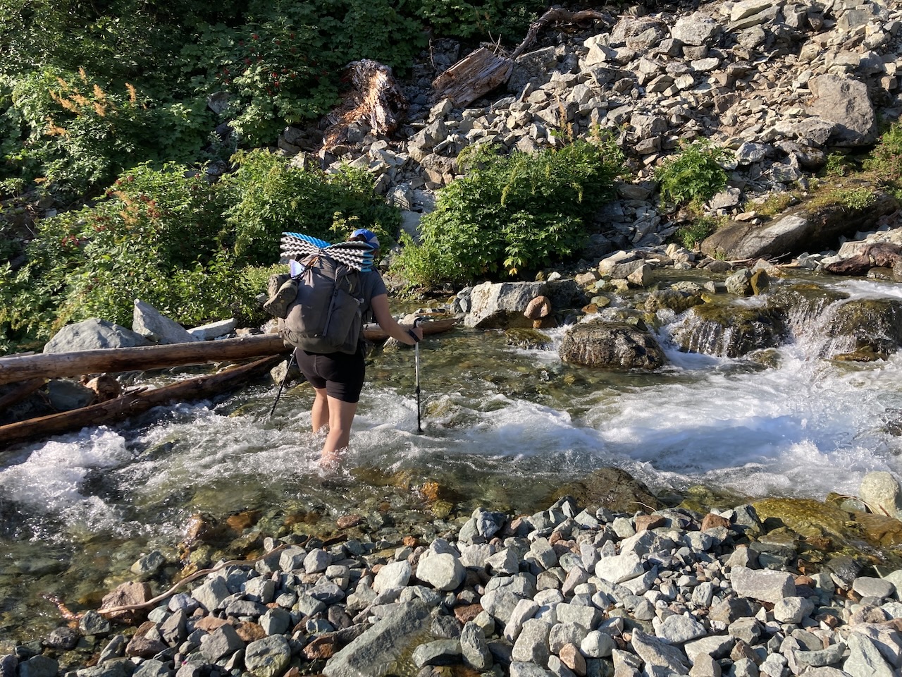
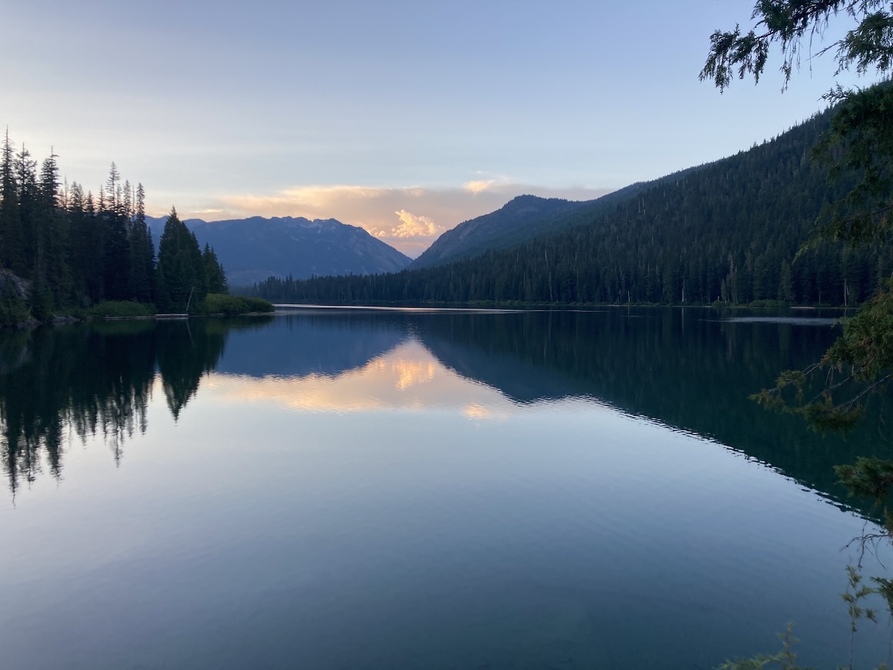
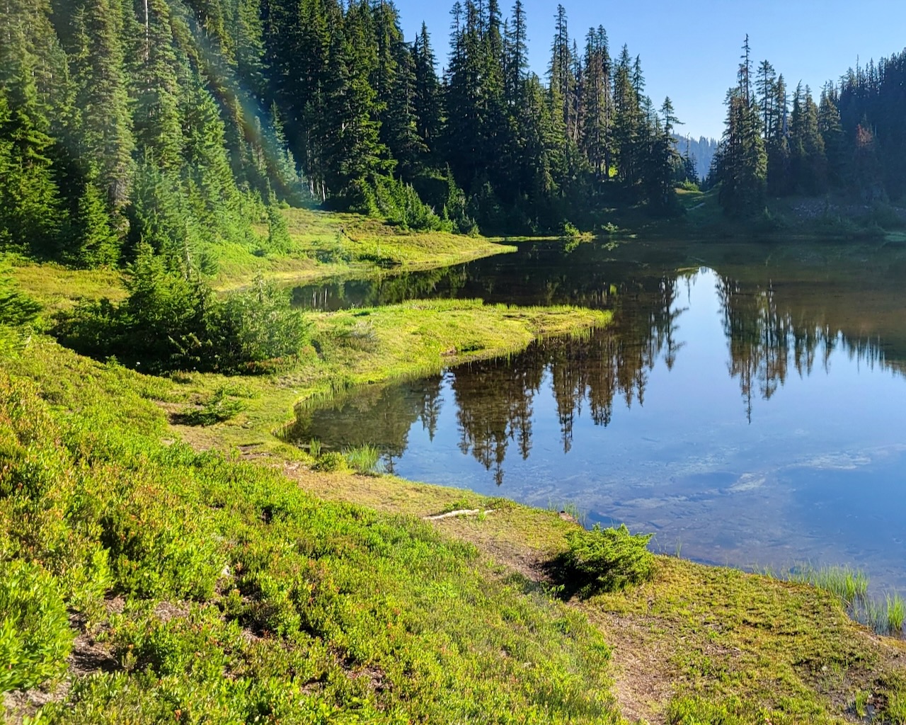
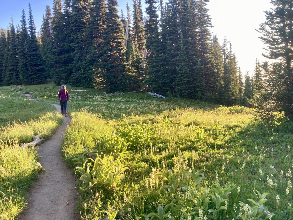
Highlights: swimming in alpine lakes many times when it was hot. Snacking on huckleberries for miles and miles. Finding out that the scary water crossing we were warned about was easy. The Kendall Katwalk was not as scary as I worried but the section north of it was.
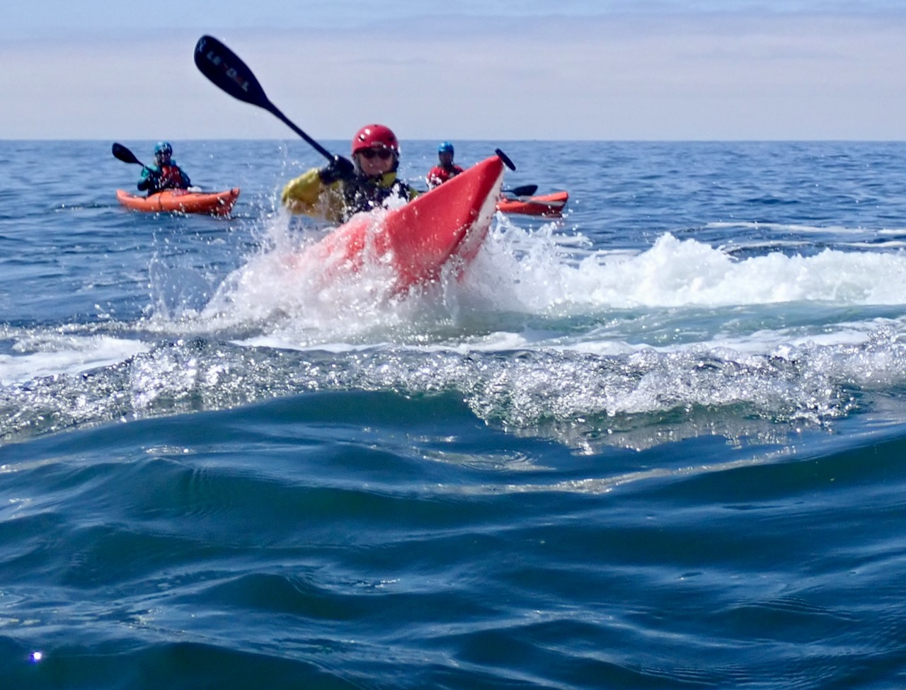
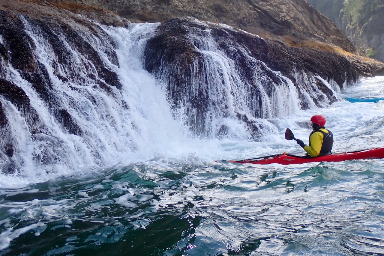
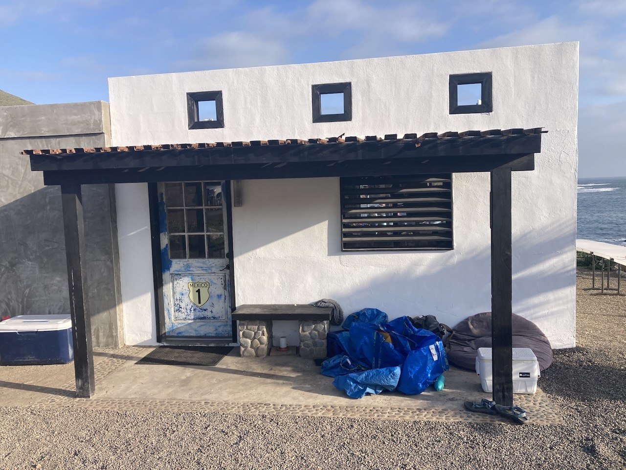
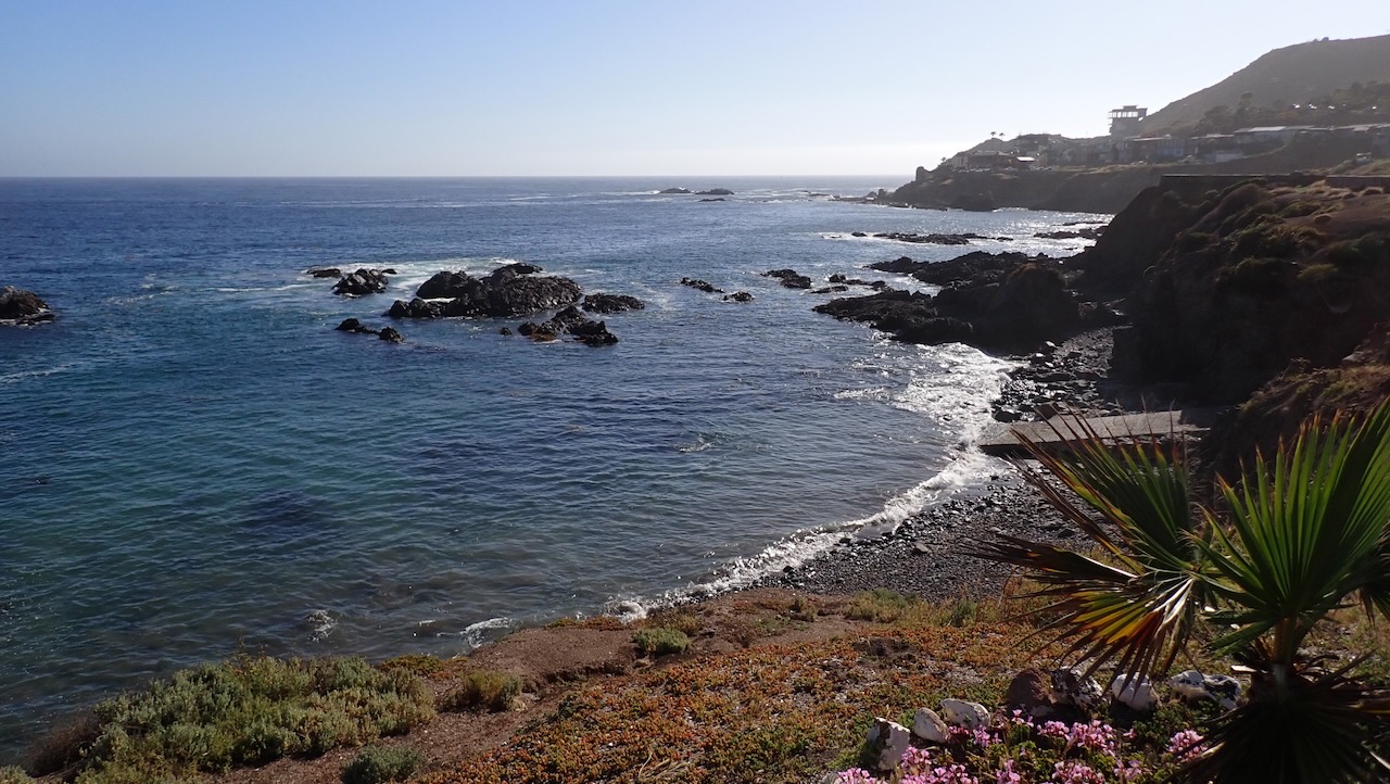
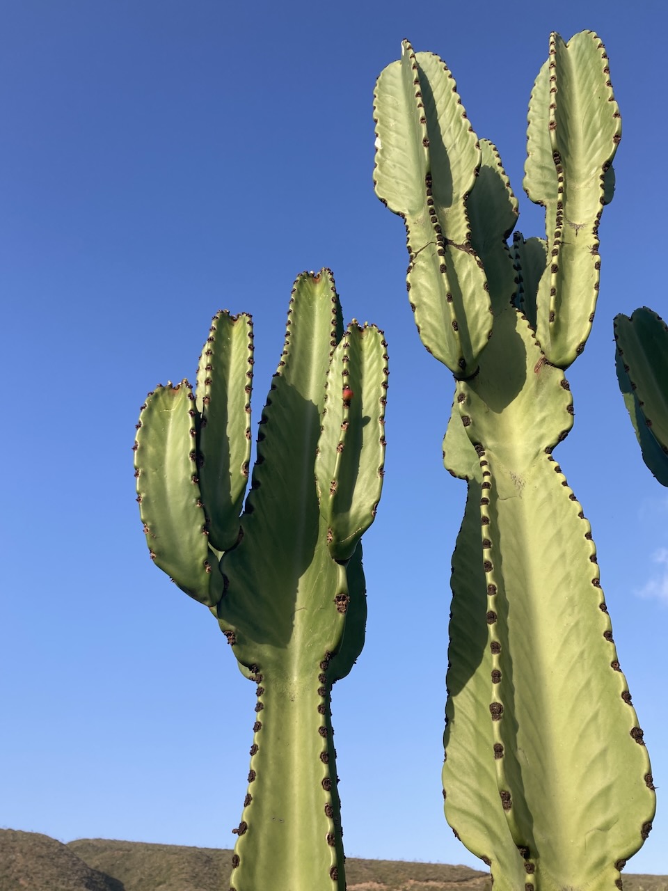
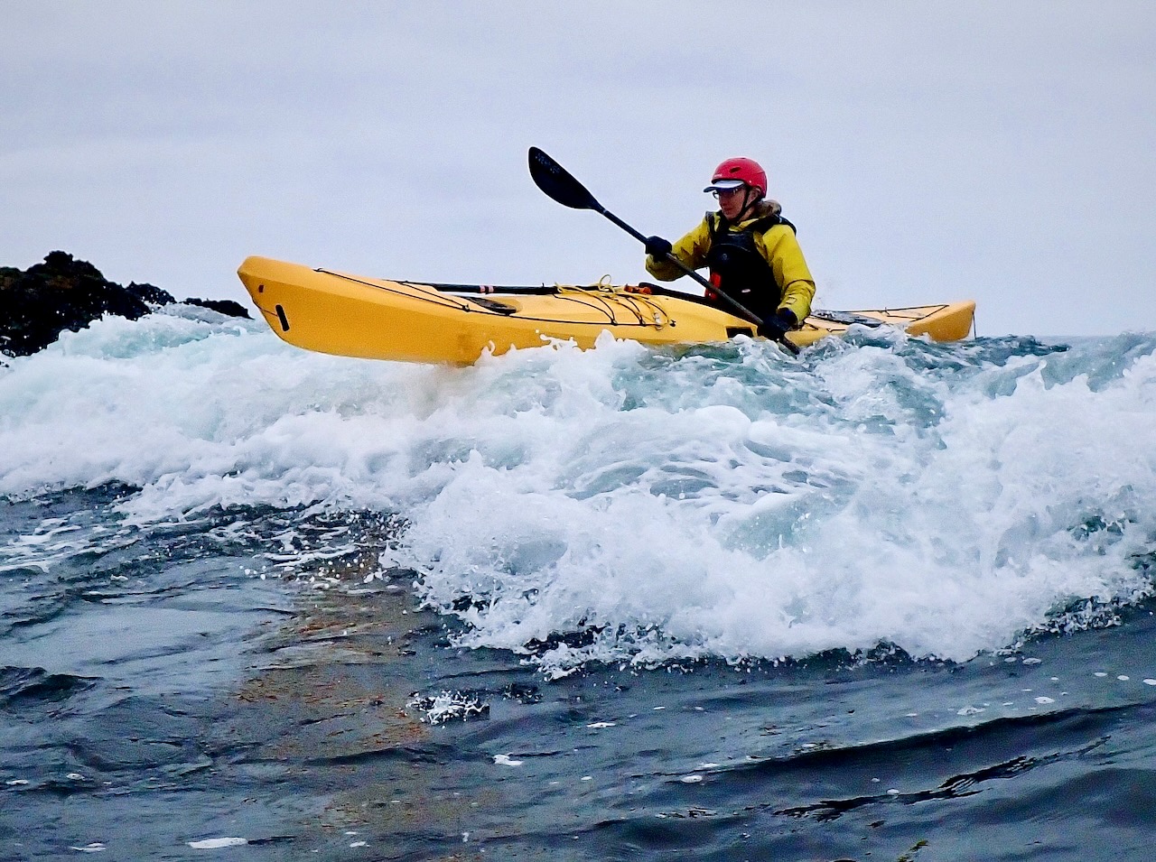
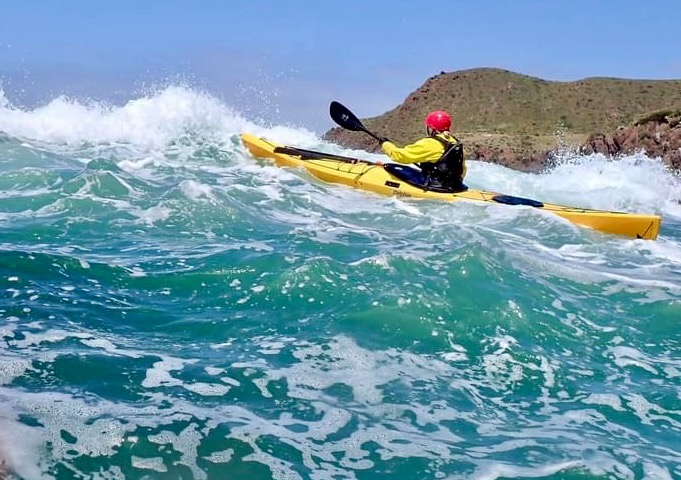
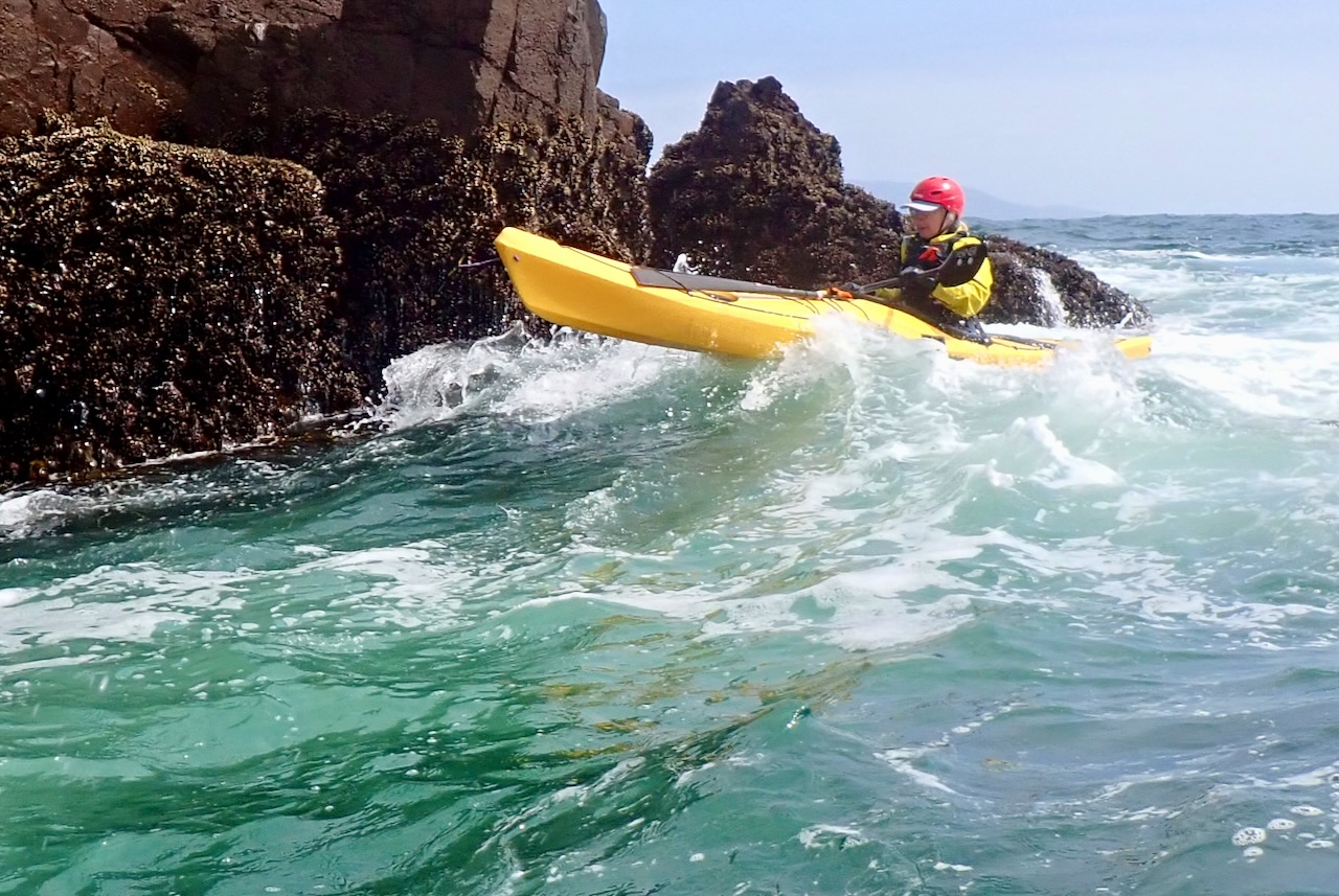
May 2024 my art class was interrupted by fun things! Went kayaking with Bill Vonnegut for a week in Baja Mexico. He’s down there for 5 weeks or so in the spring but this week long session was advertised as being ‘Lite’ & for people who weren’t confident enough for the full experience.
The joke was on us because once we were there we were told that conditions our week were bigger than they’d been all year and we were doing all the same things. This has redefined my thoughts about what ‘big’ conditions look like.
We stayed at a little cabin owned by Victor Leon – either inside the cabin or camping outside. I did both because I started camping but on day 2 my air mattress deflated and I moved inside. As you might expect in Baja, it was sunny and warm and we were right on the ocean.
All photos of me below are by Bill Vonnegut. Bill has a knack for making your run look really epic.
Bill also took this video of me at the “elevator”. It took me about 20 minutes of watching the waves and others before I was willing to get this close to it. By the end I was ready to get closer.
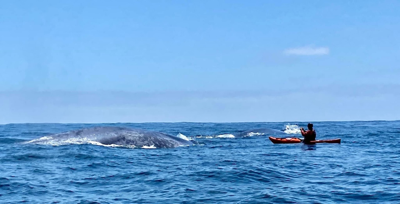
When we first drove up there were blue whales spouting just offshore. They stayed in the area for about 4 days and we were able to get quite close to them once. Photo by Victor Leon. I’ve been close to Orcas before but the idea that a living creature can be this large is just amazing.
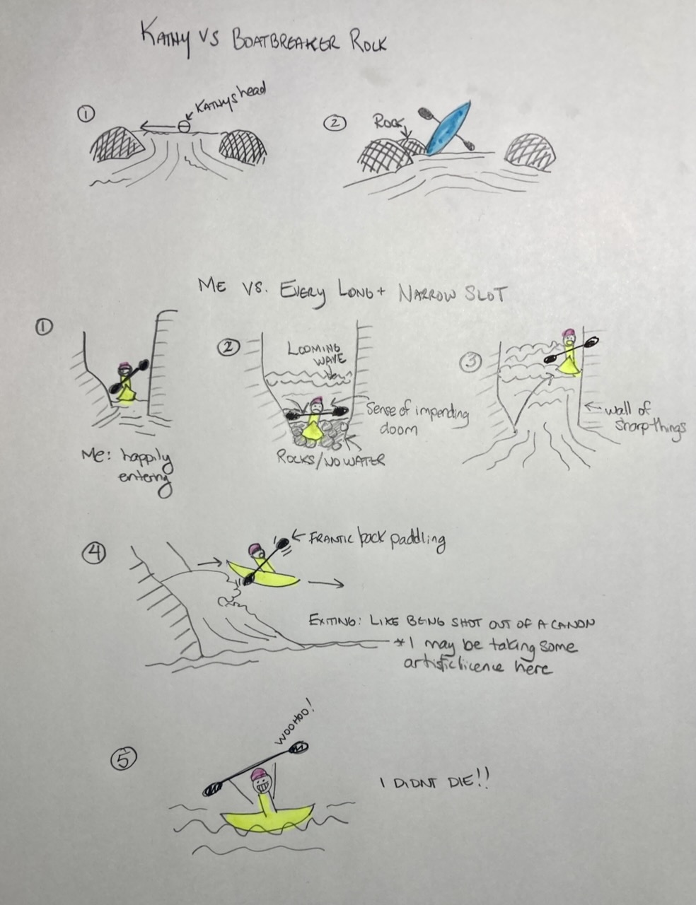
There was no video of my best ‘near miss’ so I created this helpful cartoon to illustrate it. (Bonus cartoon of what it looked like when Kathy got surfed into a rock)
Summary: this was an amazing trip where I feel like I really leveled up my skill. A+ Would go again. Probably not until 2026, but I very much want to go back.
The captions read: 1. Me: happily entering. 2. Looming wave + Rocks/No Water + Sense of impending doom 3. Wall of sharp things. 4. Frantic back paddling + Exiting: like being shot out of a canon * I may be taking some artistic license here. 5. Woohoo! + I didn’t die!!
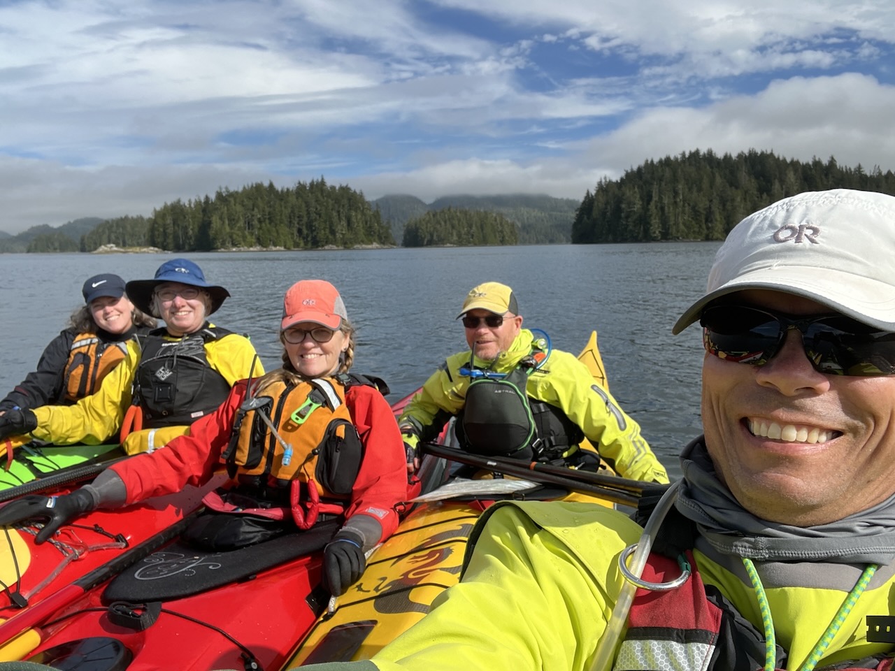
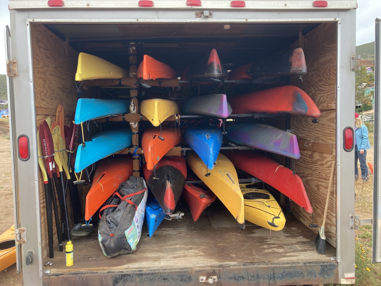
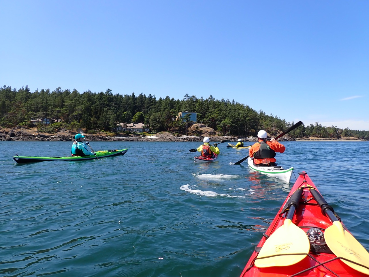
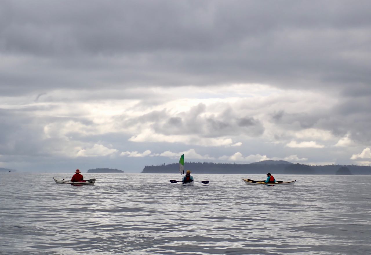
More kayaking! Over the weekend I went to a 3-day kayaking ‘jamboree’ at Deception Pass where we had instruction and spent the rest of the time learning about camping, knots, and going on multiple paddles (one of which I led)
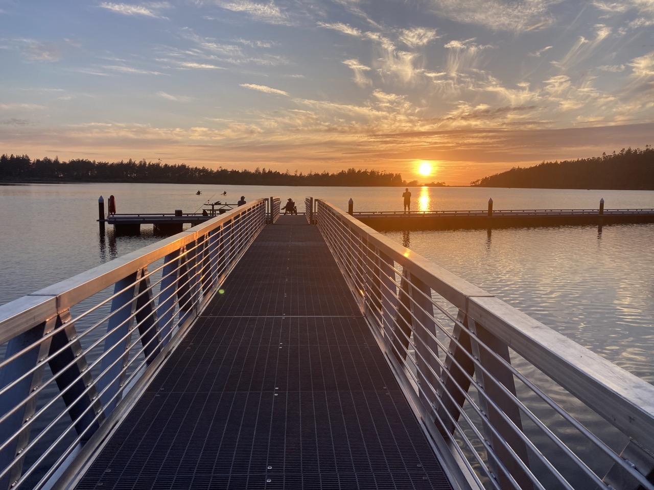
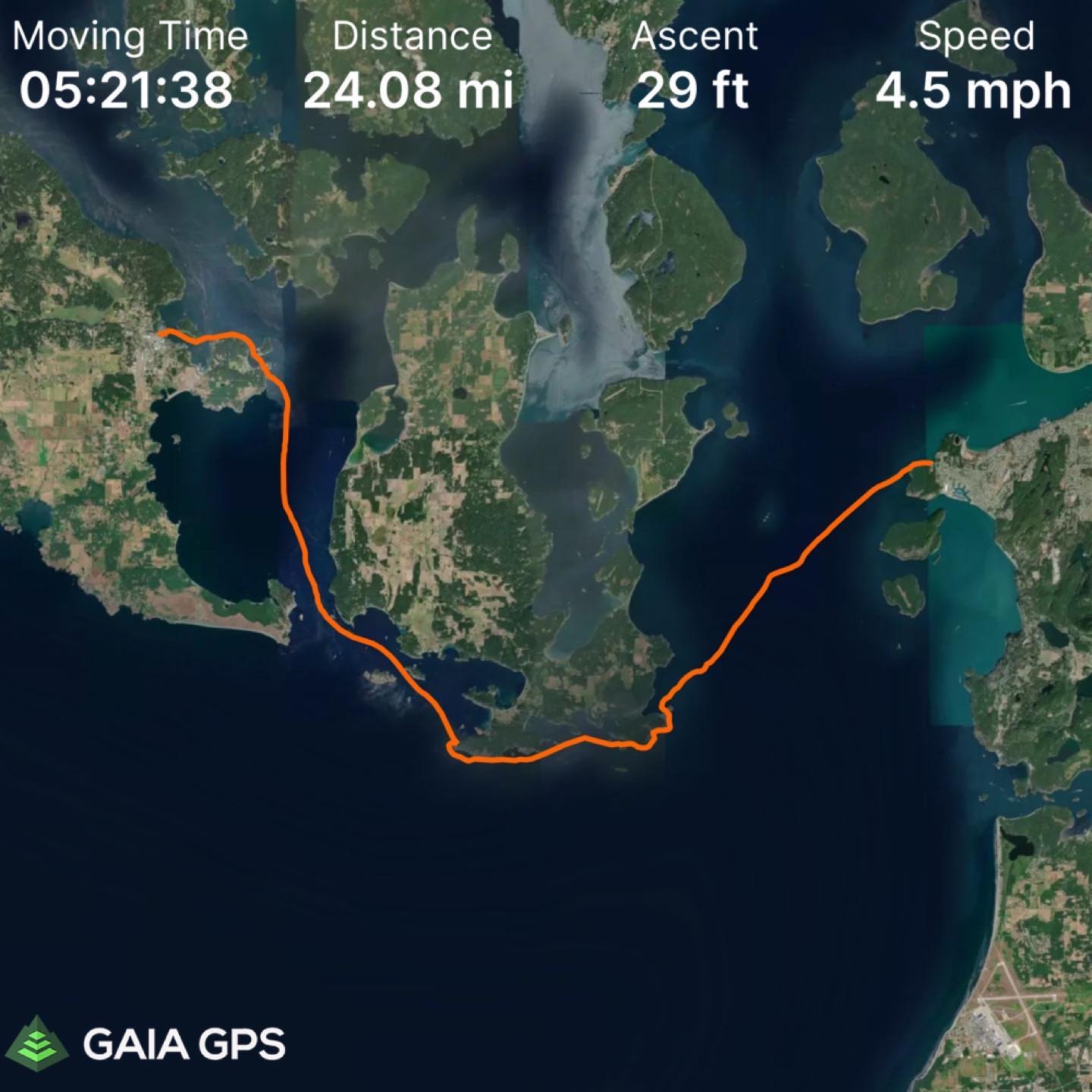
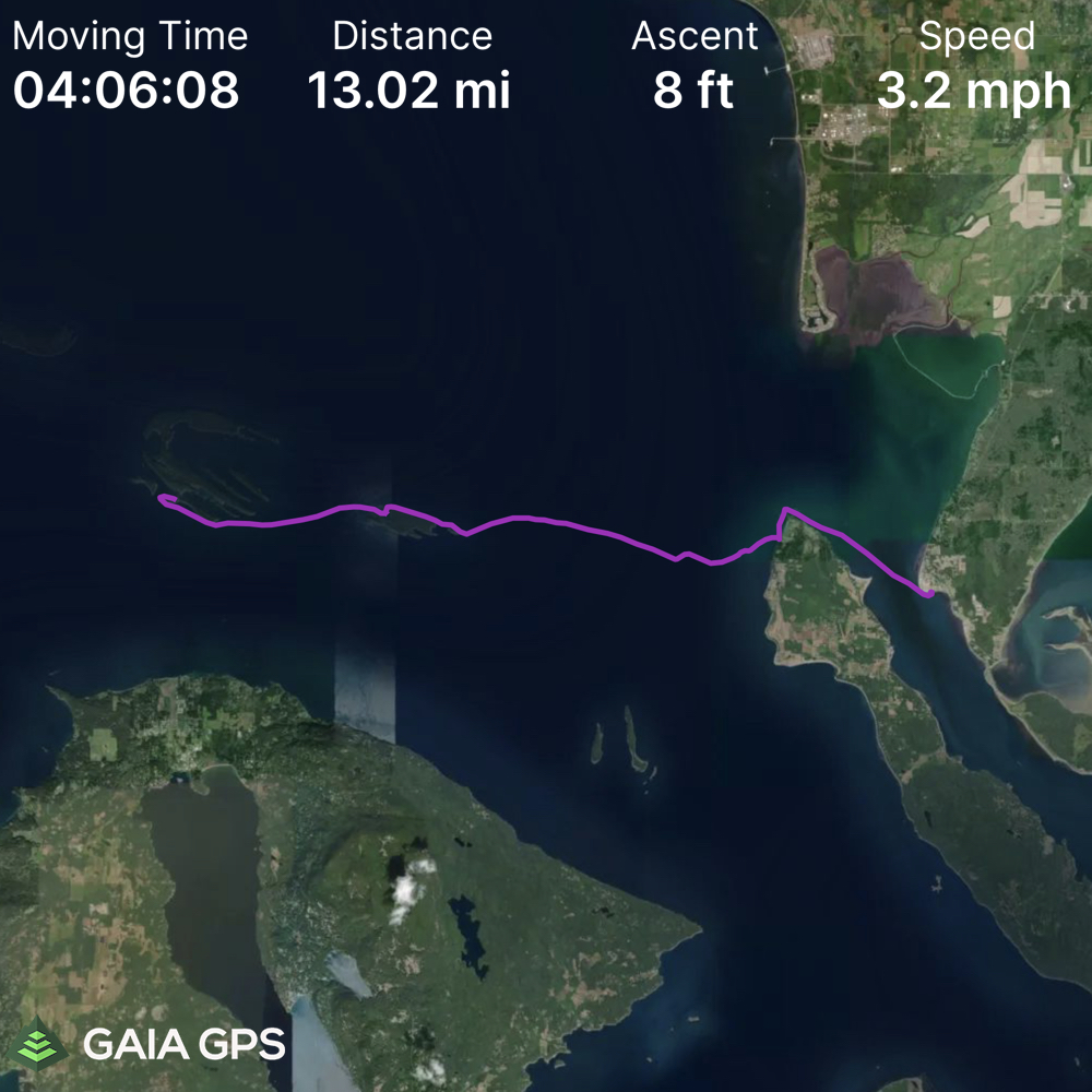
But now it’s time for the real adventure. I’ve been wanting to do this paddle since last year but I’m not ready to do it alone and it’s only scheduled so often. So here it is: Washington Park in Anacortes to Friday Harbor on San Juan Island going south around the tip of Lopez Island. It’s 24 miles and goes through Cattle Pass which can get ‘spicy’.
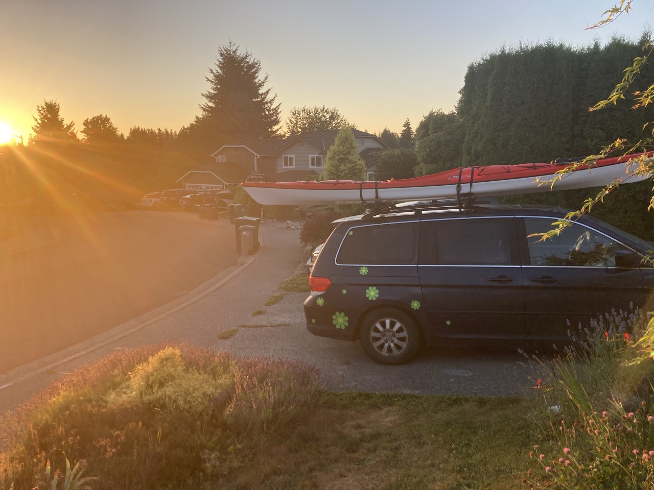
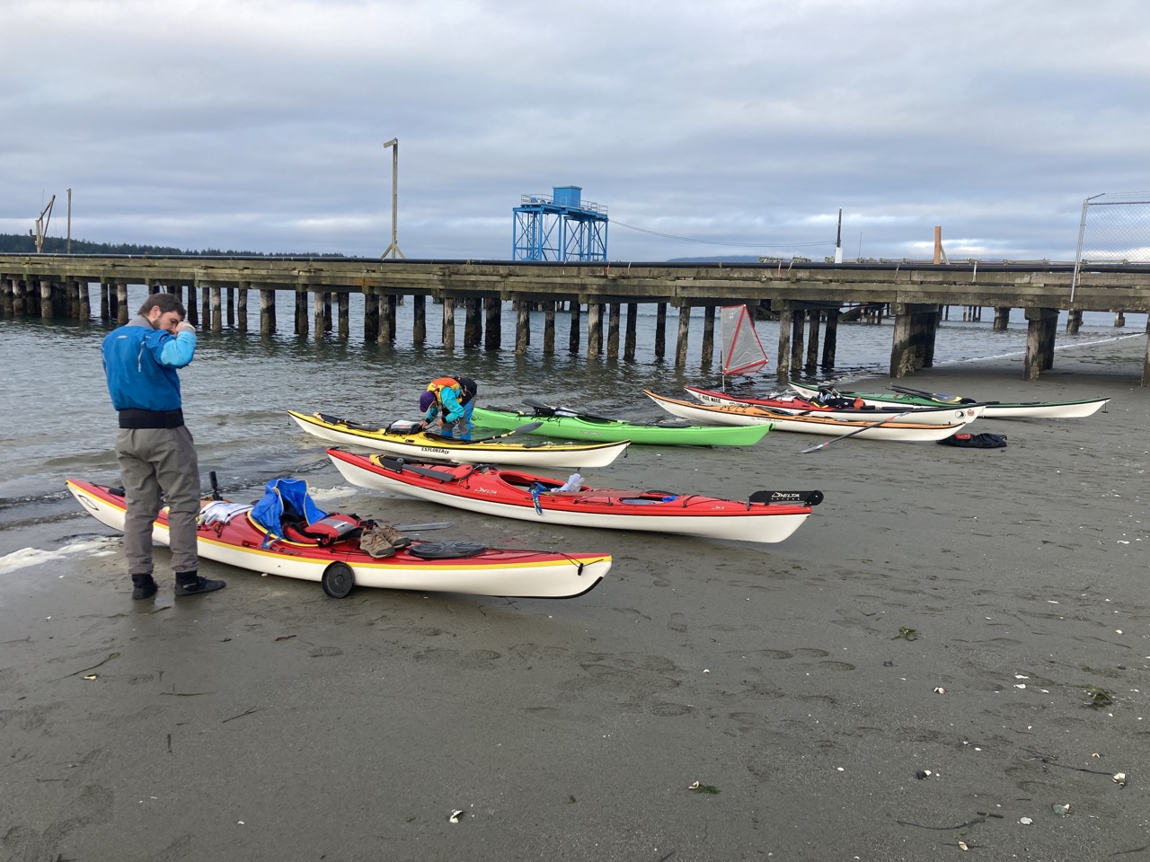
Of course an early start is necessary. Here’s my adventure-van.
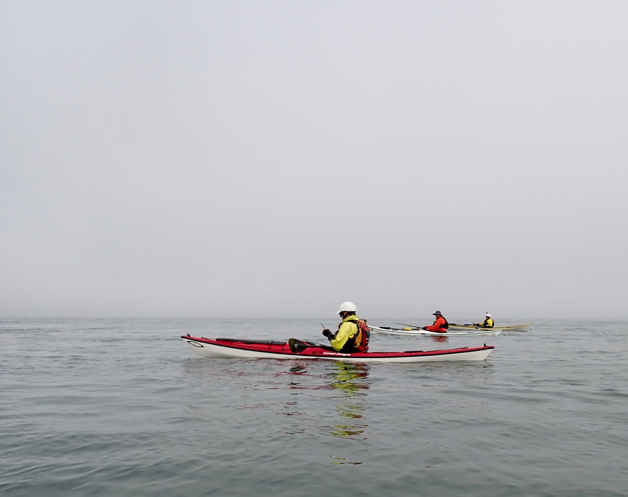
This was unexpected (to me) given how clear it was on the drive over, but on the water there was heavy fog. We thought the sun might burn it off quickly but no – we made the whole crossing in heavy fog. With a strong south current pulling us if we’d been navigating entirely without GPS there was a chance we might have missed Lopez island entire. Here our trip leader is calling Seattle Marine Traffic on the radio to confirm there are no large ships before we cross the shipping lane.
The fog broke just before lunch at Iceberg point on the south end of Lopez and then we quickly got into Cattle Pass before it reached max flood (which was about 6 knots). Even though we went through early we still reached a max speed of 10.5mph at one point. It felt like it took no time at all to reach Turn Island.
No photos of the excitement of Cattle Pass (a relatively calm day, I’m told) because I was busy not falling out of my boat.
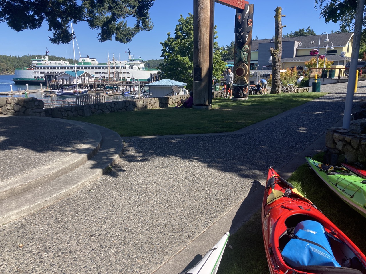
Friday Harbor! I always feel very fancy when I get to arrive at dock, climb out and go get food. Which is what we did! We left our kayaks in front of the ferry terminal and went across the street for an early dinner. We landed at 3pm but wound up having to wait for the 6:30pm ferry, which was then late. But Friday Harbor is always enjoyable so we walked around and spoke to the caretaker at their community garden.
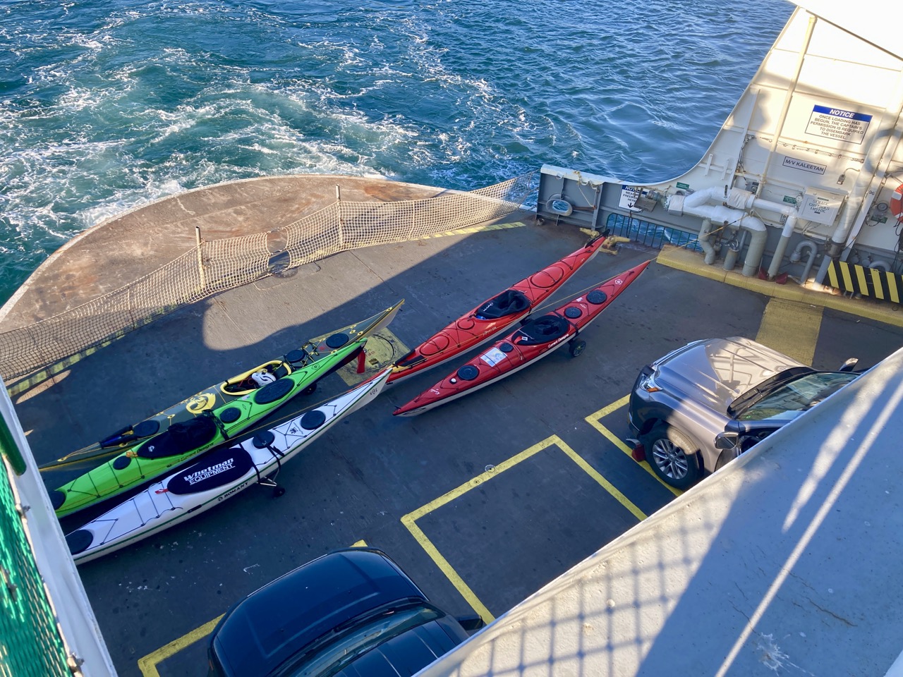
Finally on the ferry heading home with all our boats loaded in the front. We brought wheels to roll on and returned to our cars back in Anacortes.
Here’s the summary: 24 miles, just over 5 hours moving time and an average of 4.5 mph. I’d do it again, and I’m feeling less intimidated by Cattle Pass (even though I know we got it on an easy day and nobody was sucked into a whirlpool).
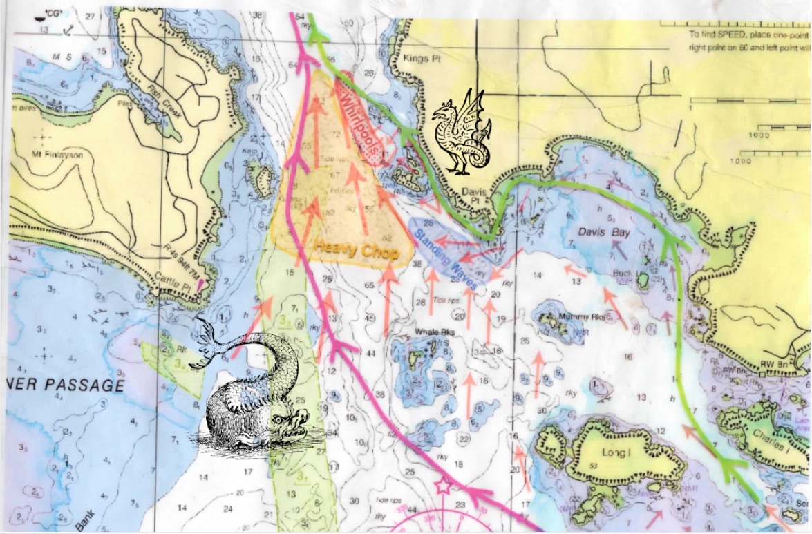
A quick edit – I thought I should include this planning map we made to outline the potential hazards in Cattle Pass. See if you can spot my special additions!
I had to cancel a trip I was leading earlier in the month but was invited along on this little 3 day as a make-up paddle. The trip was planned to Sucia which I was excited about because my only previous trip to Sucia had to be cut short due to weather.
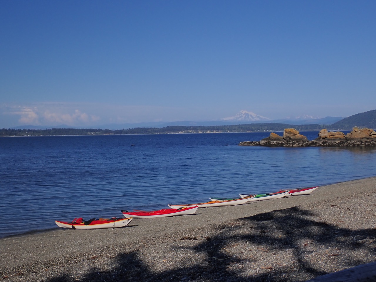
We launched from the small beach area next to the Lummi island ferry. Total of 8 paddlers and we knew we might need to change plans due to some predicted high winds. The original plan was Day 1 Sucia, Day 2 Patos, Day 3 return. Instead we did Day 1 Sucia, Day 2 Clark, and Day 3 return. Moving to Clark placed us much farther south so the wind would blow us in the correct direction on day 3.
Day 1Day 2Day 3
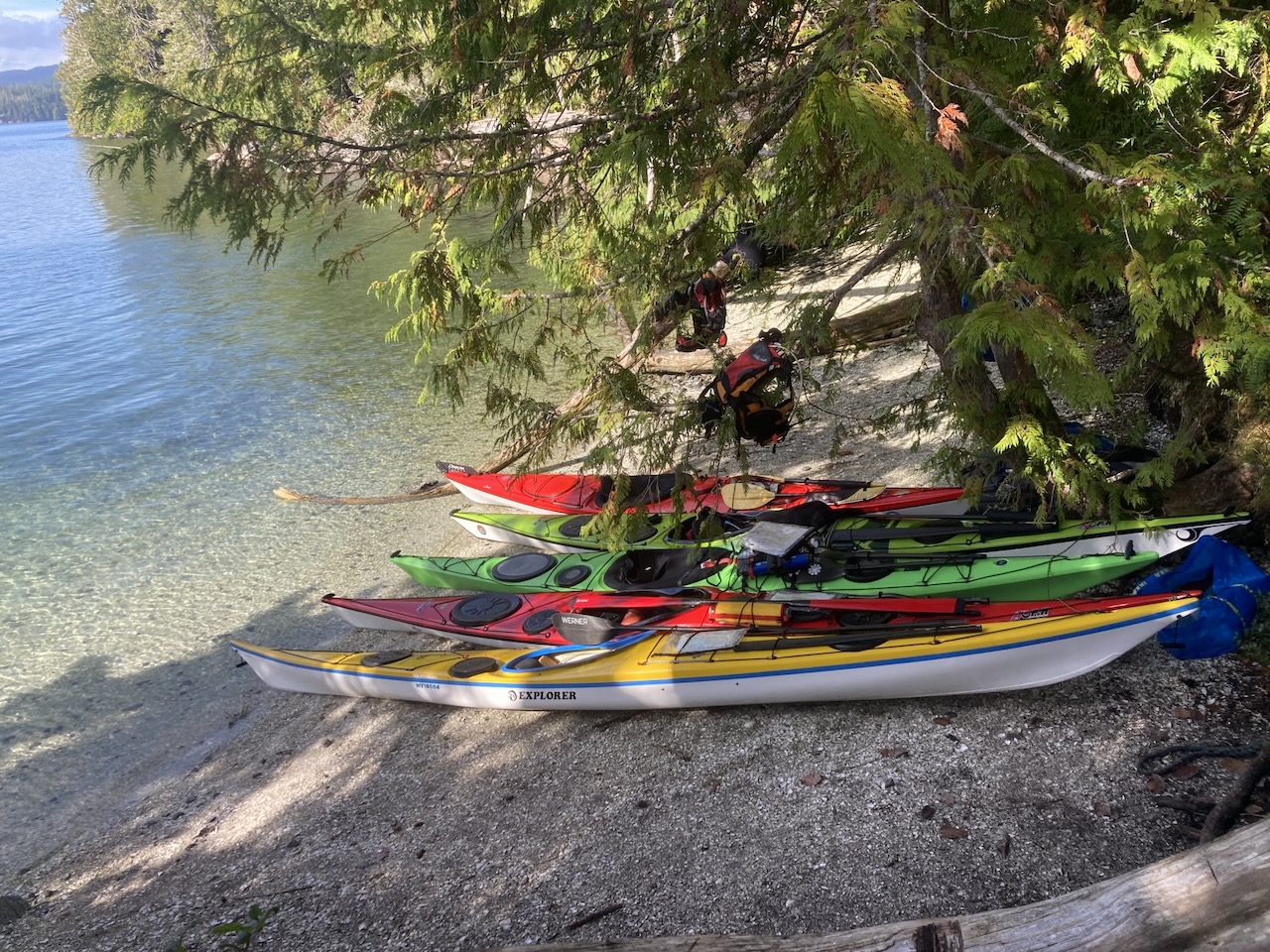
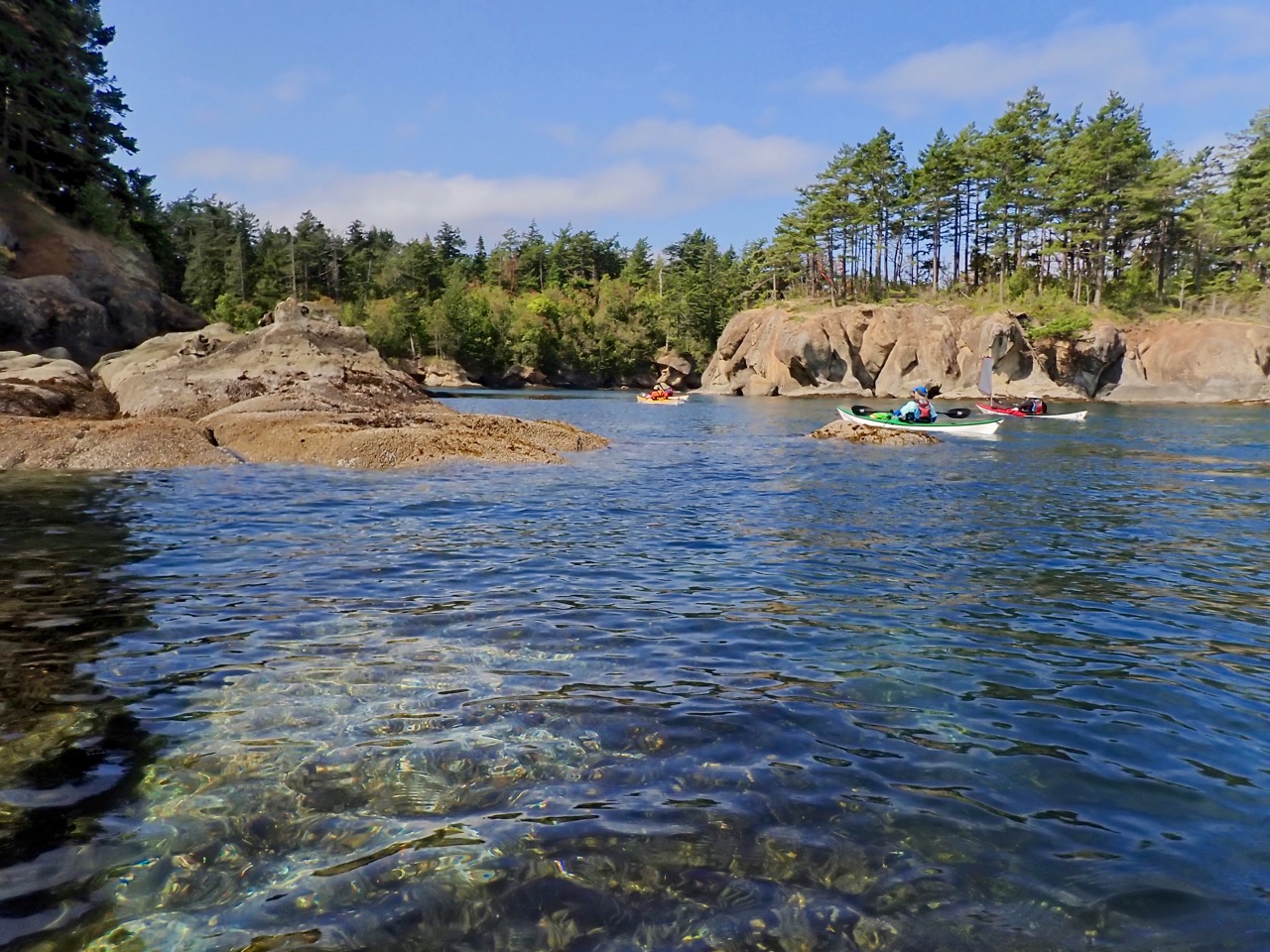
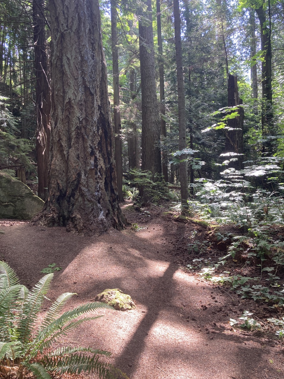
On our way we stopped at Matia Island and despite a lot of discussion on the topic I’m still not sure how to pronounce it. It had a beautiful forest loop, a large boat dock, and limited forested camping.
The loop trail on Matia
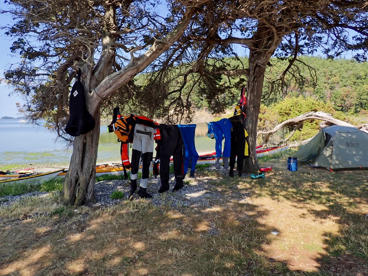
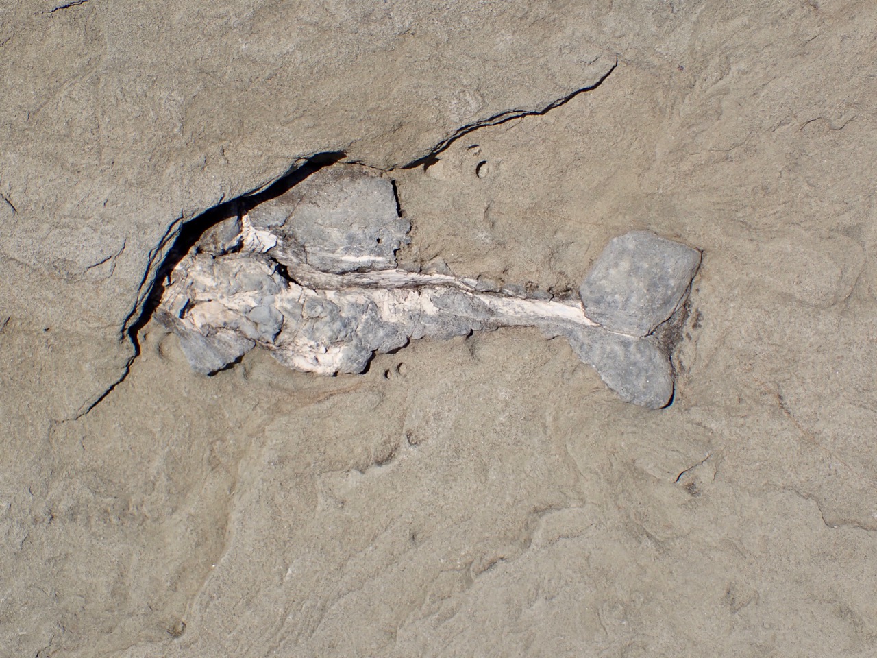
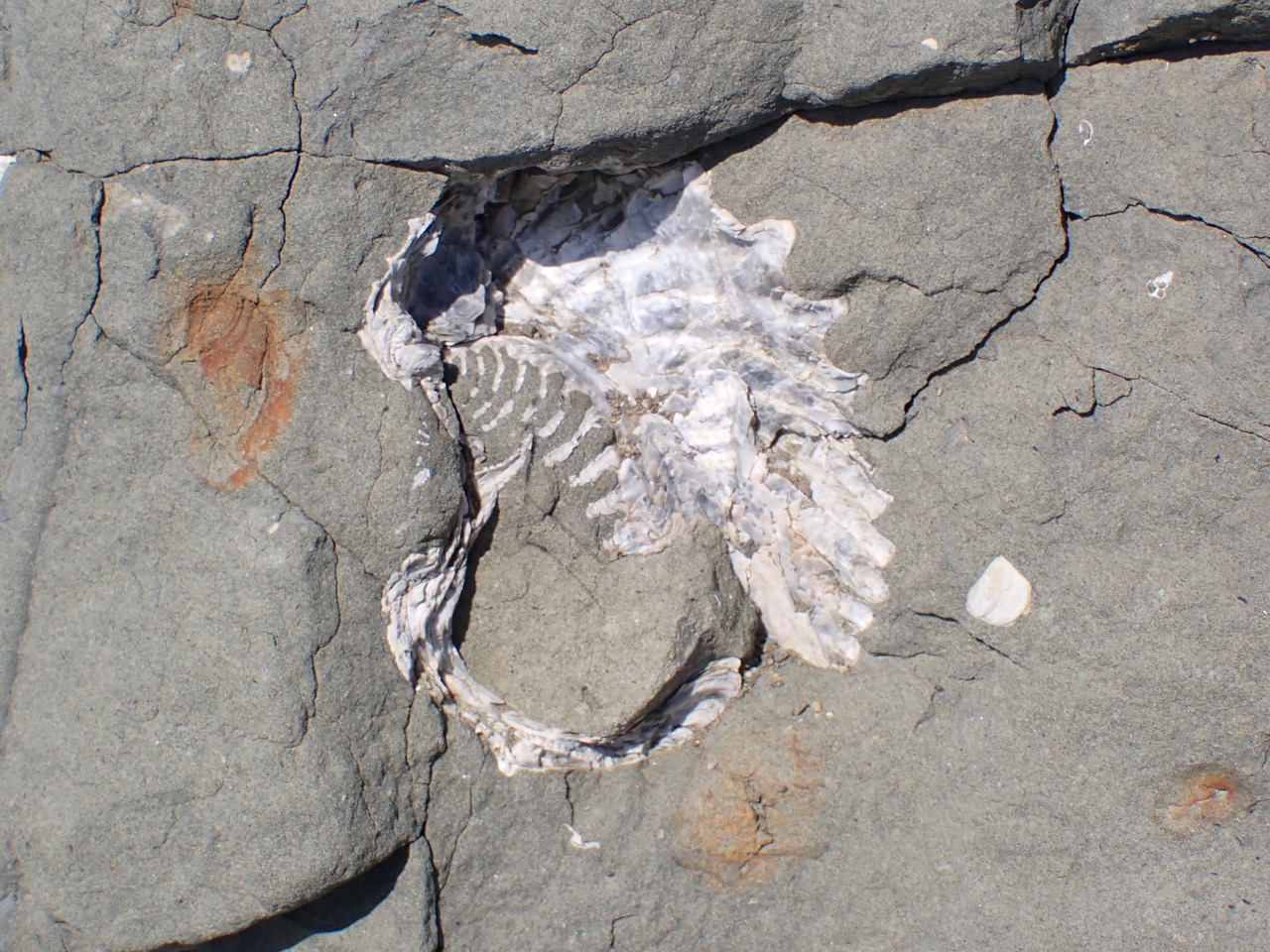
Sucia was lovely again. Soon after landing we made camp, hung our gear to dry and set out exploring. First we explored the shell fossils along the beach but I mentioned to Steve that there was a really nice fish fossil on the other side of the island and we decided to go see it. It’s a small island, how far could it be? It had seemed pretty close when I paddled over there before.
It was 3 miles each way. So we got a good hike in. Still worth it.
Gear drying on Sucia65 million year old fishshell fossil
The next day we checked the weather forecast and our trip leader decided the best option was to wind up on Clark Island to the south so that the following day the winds would be blowing us toward our destination and not into Canada. That meant Day 2 was a much longer day than originally planned.
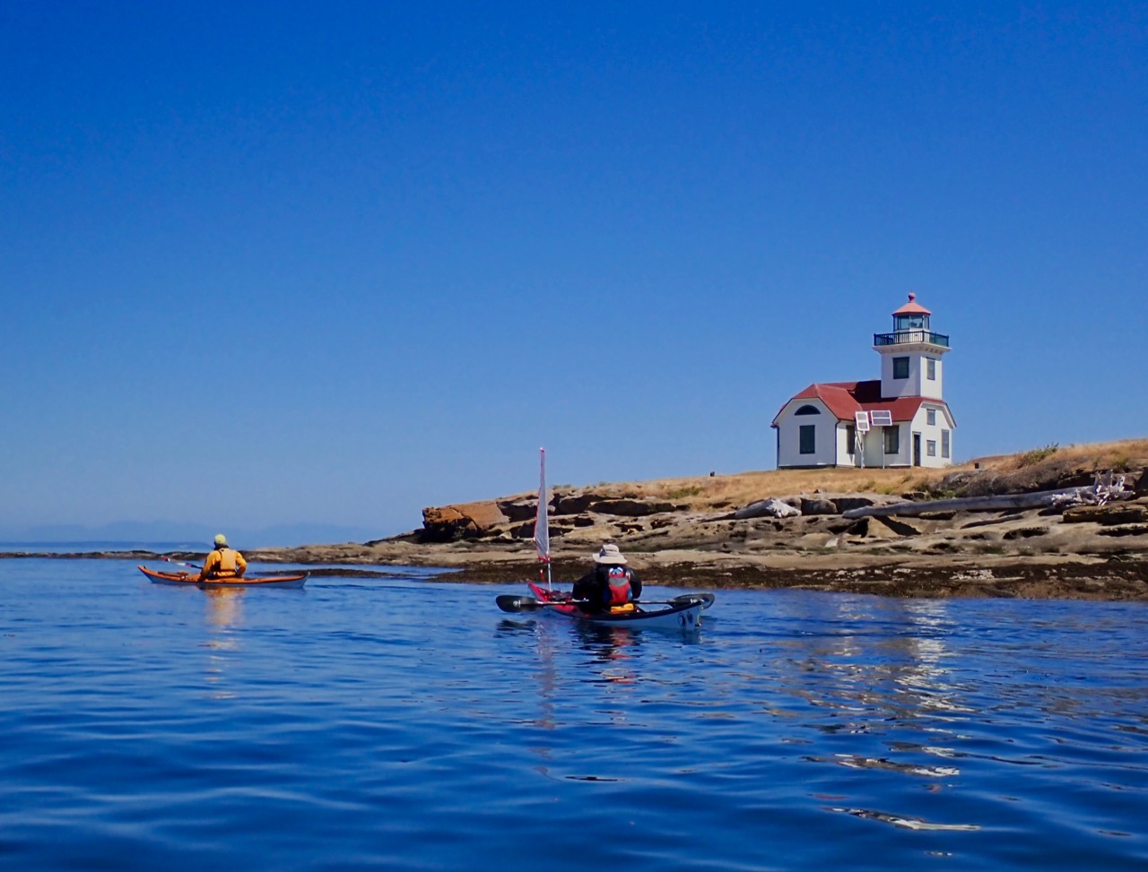
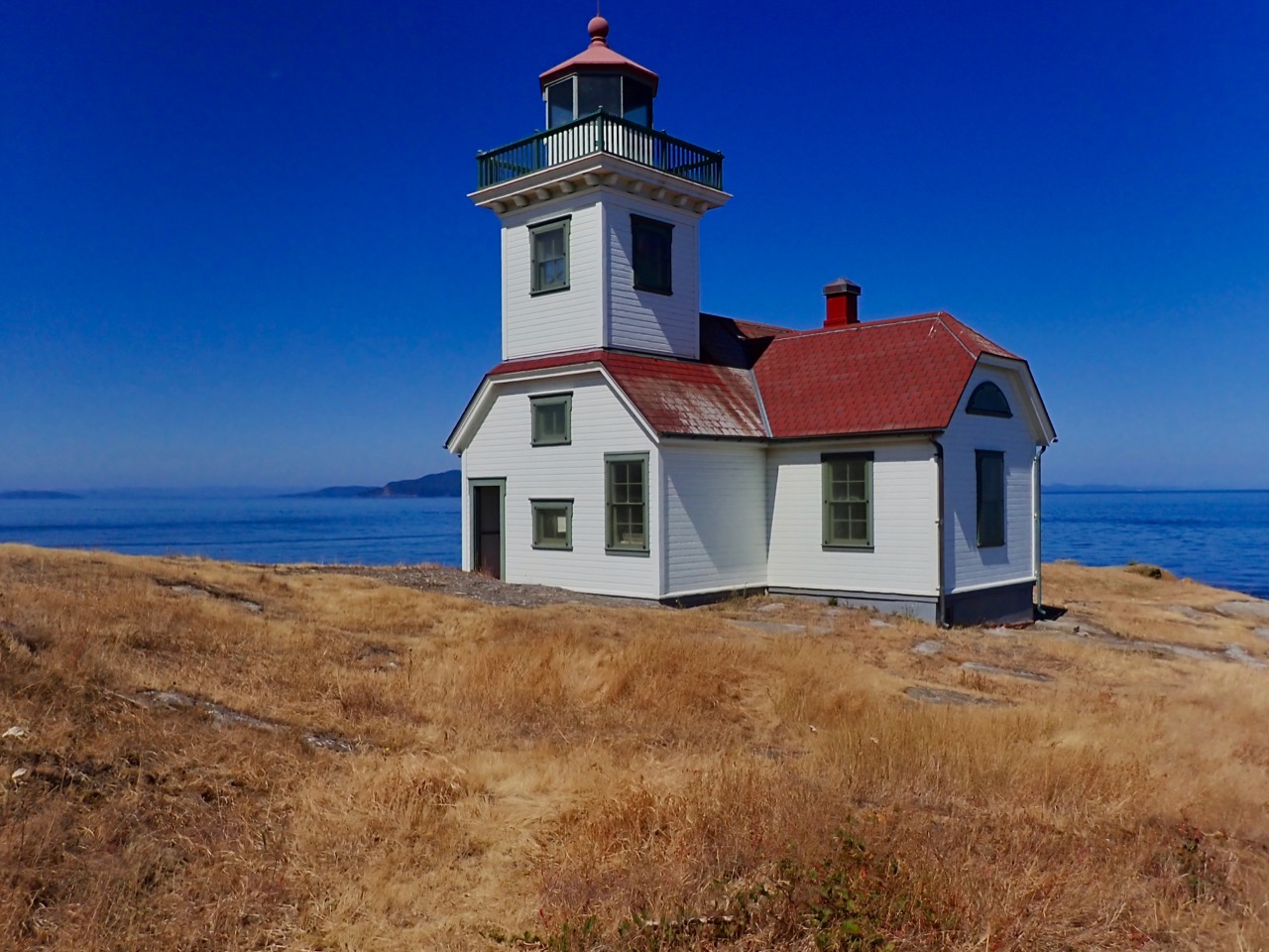
First we headed over to Patos Island where we met some other paddlers we knew, scoped out the campsites, and met the docent at the lighthouse who opened it up a few minutes early so we could have a tour. See those two solar panels? They replaced an entire room full of machinery that the lighthouse used to need to function. The light is now LED and only about 5 inches high.
Patos Lighthouse
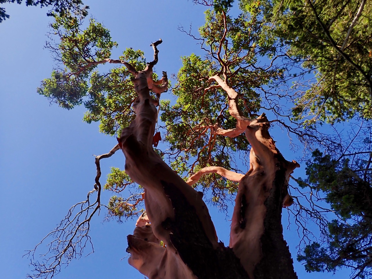
Steve’s favorite madrone tree on Patos
We then turned back east, paddling along the north side of Sucia and stopping for lunch so everyone could check out the fish fossil (without a 6 mile hike). We passed by Matia toward Clark, making a 6 or 7 mile crossing. Here’s where I found out I was getting too much sun or not enough water or something: I got a migraine that did not go away with medication. A few miles in and I was struggling – everyone could tell and offered to help out with a tow. We set the lines up and while I never quite stopped paddling, several people traded out giving me an assist so we got where we were going. So when you see our slower time for that day – this is why.
As soon as I was able to sit down in some shade for a decent amount of time I felt better.
Clark Island
This time we were able to snag some of the beach sites out of the wind. They were not as private and the toilet was farther away, but building a fire on the beach was pretty cool. We had a firelog along, this time courtesy of Susan. And we had an excellent view of Baker.
The next morning was windy but not as exciting as we had feared. The whitecaps settled down while we made our crossing toward Lummi and we made it back to our launch site a little early.
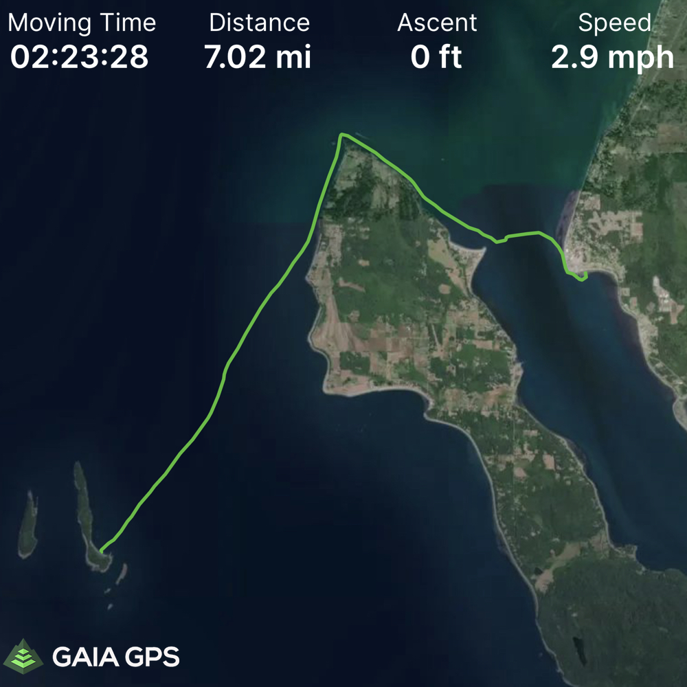
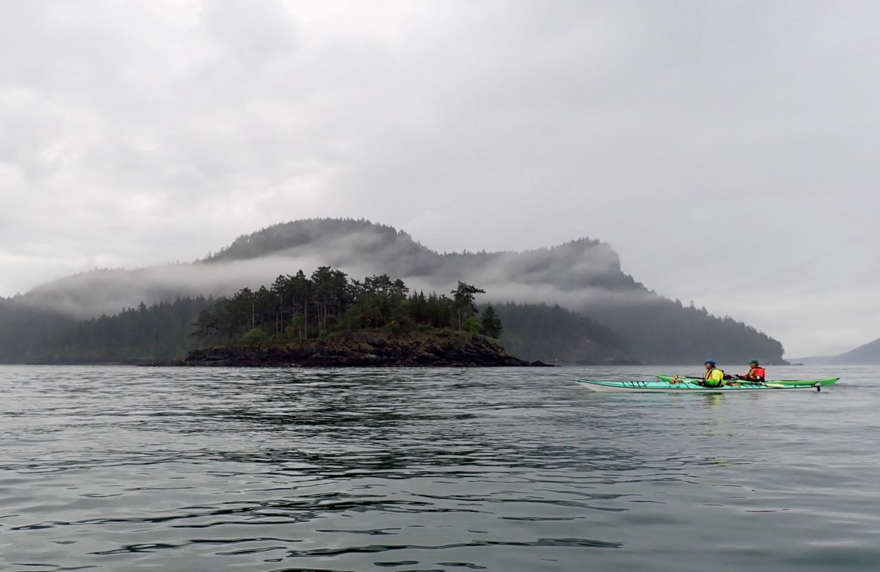
This summer I really want to explore the San Juan Islands by kayak – as much as possible! And if I’m able to do it without getting onto a ferry, even better. Yesterday I left for a 1-night (Sat-Sun) trip from Anacortes to Clark Island. Clark is located just off Orcas Island and isn’t far from Sucia (where I need to get back to).
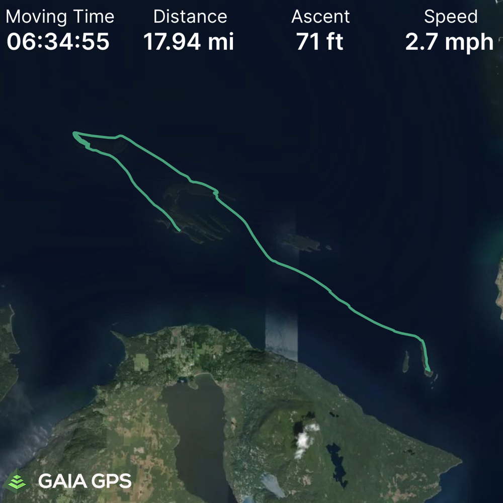
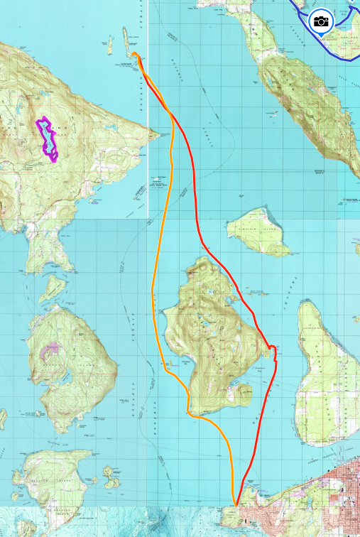
Our route as mapped on Gaia. Anacortes to Clark (orange), 15.2 miles in 2 hrs 57 min. Average moving speed was 5.4mph with a max speed of 7.9 mph. As you might guess we had a substantial current pushing us along.
Return trip (red) 15.36 miles in 3 hours 43 minutes. Average moving speed 4.4mph and max speed 6.8 mph. We still had the current with us but had a substantial headwind until we were close to Cypress Island. We also stopped for lunch at Cypress Head.
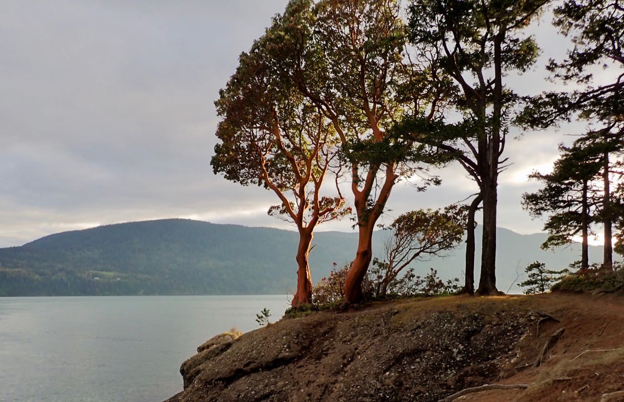
Setting sun catching the madrone trees on Clark Island.
We launched at 2pm to take advantage of the current assist. There was no rain or wind but it was overcast the whole way. We passed by a spectacular view of Eagle’s Cliff at the north end of Cypress and I hope to go back to hike it soon. North, near Lawrence point the currents were confused – first pushing left, then right, then left again, but it was slow enough that it was hard to see which direction they were going before they caught you. I’m told that it can be MUCH more exciting than what we experienced. We arrived a little after 5pm and found, to our surprise, that the entire beach area was filled up!
There were many empty sites, though, up the little hill in the forest and I picked one that had a view of the rocks to the east and south to Orcas.
View from in front of our campsite
It rained overnight which meant it was kind of gross to pack up, but it didn’t rain ON us, at least. THere was a pretty brisk wind from the SSE (but less than 10 kts).
Dave and Jeff, north of Cypress
Fred, Susan, and Terri
I was a little cold when we started, but, as usual, working hard warmed me up. By the time we reached Cypress the wind had died down and we could see some sun start to break through. We stopped for lunch at Cypress Head, paddled through some confused currents to the east of it, and then rode the last of the ebb back to Anacortes. We only had to dodge one ferry (and it was quite far away). By the time we returned to the launch it was warm and sunny.
This felt like a pretty ambitious trip to me, and we got quite far into the San Juans. It makes me confident that I can do a lot of exploring without always having to take a ferry. I guess the trick is the weather and timing the currents.
No photos of these, but we saw porpoises, lots of seals, and two sea lions who came very close to the boats.
On April 18-19 I took an “Introduction to Surf Zone” kayaking class with Fidalgo Paddle Sports. There were only 3 students plus the instructor and we met at Crescent Beach, west of Port Angeles.
I had some misgivings about this – I can do some distance but I’m not a very technical paddler – and the closer we got to the date the more concerned I was about the weather. First – it’s mid April and I was worried I’d be too cold to camp, or that I’d get too cold falling in the water and then never warm up at night, and second, I checked the surf forecast for this beach and it was predict 4-6 foot waves when I thought maybe half that would still be a challenge for me. But I spoke to the instructor and he was still enthusiastic so in I went!
I’d never been to this beach before and it was beautiful, even with the clouds and the snow line only a hundred feet or so above sea level. More importantly, when I got there Tuesday morning (after taking the 5:35 ferry!) the waves were small. No more than 1-3 feet and I was very grateful for that. We could see whitecaps out in the straight, but the beach was sheltered from the worst of the wind and waves.
Crescent beach looking much less scary than predicted. This photo was taken during a relative lull, we had more than this but it never got really big.
The other two students were Audrey and Erik, a couple, but she lives in Canada and is a kayaking guide on Vancouver Island, while he is currently still working in Seattle. They (and Jesse, the instructor) were all great to work with.
All 3 students at once!
Our first task was to practice paddling parallel to the beach in the soup/wash zone where we had to learn how to do an effective low brace or get rolled over. I was pretty successful with this (not that I was able to keep it up once things got bigger, but I started well). Having a wave break right next to you and shove the whole kayak sideways was actually pretty fun.
Things I learned: I habitually edge to the wrong side when I’m ruddering – I think it just never mattered when I’m going slow, but it absolutely matters when I was trying to keep myself straight down a wave. Three foot waves are still a bit scary and much more likely to turn & roll me. I don’t drop my paddle when I get rolled! (yay! I was worried I might) I do, however, see that I’m about to roll and dive out of the boat completely. (Probably not terrible but not really great either) Getting dumped and having to drag the boat around, empty it, and launch again got tiring quickly. Falling out isn’t as scary as I was worried it would be – which is good because I fell out a lot. Paddling OUT through the surf, even when it was 3 feet, was a blast. Even though my drysuit is nearing the end of its life and I was getting a bit damp, I wasn’t cold. I need to start edging a lot more aggressively – I think I may need to add padding to snug up the fit in my kayak to be able to do this effectively.
Not my biggest ride, but a successful one! Also – this wave FELT bigger when it was behind me and I couldn’t see it.
Our campsite was right across the road from the beach and there was very little traffic on the road – at least in April. The weather was much better than expected but it still hailed on us a little. I brought two sleeping bags and still slept warm – so that concern was also mitigated.
I had to get up from supper to take a picture of these amazing clouds.
Conclusion: I would absolutely do this again and it did a tremendous amount for my confidence in what I might face while touring.
I took a few notes along the way and these are the things I want to remember for later.
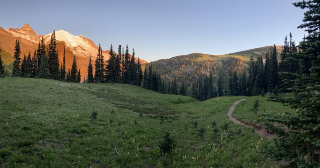
Highlights: Yellowstone Cliff & Windy Gap, Emerald Ridge, swimming at Golden Lake and St Andrews Lake, the ‘fairy hall’ like quality of lower Ipsut Pass in the fog, the Silver Forest south of Golden Lakes, the entire stretch from just north of Nickel Creek through Indian Bar to Summerland.
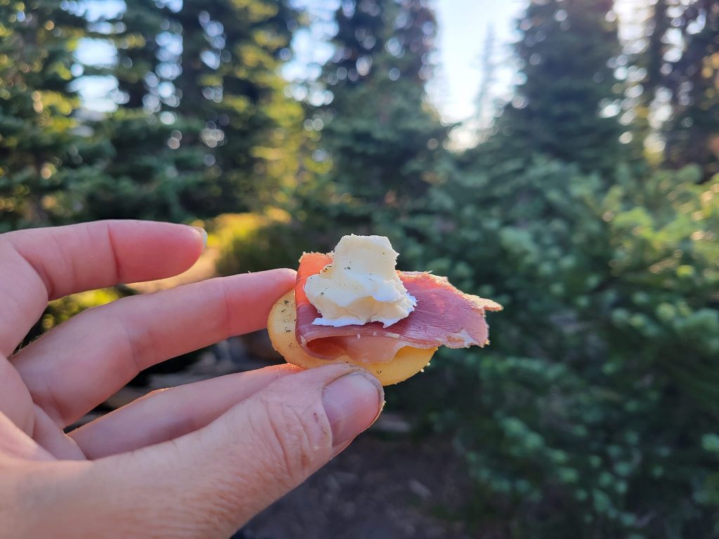
Should have brought: A dedicated bottle for the bidet – one that I don’t like very much. A sit pad (got left behind by accident), waterproof pants/lighter rain gear, more socks for S, neosporin, a safety pin in my med kit, more alleve, warmer PJs for S, ramen flavor packets to add to our food, miso soup, spices in general, more TP (N saved us), soap! (which somehow got left behind), a faster water purifier, and the pesto & parmesan noodles I’ve brought kayaking before but left out this time.
This was a great idea: bandana, pickles, snickers bars, dehydrated risotto, dehydrated panang curry, mashed potatoes, clothes that quick dry
Leave behind: extra fuel cannisters, my heavier raincoat (replace with something lighter). We never used the playing cards – so maybe?
We had word (from a bit of cell service back on day 8) that N, K’s sister was going to try to hike up to Summerland camp before sunrise on our last day to bring us breakfast and also to get some early morning photography. Thus we all got up super early to watch the show. My iphone wasn’t really up to the task, so trust me that it was far more spectacular than what you see. For starters there were, as you might imagine, so many stars. We sat in the darkness looking up at the mountain and I saw more stars! It took me a moment to realize that I was seeing the headlamps of climbers on their way to the summit. We were able to make out more the longer we looked, at least a dozen, and we could see that they were making progress and see a rough outline of the route all of them were taking. I also turned and saw another night hiker’s light up at Panhandle gap, where we’d been the day before.
The rising sun turned the mountain pink
Our campsite at Summerland
Searching for the best view
A bit after sunrise N turned up with, I kid you not, a charcuterie board. Not exactly a board – but crackers, brie, prosciutto – the works. You know how any regular food tastes like the best food you’ve ever had right after you’ve been eating, for example, rehydrated rice and beans for 10 days? This was amazing. Also that light I’d seen at Panhandle Gap? That was N. She’d gone past us all the way up to the gap to catch the sunrise, then hiked back DOWN to bring us food.
Best breakfast ever
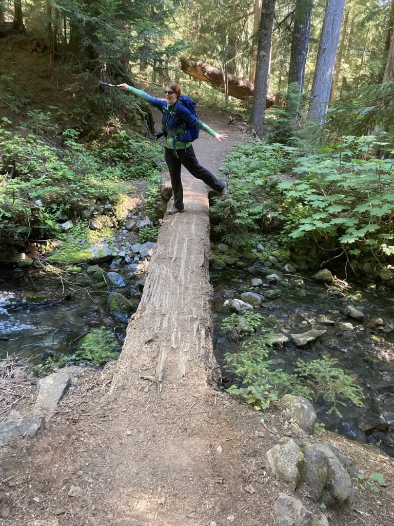
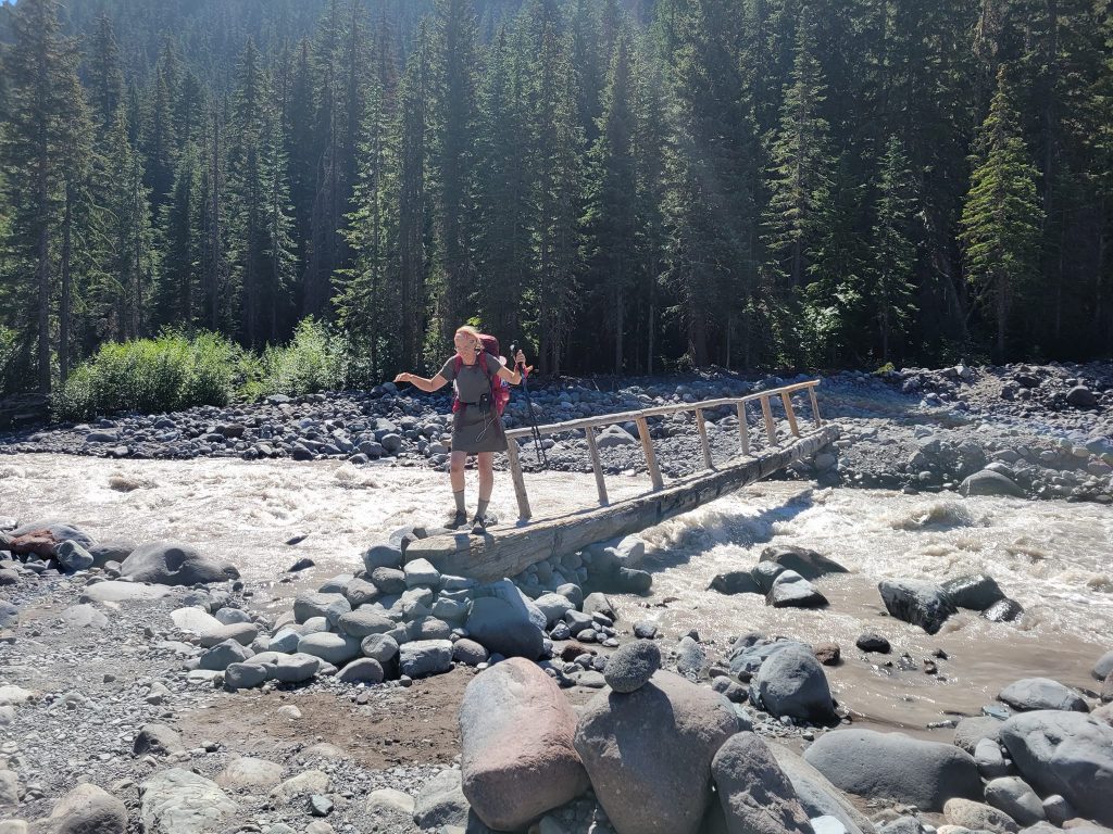
N showing me how crossing bridges is done
Half of this hike was familiar to me. I’d been as far as Panhandle gap with K in the past, so it wasn’t until we passed the trailhead and kept going toward White River that I was in new territory. But I can see why K chose it – it’s one of the prettiest places in the park. The hike to White River was mostly deep forest, with only one ominous warning sign that the White River bridge was out and impassable. We deduced that this sign was old, since we’d seen the bridge when we started the first day and there hadn’t been any significant weather since then. Also, we spoke to almost everyone going the other way and you’d think someone would have mentioned it.
A bit of celebration at the last scary bridge (3 banana peels)
And we were done. Time to return to everyday life. On the one hand, I really wanted a proper shower, but on the other hand, I wasn’t looking forward to returning to the world and its problems.


")


