Posted on 1 Comment

Dubious Water Crossings on the Wonderland Trail

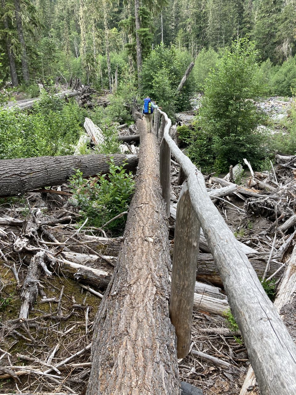
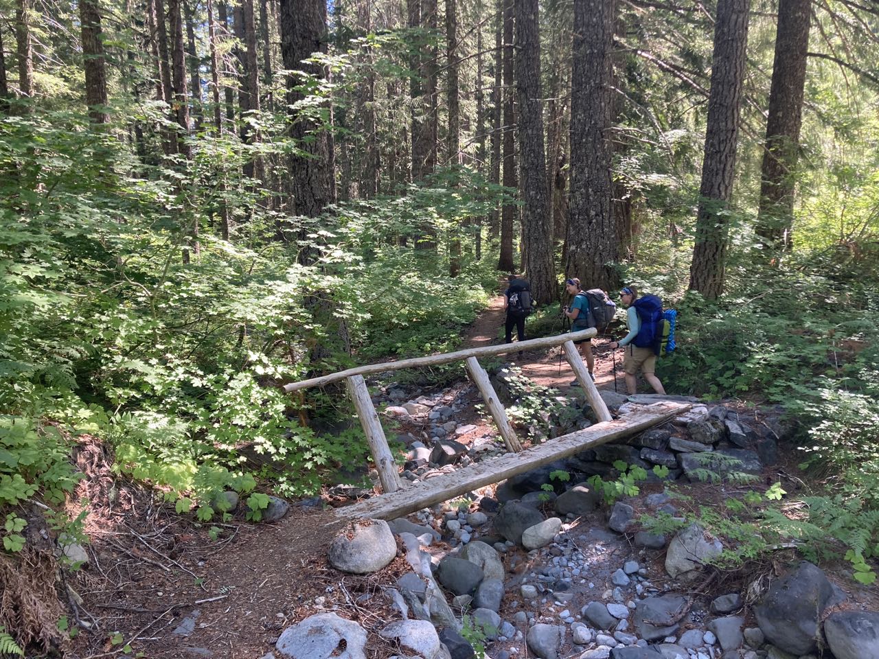
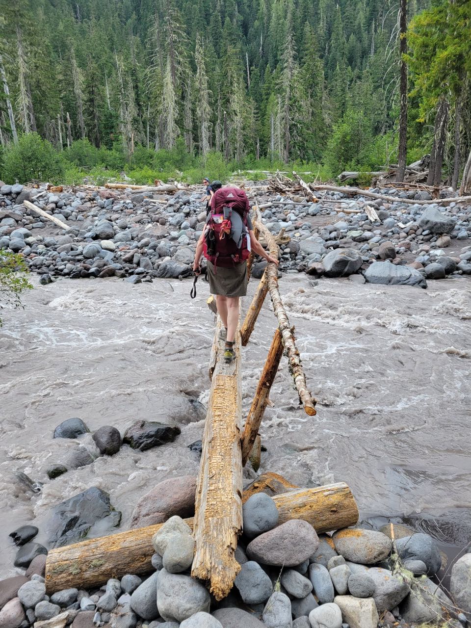
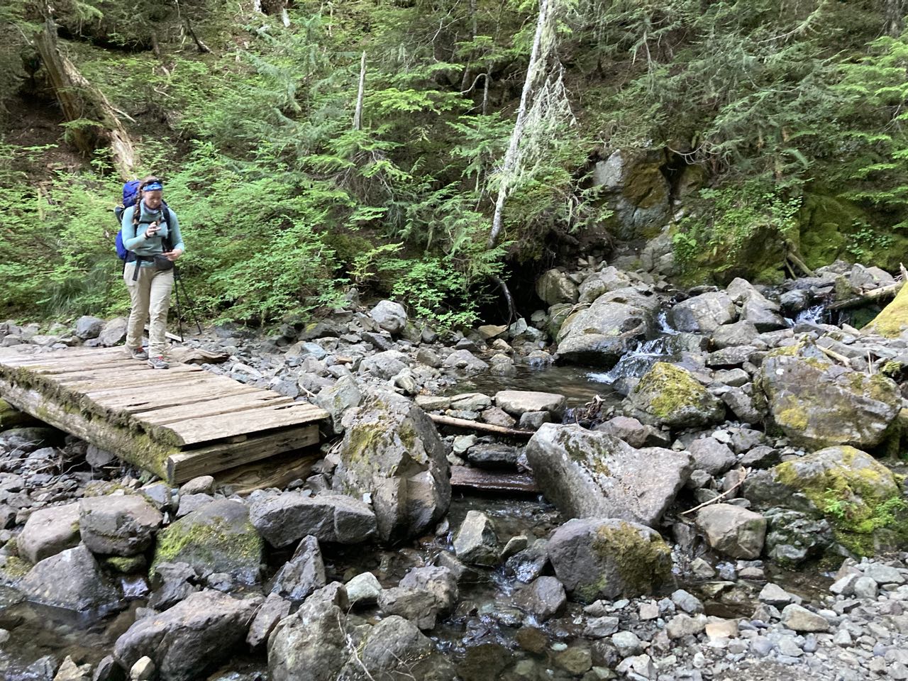
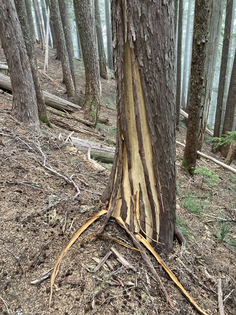
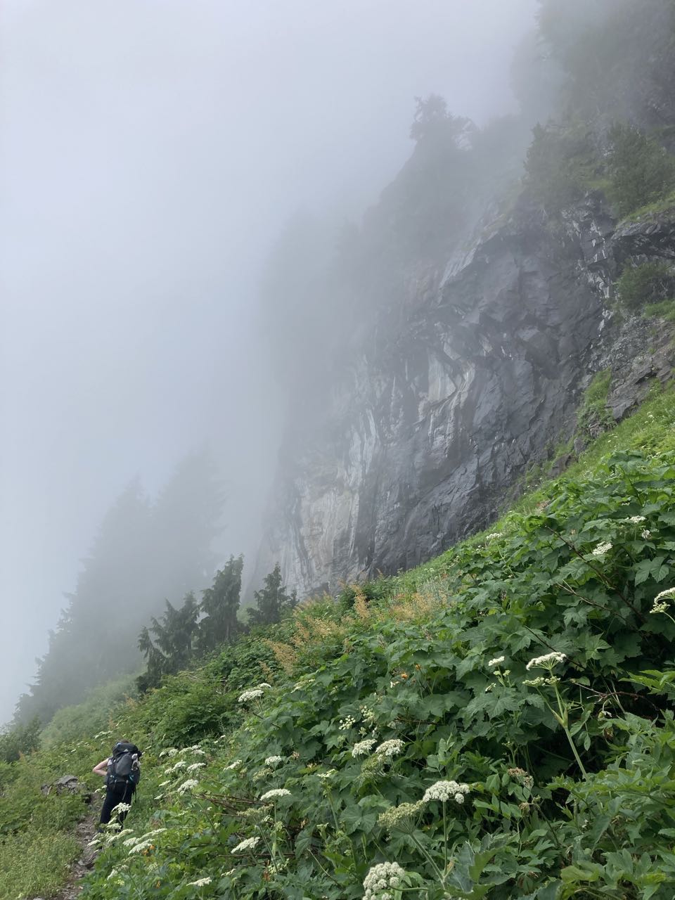
On day 3 I had to cross MANY “bridges” that I deemed ‘sketchy’. Most of these bridges were logs that had been smoothed on one side with a railing bolted on. But sometimes the railing was broken, or loose, or leaned so far away that I couldn’t reach it, or sometimes the whole log had rolled a bit and now was at an angle. I am NOT a fan of these things. I’m not a fan of heights and I don’t trust my balance as much as I did when I was younger.

I eventually came up with a rating system of ‘banana peels’ to describe how likely I thought it was that I would plunge off of one to my death. Here is the moment that inspired the rating system, but I want to note that this was not the scariest bridge I crossed this day. That honor went to the broken slanted log we crossed before I started documenting them. I had to scoot across that one on my butt.

4 banana peel bridge over the Carbon River

THE RATING SYSTEM
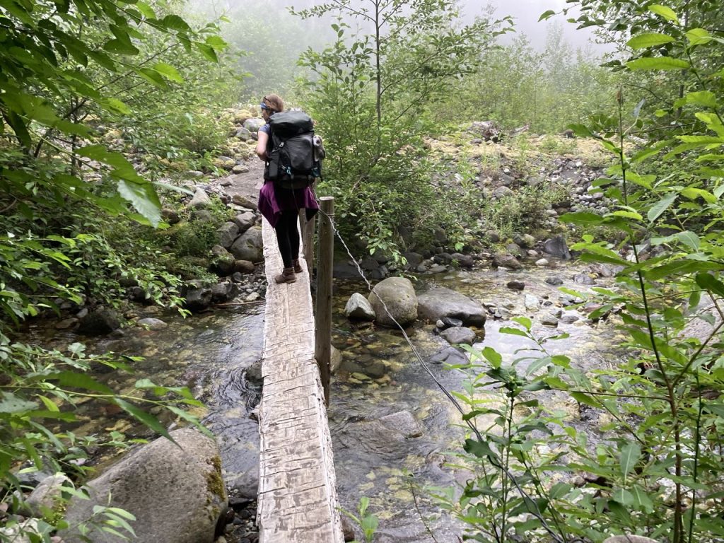
One banana peel.   This is a solid bridge.  It’s wide, flat, no rotten boards.  You’d feel comfortable letting someone pass. You can hang out here and take photos.  I would walk backwards across this bridge.

Two banana peels.  Still a solid bridge.  It’s comfortable to walk across and stop on.  It might not be wide enough for passing, or, if it’s a wide bridge, maybe there are some rotten boards you need to watch out for.

Three banana peels.  There’s something not great about this bridge.  Is it missing a handrail when it needs one?  Is it too narrow?  It’s slanted at an uncomfortable angle.  Maybe it’s very high and narrow, or it moves a bit.  I’ll still walk across it at a normal pace but there’s something about it to give me pause.

Four banana peels.  Something has gone seriously wrong here.  Who built this thing? I’m walking sideways or slide-stepping to cross this.  It’s wet and narrow, or there’s a vertigo-inducing whirling cataract below it and it moves. Multiple points of failure. 

Five banana peels.  How has it come to this?  I’m questioning my life choices that have led me down this path. I’ll still cross it, slowly, but I’m muttering obscenities, or curses, or prayers.

Six banana peels. This is probably not a bridge but something that has to be crossed anyway.  It’s a rotten, slanted, broken log.  Bonus if it’s wet.  It’s a stack of slippery logs over a raging torrent.  I’m not walking on it.  If it must be crossed I’m crawling or scooting on my butt.

7+ banana peels.  I’m not crossing it.

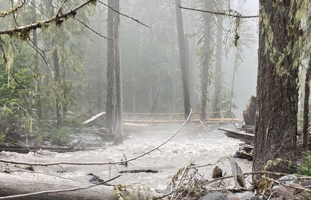
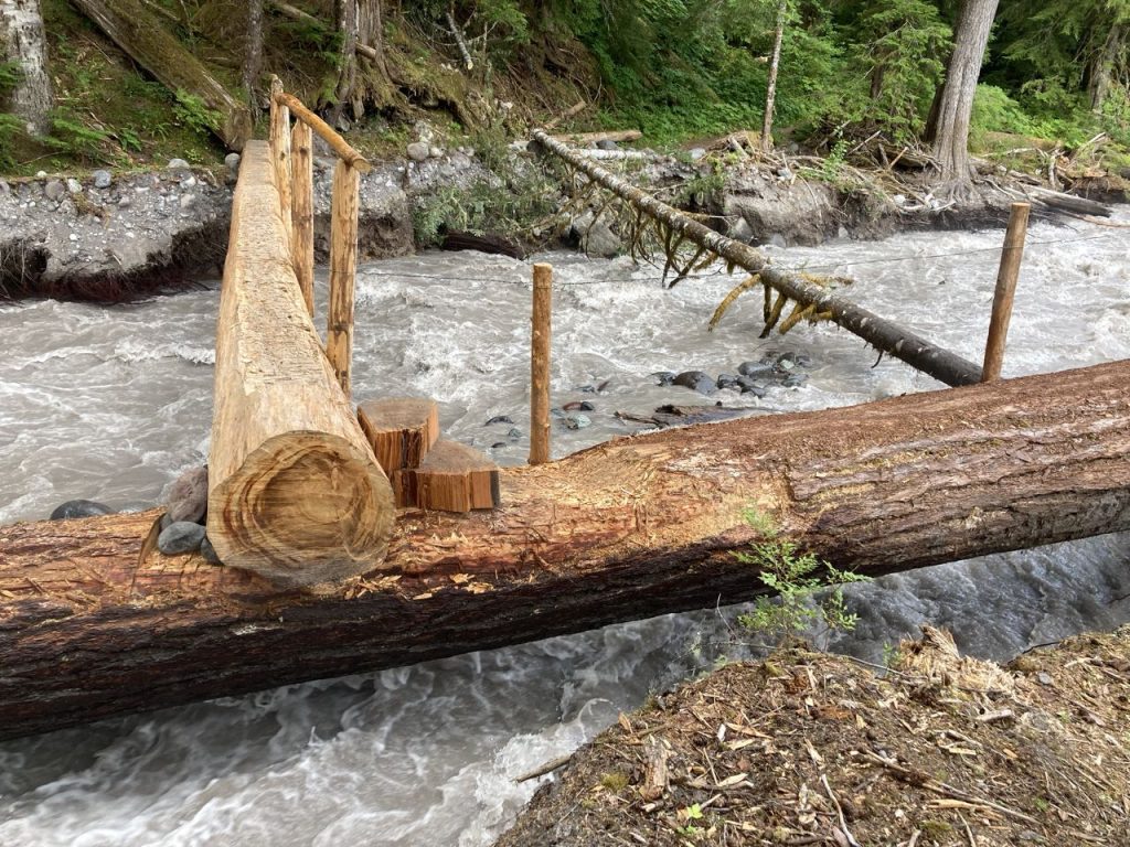
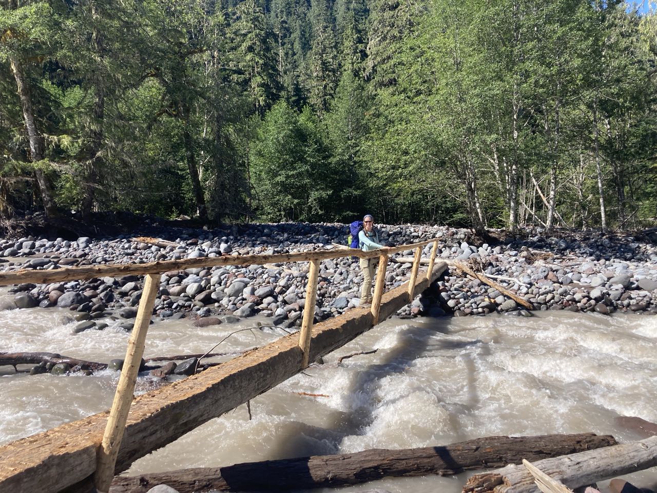
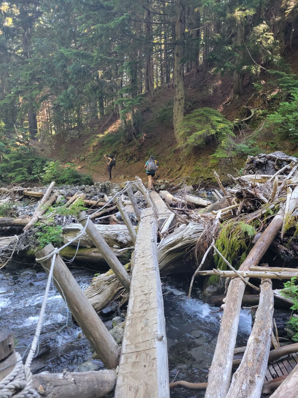
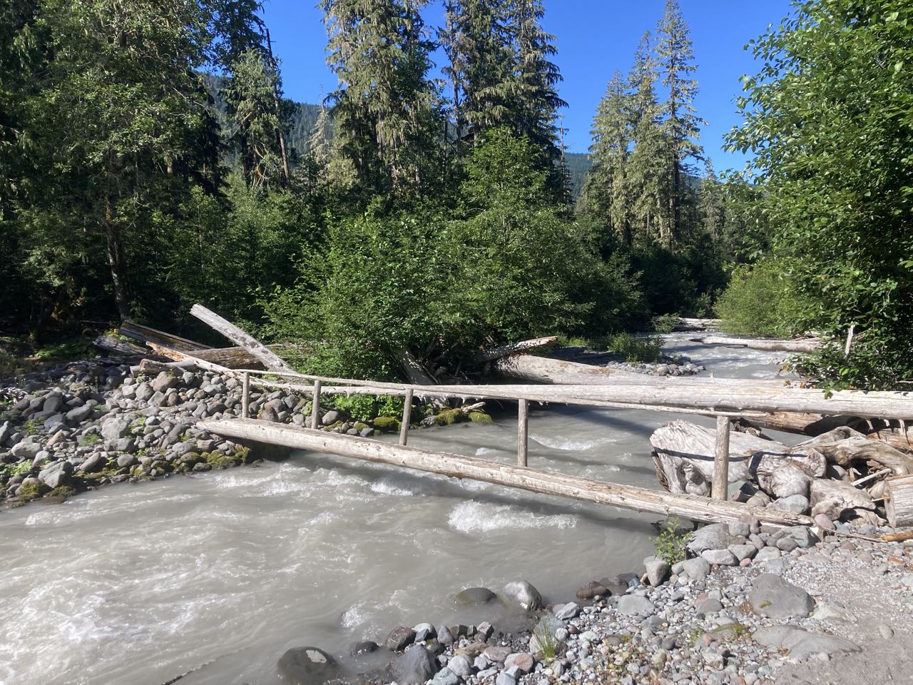
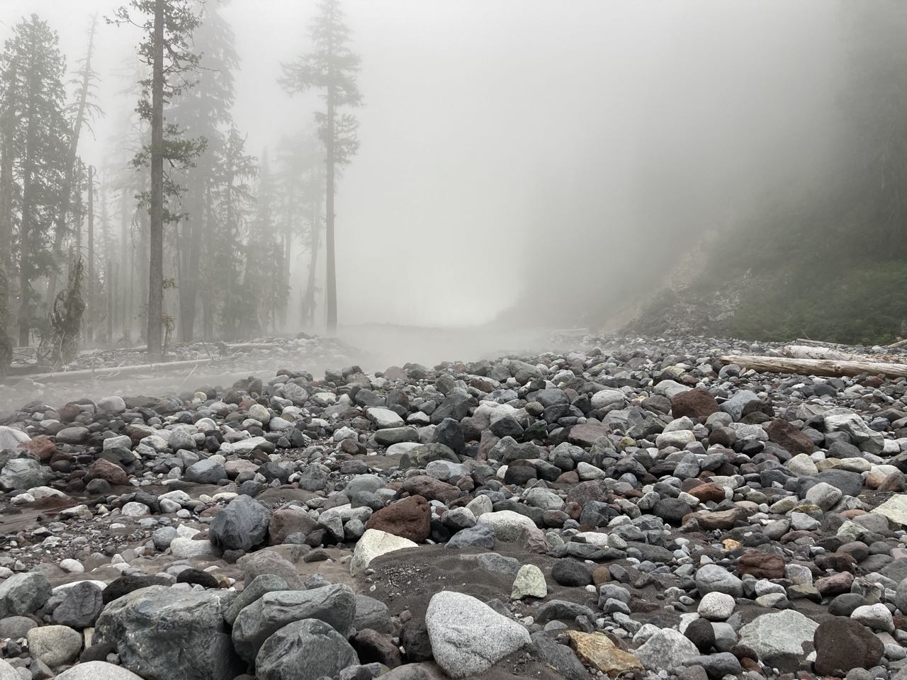
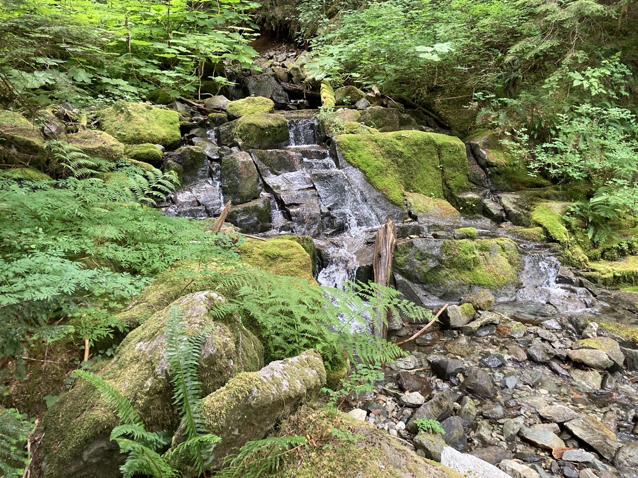
Since the bank of the Carbon river seemed to be crumbling there were something like 6 bridges over parts of it even after we’d crossed the main bridge. I didn’t take pictures of them all but some of the bridge designs were quite unique.

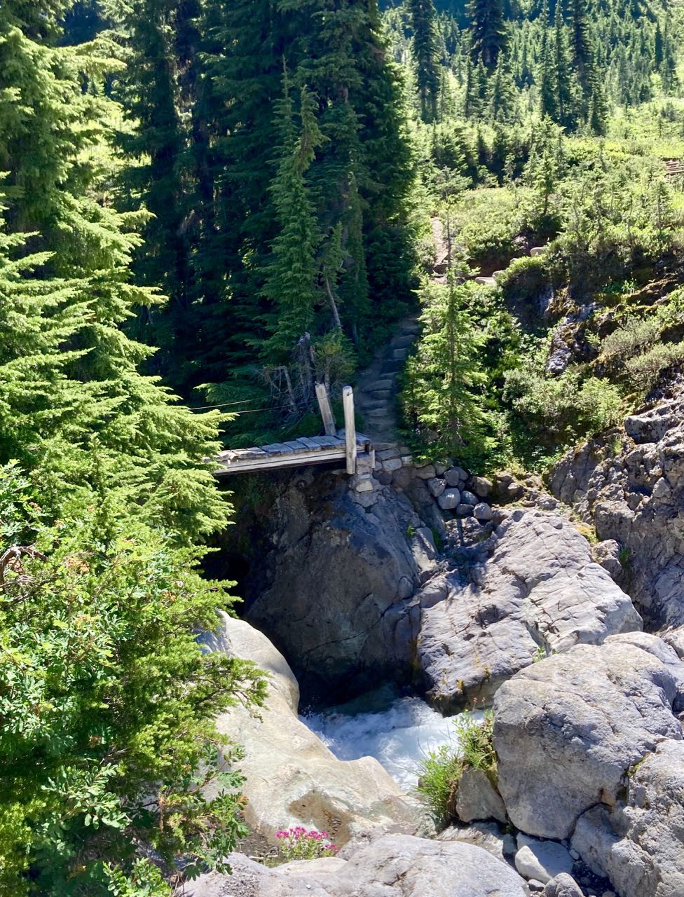
Now that’ I had a rating system I started to pay more attention to other bridges as we came to them.

R not finding this as terrifying as I found it. 4-peel bridge. Handrail ends before the end of the bridge.

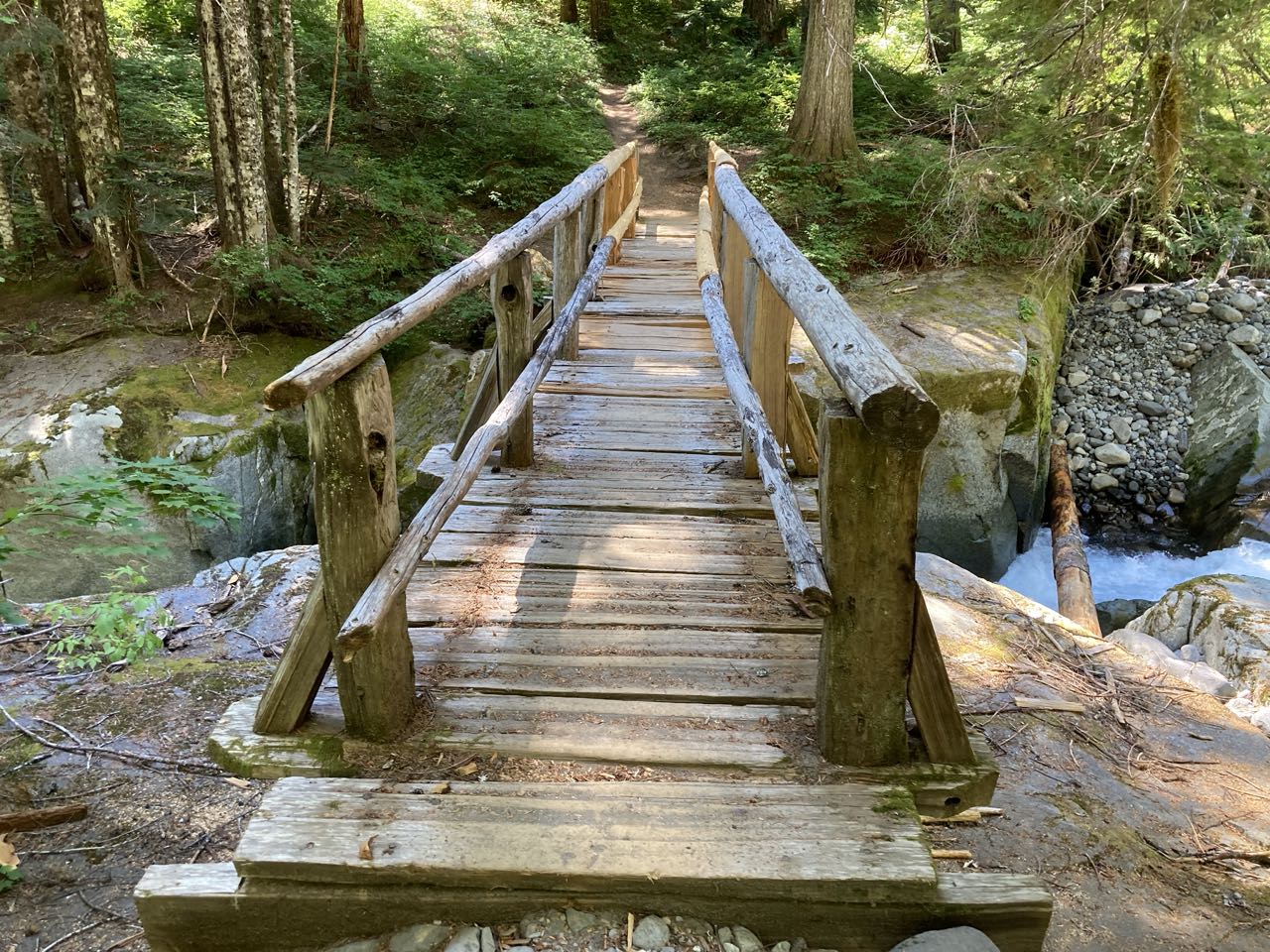
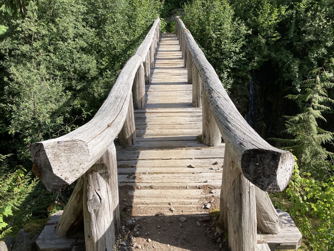
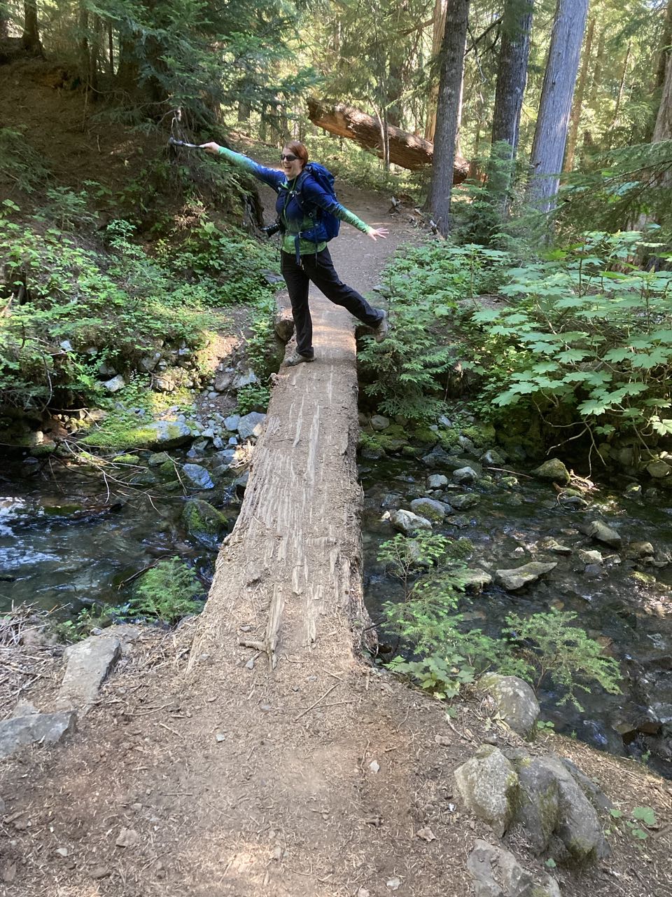
Here are some very safe 1-banana peel bridges

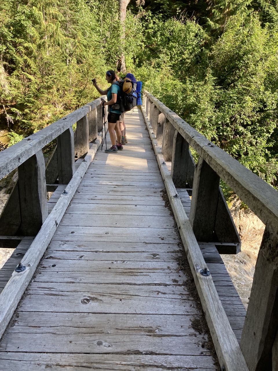
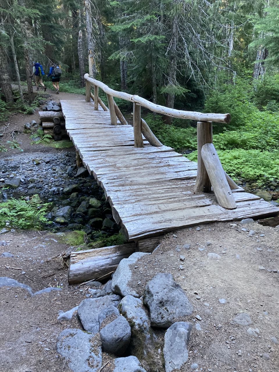
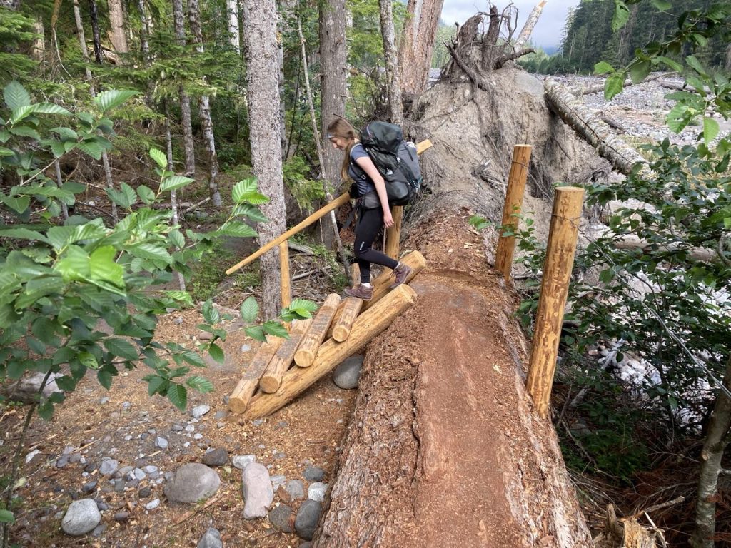
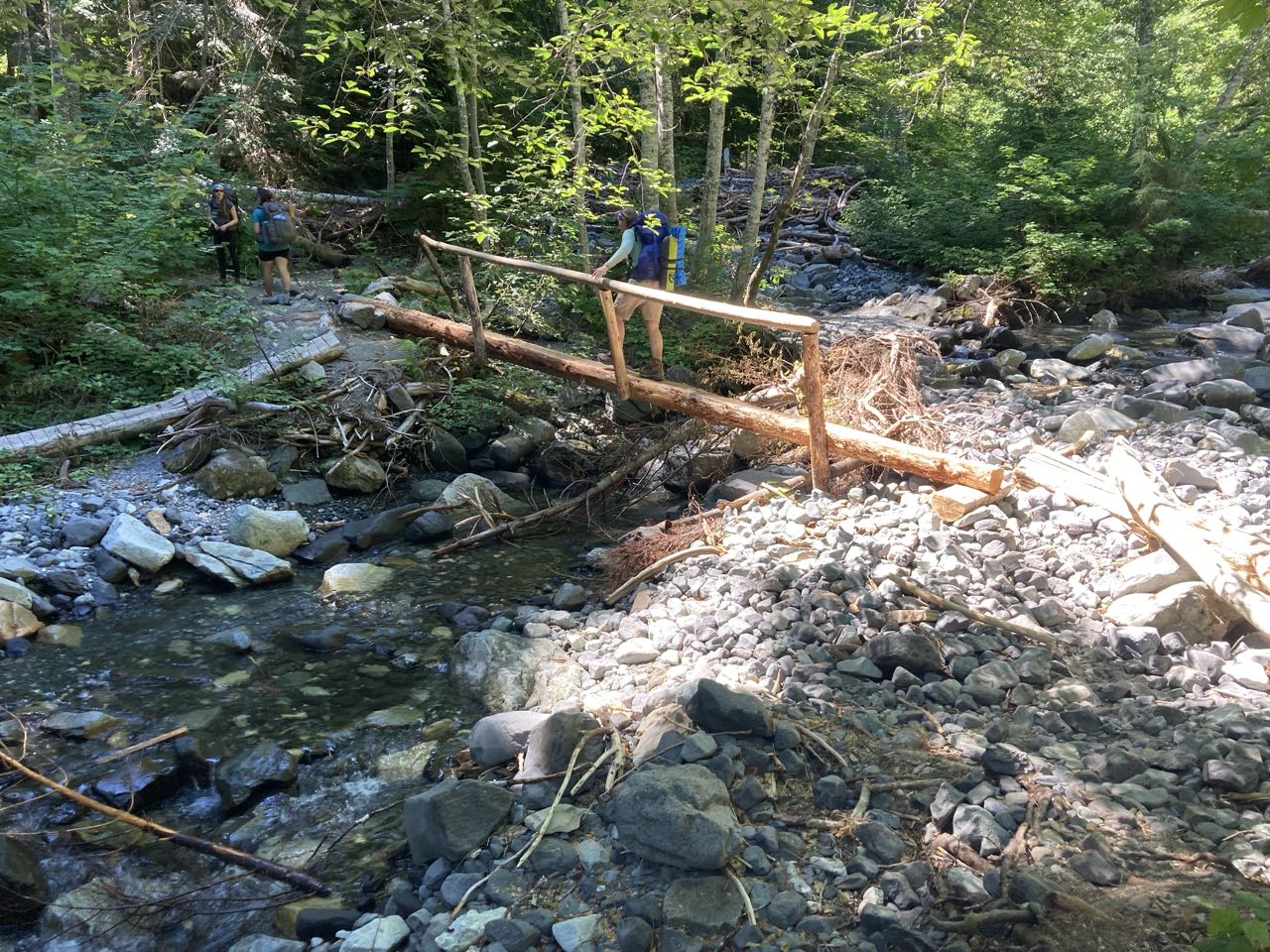
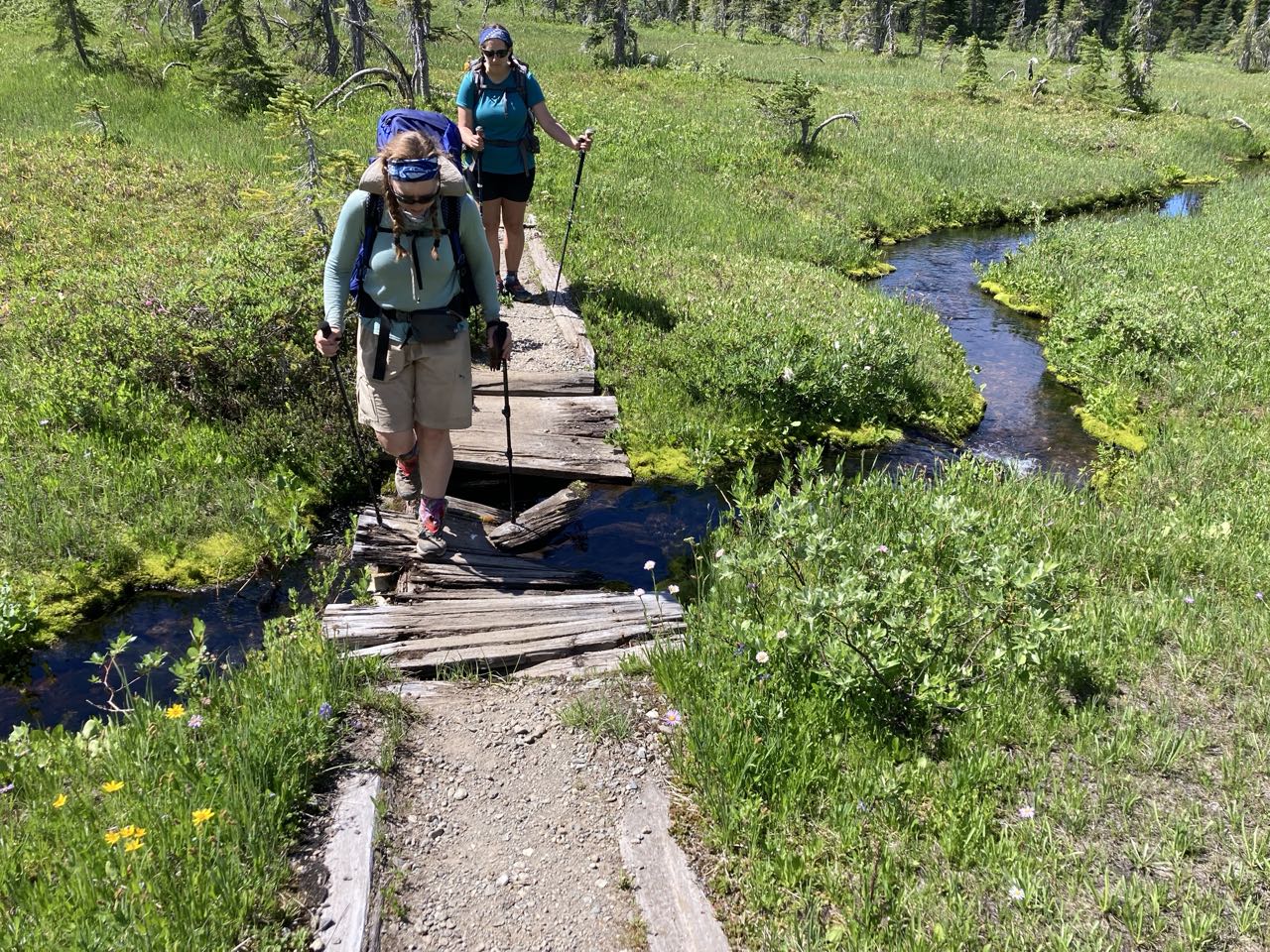
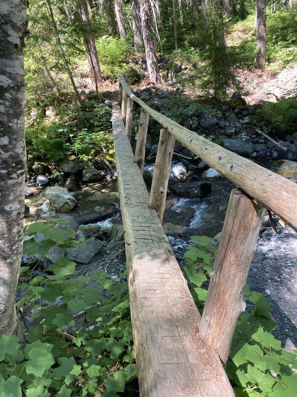
These are all in the 2-3 Banana Peel Category. Nothing too terrifying, but I had to steel myself for a few.

I should have taken better notes. I know that some bridges turned out to be not as scary as they looked, and some that looked safe in the photo felt terrifying when I was there. Clearly I have to go back. But here are two standouts.

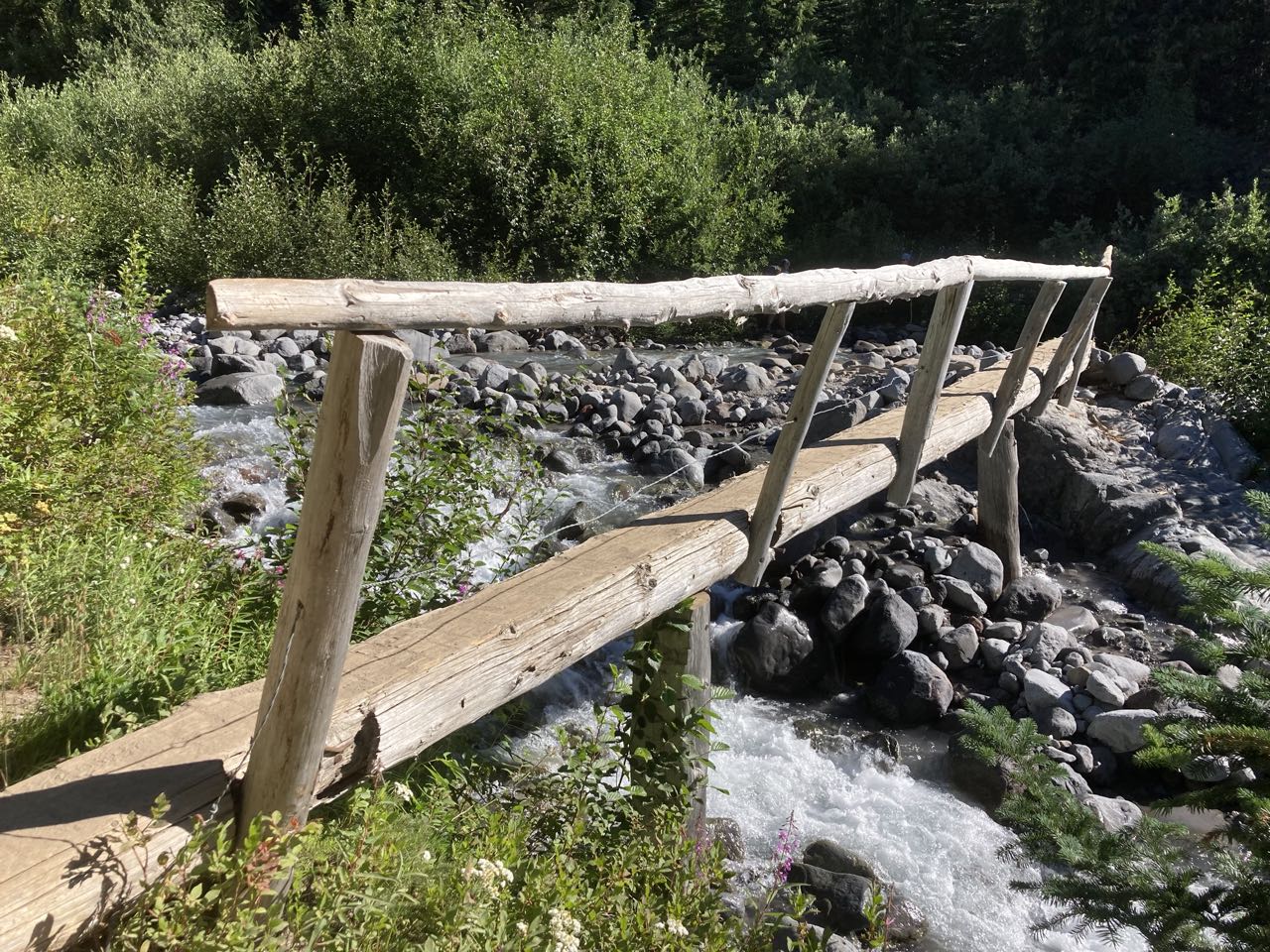
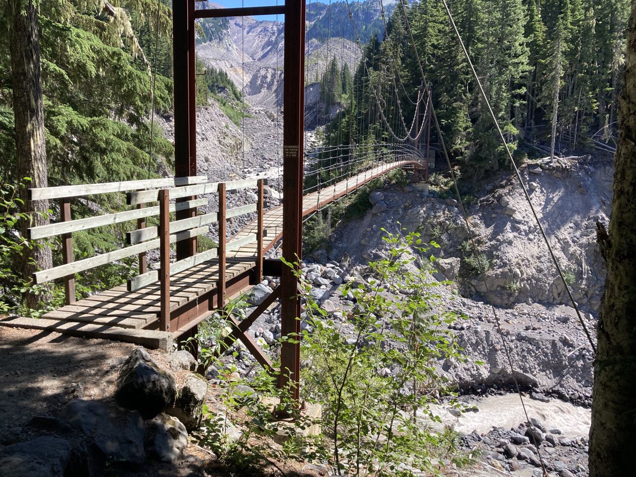
The Tahoma Creek Suspension Bridge is where I gave everyone a scare. It was really high and narrow and there was a sign saying only one person at a time. I asked to go first on the theory that I’d get it over with and could take pictures of everyone else crossing. What happened: I got about 30 feet out and stopped abruptly and my friends thought maybe I was starting to panic. What happened was I stepped out of the shelter of the canyon wall and was suddenly in high winds which started to blow my hat off. I had to stop and I stuck the string from my hat in my mouth so I could keep going. I rate it a 3 banana peel.

The Tahoma Creek Suspension Bridge.

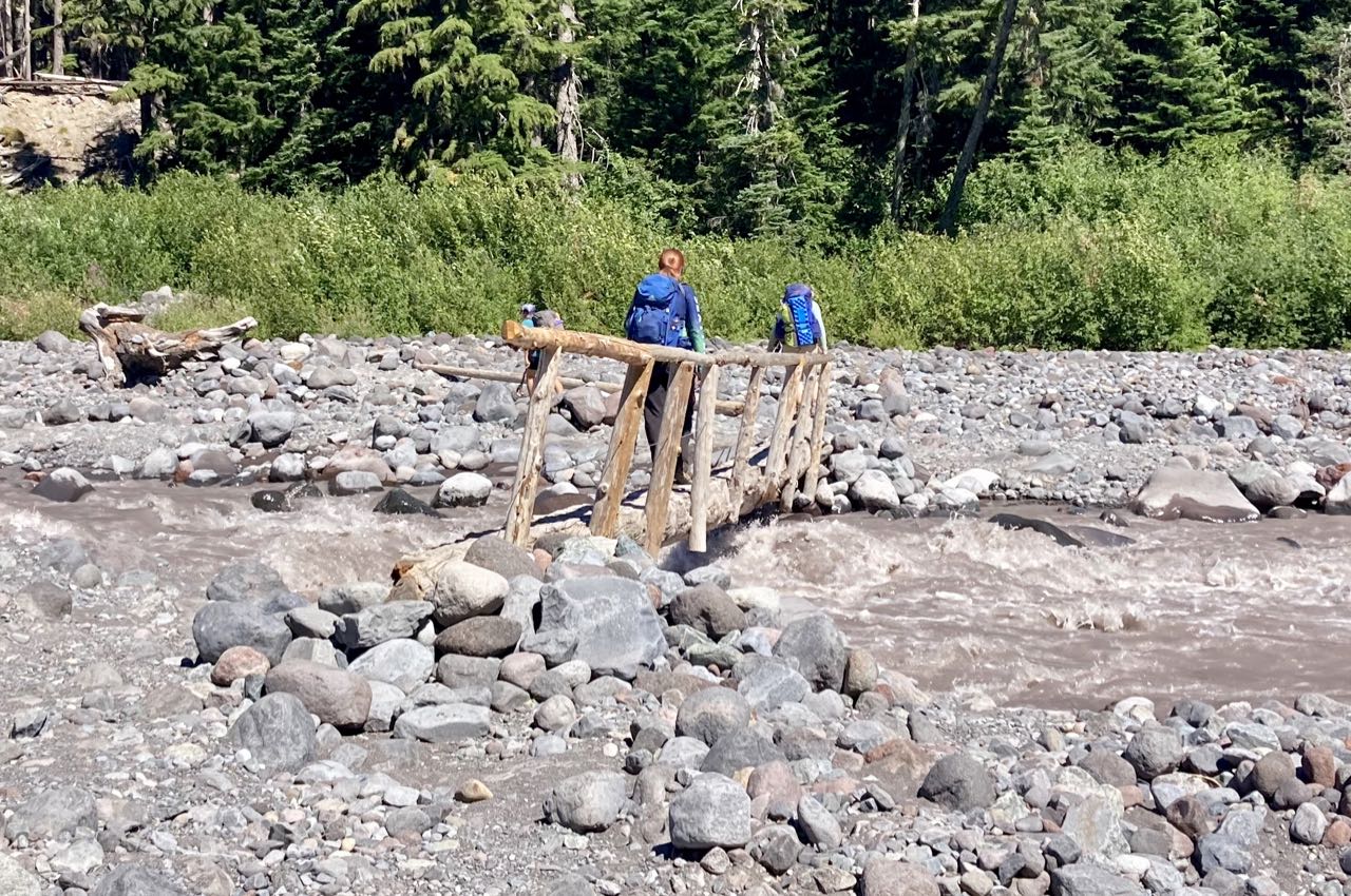
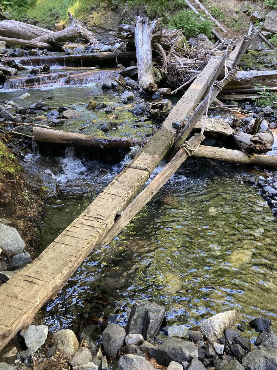
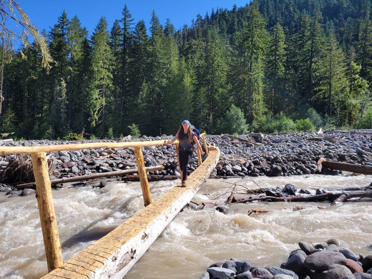
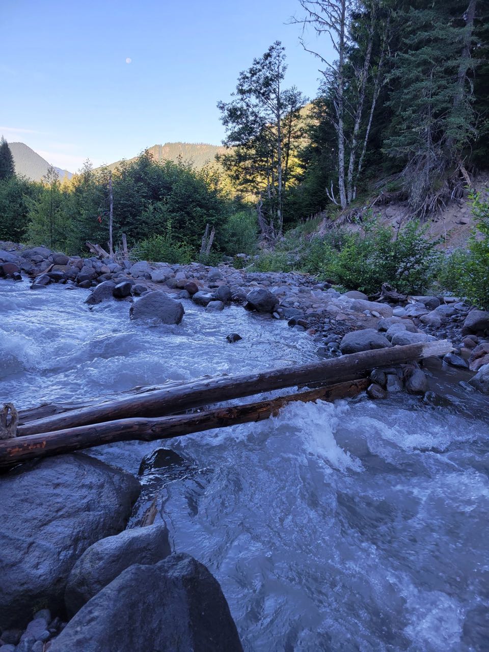
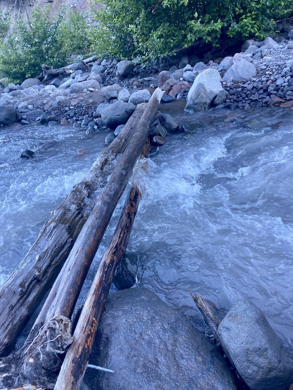
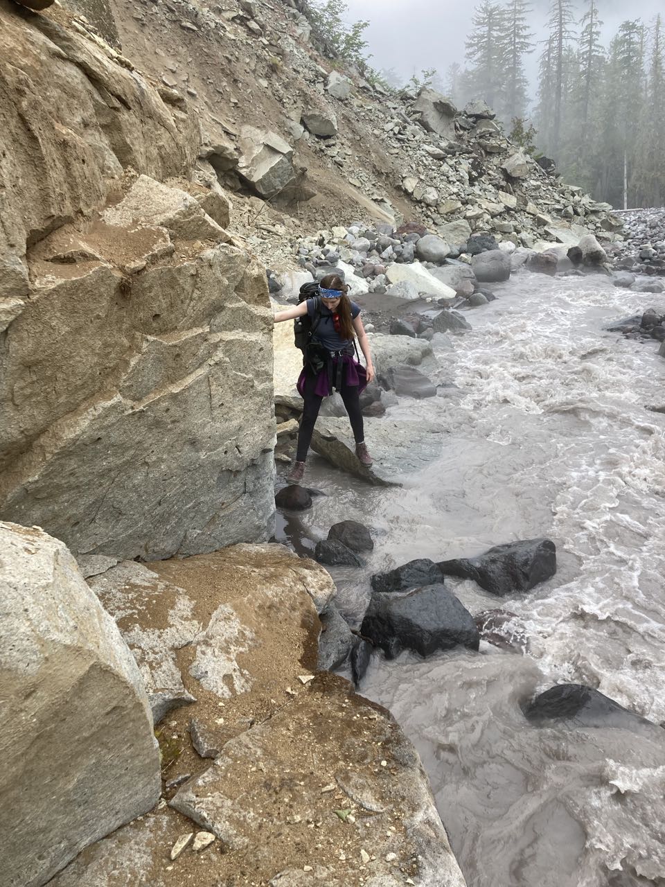
This atrocity. I think this was the crossing of the Kautz Creek (it may have been Pyramid) just before Longmire. The creek had a shallow spot and if I’d really wanted to avoid it I could have put on my sandals and waded across, but S threw down the gauntlet by scouting upstream a little to find this not-a-bridge, pile of wet logs that she hopped over to cross. What you can’t see is that she tried to use a stick to brace in the water and the stick almost vanished because that little bit of creek is both fast and easily 3 feet deep. I got across it by putting my feet on the lower log, the one in the water, my hands on the upper one and crab-walking over it. My feet got a little wet. 6 banana peels.

Posted on 1 Comment

Wonderland Trail – Day 3

Yellowstone Cliffs to Mowich Lake, Aug 10

Today we planned to split the party. K & R really wanted to hike the “Spray Park” section of the trail, which sounds beautiful, but my daughter said she wasn’t used to the pace yet and was unsure about committing to an additional thousand feet of elevation gain and 3 miles. Two days later she’ll be charging ahead of everyone while holding a coffee mug casually, but she wasn’t ready yet.

The day started sunny but we saw the fog in the Carbon River valley below us, and we followed the trail down into the fog. We hiked together down to the Carbon River turnoff and split up. At that point my daughter and I promptly got lost.

The Carbon River Bridge is one that had washed out multiple times and been replaced so when we came out of the forest in the fog, it wasn’t immediately clear where the bridge WAS. Scanning around we spotted flagging that led us over river cobbles to the north until we finally spied the bridge in the distance. I did NOT like this bridge. I have this quick panning shot of it that doesn’t really show why it was scary. The river was fast and dangerous, you could hear the rumble of rocks being turned over in it, the bridge was high above the water, and at a few points the railing pulled so far away from the main log that I couldn’t reach it. Or if it DID try to reach it I’d have to be resting all my weight on it, which seemed like a really bad idea. I hated this bridge.

Also it moved under my weight

We’d gone quite a ways north to find the bridge and so I assumed we’d have to backtrack to a spot parallel with where we left the trees to get back on the trail on the other side. I was wrong about that. But that’s what we did, walking right past some flagging in the fog, and following the river bed upstream to the south. Eventually we found ourselves scrambling over boulders and hopping on rocks, which was when I had the idea to check the mapping app to see what the problem was. We’d walked right past the trail and were now running parallel past an old section that had been abandoned due to washouts.

This is not the trail

All told it took us an hour to get from the trail on the east bank to the trail on the west bank after all the boulder hopping, getting lost, and then stopping for a snack. S said this was her favorite part of the trail (where we got lost) because it was more technically challenging.

But we were back on course now! This next section, as we headed toward Ipsut Creek had a lot more hikers on it (since we were somewhat near a big trail access point) and also featured perhaps 5 or 6 more bridges over parts of the Carbon River that had fallen in.

The fog never lifted as we went along the Carbon River, or when we turned up Ipsut Creek toward Ipsut pass. I think I’d like to come back here in the sun as I feel I probably missed out on some good views as we gained more and more elevation, but even in the fog the trail was full of tiny waterfalls and narrow, magical little grottos.

We took a break between the two cliffs at the top of the pass before taking our time heading gently down to Mowich Lake. This is a bigger campground, accessible by car and the location of our first food cache. So while it spoiled the atmosphere of being deep in the wilderness, we also had access to lots of snacks. Snacks were important! Sometime on day 1 we’d started talking about Lord of the Rings, assigned ourselves hobbit names, and stressing the importance of hobbit meals. This turned out to be useful for everyone as a pattern of taking multiple small meals throughout the day was what wound up working best to keep everyone safe and happy. Breakfast, Second Breakfast, Elevensies, Lunch, Tea, Dinner, and Supper. On most days we’d reached our campsite by Tea time.

We had a harder time than you might expect finding the campsite at Mowich Lake because there were little trails everywhere but no signs. Eventually we found it, pitched our tent, found the cache and waited for K & R to meet us. It rained some that evening but not before we had a chance to see another visitor. This time a mama bear and her TWO cubs. I saw both of the cubs but, again, didn’t get a photo of them. Although she is cinnamon-brown in color, she is a black bear. You can see how close she was to the tent sites.

To recap: on day 1 we saw one bear. On day 2 we saw two bears. On day 3 we saw three bears. We felt that this might get really exciting by day 10, but alas, we would see no more bears for the rest of the trip.

(edit) My notes from the trail
Deer, snakes, banana slug. Hiked down (long way down!) to the river where we split – sending Frodo and Sam down the river while Merry and Pippin entered Fangorn.
It took us an hour to cross the river because 1) the bridge was hard to reach (boulders) and then we got lost – walking past the trailhead and scrambling up the riverbed until we realized our mistake. Along the river were many scary bridges but it was flat until past Ipsut. We began the slow incline past many waterfalls & mossy rocks.
Last mile was very steep and overgrown. We emerged between 2 towering cliffs pursued by fog. Easy descent to Mowich where we got lost again. Heavy mist -> rain. Cider was amazing! K & R arrived about 1 hour after us (5pm). Cinnamon bear and 2 cubs in campground.

Posted on Leave a comment

Wonderland Trail – Day 2

Berkeley Camp to Yellowstone Cliffs

Just one overnight put us on a much less traveled part of the park. The farther we got from Sunrise the fewer other hikers we saw, and while we shared our camp with 2 other groups our first night, we would have Yellowstone Cliffs to ourselves. Our trip was going counterclockwise and most people do the route clockwise. This meant that we didn’t have the experience of traveling alongside a similarly-paced group for multiple days.

More wildflowers, including avalanche lilies which we did not see in other parts of the park. There were more tadpoles than I expected in some of these mountain pools, I suppose I thought it would be too cold for them, but where the water was shallow they were full of tadpoles.

North of Berkeley Camp there was a huge open field with a trail that branched off to another destination (perhaps we will go back one day). This area reminded me of Valles Caldera in New Mexico.

This area had a many tiny waterfalls and jagged peaks, even when we couldn’t see Rainier itself.

We got to this viewpoint and realized we had to climb ALL THE WAY down to that river, then all the way back up the mountain on the other side. Who booked this itinerary anyway? Oh yeah – that was me.

The Abyss – who planned this trip anyway?

We weren’t 100% alone at Yellowstone Cliffs. When we arrived there was a mama bear and her cub nosing around between the campsite and the pit toilet. We talked loudly to each other until she moved on. I didn’t get a photo of the baby, but I did get a pretty good one of mama.

mama bear
Yellowstone Cliffs from near the campsite

(edit) My notes from the trail:
Left Berkeley @7AM and hiked to Grand Park – reminded me of Valle Grande + why are there no trees here? 2nd Breakfast. Hiked down into the Abyss for elevenses. Note that I am Sam, S is Pippin, K is Frodo, R is Merry. We want to watch LoTR when we get back. Crossed a scary log before the bridge (also scary), then hiked uphill forever. 11+ miles and over 3k feet.
S thinks Little Tahoma looks like a moving castle that has remained still too long. At WIndy Gap – beautiful streams and a lake where we rested. Yellowstone cliffs are amazing. Bears and deer in campsite. Arrived 6pm. Tomorrow we Split The Party. Saw frogs, deer, bears, salamander.

Posted on Leave a comment

Wonderland Trail – Day 1

White River to Berkeley Camp Aug 8

Back in August I had the chance to check something off my bucket list – I don’t really have a bucket list but this trek was definitely a goal. There are so many epic hikes in Washington and every year I apply for permits to at least a few with the understanding that most of them won’t pan out. This year I won a slot to book an early itinerary on the Wonderland Trail. For those who don’t know, the Wonderland is a 93 mile trail that circumnavigates Mount Rainier. It is not a climbing permit and I did not summit Rainier. Winning the lottery didn’t actually guarantee I could do the whole trail either, at the time I tried to sign up I was only able to book reservations for the ‘northern loop’ but I spoke with my 3 hiking partners and we decided that I would go down to the ranger station the day before and try to switch our permit to a whole loop. This was a bit of a gamble but it paid off! We were able to get all our desired sites plus our final days camp at the coveted “Summerland” campsite and complete the full loop. We spent that night at the drive-up campsite at White River and on the morning of August 8, set out on our journey. Our hiking group was me, my daughter S, a local friend K, and her good hiking buddy from out of state R. My daughter and I shared a tent but the other two each brought their own.

The day started off with a steep uphill from White River to Sunrise, followed by some rolling terrain along the Wonderland, then diverting north onto the “Northern Loop”. For those playing along at home – yes this means we wound up doing more than 93 miles of the regular Wonderland, we did the “super wonderland.” In the meadows below Sunrise we saw our first bear browsing around and minding his own business about 50 feet off the trail.

Bugs were bad at Berkeley. I’m still not sure if some locations were buggier than others, or if some days weather conditions promoted more bugs than others. There were so many wildflowers! I no longer have exact mileage for each day but most days were between 10 and 11 miles, with our shortest day being just under 8 and our longest day being about 12 miles with between 2000 to 3000 feet of elevation gain. This was a shorter day so we’d have an easier one when we set out.

(edit) My actual notes from the trail:
On the trail by 730AM. Up the big hill. Met 3 girls who recognized R from another long distance hike. 2nd Breakfast at Sunrise. Saw a Bear, ground squirrels, a frog, butterflies. Lots of mosquitos and flies. Reached Berkeley @2pm, So many Wildflowers. Passed a creek that went underground.

Posted on Leave a comment

Gulf Islands Adventure – Final Day – We Made It!

After all the wind, this day was flawless. We packed up early enough that we had time to kill on our leisurely way back to the Mayne Island ferry.

We reached the ferry dock in plenty of time as well and used the spell of good weather to change and hang some of our stuff out to dry on the fence. I went looking for snacks at the little shop behind the ferry parking and discovered, that, while it did have a little fridge with some drinks and a small selection of snacks, it was mostly an art supply store. So I guess if you came to the island and had a sudden need to make an acrylic painting, you’d be set!

We rolled back onto the ferry and had an uneventful return. We hope to return next year and we have an invitation to stop by and visit Ian if we are in the vicinity!

Posted on Leave a comment

Gulf Islands Adventure – Day 8 – the second long haul

We left Ian with some reluctance and turned back into the wind – which was of course still blowing. If anything it blew harder today, up to 15 knots, straight into us and we kept trying different sides of the little islands to see if one of them was more in the lee than the other. Nothing really seemed to help. At one point we pulled off for 30 minutes because the wind was just so strong that we were barely making any progress.

Our goal fo the day was to make it all the way across the northeast of Salt Spring Island to Prevost. If we reached Prevost today, we would be back on our original itinerary with only a short hop the next day to catch the ferry. This whole day was something of a slog but it wasn’t really *hard* if that makes sense. I never had the feeling that my strength would give out or that I was exceeding my ability, it was just taking a really long time.

Late in the afternoon, around 2pm, we got a break in the clouds and a rainbow. This was our signal that the wind was about to end, and shortly after we had sun and calm for our final crossing to the very muddy campsites at Prevost. We just paddled 40 miles in 2 days.

Posted on Leave a comment

Gulf Islands Adventure – Day 7 – behind schedule

Having spent two days up at Nanaimo we now have to change our plan. Either we go on the route as written and return two days late, or we shorten the trip to try to maintain our schedule. We opted for the latter, knowing that we’d have to put in some long days to get back in time. First we packed up our wet gear and headed out toward False Narrows.

Breaking camp after the storm. Photo by Tom F

Our first landing was at Pirates Cove Marine Provincial Park, and while we’d gotten a late start to time the narrows, we were all still feeling pretty good and we knew how much farther we had to go to make our ferry. After consulting each other and some maps, we made the decision to press on, hopefully to return to Wallace Island if we had enough fuel. By which I mean we “crouched over our open hatches shoveling food into our faces like animals” (That’s how A phrased it)

Me – eating most of a summer sausage like a starved coyote. (Photo by Tom F)

Leaving De Courcey Island, the wind was still against us. It had been blowing in our faces for most of the trip and we kept trying to find some shelter by switching from one side of the little islands and then the other, but nothing was going to change the fact that we were mostly going straight into a 10 knot wind. We’d been looking at the forecast and nothing was going to change for a while, so this was just how it would be. We skirted Pylades and now had a long open crossing ahead. We decided there was nothing for it and just started straight into the wind toward Reid.

No plan survives, they say, and here’s where we ran into trouble. The crossing took FOREVER. And by the time we finally made it to Reid Island, our first landing spot for a rest, it was already getting dark. We hadn’t planned to stay at Reid, it didn’t have a good camping spot, but we pulled out onto a tiny private beach, checked the maps, and found there was a teeny islet of public land at the south end. We resolved that we would pitch tents on it no matter how bad it was rather than trying to continue after dark. We headed back out. And now as we rounded a point it was clear that both the wind AND the current were against us, that’s why we were making such poor progress. We battled around the corner when this happened:
P: “Uh oh.”
everyone: “what?”
P: “I left my phone on that tiny beach”
T: “A & I are still feeling good. Stay here and we will go back for it.”
They head back around the point. Five minutes later:
P: “Uh oh.”
Me: “What?”
P: “I found my phone.”
We tried to call T & A to let them know, but there was no answer so there was nothing for it – and we both turned back to tell T & A not to spend all their time looking for a phone that wasn’t there.
And that’s when our miracle happened!
When P & I got there, we found A talking to someone new. It was the landowner, Ian, who had a house on the point and had been watching us struggle around in the wind. He’d come down to offer us space in his bunkhouse for the night!

This was such an incredible relief! It was so lucky that he saw us, that we had to turn back and were able to meet him. A kept asking “did we die? Are we dead?” Ian offered showers, beds, and beer/wine while we traded stories that evening.
A thing I learned: If I spend 8 hours bouncing around in a kayak when I get back onto land it still feels like the ground is swaying. If I drink just one glass of wine on top of that I become legless.

Total mileage for the day: 22 miles!

Posted on Leave a comment

Gulf Islands Adventure – Days 5 & 6 – The plan changes

We had a late start the next morning because we had to wait for a slack tide at a narrow passage up ahead, but after a leisurely start, things went wrong. We had some wind, but more, we had some trepidation about an upcoming day – twenty miles long with some precise timing and no good bailout points. As we passed the ferry terminal that went from Gabriola Island to Nanaimo, D had the idea that this might be a good place to end the trip. We rafted up to discuss the options and wound up turning northwest, across the bay to Nanaimo. The wind was against us and we had two foot waves on the approximately 3 mile crossing. This was a little rough and it seems that during that crossing, Vincent also started having second thoughts (also his boat was still sinking). Once we’d made it to Nanaimo both opted to board the ferry back to Vancouver. A and P went to help them with logistics while T and I headed over to Newcastle Island to see about camping spots there – we’d already missed our window to head south that day.

Changing the plan. Photo by Tom F

We found camping at the resort but it hadn’t yet fully opened for the season. What this meant in practice was that we pretty much had the run of the place. We set up camp in a big meadow, were told about the white raccoons, and left to explore the hiking paths, millstones and native art. Oh – did I neglect to mention the mysterious post covered with bras in the channel between the island and the mainland? We have no idea what that meant.

That night was still and perfect. We went for a night paddle over to Nanaimo and came back through all the boats anchored in the bay. The next day, however, was a storm. We’d about it the day before, saw that there were potentially 30 knot winds predicted and opted to shelter in place rather than risk it.

I have no photos from that next day because it was WET. We took the tiny passenger ferry to Nanaimo, ate at a fancy restaurant and did some sightseeing. More importantly – I found a place to drop of the COVID TEST! Finally getting rid of that albatross meant high-fives all around. We stayed in town as long as possible before returning to our very wet campsite. The camp had wood for sale, but we didn’t think we could get it to light, until I thought to ask if we could use the covered shelter right next to their gift shop. They said they used that space for salmon bakes, but since no one was around to go right ahead. They sold us some damp wood and by using that plus their giant pile of discarded cardboard we made ourselves a pretty decent fire.

We spent the rather cold, wet evening, watching raccoons fight over a box of bagged chips that had been left on the porch, smelling like a trash fire, trying to smoke a little recreational herb that our neighbors at Descanso had given to T, and made a new friend, a young woman from Germany who also appreciated the warmth of the fire.

Our Trash Fire – Photo by Tom F

Posted on Leave a comment

Gulf Islands Adventure – Day 4 – Flat Top to Descanso

We said goodbye to the Crown Islets and worked our way through the other Flat Top Islands, heading northwest around Gabriola. This part of the trip hinged on good weather because we were out on the relatively-exposed Straight of Georgia. The weather held and it was bright and sunny for most of the day. There were more seals and sea lions that we saw near a lighthouse. I also tried to call Canadian Public Health and some company called “Purloator” about picking up my Covid test, but didn’t really learn much. I turned my phone to airplane mode for most of the day.

The cliffs here had dark staining that sometimes looked like faces to me.

The main paddling challenge today was that Vincent’s boat seemed to be sinking. It had started earlier, but after he’d paddle for a little while, his boat would get lower and lower, and when we would stop we’d have to pump out the rear hatch.

Vincent H Paddling along Gabriola Island
passing waterfalls (photo by Paul M)

I backed into this slot around a corner so I could hide and surprise Alice and Diana when they came around, but some boat wake interrupted my cunning plan.

so sneaky
Guillemots (photo by Tom F)
Descanso Bay

We reached our campground in Descanso Bay, across from Nanaimo, and, according to our original plan, this would be as far north as we would go. Am I hinting enough that things won’t go to plan? There were two potential beaches to land at. One with a nice beach but a bit of a carry to get to the campsites, and one right next to our campsites, that was full of sinking mud and broken, sharp, oyster shells. I noped out of the oyster-beach and was later joined by everyone else when the tide started to go out and threatened to leave everyone’s boat trapped in the mud. We saw otters here and a pileated woodpecker.

That evening we walked about a mile to town and went to a very fancy pizza restaurant & I bought a mojito because I’m fancy. These wild turkeys were standing in the parking lot when we got out.

Turkeys looking for some lumber
Posted on Leave a comment

Gulf Islands Adventure – Day 3 – Wallace to Flat Top

June 6th – we had some rain overnight but it was dry when we had to pack up. Today our timing mattered because we needed to go through Gabriola Pass near the slack. We were told, and I’ve since seen some video, that currents in the pass can get up to 8 knots and we didn’t want to deal with that in our fully-loaded boats, many of which had gear or wheels strapped to the deck.

After packing and oatmeal for breakfast (I’ve decided that oatmeal is always a good breakfast – it’s quick, it’s warm, and I can put as much dried fruit in it as I want) we were on our way. We set out northwest past the Secretary Islands and along the west side of Reid before making a big crossing, diagonally, to Valdes. This area is full of tankers and container ships waiting for a slot to open at the port in Vancouver. They made me a little nervous as we are very small and they are huge, but they luckily never moved while we were there.

Our lunch spot was a bit north of Blackberry Point and we waited for a while, looking at a Gary Oak to make sure we were hitting the slack, and then we entered the pass. The sandstone cliffs along Valdes were impressive, and we saw many sea stars – which I found encouraging because they had suffered a big die off a few years back.

Sandstone cliffs making us look small
Sandstone formations on Valdes
Purple Sea Star (photo by Tom F)

The pass turned out to be … nothing impressive. We even wondered if it really got as bad as they say, but we took a few minutes to explore the marina and then paddled through, looking for our mysterious islet in the Flat Tops.

Most of the Flat Top Islands are privately owned and off limits, but there are two tiny islets that are open to camping, with NO services. When I first saw them I was highly skeptical that we could even fit 6 tents on them – one was basically a grassy rock with one tree on it. The other didn’t even have a tree. But we did, and once we were settled in I was so glad we had stayed there. It was magical.

We saw many seals and one sea lion as we pulled in.

are we really going to put 6 tents on THAT?
Alice’s method of letting the tide lift the boats to us (photo by Alice V)
The Magic Happens
Sunset from the Flat Top Islands